|
|
|
Roads
and Tracks of Ayrshire
AYR
COUNTY COUNCIL - THE HIGHWAY COMMITTEE
|
Note:
The photograph of Kilmarnock town centre is from the
Detroit Publishing Company's Views of Landscape and
Architecture in Scotland - see thumbnails on Library
of Congress site here.
| Local
Government (Scotland) Act 1929 |
The
next major change took place in 1929 with the passing
of this Act. With regard to roads the structure now
became:
1.
County Councils These retained those powers exercised
by the former County Road Board. In addition they took
over the functions of the earlier District Roads Committees
and roads in small burghs (under 20,000 population).
To deal with these new responsibilities a Highways Committee
was formed in Ayrshire.
2. Large Burghs (over 20,000 population) The previous
responsibilities continued.
3. Small Burghs (under 20,000 population) As said, their
responsibilities passed to the County Council.
4.
District Councils These took over responsibility for
footpaths from the parish councils. They had the right
to repair and maintain them and make representations
to the County on any infringements of right of way.
Over
the years, several acts have been passed besides those
mentioned above, which have affected the function of
the roads' authority and cumulatively have defined what
that function is. In some cases they are still with
us today having been incorporated into later acts. Among
these is the Barbed Wire Act of 1893 that allows for
its removal where it has become a nuisance. A 1925 Act
dealt with removing obstructions to sightlines at corners,
and allowed the planting of trees and shrubs beside
the road for landscaping purposes. The Ministry of Transport,
formed in 1919, drew up a system of road classification
and numbering that is still in operation. It is interesting
to see that the road numbers are based on many of the
old turnpike routes.
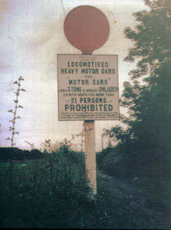
Motor vehicles had to be licensed under the Motor Car
Act of 1903 and later acts; the licences were issued
by burghs of over 50,000 population and county councils.
The registration letters for Ayr County in 1930 were
AG and SD; none of the boroughs were licensing authorities.
Strawhorn gives registration totals - in 1903 there
were only 37 rising to 5438 in 1923 and 14518 by 1938.
(1)
The actual traffic of course was much greater, particularly
because of the number of resorts on the coast. For example
the daily flow between Monkton and Ayr was 1203 in 1925
and 4467 in 1938.
The
Road Traffic Act of 1930 had considerable impact not
just on roads but also on drivers, detailing driving
offences, introducing insurance, and providing a Highway
Code. Local authorities, amongst other things, could
issue orders to close roads to allow repair or construction
work. They could erect traffic signs; create refuges
and subways for pedestrians; provide parking places
and run their own bus service. An Act in 1933 allowed
the placing of weight restrictions on bridges. In 1934
the Road Traffic Act introduced the 30 mph limit and
a requirement to erect traffic signs that would let
a driver know they were in a 30 mph area.
The
above Act gave the County Council greater responsibility
for roads. Parish councils were abolished, Ayr and Kilmarnock
were regraded as large burghs, and 15 other towns including
Irvine were classed as small burghs. The large burghs
were responsible for roads in the town but roads in
the landward areas passed to the County.
In
1930 the Highway Committee was formed and continued
up to the formation of Strathclyde Regional Council
in 1975. The minutes of the meetings contain much of
interest and in this section an acount is given of proceedings
of interest up till the early 1950's.
(2) This
is supplemented by details of roads built or closed
up during the life of the committee, with some further
details of major road schemes up to the present.
The
Committee first met on 20 May when G. S. Barry was appointed
County Road Surveyor. He had been in charge of the Ayr
District. Other candidates were James Lang of the Kilmarnock
District and R. McDonald of the Northern District.
A
circular letter from the Ministry of Transport on the
standardisation of road direction posts, warning signs
and traffic notices was noted. Claims from the Kilmarnock
District Unemployment Grants Committee for the "bye-pass"
road at Fenwick were considered. The Committee approved
Carrick District's plans under the MOT's 5 year programme.
The
previous administrative districts, viz. Northern, Kilmarnock,
Ayr and Carrick with their respective offices in Kilwinning,
Kilmarnock, Ayr and Maybole were retained. The case
was made for a central office in Ayr. The staffing structure
consisted of the County Surveyor, a Depute, four Divisional
Surveyors, a Chief Engineering Assistant, 5 Engineering
Assistants, 6 Clerks, 7 Typists, a Quarrymaster and
700 workmen.
Classified
roads within the 14 small burghs were put under the
supervision of the Divisional Surveyors, and some Burgh
Council roadmen were taken over by the County. The Carrick
District roadmen were being paid less than those in
other districts.
Large
numbers of unemployed were used as roadmen under a relief
scheme. It was noted that the County Surveyor would
submit schemes for grants such as the extension of the
Beith bye-pass road as far as the Glengarnock - Kilbirnie
road and the improvement of the Langlea Brae on the
Dalry-Stewarton road.
The
Labour Exchange referred a letter received from the
National Unemployed Workers Movement to the Committee.
This protested against the use of the same men on the
Glasgow Road Scheme near Fenwick. In the interest of
fairness they asked for the rotation of workers. The
Committee rejected the request. In November 1932 the
Fenwick by-pass itself was opened.
Mr
Barry reported that he wished to use pit deposit material
for work at Machouse between Cumnock and Muirkirk for
which the proprietor wanted 3d per ton. The Committee
told him to take the material at no payment under Section
80 (Schedule C) of the Roads and Bridges (Scotland)
Act of 1878.
Irvine
District Council submitted several road schemes for
Ministry grants. Judging from the County Surveyor's
comments' one is tempted to see "politics" as work.
Thus the Dreghorn to Drybridge road "is quite satisfactory
for all traffic needs and really calls for no work being
done upon it." The Shipmill Road, Annick Lodge "is a
road of third rate importance, and is quite sufficient
for all traffic needs." The Springside to Cunninghamhead
road was also "sufficient for all traffic needs. If
any work is considered necessary then a footpath would
be the most suitable scheme, though hardly essential."
Fifteen schemes costed at �330,910 and attracting �268,309
grants were submitted under the Ministry's Five Year
Programme and Trunk Road Programme.
There
was an interesting proposal in February 1933 to erect
First Aid cabinets with adverts on roads but the Committee
rejected this.
To
give an idea of the matters considered at a meeting,
the following was dealt with on 14 May 1931: - improvement
at Bridgend, Kilwinning and widening of Lainshaw Street,
Stewarton
- condition of certain roads in Dalry, of Blair Road
leading to the Hurlford Housing scheme and of a private
road in Mauchline
- improving the water supply to the roadman's cottage
in Dailly and the drainage at Burnside in Patna
- rental of Tile Work Cottage in Patna
-
retiral of a road foreman
- purchase of a tool shed for the roadmen in Dalmellington
- additional staff for the Five Year and Trunk Road
Programmes
- permission for a garden entrance in Alton Street,
West Kilbride, to erect a steam pipe and telegraph lines
above various roads and to put in a new electrical distribution
box in West Kilbride
- a high hedge in Stevenston
- roads on Seafield Estate
-
the Institute of Municipal and County Engineer's Conference
- a report by the Deputy Chief Engineer of the MOT on
the Canadian Roads Convention at Quebec and the Sixth
International Roads Congress at Washington in the USA
- a Road Vehicle Order
- grants from the Road Fund for the widening of Rigg
Street, Stewarton
- claims against the Council including one for a fatal
accident
- stopping places for buses
- a Public Sitting of the Traffic Commissioners
- request from Ayr Burgh to erect a road sign at Bellisle
Park.
Some of these items were carried on from meeting to
meeting until concluded.
In general terms the Committee dealt with major and
minor road schemes and the improvement of sightlines
by cutting back hedges or demolishing buildings. It
considering applications for items that impinged on
roads and traffic such as petrol pumps, overhead wires,
telephone kiosks and AA boxes. It also dealt with drainage,
insurance claims, tenders for road works, staffing matters,
road stoppages and adding or removing a road from the
list of highways. There were three sub-committees: one
for proposed road improvements, another for the Road
Traffic Act as mentioned, and one for road inspections.
The
minutes often make interesting reading, if only for
their quaintness. Thus the Sub-committee on the Road
Traffic Act, which dealt with public transport and freight
licencing made representations to the Traffic Commissioners
that a road service licence to inaugurate a service
of stage carriages (i.e. buses) on the Edinburgh - Ayr
route should be refused as the route between Darvel
and Ayr was already very crowded. Still on buses, the
Patna to Burnfoot Hill road was restricted to a 14 seat
bus because of the steepness of the hill and the narrowness
of the road. Petrol pumps were not to project beyond
the line of a street and the swing arm was to be no
more than 8'6" in length. Pumps at Hurlford, Tarbolton,
Stewarton and Ochiltree are mentioned on 16 June 1931
and this old type of pump can occasionally be seen today.
It is quite clear that pumps were sited on the pavement
and that cars would stop on the road to fill up with
petrol. On 12 November 1931 there was a proposal to
have an "in" and "out" roadway in Dalmellington "thus
taking motor cars being supplied with petrol entirely
off the highway."
In July 1931 a farmer wanted to erect gates on the old
Kilmarnock to Glasgow Road at Kingswells Farm but this
was refused as it would obstruct the route. It was noted
that Ardrossan Town Council was going to discontinue
lighting of the lantern on the island at the Cross and
that a traffic census on Class 1 roads would be going
ahead. In September it was agreed to take the front
wall of Dunlop Primary playground back 12'6" to bring
it in line with the rest of the properties. In April
1932 it was proposed to buy and then demolish Holmston
Toll Cottage and Kilruskin Old Toll House in West Kilbride
to improve sightlines.
The
minutes of 11 February 1932 refer to serious flooding
(3 feet of water) on the A70 west of Muirkirk. Traffic
was diverted through Strathaven. The problem was caused
by old mineral workings and had happened before - twenty
years previously the road had subsided and had had to
be built up.
At
a fatal accident enquiry (Gree Bridge in Beith parish
on the Irvine to Barrhead Road) the jury had recommended
the bends should be straightened out and, if this was
not possible that they be resurfaced with non-slippery
material. The County Surveyor pointed out the very heavy
cost of straightening out the bends as this would require
a new railway bridge (because of the expense of construction
these were usually built at right angles to the railway
and hence were often associated with quite severe bends),
and could not agree that the road was slippery. However,
in order to meet to some extent the jury's suggestions
he recommended superelevation at the bend and a white
line be painted in the centre of the road for 80 yards
from the bridge in either direction with the word SLOW
at each approach. Camber is the gradient from the centre
of a road to its edge and helps drainage; superelevation
is the whole "tilt" of a road, including its camber,
which by involving centrifugal force allows a corner
to be negotiated at a higher speed or, as in this case,
more safely at a slower speed.
In March 1932 traffic robots make their first appearance.
This was in a report from the Surveyor and the Chief
Constable about the "fixing of electrical traffic controls
or traffic robots within the County," i.e. traffic lights.
Three locations were considered: the Cross at Irvine,
the junction of Fullarton Street with Bridgegate in
Irvine and the Crossroads at McMaster Hall in Girvan.
They gave an estimate of savings (�76 p.a.) as against
the use of a policeman and recommended the Girvan location.
The Committee agreed to a trial.
In
1934 "foot passenger crossings" were considered, following
their introduction in the 1934 Road Traffic Act. The
County Surveyor and Chief Constable had consulted with
the small burghs and reported that:
"the general feeling was that such crossings would be
of little or no value, and this view is supported by
an examination of 550 reports of accidents involving
personal damage that happened in the County up to the
end of November this year.
"In only six of these could the utmost stretch of imagination
allow it to be said that a passenger crossing in the
neighbourhood might have prevented the accident.
"The most frequent cause of accidents to pedestrians
is the thoughtlessness of children who run across the
street, and the stupidity of their elders, who usually
select the most dangerous starting-point for their crossing
- from the shelter of a standing vehicle."
However,
they recommended a trial at 35 sites and approved 12
at a cost of 11 pounds each.
They
reported back in May 1938 by which time the number had
grown to 32. They considered that they were underused
by adults and were only useful where used by children.
They concluded that the expenditure had not been justified.
It
was not just child pedestrians who were in danger but
child passengers too when being transported to school.
In December 1936 it was said that the saloon car at
Glenafton used to take the children to school in New
Cumnock would have to be replaced immediately in view
of its mechanical condition. A replacement car and a
suitable trailer had been identified.
To
be fair, in 1947 the County Council in association with
the Burghs, set up an Ayrshire Council for Accident
Prevention under the Royal Society for the Prevention
of Accidents. Annual road safety poster competitions
were held in schools, publicity campaigns carried out
and an exhibition toured the county.
(see
a "Safety
First" collection of cigarette cards from the
1930's for some amusing illustrations on road safety)
An interesting entry in February 1937 says first that
the foreman at a quarry had travelled over 5000 miles
in his car and a request was made for his expenses in
running the car. It then says that the car allows him
to carry explosives necessary for his work.
In
February the following year the Ayrshire branch of the
National Farmers Union requested materials and equipment
to maintain roads to farms but this was rejected as
they were private roads. It was proposed to build an
Irvine by-pass.
Road signs and markings were much less frequent than
they are today and warning signs were limited to just
a few hazards. Although unofficial signs had been erected
by some local authorities the first official provision
was in the 1903 Motor Car Act. This allowed for a speed
limit sign that was a white open circle above a plate
giving the speed. Warning signs were red open triangles
above a plate warning of steep hills, dangerous corners
and crossroads. Prohibitions had a solid red circle
with a plate beneath and all other signs were of lettering
on a diamond shaped plate.
 |
| Early Road Signs |
In
1921 they were expanded to include schools; level crossings;
cross roads; corner; double corner and steep hill with
symbols. By 1930 signs were available for road junctions,
open level crossings and "Dead
 |
| Occasionally one
still finds old road signs |
Slow"
signs for the minor road at a junction. There were also
signs for roundabouts, one-way streets and parking places.
MOT guidance on signs was not compulsory and local variations
were common. It was not until 1933 that uniform road
signs were introduced. Road markings were not used until
after the First World War but became fairly common in
the twenties with an advisory circular issued by the
MOT in 1926. A 1933 report recommended their use as
"stop" lines at junctions controlled by lights or police,
and to indicate a course traffic should take at bends,
hills and junctions. In Ayrshire in the early 30's the
only markings mentioned are SLOW and some centre lines.
It is worth remembering perhaps that measures we now
take as obvious and commonplace such as edge-lining,
pedestrian crossings and stop lines were still to be
invented. The minutes contain occasional references
to signs and it is perhaps not too much to say that
they were put in after an accident problem made itself
apparent.
The
old "fingerpost" signs of course are a nostalgic reminder
of this era and David McClure gives a full account of
the 16 remaining.
(3) All are in Carrick with
the exception of two in Dundonald and Troon. The signs
were made by the Royal Label Factory in Stratford on
Avon and were of two types dating from the late 20's
and early 30's. Most were refurbished in 1999 - 2000
by South Ayrshire Council, along with the repainting
of some milestones. It is odd that they should have
survived in Carrick and not elsewhere as there are other
rural parts of Ayrshire. Many of the signs were removed
during the Second World War so that invading troops
would be unable to find their way around but were never
reinstated.
One
useful aspect of the minutes is references to roads
that were being considered for inclusion in or removal
from the list of highways. On 20 July 1932, two miles
of the Blair Road in Dailly Parish was removed between
the B741 at Poundland Old Toll and Blair Farm. It continued
on to the Balloch Road.
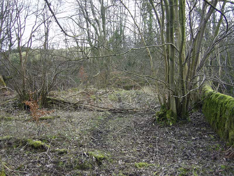
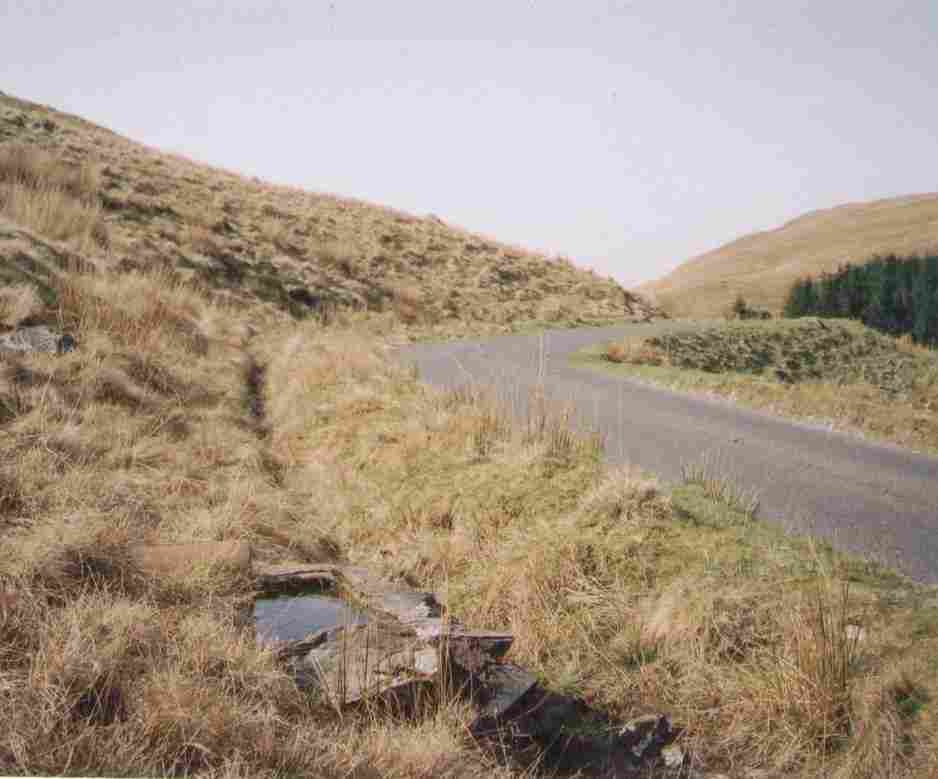
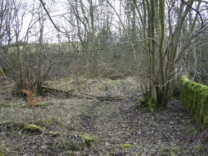
A � mile length of the Killochan Glen Road in Dailly
was also removed. It ran from the B741 near Killochan
Station by Killochan Castle to the Hawkhill Road. It
crossed the Water of Girvan by a ford that was very
difficult to cross. Also running from the B741 was the
Littleton Road that ran past Ladywell and High Park
to Knoxhill Road. The section removed was 1� miles from
Culroy Bridge to the Dowhill Road.
The
Muick Road in Barr Parish had 2� miles removed between
the B734 near Pinmore Mains to Mark Farm. The section
past Ballymore and Barbae remained. Two and three quarter
miles were removed from the Tig Road in Ballantrae Parish
between the A77 and Crailoch. This ran in a north easterly
direction crossing the Beneraird track and had the Smyrton
and Crailoch bridges in its length. McDowell drove along
it and says there was still a couple of milestones to
be seen. (4)
As noted earlier, at least one of these is still there
at NX123824 and looks quite unlike later turnpike milestones
although it is similar to ones on the coast road up
to Girvan. It is now hard to read but the 1857 6" OS
map notes that it was 17 miles to Stranraer and 4 miles
to Colmonell. As said earlier, the road was a turnpike
with a toll at Auchencrosh and is shown on Roy, Armstrong
and Thomson. The section past Heronsford to Colmonell
remains as a public road and is an attractive route
with its views of Glen Tig and Knockdolian.
Also in Ballantrae was the Auchairne Road that ran from
the A77 near Garleffin past Low Kilwhannel to Beneraird
Hill. The 3 miles from Low Kilwhannel to Beneraird Hill
were removed. This road continued as the Lagafater Road
for 2� miles to the Wigtonshire boundary past the farms
of Shennas and Barnvannoch.
 |
| The Lagafater road as it leaves
the Colmonell to Kilantringan road |
The part in Wigtonshire was on their list of highways
and so maintained. It was decided that as it was in
very bad condition it should not be taken over. A sad
end for what had once been a main road to the south.
McDowell writes, "in these days of heavy motor-taxation
and possibly some unemployment following the termination
of the Second Great War it would seems proper that this
old road with yet a substantial under-surface should
be made passable for motor transport, tourists and farmers."
He argues further that there are wonderful views and
that "the provision of passable roads through these
glorious hills and moors would mean not only work for
many but would ultimately probably lead to the re-population
and reclamation of much of the area." At present the
road at the southern end is surfaced as far as Lagafater
Lodge on the county boundary.
 |
| The Brandy Well today |
As
an aside he describes the Brandy Well just south east
of Nick o' the Balloch in similar poetic terms that
belie its appearance today: "The cooling and refreshing
waters of this ancient well will serve man, horse and
motor car as well as the native birds and animals of
the wild inhospitable area."
There
is an interesting reference in July 1934 to an alleged
right-of-way from Dalry to the Largs - Kilbirnie road
at Camphill. The first part south of Brodocklie Farm
was a public road. It went up to South Camphill then
followed a "steep and tortuous course," and crossed
the Rye at a stone bridge in poor condition. It was
6 or 7 feet wide. Between Plann and Haining only pedestrians
used it and at one point it was badly overgrown and
unrecognisable. It then forded the North Burn. It had
been in this condition for the last 50 or 60 years.
It lay about � mile west of the track shown on Armstrong
that ran in the same direction but was on the other
side of the Rye Water.
In 1939 complaints were raised about unnecessary work
carried out in the Dunlop area but the County Surveyor
was able to show that if these works had not been carried
out there would have been serious consequences to the
state of the roads. There had also been complaints about
road workers in the same area carrying out work on private
properties and supplying some individuals with road
metal. As a result of an investigation, there was a
tightening up of working practices so that there could
be no grounds for public complaint in the future.
At
the very outbreak of war the MOT put a hold on any new
works including the Ayr and Prestwick by-pass, planning
for which had been well underway.
There
are some fascinating entries, which relate to the war,
giving visions of signpostless roads torn up by tanks
on war exercises and busloads of workers being taken
to munitions factories in the middle of nowhere.
Thus
in April and May 1942 there is reference to the road
between South Barr Farm and the new ICI factory near
Giffen Station being too narrow for double deck buses.
The Council was asked to widen the road and cut back
the vegetation, at a cost of �450. Interestingly, given
that it was wartime, they refused to fund this work.
Signposts
had been removed in 1940 but it was noted in November
1942 that they could be re-erected in towns for important
routes in consultation with the military.
In February 1941 reference is made to the work being
carried out on emergency defences - these consisted
of immobilising possible landing grounds and constructing
road blocks. The reference in Hay
(5) to the Home Guard putting
up concrete road blocks around the Tarbolton area and
erecting 20 foot high poles on a straight stretch of
road between Tarbolton and Walston Farm to prevent aeroplanes
landing must date to this time. Arrangements were made
for local authorities to assist each other in keeping
roads and bridges open in the event of invasion or heavy
bombing.
In December 1942 it was reported that Scottish Command
wanted to set up a control on the A77 on each side of
Cairnryan, and this would exclude the use of the road
for pleasure traffic. No waiting signs were put up alongside
RAF Dundonald.
In
June 1942 the control of the huge bus queues at Dundonald
Camp is mentioned. A long layby had been built on the
east side of the road for buses but barrier rails were
required.
In
May 1942 there was a complaint about the damage caused
by tanks of an Armoured Division that had recently moved
into the county for training.
In
1940 the Roads department lost 78 staff when the War
Office requested a General Construction Company be formed.
It was to be a unit of the Royal Engineers. The County
Council, Burghs and large contracting firms supplied
two hundred and fifty men who had a wide range of skills
like plumbing, building, carpentry as well as road building.
After training, the unit went overseas. Roadmen also
worked on farms to help with the harvest. A proposal
that women work on the roads was thought impracticable.
Other
business carried on. Thus there were several entries
about snow clearance including a report giving the location
of snow ploughs. Soldiers helped in the snow clearance.
An old cart tramway of trough rails near Fail Toll,
Tarbolton was to be disposed of as scrap. There is even
the minutiae of an 8' tubular rail barrier to be installed
on the footpath outside Kilmaurs school - it was to
be painted white. Nationally in fact a 1936 report on
the Road Safety of School Children (there was a separate
report for Scotland) had identified and recommended
exemplary measures designed to ensure the physical safety
of children. These included the now obvious measures
like barrier rails, and opening gates to allow only
one child out at a time. As an aside this report has
the alarming quotation: "Witnesses referred to the possibility
of "Safety First" lessons resulting in the fostering
of a selfish prudence among children and in a stifling
of the spirit of adventure." "Was there not the possibility,"
they asked, "of rearing a timid generation, and of depreciating
manly courage and the thrill of danger so attractive
to the healthy schoolboy."
On 5 October 1942 it was agreed to widen and superelevate
the road at an awkward bend near Little Cutsburn on
the Stewarton - Fenwick road (B778) to allow traffic
to negotiate it at 15 mph.
After
the war, things slowly got back to normal and the usual
business of road maintenance was resumed with occasional
mentions of new roads such as a two mile long by-pass
for Kilwinning.
In January 1951 there was mention of an employee misappropriating
a spare wheel that fell off a passing vehicle. In February
a new access road and bridge at the south end of Patna
were proposed. A request from Cumnock Town Council to
widen Tanyard Lane and use it as an internal bypass
was rejected as the MOT had approved the line of a new
Cumnock Bypass.
A
number of quite major road schemes were being considered
at this time. Thus in March 1951 there is mention of
a proposed bypass for New Cumnock from Marchburn at
the county boundary to the north of the town at Whitelaysike
Bridge. Another was to the east of Cumnock from the
Meadow to the Filter Station and one was to the west
of Cumnock from near Skerrington to the Dippol Burn
Bridge. There was also a proposal to have one to the
east of Mauchline from proposed improvements at Howford
(June 1949) up to West Hillhead. Associated improvements
on the A76 were various stretches south of Cumnock near
to Rottenyard, Mid - Lowes, Boreland Smithy and Meadows
- the old line of road can be clearly seen today. Farther
north the A76 was to be routed from Bowhouse over to
near Kirklandside Hospital - this is the line taken
today and is effectively a Hurlford by-pass.
| Realignments south of Maybole
- these were started in the late 1960's and completed
in the early 1970's. They can also be seen in Google
Street View |
On
the A77 it was proposed to improve the road from Woodland
to Ardmillan House Lodge and near Ardwell at Girvan.
In April 1951 there is a mention of three short realignments
north and south of Minishant and south of Kewnstone
near Cassilis Station. There were plans for a new stretch
of road from Balkenna Bridge (near Turnberry) to Girvan
Mains, and a bypass for Girvan itself from Bridge Mill
east of the town to Shalloch Mill. Also on the A77 route
were the Kilmarnock Eastern By-Pass Road and the Ayr
- Prestwick By-Pass.
There were also plans for the A78. Thus there is mention
in the early 1950's of by-passes for Kilwinning, Ardrossan
- Saltcoats, Loans and Fairlie. A new stretch between
Kilruskin Bridge and Carlung Lodge in West Kilbride
parish is also mentioned.
These
plans were not realised for many years and it is interesting
to see when some of the schemes were completed.
| Scheme |
Date of completion |
| A77 Prestwick by-pass |
1961 |
| A77 Kilmarnock by-pass |
1973 |
| A76 Hurlford by-pass |
1973 |
| Irvine New Town
- various schemes |
1970's |
| A77 South of Ayr
|
early 1970's
|
| |
Ayr by-pass - 3rd
and final stage - Holmston Roundabout to Corton
Bridge crossroads |
| Monkwood Bridge
- new bridge and 1 mile of new road |
| Minishant Bridge
and approaches - reconstruction |
| Hoggs Corner - realignment
3/4 mile |
| Nether Culzean -
removal of a bad bend |
| Maybole to Crossraguel
- realignment 1 1/2 miles |
| Damhouse,
Kirkoswald - removal of a bad bend |
| A76 Cumnock to New
Cumnock improvements |
early 1970's |
| A78 Loans by-pass |
1983 |
| A71 Irvine to Kilmarnock
Road Phase 3 Moorfield to Bellfield |
1987 |
| A76 Cumnock and
Auchinleck by-pass |
1992 |
Sources:
Information leaflets, I W Smith
and P Iley, Major trunk road works in Ayrshire, Journal
of the Institution of Municipal Engineers, 1969
(5a)
The
above paper by I W Smith and P Iley, Major trunk
road works in Ayrshire, gives many interesting technical
details about the Kilmarnock Bypass, the Hurlford Bypass
and the improvements south of Ayr.
In June 1951 the Ministry of Transport wrote to councils
advising them of the new zebra crossings that were to
be introduced from October that year. They asked councils
to select one third of their existing crossings and
convert them into zebras and do away with the rest.
As a result Ayrshire lost more than 30 crossings. It
is interesting to see that the Minister thought that
the fewer the crossings, the more effective they were
likely to be, particularly with the new distinctive
markings and simplified regulations. Some of the towns
were very unhappy about losing their crossings but to
no avail. In fact, when the council submitted that they
needed to keep 26 out of 62 crossings they were told
to reduce them still further.
One or two minutiae from this time are of interest.
Kirkton Road in Fenwick was known variously as New Road,
School Road and Wyllieland Road - it was decided it
should be Kirkton Road, and a family requested new wellington
boots for their children who were required to walk over
a moor to their school.
It was agreed to put School Crossing Patrols at 23 sites
and the first ones were at three schools in Ardrossan
in September 1953. Traffic wardens were appointed at
the same time.
The
following summary gives details of roads that were removed
from or added to the list of public highways during
the life of the Highways Committee (1930-1975) as well
as some additional information. Some short lengths of
country roads have not been included nor have streets
in towns because of the large numbers of these although
it is interesting to see clusters of entries for housing
estates in the 1920's and 30's and later. Nevertheless
it gives a good idea of what work was done in this period.
The source is additions to the 1878 List of Roads and
Bridges.
Coylton
In 1933, � mile of the Dalmacar Road from the B730 near
Littlemill, to Craig Road was removed. Just after the
Second World War, there were plans for a new town of
30000 - 40000 population, initially for Coylton and
then Drongan. Work started on the new housing at Drongan
but it was reduced in scale in favour of new housing
developments in Cumnock. The "new town" would have covered
a much greater area than the present town and there
would have been major changes to the road system as
happened in other new towns such as Irvine.
(6)
 |
| Note: Not all parishes have
entries |
Dalmellington
In 1938 work on a dam at Loch Doon resulted in the abandonment
of the Old Bridge of Ness, and using the top of the
dam to drive over.
Dalrymple
There were small scale improvements on the Ayr-Dalmellington
Road in 1933. These were a short stretch at Hollybush
School, a new bridge over the mineral railway on the
main road, with a link to Martinham Road. A half-mile
of new road to Benston and Boghead Cottages replaced
the old line of road.
Monkton/Newton
In 1964, a new loop road from Prestwick to Monkton was
built. It ran from the bridge over Annbank Branch railway
at Prestwick, up to the A78 at a roundabout north of
Monkton. Some short stretches of road were taken out
of commission.
New Cumnock
No mention
Old Cumnock
A new stretch of road (210yds) was built in 1959 south
from Borland Smithy Farm, south of Cumnock on the A76.
Another stretch (250yds) was added in 1960 north of
the Meadow, Cumnock.
The
old bridge on the Cumnock-Muirkirk Road was replaced
in 1960 and the road rerouted. The bridge is easily
accessed from the present main road.
Ochiltree
A quarter mile length of the Mill of Shield Road, Drongan
from its junction with the Drongan-Littlemill Road (B730)
was relaced by a new section in 1955.
A new bridge in Ochiltree was built in 1963.
St
Quivox
The effects of expanding Prestwick Airport can be seen
in the stopping up of nearly one mile of the Sherwood
Road in 1954 and 1955 from its junction with the A719
Ayr-Galston Road to the junction with Glenburn Road.
Part of St Quivox Road (480 yards) was closed in 1954
and then in 1956 two further
 |
 |
Based
on 1945 1" map with thanks to Ordnance Survey
Other
image produced from the Ordnance Survey Get-a-map
service. Images reproduced with kind permission
|
stretches
from each end of the closed section, leaving only two
short stretches of track. In the 1950's the remains
of Fail abbey were used to provide foundations at the
airport.
(7)
In
1960, 595 yards of Sandyford Road in Monkton were removed
between its junction with the Ayr-Galston Road (A719)
and Shields Farm.
In
the early 1930's there were plans to bypass Monkton
and Prestwick but these were shelved in favour of an
Ayr bypass.
Beith
 |
 |
| Approach
road to Clark's Bridge, north of Beith. A bridge
is shown here on Blaeu's map of 1654. This one was
rebuilt in 1715. |
On the bridge. It
was replaced in the 1930's with a new road on a
massive embankment under which a culvert runs. |
A mile and a quarter of Middleton Road from near Highgate
to Lochend was removed in 1952. The Beith bypass of
about one and a half miles length was built in 1933.
It ran northwards from Manrahead to Knowehead.
Short stretches of Kirk Road and Elms Place in the town
centre were removed in 1962.
Dalry
In 1940/41, work on the new Muirhead reservoir on the
Largs-Kilbirnie Road led to a rerouting of over a mile
of road between Blairpark and Whitehill. The old road
lies near the reservoir.
In
1938, just over a half mile of the Pitconburn Road was
removed from near Carsehead to the Maichbridge Road
near Burnside Place. A further half mile was removed
from the Garnock to the Dalry-Kilbirnie Road near Burnside
Bridge.
Ballantrae
In Ballantrae itself, the old bridge was replaced in
1965. In 1933, 5/8 of a mile was removed from Finnards
Road, and one mile from Balkissock Farm to a ruined
farm called Liglea. Most of the Mains of Tig Road (15/8
mile) running from Mains of Tig Farm to Ballymore was
removed.
In 1934, a new road just over a mile in length, the
Downan Road, was built between Big Park Road near Garleffin
to Downan Cottages. It ran past Downan Farm
Colmonell
In 1960 Black Clauchrie Road, Barrhill was added to
the list. It runs for two and a half miles from the
A714 at Blair, past Laggan Farm to Darnaconnar House.
In
Pinwherry, the Sixpence - Drumskeoch Road was added
in 1962. It was 1� miles in length and left the A714
at Sixpence and ran towards Drumskeoch and Farden Farms.
Bardrochat Road in Colmonell was extended by a mile
in 1960, continuing eastwards from Bardrochat House
to the access road to Ruchal Farm.
Girvan
In 1963, just over half a mile of the Newton Kennedy
Road from the A77 near Bridge Mill Railway Station southwards
to Knockavalley, was removed from the list. This appears
to be the present Golf Course Road running from near
the bridge on the A77 north of Girvan down to the north
side of the river opposite the harbour, so it must have
been reinstated at some time.
A similar length of road from Chapeldonan to the Ladywell
Road to the east was removed. Eleven hundred yards of
the Ladywell Road was removed from this point to the
B741 near Macrindlestone.
Irvine
District There is no mention in the above mentioned
source of the new roads built in this district. There
were of course major improvements to main roads such
as the A78 as already referred to, and there were major
changes when the new town of Irvine was built. We have
already noted some of these changes but they are so
numerous that it is best if the reader compares the
road network as shown on one of the older OS maps with
a more modern map.
Dundonald
Part
of the Monkton-Loans Road (277 yds) near Southside Farm
was removed in 1959 as traffic was using the new trunk
road section.
Although
no date is given, half a mile of road, the Gailes Cart
Road, was built from the Ayr-Irvine Road near Newhouse
Farm to the Military Camp. A further 560 yards were
added in 1935.
Another
new road was built in 1937. It was just under a mile
in length and ran from Crossburn Farm, Loans to Craiksland
Quarry.
Riccarton
Cadger's
Road was renamed Cessnock Road in 1945. It had been
added in 1908 and ran from the Mauchline road up to
Howie's Brickworks
In
1933, 5� furlongs of the North Netherland Road from
the A76 near Crossroads to West Overland Farm was removed.
Other removals were half a mile of Whatriggs and Newmill
roads running from the Riccarton Road (A734) near Kaimshill
to the entrance to New Mill. This included an iron footbridge
over the Irvine near Struthers Ford. A similar length
of the Skerrington Road between Skerrington and Milton
Hill Farms was also removed.
Fenwick
In 1941, a few hundred yards of the A719 were rerouted
when the old bridge over the Fenwick Water was replaced.
This was near Waterside between the bridge and the A77.
Kilmarnock
The
growth in traffic in the 1930's led to plans for a bypass
in Kilmarnock. The proposed route was to the west of
the town but although work began on it the war intervened
and today only the stretch of dual carriageway on Western
Road is testimony to the project.
 |
 |
| Western Road, Kilmarnock |
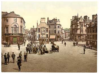
Kilmarnock town
centre, c.1900 |
After
the war, despite major congestion, it was not until
the 1970's that a bypass was built. In the intervening
years roundabouts, traffic lights, and a one-way system
were tried out in the town.
(8) The new road linked two
previously completed sections of dual carriageway north
and south of Kilmarnock giving dual carriageway from
Fenwick to Ayr. There was an associated road bypassing
Hurlford.
This
new stretch of the A77 is built mostly over boulder
clay; but the Hurlford bypass required the excavation
of 12 feet of peat and the construction of a lightweight
embankment of pulverised fuel ash on a 30 foot depth
of soft silt. This embankment, which is 20 feet high
as it goes over Hurlford Moss effectively extends a
further 12 feet below ground and is laid on a three
foot layer of rock. Drainage on both roads is complex.
(9)
Loudoun
Burnfoot
Road was added in 1936 and ran for just over half a
mile from Muck's Bridge on Foulpapple Road westwards
to Burnfoot Farm and then towards Brocklees Farm.
Two furlongs of Whatriggs Road near its junction with
East Newton Road was removed in 1933 but restored to
the list three years later. Whatriggs Road ran from
the Galston to Kingswells Road to near Whatriggs Farm.
In 1965 just under half a mile of Milton Road (Loudoun
Kirk Road) was removed. It ran from just west of Burnbank
Bridge to the road leading to Ladyton. More of this
road was closed in 1999.
Auchinleck
Mill
Affleck Road that ran for just over a mile from the
A70 at Ochiltree Tile Works to the B7036 near Barony
Pit was removed in 1933.
Work
on the A70 was carried out east of Boghead in 1963 when
the road was realigned and a new bridge built over the
Boghead Burn. Cronberry road end was improved the following
year.
Also
in 1963 Rigg Road was realigned between Rigg Toll and
Rigg Farm.
Mauchline
Sawerston
Road, � mile in length, was removed in 1933. It ran
from Darnhay Road to Auchmillan.
Howford Bridge was opened in 1961/62 and the old bridge
bypassed. A road closure was taken out on the old bridge
in 1999.
Muirkirk
 |
| Road to Netherwood |
In
1933 a new bridge and � mile of approach roads were
built on the A70 over the River Ayr near Wellwood. Stretches
of the old road can still be seen. Details of the Sanquhar
road are given.
One
mile of the Aitkencleugh Road was removed in 1959. It
ran from the Muirkirk-Sorn Road near Townhead of Greenock
north and then east by way of a ford
(see Muirkirk entry) to Aitkencleugh. The rest of the
road to Netherwood remains on the list. The old track
with its double hedgerow is easily spotted from the
Sorn road.
In
the 1990's, part of the road serving Glenbuck was removed
to facilitate opencast mining operations.
Sorn
In
1953, one mile of road from the Galston - Sorn Road
up to High Braes was removed. It left the Galston -
Sorn Road, two and a half miles north of Sorn, and passed
North Blairkip Farm on its way to High Braes. There
is a further mile of track leading to a sheepfold.
 |
| Early AA road sign in Culroy |
Maybole
Road
improvements in Maybole parish are not noted in the
amended 1878 List. However, it is quite clear when driving
between Ayr and Girvan that there have been major improvements
to the A77 as evidenced by the numerous lay-bys and
superseded stretches of old road. These date from the
early 1970's.
Barr
The
Muick Road ran through Colmonell and Barr parishes from
Pinwherry via Fardenreoch, Docherneil and Ballymore
over to Pinclanty on the B734. In 1932 2� miles of the
Muick Road from the B734 to Mark Farm Roadend was removed.
This left a mile and a quarter from here to Docherneil
Bridge as a public road in Barr parish. From there it
continues as a public road in Colmonell parish to Pinwherry.
Nearly three miles of road was added in 1960. This was
the Black Clauchrie Road in Barrhill that ran from the
A714 at Blair northeast by Laggan Farm to Darnaconnar
House.
Kirkoswald
In
1932, 1� miles of the Littleton Road between Culroy
Bridge and the Dowhill Road was removed. This is still
a well-defined track about � mile from the A77 running
south from near Turnberry Holiday Park to the Industrial
Estate north of Girvan. It contains a number of bridges
including Lady Bank Bridge and is very attractive as
it winds between overgrown hedgerows.
The
following year the Corriston Road was removed. This
went from Kirkoswald Church south over a couple of fords
at Corriston Farm to the Hollowshean Road just over
half a mile away. One hundred yards was added in 1955.
Also removed in 1933 was � mile of the Drummochreen
Cairn Road near Craigdow in the hills about 3 miles
south of Maybole.
Straiton
In
1939 the old Bridge of Ness (at the north end of Loch
Doon) was replaced by a dam (image)
and various sections of road alongside Loch Doon were
removed from the list.
 |
| The
old road can be seen near the loch |
These
were: 1185 yards south from the bridge; 1890 yards south
of Beoch Farm as far as the old bridge over the Garpel
Burn; 2100 yards south of Lamdoughty; and a stretch
of 110 yards near Craigmalloch Holding, a total of 3
miles (see also Dalmellington). Much of the old road
can still be seen today from the new stretches of road.
Over a quarter of a mile of Holehouse Road north from
Glenhead Cottage was removed in 1957. This is part of
the old hill road from Straiton to Patna.
Although
not a County Council initiative, Maybole Burgh commissioned
a development survey of Maybole
(10) in the late 1950's and
this included transport in its remit. The writer analysed
traffic problems in the town, particularly the narrowness
of the High Street and proposed a by-pass to the north
of the town centre close to the railway line. This,
however, was never built.
Interestingly,
the writer notes one of those minor administrative details
on local transport that are all too often forgotten.
This was that in 1947 the County Council and the Agricultural
Executive Committee introduced a new programme of housing
for agricultural workers. They could either be housed
on the edges of towns where they would be able to enjoy
the amenities of the town yet be within easy reach of
their place of work, or else settled in groups of 6,
8 or 10 houses on a bus route. Both of course are dependent
on regular bus services and when these became less frequent
it made travel difficult for the residents.
Burgh
Councils had a limited responsibility for roads. (11)
Thus at one meeting of Ayr Burgh
in 1930 they only considered road direction posts and
signs. In 1931, Girvan's Bus Stance Committee granted
Girvan Motors a stance for one taxi at 30/- rental for
the summer, and J. S. Bingham a stance for a charabanc
and a taxi at �4.10.0. It was agreed to keep an area
near Carson's Stores free of "standing private cars"
so that buses could stop there.
1.
J Strawhorn, History of Prestwick, John Donald, Edinburgh
1994
2. CO3/8/2/ - Ayrshire
Archives or see Council Minutes by year, Local History
Collection, Carnegie Library, Ayr
3.
David
McClure, Old Fingerposts in Ayr, Ayrshire Notes
No.18, Spring 2000
4.
J Kevan McDowell, Carrick Gallovidian, Ayr, 1947
5.
S Hay, Gathered Threads, Tarbolton
5a
I W Smith and P Iley, Major trunk road works in Ayrshire,
Journal of the Institution of Municipal Engineers, 1969
6.
Janet Retter, Drongan, The Story of a Mining Village,
Cumnock and Doon Valley District Council, 1978
7.
William J Dillon, The Trinitarians of Failford, AANHS
Collections, 2nd Series, Vol.4, 1958
8. J Mackay, Kilmarnock,
Alloway Publishing, Darvel 1992
9.
leaflet produced by Ayr County Council for the opening
of road
10.
Survey Report, I Cooper - copy in Local History Collection,
Carnegie Library, Ayr
11.
copies held in Local History Collection, Carnegie Libray,
Ayr
|
|
|
|
|
|
|