 |
||
| Home > Roads and Tracks of Ayrshire > Local Roads |
|
|
The writer of the NSA gives a poetic description of the coast road "having on the one side the rocky shore and majestic ocean, and on the other the verdant hills of Carleton and Bennan." The road along the banks of the Stenchar (stet) with "its windings amid the most picturesque scenery, and the beautiful hill of Knockdolian," presented a variety of enchanting pictures to the eye. Another road, used by the mail from the south, came from Barrhill on the Girvan to Newton Stewart road. Barrhill had only recently sprung up and was the only resting point between these two places.CoyltonUseful details of the roads are given in the NSA. There were 14 miles of turnpikes with gates at Crosshill, Dykneuk, Broadhead, Potterhill and Dalmacow. The rent for the first two combined was �239, and for the others was �145, �30 and �37 respectively. It cost �30 p.a. to maintain the Ayr - Dumfries road for each mile, and �6 and �8 for the Dalrymple and Broadhead roads.There were 11 miles 2 furlongs 177 yards of rather poor parish roads and income from the Statute Labour conversion was �52.14.2. The roads came under the surveyors for the Ayr and Mauchline districts. There were also private roads to farm-steads.Although the stagecoach from Old and New Cumnock to Ayr passed daily, carriers were weekly. Goods were also carried on the coal carts that went each day to Ayr.Craigie
The OSA says that the condition of the roads was good "considering the great number of coal and lime carts that are constantly passing over them."In 1894, there was a revival of a race at Barnweil which had last been held 20 years before - there were two hundred carriages on the hill and road to watch the race. (6)DaillyThe NSA account noted that the parish had good roads, there being 5 miles of turnpike on the north of the river and 6� on the south with other turnpikes branching from these. The Girvan was crossed by three public bridges and one private bridge; smaller streams also had bridges. There is mention of only one coach, weekly, between Girvan and Ayr.As mentioned under Ayr, Drumgirnan Bridge over the Water of Girvan near Kilkerran was built by John and James Rutherford of Ayr in 1799. (7)DalryReference is made in the OSA to the good condition of the main roads and the expectation that the "by-roads" would soon be attended to. There were 9 bridges close to the village.The NSA says that there were 22 miles of turnpike, and 26� miles of parish roads. The parish had 5 tolls although the Largs Toll was three times more expensive than the others, charging 6d per cart and 3d per horse. Although the roads were good, many were "steep" and "ill-directed." When describing the coaches and carriers in the area the writer says that bread carts went each day to the surrounding towns and villages.He also says that "about 80 years ago, there was nothing deserving the name of a road in the parish, the intercourse being chiefly carried on horseback, on cars destitute of wheels. The roads were consequently mere horse paths, and from the boggy nature of the low ground, the more hilly paths were preferred." There were two bridges over the Garnock and two bridges over the Rye and the Caaf. He complains about the narrowness of the Garnock bridges although they were not as steep as they used to be since the Beith road was built, and deplores the fact that the ledges (parapets) of some had been "thrown down."DalrympleThere is just a brief mention in the OSA of the benefits brought to the parish by good roads.At the time of the NSA, a carrier went to Ayr twice a week. The mail coaches to Ireland passed each evening a mile and a half west of the village but it is not clear if one could stop them on passing. A reference is also made to the putative Roman road nearby.Dalmellington
Although roads are not mentioned in the OSA, the writer says that coal was carried south into Galloway for up to 30 miles.The NSA says that there were 6 bridges over the Doon and about a dozen over other streams. One bridge, over the Doon, was 116 years old and another, over the Muck, about 60 years old. He suggests the first roads in the parish were also about 60 years old. Details of coaches and carriers are given.Mention should be made of the villages built by the Dalmellington Iron Company and others for their workers. These were sited at various locations in the hills around Dalmellington but over the years they were closed down and the residents transferred to Dalmellington, Bellsbank, Polnessan and Patna. (8) The villages were surprisingly large. Waterside had a population of 1500 and Benquhat 700.The villages and the roads and tracks serving them can be seen on earlier OS maps. Lethanhill and Burnfoot were a mile east of Patna - there was no road until 1924, only a rough track to Burnfoot prior to this. Waterside was sited on the main road and higher up the hill and so was not as isolated as the other villages. Craigmark, one mile north of Dalmellington, was on the old track to Rankinston - a new village was created for the inhabitants at Burnton in 1925. Further along the Rankinston track there was a branch road to Benquhat.There were two small communities on the Dalmellington to Ayr road north of Patna - Kerse and Tongue Row. East of Dalmellington there were pockets of housing near Pennyvenie on the New Cumnock road, and a village at Beoch with an access road a mile long.DreghornThe OSA has a brief mention of strolling beggars.The NSA refers to the ford on the road between Dreghorn and Dundonald. There was a mediaeval stronghold nearby, probably sited there to monitor movement at the ford.DundonaldApart from a reference to the dangers of quicksand on the coastal route (cf. Armstrong's map) between Ayr and Irvine, roads are not mentioned in the OSA. However there are sufficient references to markets, fish, coal etc to assume considerable local movement.The NSA says that the three turnpikes that ran through the parish were in good condition although tolls were expensive. These turnpikes were Ayr to Irvine, Irvine to Dalmellington and Kilmarnock to Troon. The parish roads were in fairly good repair. The writer remarks on the need for a bridge over the Irvine at the ford near Dreghorn.DunlopAt the time of the OSA the parish was well served by roads which made travel easy.The NSA notes that in addition to 9 miles of turnpike to Paisley and to Neilston there were 14 miles of good parish roads. As Dunlop is still noted today for cheese making, there is an interesting reference to cheese cadgers who would buy from the farmers and take it to outlets in the towns. Although this trade had shrunk in past years there were still 14 people in the parish employed in this.FenwickThe OSA mentions the "great road" from Glasgow to Ayr, by Kilmarnock as well as good roads to Loudoun, Gulstin (stet), and Irvine by Kilmaurs. The parish had completed their part of the road to Stewarton. He relates the story of King James VI who journeyed this way in the late 1500's losing his horse in a bog and being appalled by the state of the road (p.59).The story is repeated in the NSA.In the Annals of Fenwick, Taylor recounts an accident in April 1842 when a horse ran away with a phaeton through the village at full speed. Three of the party managed to jump out but one had to endure the ride as far as Waterslap where he had to leap from the carriage. (9)Galston
The OSA says that the Edinburgh - Ayr Road and the Glasgow - Dumfries road passed through the village. It also refers to peat being brought on horseback from Caprington 50 years before, through almost impassable clay roads (p.78).After speaking about the Roman fort at Loudounhill, the writer of the NSA refers to the fact that "the Roman Military way, which may still be traced on the opposite bank of the Irvine (i.e. north side), furnishes incontestable evidence that the parish of Galston has received at least one visit from the masters of the world."There were 10 miles of turnpike roads and more than 20 miles of parish roads as well as roads within Lanfine Estate. Coaches went to Glasgow, Edinburgh and Dumfries, and carriers went to Kilmarnock each day.Girvan
The only mention in the OSA is of the Portpatrick road and there being a want of roads in the parish.The writer of the NSA says that nine miles of the Portpatrick turnpike ran through the parish, with good inland roads branching off in all directions.Girvan had a low wooden bridge still existing in 1894. The Reverend Lawson (10) writes of this bridge that "the very holes in the footway which made it dangerous to the unwary, were a constant parable to us of the bridge of life, through which, ever and anon, as in Mirza's Vision, travellers were dropping to be seen by us no more." A new iron bridge was built about 1890.IrvineThere is reference in the OSA to roads to Kilmarnock, Ayr, Greenock via Kilwinning, and Glasgow via Stewarton. Statute Labour money was used for their upkeep but the writer noted that the 3 shillings per household was a burden for poorer people. There was a "fly" to Glasgow, via Kilwinning, Dalry, Beith and Paisley 3 times a week, and a stage coach to Greenock twice a week.
The Earl of Eglinton built roads on his estate near Irvine and in fact intended to build a road that would run through his lands from Eglinton to Cleughearn Lodge south of East Kilbride. He started this but ran out of money after the failure of his tournament in 1839 and today only a short stretch near Eaglesham has its origins in the scheme. (11)In 1827 the bridge in Irvine was widened to 25'3" and to 38'4" in 1888. The Ayrshire Roads Act of 1847 had passed responsibility for maintenance to trustees and in 1887 this passed in turn to the corporation. (12,13)Island of CumbraeThe OSA says that little was done to the roads except between Millport and the ferry to Largs.By the time of the NSA, Cumbrae had been transferred to Argyleshire. The only regularly constructed road was that between Millport and the ferry but the use of this was being overtaken by direct sailings from Millport.KilbirnieAt the time of the NSA there were 5� miles of turnpikes and two good parish roads, 6� miles in length. There were 12 bridges. Although there were regular carriers to Glasgow, Paisley, Beith and Largs, people had to travel to Beith to pick up a coach and no conveyances could be hired in the village.Again we see a problem with broken parapets for on a "dark stormy night in the winter of 1811, a native fell over it, and was carried off by the swollen river and drowned." The turnpike on the south side of the loch had no bridge so was impassable after heavy rain, although there was a wooden bridge for pedestrians.KilmarnockThe OSA refers to roads leading to Glasgow and other towns and to roads made on the Barrowfield estate. There was a post office which served the neighbouring parishes.The writer of the NSA says that there were 5 bridges over the Water of Kilmarnock within the town, and two over the Irvine. The turnpikes were in good condition and the town was well served by coaches and carriers. The parish roads were numerous and were the equal of any in Great Britain and although "old streets in the town were narrow and inconvenient, the modern thoroughfares were spacious and handsome." With regard to narrow streets McKay's reference to a passenger on a coach lifting a bowl of porridge from a house is pertinent. (14)
Accounts of floods are quite common in the local literature and at times have been very severe causing considerable damage to bridges. Thus McKay tells us that in 1852 a great flood destroyed several bridges in the Kilmarnock area: 2 stone bridges over the Croilburn were swept away; as were Dalraith Bridge on Craufurdland Water; the wooden Duke's bridge near Dean Castle; and two wooden bridges south of the town centre. There was alarm in the town centre as the parapets of Townhead bridge were destroyed and prisoners had to be moved from Flesh Market Bridge (built in 1779) where they were housed in a prison. This bridge held the council chambers and some houses. A lot of the damage was done by a huge boiler which had been swept away from a factory upstream and crashed into the bridges.The new bridge in Kilmarnock was built in 1804.Kilmaurs
The OSA mentions roads from Kilmaurs to Kilmarnock, Irvine via Cunninghamehead and Perceton, Fenwick, and Ayr via Bushby and Fairlie Bridge and generally easy travel within the parish. The writer explains the system of funding the roads.McNaught gives an interesting insight into rights of way near villages. (15) We tend to assume that rights of way are indicative of old roads which went from village to village or longer distances. There are such of course but it is quite common to see a pattern of short routes of a mile or so radiating from a town. These, as McNaught shows, were in fact linked to common lands.He says that Kilmaurs had an old ford which had probably been in use since mediaeval times. There was a steep incline on each bank down to the ford and this remained when a bridge was built at the location. In 1848 during a time of economic hardship the unemployed were used to raise the level of the road by several feet to lessen the gradient and remove what had always been seen as a nuisance.A woman was killed in 1826 when during a drought she had driven onto the river bed in search of water. Unfortunately the horse bolted and she hit her head on the bridge and was killed. In 1843, two girls trying to find the bridge on a stormy December night strayed too near the river and were swept away.There was also another ford with stepping stones, and a footbridge was built there in 1824. The Townend bridge was widened in 1880. He refers to a parish road through Corral Glen built about 1835.Kilwinning
There
were 4 turnpike roads by the time the OSA
was written. These were funded under the statute labour
system and as the sum raised was sufficient to keep
them in repair, no tolls were levied in the parish.
However these roads were on the margins of the parish
and all other roads were totally neglected. One stretch
of 6 miles to the east was estimated by the writer to
be the worst in Ayrshire.
|
|||||||||||||||||||||||||||||||||||||||||||||||||||||||||||||||||||||||


 |
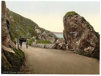
| Near Turnberry - view to the south towards Girvan |
 |
| Kirkoswald - Souter Johnnie's Cottage |
The OSA says that 40 years previously there was no communication with Ayr except for a riding post and a foot post once a week. There were no carriers. At the present time there was a daily post to Ayr with three carts weekly between Girvan and Ayr, one of which continued to Glasgow. In addition there was a carrier each fortnight from Maybole to Edinburgh. Post horses and chaises could be obtained at Girvan, Maybole and Kirkoswald and a diligence ran thrice weekly between Ayr and Portpatrick.
The writer mentions the great post road from Ayr to Girvan which passed through the parish. He refers to the great number of Irish vagrants and beggars passing along this road who oppressed the farmers with their "importunate and violent cravings."
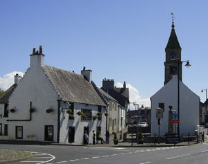
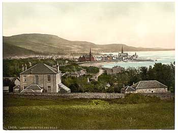
Largs
The OSA says that the Glasgow to Port Patrick road ran through the parish. To the north of Largs it had run over the hills but five years previously a shore road from "Skelmorly" was opened. This new road as well as three new bridges, had been funded by a toll at Kelly bridge. The rest of the parish however had suffered from a want of roads, the only one kept in repair was that to Brisbane in the direction of Kilmacolm, at the proprietor's expense.
It is clear that the surplus was being used to reduce the debts incurred in building the toll roads. Whilst this was legal it could only be done until the tolls were self-financing and the writer hoped that this would happen soon so that the parish could be repaired. The local people - each family had to pay 3 shillings conversion money - were very unhappy about the situation.
He gives a picturesque description of an annual fair where dozens of boats from the Highlands would sail over to trade. The fair attracted people from 40 or 50 miles around (p.518).
Roads had improved by the time of the NSA. The parish had 13 miles of turnpikes and 11 miles of parish roads. The writer appreciated the excellent turnpike to Kilbirnie and Dalry. A parish road had been made through the Vale of Brisbane up to near Loch Thom. Two new roads to "Kilburny" and Dalry, and Kilmacolm were proposed, although they had been talked about for years and nothing done. Where there were no roads access was on foot or horse. Mention is made of the water of Nodesdale and Gogo, the former being a "very impetuous stream" which often flooded.
 |
 |
| Main Street, Largs - note the gutter defining the pavement | Largs from the Red Road, c.1900 |
The "Red Road" from Netherhall to Meigle was completed in 1824 and served as the main road to Greenock. The Brisbane Glen road was started at this time. By 1840 the Kilbirnie road had been completed and a twice weekly coach service to Paisley was started.
To the south the main road ran past Law Castle (NS211485) on its way to West Kilbride and from there the road to Dalry can still be seen with its holloways and parallel stone dykes. There were tolls at Haylie, Noddsdale Bridge and Kelly. (17)
Loudoun
 |
 |
| Newmilns | Feature incorporating the old toll-gate, once in the main street of Darvel |
According to the OSA, John Earl of Loudoun had started making roads in the parish in 1733 and was the first to do so by the statute labour system. In addition, a bridge was built over the Irvine . About this time there were only 2 carts in the parish, belonging to his father and the factor. Ordinary people used sledges or cars for their grain, and small horses for coal. At the time of writing there were over 250 cars, along with a number of wagons.
Roy and Armstrong show the road through Newmilns and Darvel much as it is today but there have been changes here and there over the years. The 4th Earl of Loudoun straightened and widened the road through Darvel in the 1760's and 1770's, and in the early 1800's a local set aside a piece of land to the south of the road for a footpath. Road widening left the Dagon stone, a prehistoric monolith, stuck out in the middle of the road. In 1873, there was talk of removing this menace to traffic and breaking it into road metal. There was a changehouse at Goursbraehead where coach horses could be changed. (18,19)
Mauchline
In the OSA reference is made to the Ayr - Edinburgh and the Kilmarnock - Dumfries turnpikes crossing at Mauchline, as well as to several bridges in the area including the new bridge at Barskimming.
The NSA also refers to the two turnpikes. There were 11 miles of turnpike roads in the parish and several bridges, including the new bridge at Barskimming, built by the late Sir Thomas Miller, which " excels all the bridges in the country in beauty and elegance."
 |
| The Burns Memorial, c.1900 |
Mauchline had an annual horse race on public roads until the 1850's. This went along the road from the Burns Memorial to the foot of the Skeoch Brae. (20) Burns himself lived in Mossgiel, a mile or so north-west of Mauchline. William Fisher, the object of his famous satire, "Holy Willie," was on the surface an upright elder but in fact was a sanctimonious hypocrite much given to drink and even said to have stolen money set aside for the poor. On his way home late one night he fell into a ditch and drowned. A whisky bottle and a loaf were found nearby. The spot was at South Auchenbrain, three miles north-east of Mauchline towards the Sorn - Galston road. (21)
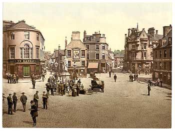
Maybole
 |
| Maybole |
The NSA gives the length of the turnpikes to the nearest yard - 28 miles; 6 furlongs; 0 poles and 8 yards. The local roads and their associated bridges and embankments were in excellent condition.
In 1773 we read that "the Cross of Mayboill (set up around 1516 after the town received its charter) is ane obstruction and hinderance to coaches and carridges as they pass and repass along the street."
In 1787, MacAdam built a road using his methods from the Maybole Road at Culroy up to his property, Sauchrie House. He later became a Roads Trustee. (22)
Monkton and Prestwick
The only mention of roads in the OSA are of bridges on the toll road between Monkton and Ayr and one on the road to St Quivox and Tarbolton.
The NSA details the four turnpikes, totalling 12� miles in length, that passed through the centre of Monkton, viz: Ayr to Irvine and Kilmarnock, Mauchline and Tarbolton to Irvine and Cumnock, Coylton and St Quivox to Irvine. There were frequent coaches.
Muirkirk
 |
| The road to Sanquhar and Dumfries |
The OSA says that the Edinburgh - Ayr road ran through the parish. Although its condition was tolerable elsewhere, it was not in good repair in Muirkirk itself. Work on a new road ("another great road") to Dumfries and Carlisle was being undertaken. At the time of writing, three bridges were being built on the Edinburgh to Ayr Road, over the waters of Ayr, Greenock and Garpel.
By the time of the NSA, there were turnpikes to Strathaven (in excellent condition), Ayr to Douglas, and Mauchline via Sorn. Several bridges, particularly on the Douglas road were in "tolerable" repair. Work had recently been carried out to repair some of the parish roads and more work was envisaged.
Glenbuck, in the east of the parish, used to have several hundred people living there but now has only a few inhabitants. A road left the A70 and looped through the village to re-emerge near the reservoir but the western section of this road has been closed.
New Cumnock
The NSA refers to one turnpike and several parish roads, all in good condition. A stagecoach passed through daily on its way to Dumfries. The local roads, particularly on the east side of the Nith, had been poor but were improving. A local landowner, Sir G Stuart Menteath made a railroad for coal and lime three miles in length, which went to the summit at the boundary with Dumfriesshire where it was transferred into ordinary wagons for the four miles descent.
Newton Upon Ayr
The OSA refers to two tolls on the main turnpike through Prestwick and Kilmarnock to Glasgow. The rents were �100 and �285 per annum.
Ochiltree
 |
 |
| Ochiltree village - the name is Brythonic and dates from the Dark Ages at least | Just east of the old bridge the road swung to the north. At a later date it was rerouted eastward to what is now the B7036 and headed up to the Barony Road. Later still the old bridge was bypassed by a new bridge and a new stretch of road. See map and photo below. |
 |
|
| Image from Google Earth. © 2009 Tele Atlas. Image © 2009 Getmapping plc | |
The Minister writing the OSA account gives substantial details of the roads in this parish. The Cumnock to Ayr turnpike passed through the village, where there was a toll. Another turnpike from Barskimming Bridge cut the north west corner of the parish; it joined another turnpike from Stairbridge to Dalmellington and this also ran through the parish for 2 miles and 57 falls. This was an old Scots measure of which there were 285 in a mile.
Locals felt that once the considerable surplus from the statute labour funds had been used to repair the above roads, the remaining money should be used on the "parish or cross roads, which are most wickedly bad, and on which no statute money hath hitherto been expended."
At the time of the NSA there were 7 miles of turnpikes, and 16 miles of other public roads.
Old Cumnock
 |
| View of Cumnock in 1890's |
Mention is made in the OSA of good turnpike roads from Ayr to Dumfries, and from Ayr to Muirkirk, Galston and Kilmarnock. There were also 10 or 12 miles of "cross roads" made by the Earl of Dumfries for conveying coal and lime, and open to the public.
The NSA refers to 14 miles of turnpike in the parish and very good "cross-roads" in all directions. Improvements were at long last being made to the Ayr Road, but the Sanquhar road was in "great need of an improved line." Communications to Ayr, Kilmarnock and so on were reasonable, both by coach and carrier. Post horses, chaises and cars could be hired in the town.
There were 16 bridges, 3 of which were in the town, generally too narrow, and the one over the Lugar "at by far too great an elevation above the level of the road."
Prestwick
Strawhorn (23) notes that the turnpike trustees originally favoured a route by the back of Prestwick. Part of this route was laid out, and a small bridge (another "Roman" bridge) built over the Pow Burn. Sandfield Cottage was to be a hostelry on this route. They changed their minds, however, and took the route through the town centre.
Interestingly, to make sure people paid their tolls, the trustees proposed to build a dyke from Newton Loch to the toll bar and then to the sea but this was too expensive. In any case, people who wished to avoid tolls used the shore although further up there were dangerous quicksands where over the years a number of people had lost their lives.
Riccarton
The NSA
says that three major turnpikes ran through Riccarton
and, as a result, communications were excellent, including
a public omnibus to Ayr. There were two bridges in Riccarton,
one of which with its associated approach roads was
new and one in Hurlford, recently improved. The parish
roads were in "tolerably" good repair.
Sorn
Twenty five years earlier, says the writer of the OSA, "there was nothing, of any extent, in this parish that could properly deserve the name of a road." At the time of writing, however, there were half a dozen private roads and three public roads, viz. Glasgow to Dumfries via Galston, and the Ediburgh to Ayr routes via Cumnock and via Mauchline. This latter route from just past Muirkirk through Dalgin was meant to follow a easy path by the river to Sorn but was built at a higher level by mistake. This section included two steep hills which caused difficulties to travellers.
There were a number of small bridges as well as two larger bridges, one on the Old Cumnock road and one near to Sorn Church.
The writer also mentions various mineral deposits which of course would have had tracks to them. One in particular is coal extraction from the Burrowlands which had been going on since 1497. (24)
By the time of the NSA, there were 11 miles of turnpike on the Ayr to Douglas and Edinburgh road, and the Dumfries road through Galston. Transport connections were reasonably good. In fact, the list of occupations notes that 15 people were carters and carriers. The Catrine Company sent goods by wagon to Glasgow every "lawful evening" and they would arrive before noon the next day, a journey of approximately 12 hours.
The writer refers to a stone bridge built over the Ayr, near the manse on the Galston to Auchenleck turnpike (present B719), due primarily to the Reverend William Steel who was Minister in the early 1700's. There was also an excellent bridge in Catrine on the Mauchline to Muirkirk road.
In 1782 James Boswell laid out a new road to Sorn. It left the Barony Road at Merlinhill. (25)
There was a ford over the Ayr at the town, the present Ford Street, with a track to Mauchline and another to Cumnock. A timber bridge (the Tim'er Bridge) was built near the ford and replaced in 1879 by a metal footbridge. There was also Shepherd's Bridge on the Mauchline road but this is now ruined. (26)
Stair
 |
| Bridge at Stair - this is a very old crossing point, the name itself is Celtic for a crossing and Pont shows a Zett (i.e."gait") nearby |
At the time of the OSA, the parish had two turnpike roads, and 3 bridges over the "water of Air" including the well-known Barskimming Bridge built by Sir Thomas Miller at his own expense. Sir Thomas had introduced wagons and carts into the parish; before then pack horses had been used.
The same two turnpike roads, 6 miles in length, are mentioned in the NSA. Of the three bridges over the Water of Ayr, the upper one was "very ancient" but in good repair. The lower was built in 1745 and was very costly; the other bridge was the famous bridge at Barskimming.
Stevenston
Although there is no specific mention of roads it is clear from the OSA that there was regular communication with the rest of the county and beyond for purposes of trade - the road and salt industry, for example, was extensive. There were 16 carters and carriers in the town.
The NSA says that there were daily coaches from Saltcoats to Glasgow and Kilmarnock. During the summer, coaches ran to Ardrossan where steamers left for Arran.
Stewarton
Mention is made in the OSA of turnpike roads to Kilmarnock, Irvine and Glasgow and that Stewarton was a post town with a good service. He says that the inhabitants are "oppressed by the great numbers of strolling poor from Glasgow and other towns".
The NSA says that the roads were very good and caravans went frequently to Glasgow, Paisley and Kilmarnock.
Straiton
The OSA says that the name might indicate a Roman road in the area. The nearest supply of coal was about 4 miles away but as the road was impassable for carts for most of the year it had to be brought from Dalmellington, 8 miles away. There was regular trade with Ayr.
The writer of the NSA (1, 2)says that there were 23 miles of turnpikes, 10 stone bridges, two wooden bridges suitable for carriages and four for foot-passengers. He mentions that it was seven miles to Patna by public road and four and a-half miles over the moor. This was almost impassable in winter.
A coach ran for 14 years from Ayr to Newton Stewart through Straiton but was uneconomical. A coach to Ayr ran for a few months in 1832. Travellers to Dumfries could pick up the coach at Keirs bridge or at Dalmellington, a few miles away.
Symington
 |
| The old church of Symington |
The OSA refers to the good roads in the parish, in particular the Glasgow-Portpatrick road. Fifty years before the parish was almost in a state of nature and the roads were deep and unformed (p.396). Again reference is made to the main road bringing its infestation of "Irish vagrants and sturdy beggars from the neighbouring towns".
The NSA says that the major turnpike to Portpatrick ran through the parish for four miles. There were 5 daily coaches plus mail coaches and a "great number of carriers, waggons etc." This is an interesting reference which makes one realise that traffic on the roads was not just composed of the stagecoaches and carriers on their daily and weekly runs but also of farmers, manufacturers who had their own vehicles, carts carrying coal from the mines and numerous others. There would also have been many people on foot and on horseback.
St Quivox
The NSA says that communications benefitted from being so close to Ayr. The roads to Mauchline and to Galston were in excellent repair.
Tarbolton
 |
| Tarbolton |
The writer of the OSA says that the "cross roads" of the parish whilst good have the disadvantage of being "conducted without any distinction, indifferently up heights, and down into hollows."
The NSA says that the parish was crossed by the Kilmarnock - Dalmellington and Ayr - Muirkirk roads. There was a daily post and weekly carriers to Glasgow, Kilmarnock and Ayr.
A Tarbolton history by H Stein refers to villagers travelling by cart to the market in Kilmarnock with butter and eggs to sell. (27) Although only a few miles it was a very rough drive, and the passengers were seated or sprawled amongst their produce. It was an open cart but a canvas cover could be pulled up in case of rain.
West Kilbride
 |
| West Kilbride |
In the OSA there is only a reference to the great road from Greenock to Port Patrick (p.423). However, in dealing with Portencross he suggests that this was where pilgrims embarked for Iona and where early kings were carried over the seas for burial on the island. Moreover he says that "the track of a line of road, can be distinctly traced through the country, leading from the capital (Edinburgh) to this port". This was thought to be in the time between Kenneth McAlpine and Malcolm Canmore.
Newall and Lonie had referred to what they suggested might be a Roman road running from near Kilwinning and that near to West Kilbride it could have been the Haaf Weg or "road to the sea". A reference below is to Halfway Street in West Kilbride. Given the evidence in Largs parish of frequent contact with Argyll, it is not impossible that this is the case, particularly when local traditions in Arran support it. If true, it would be a very important find, given the paucity of knowledge of Dark Age and even mediaeval routes.
The NSA says that there were 9 miles of turnpike, viz. the coast road north and a road to Dalry. There were 13 miles of parish roads in tolerably good condition - again the use of the word "tolerable".
The Reverend John Lamb (28) says of West Kilbride that the parish roads had been mere tracks filled with field stones and very hilly as they avoided boggy low ground. Prior to 1830, the turnpike was nearer to the sea on the stretch between Chapelton and Seamill. It passed between pillars just after Yonderfield and kept to the north and west of a morass where stepping stones were used. Beyond the morass it passed Thirdpart, Campbelton and the Rest Tree at Hunterston.
Among other bits of miscellaneous information he lists eight rights of way, notes that Halfway Street ("Sea road") was the main route from the village to the sea and that there was an old road past Alton to the sea. A bridge in the Main Street has an inscription, "Jane, Countess of Crawford 1623" and a bridge on the Ardrossan road over the Gourock Burn was known as Tailor Loup where a tailor had leapt off the bridge to his death when chased by a bull. In 1826 some roads were built as relief for the unemployed.
For more information on roads and bridges in the Hunterston area see Virtual Hunterston website.
1. Dane Love, History of Auchinleck, village and parish, CARN, Cumnock, 1991
2. Rev. John Warrick, History of Old Cumnock, Paisley, 1899
3. David McClure, Two Extant Bridges of John & James Rutherford, AANHS, Ayrshire Notes No.15, Autumn 1998
4. Mackenna, Round about Girvan, Hugh Wallace, Girvan, 1906
5. Borland, Ballantrae, 1931
6. D Mackie, Ayrshire Village Sketches, Kilmarnock, 1896
7. David McClure, op.cit.
8. R Farrell, Benwhat and Corbie Craigs, Cumnock and Doon Valley District Council, Manpower Services Commission, 1983
9. J Taylor, The Annals of Fenwick. Ed. T D Taylor, Ayrshire Collections, AANHS, Vol.9, 1970, p 29
10. Rev. Lawson, Fifty Four Views of Carrick, J & R Parlane, Paisley, 1894
11. Thomas Eric Niven, East Kilbride, The History of Parish and Village, Gavin Watson, Glasgow 1988, 2nd edition, p.221
12. W Walker History of Irvine - Collection of articles which appeared in the Kilmarnock Standard, see copy in Carnegie Public Library, Ayr
13. A McJanet, Royal Burgh of Irvine, Civic Press, Glasgow, 1938
14. Archibald McKay, History of Kilmarnock, 1880, p295
15. D McNaught, Kilmaurs Parish and Burgh, Alexander Gardner, Paisley, 1912, p.251, 262
16. Rev. W Ker, Kilwinning, 1900, p.103
17. R Findley and T Sorbie Swan, Largs - A Short History, 1980
18. J Woodburn, A History of Darvel, Walker and Connell, Darvel, 1967
19. A McLeod, The Book of Old Darvel, Walker and Connell, Darvel
20. D Mackie, Ayrshire Village Sketches and Poems, Kilmarnock, 1896
21. Mauchline Memories of Robert Burns, Ayrshire Collections, AANHS, Vol. 14, No.6., Walker & Connell, Darvel, 1985
22. Rev. R Lawson, Maybole Past and Present, J & R Parlane, Paisley 1885
23. J Strawhorn, History of Prestwick, John Donald, Edinburgh, 1994
24. thought to be near Gilminscroft - see entry for coal in historical article by J Strawhorn in Among Thy Green Braes, ed. J Moore, Cumnock & Doon Valley District Council, 1977
25. D Love, History of Auchinleck, op.cit
26. 200 Years of Catrine and Sorn Parish, ed. R Dalziel and T Harrison, Catrine, Sorn and District Local History Group, Countryside Publications, Brinscall, 1987
27. H Stein, Tarbolton Its History and Associations, 1896
28. Rev. John Lamb, Annals of an Ayrshire Parish, Rae, Glasgow, 1896, 1899
Next (Coaches and Other Transport)
|
|