 |
||
| Home > Roads and Tracks of Ayrshire > Pre-Turnpikes |
|
|
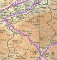
If this is correct then we are looking at a line 300 or so metres west of the present track as far as Cosses where the road split and rejoined again near Heronsford. It should be emphasised, however, that it is only suggested by inconsistencies between the two maps and the present day track; in the absence of confirming evidence one could point to change of placenames or even the positioning of farms as well as inaccurate mapping - there is after all an old road approximately where they show it, so it may be that which they are showing. Aerial photos show only the one track, that clearly seen on modern O.S. maps.One point of interest here is that McDowell in his Carrick Gallovidian refers to a couple of old milestones on this track. One is still there at NX123824.
Now hard to read, the 6" OS map shows it was 17 miles to Stranraer and 4 to Colmonell. It is fairly similar to milestones on the coast road (there is one at Ballantrae just north of the river) and quite unlike the normal turnpike milestones in Ayrshire. This may just mean that it, and the coastal milestones, were put in by a different turnpike trust. However, the writing is greatly worn and this may indicate that they are much older. As noted at the end of the chapter on mediaeval roads, they may be those referred to in Blaeu's Atlas of Scotland, published in 1654.Once over the Tig at Heronsford, Roy's road passed west of the old church and very close to the farm of Sallochan, suggesting a line west and north of the present road. There are fords, a track and double field walls near the farm which may indicate the road. Once past Sallochan Hill it sems to have had the same line as the modern road.South of Colmonell he shows a track running beside the Pyet Burn as far as Shalloch.ArmstrongMost of what was said about Roy's road would apply also to Armstrong, viz., that although running in the same direction as the turnpike it was a few hundred yards west of it.Near Heronsford his mapping is difficult to interpret. Once past Auchenflower his road went directly to Knockdhu and towards Sallochan then past Craigneil Castle (his "ruin") to Colmonell. As the Knockdhu and Sallochan placings could (with a little stretching) be consistent with a north -south line or Roy's more east - west line here it comes down to the stretch just past Auxchenflower to help us decide.A couple of factors favour a north - south road here, i.e. cutting over Cairnhill to meet Roy's road near Knockdhu Bridge. One is that the road is shown to be too far from the Stinchar and the old church at Kirkcudbright - Inner - Tig. The other is that although Mains (if it is Mains of Tigg) looks wildly displaced, it is in fact topologically consistent with its real position in relation to Sallochan and a road to the east of it - this would make it different from Roy's which would be to its west, and so favour a more north - south route.Against this, the 20 or so years between the maps make it unlikely any new roads had been built in that short time and it has to be asked where had Roy's road gone especially if the turnpike (as shown on Thomson) was built very close to it. It is easier to think that Armstrong's mapping is inaccurate and that he is in fact showing the more easterly of Roy's roads and then the single road past Sallochan to Colmonell.6. Colmonell - Pinwherry (R 2-2, 3-5; A5)Roy
|
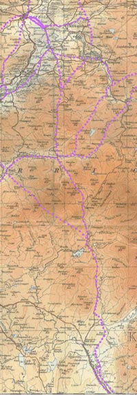
 The
diagram shows the sheets of both the Roy and Armstrong
surveys. The Roy sheet references are in black and the
Armstrong in red. The various roads are listed and an
attempt made to identify the routes Roy and Armstrong
show on their maps for each road. Each road is given
a reference to the Roy and Armstrong sheets it appears
on, e.g.,Maybole - Girvan (R 3-4, A 3,5).
The
diagram shows the sheets of both the Roy and Armstrong
surveys. The Roy sheet references are in black and the
Armstrong in red. The various roads are listed and an
attempt made to identify the routes Roy and Armstrong
show on their maps for each road. Each road is given
a reference to the Roy and Armstrong sheets it appears
on, e.g.,Maybole - Girvan (R 3-4, A 3,5). 

 South
from Turnberry it looks as if it ran closer to the coast.
It skirted Gallow Hill on the west side and then swung
over to Knockvalley to cross near the present footbridge
at the west end of the caravan park.
South
from Turnberry it looks as if it ran closer to the coast.
It skirted Gallow Hill on the west side and then swung
over to Knockvalley to cross near the present footbridge
at the west end of the caravan park. 


 Although
his road ran from near Almont to Daljarroch it doesn't
cross the river like Roy, nor does it go up past Bargain
Hill. Using Thomson, and Armstrong's placing of Letterpin
and the distinctive Motte which he marks as a camp it
is clear that the route had changed from Roy's time
and ran much along the line of the A714, although it
is not marked as a turnpike.
Although
his road ran from near Almont to Daljarroch it doesn't
cross the river like Roy, nor does it go up past Bargain
Hill. Using Thomson, and Armstrong's placing of Letterpin
and the distinctive Motte which he marks as a camp it
is clear that the route had changed from Roy's time
and ran much along the line of the A714, although it
is not marked as a turnpike.
 The
first two of these roads seem to have left the Newton
Stewart road just above Drumgrier as a single track
initially and ran over towards present Liglartie and
then up the valley towards Ballimore, though the fit
with the present day minor road is not good so it may
not be the same, albeit close to it. From near to Ballimore
and Docherneil, one road headed over towards Pinclanty
and the other to Pinmore Mains.
The
first two of these roads seem to have left the Newton
Stewart road just above Drumgrier as a single track
initially and ran over towards present Liglartie and
then up the valley towards Ballimore, though the fit
with the present day minor road is not good so it may
not be the same, albeit close to it. From near to Ballimore
and Docherneil, one road headed over towards Pinclanty
and the other to Pinmore Mains. 
 |
Armstrong
Armstrong and Thomson also show this road. Armstrong has the quote:" At the Nick of Darlae and half a Mile West the Road leads on the Side of a very steep Hill, its not above two feet broad and if you stumble you must fall almost Perpendicular six or seven Hundred feet."
11. Barr - Old Dailly (R 3-4, 3-5; A5)
Roy
 The
road had essentially the same line as the modern road.
Working south from Old Dailly it ran up behind Penkill
and crossed the Penwhapple Burn near the reservoir and
ran down the valley of the Pingarroch Burn (on its east
side, unlike the modern road which is on its west).
Once it reached the Stinchar it ran down to a marked
bridge and crossed into Barr.
The
road had essentially the same line as the modern road.
Working south from Old Dailly it ran up behind Penkill
and crossed the Penwhapple Burn near the reservoir and
ran down the valley of the Pingarroch Burn (on its east
side, unlike the modern road which is on its west).
Once it reached the Stinchar it ran down to a marked
bridge and crossed into Barr.

However, one or two things on the map are confusing. These are the positions of Balcletchy, Brockloch, Tormitchell and Barbae. Following them strictly would route the road past the first two farms which would take it a mile off course. However, he clearly shows the road running between the Mull of Miljoan and Auchensoul Hill and then cutting across two streams which fits The Lanes much better than his Balcletchy. It is also clear that his crossing of the Penwhapple Burn is very near a distinctive stretch of the burn, shown also on Thomson, which is now covered by the reservoir. Finally, the road has a generally straight course which would be significantly different if it went through Balcletchie and Brockloch.
12. Barr - Old/New Dailly (A5)
Armstrong
North of Barr, there are two roads shown, leading to Lovestone near Old Dailly and to New Dailly. The first had the same line as the modern road except at Penkill where it takes the present day right hand road to near Lovestone. Unlike Roy, his road and the modern road are on the west of the Pengarroch Burn. The other is also the same as the modern road that leaves the Balloch road at Milton However, his road crossed the river about 200 metres short of Milton Bridge and took a straight line to Milton (shown clearly on Thomson). Further on there is a stretch of half a mile or so south of Delamford where it took a straighter line and just crossed the Lindsayton Burn where it then made directly for Dailly, passing north of Balcairnie. This may be the track at Balcairnie shown on modern maps. Thomson has the later line to Muirston on the main road.
13. Barr - Balloch (R 3-4, 3-5; A5)
Roy

He shows a road running the four miles to the junction with the Nick O'the Balloch road. He routes it south of the river but it may have run on the higher ground 100/200 metres south of today's road. Due south of Dalwyne it came nearer to the river to run between it and the modern road. It crossed the river at present day North Balloch Farm.
Armstrong
As said immediately above, he has the line of the modern road between Barr and near Milton but doesn't continue to the Balloch.
14. Maybole - Crosshill - Balloch - Newton Stewart (R 3-4, 3-5; A3,5)
Roy
 This
is marked as the road from Wigton to Maybole and Ayr
and is much the same as the present road. From Maybole
to Crosshill it is clearly the modern line as all the
features match up. South of Crosshill is less definite.
He has a road heading east towards Straiton which looks
like the present day track that starts at Dalhowan so
his road has the line of the modern road. It probably
continued on this course just south of the crossroads
at Cloyntie but then took a more direct route to near
Drumyork Hill. He shows the road as passing Blair which
would take it � mile west of the modern line but Thomson
shows the present Blair as Upper Blair with a Blair
beside his road so we can assume that Roy was on the
present day line at this point.
This
is marked as the road from Wigton to Maybole and Ayr
and is much the same as the present road. From Maybole
to Crosshill it is clearly the modern line as all the
features match up. South of Crosshill is less definite.
He has a road heading east towards Straiton which looks
like the present day track that starts at Dalhowan so
his road has the line of the modern road. It probably
continued on this course just south of the crossroads
at Cloyntie but then took a more direct route to near
Drumyork Hill. He shows the road as passing Blair which
would take it � mile west of the modern line but Thomson
shows the present Blair as Upper Blair with a Blair
beside his road so we can assume that Roy was on the
present day line at this point.

South of Blair, Roy shows a straight course and this suggests it was the track shown on the 1925 1" O.S. map running between Drumyork Hill and Knockinculloch (also shown on Thomson).
South of here he shows it as relatively straight and we would be fairly safe in assuming it has the modern line. However, there may have been a straighter line from the vicinity of Sally Pollock's Bridge to North Balloch. There also seems to have been a present straighter line near Pinvalley cutting out the sharp bend here.
Once over the Nick O'the Balloch it may have run a bit closer to the river as it is shown almost touching it at one point but it seems to have realigned itself with the modern road by Cairnfore and the county boundary.
There is an interesting "lost road" which left the main road at Drumyork and headed towards "Whiteford" which was Blairquhan. It is also shown on Arrowsmith (1807) running very directly to Blairquhan.
Armstrong
His road south of Maybole seems the same as Roy except that he has a definite bend near Barclay before realigning with Roy down to Crosshill.
South of Crosshill he calls it the Foggy Road. He is much less accurate than Roy but there are enough clues to suggest it had the same line as Roy's road, as would be expected anyway with only 25 years between them.
 |
15. Crosshill - Straiton (R 3-4; A3)
Roy
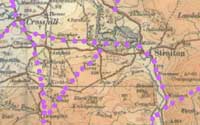 As
said he shows a road leading off the Balloch/Newton
Stewart Road that fits the track opposite Dalhowan,
just south of Crosshill. This ran over to a place called
Whiteford, now Blairquhan. Just west of Blairquhan near
the distinctive "island" formed by the meanders of Girvan
Water, the road from the "Nick of the Balloch" road
joined it. From here to Straiton it looks as if it headed
for Milton and then went close to the river to cross
near the present bridge.
As
said he shows a road leading off the Balloch/Newton
Stewart Road that fits the track opposite Dalhowan,
just south of Crosshill. This ran over to a place called
Whiteford, now Blairquhan. Just west of Blairquhan near
the distinctive "island" formed by the meanders of Girvan
Water, the road from the "Nick of the Balloch" road
joined it. From here to Straiton it looks as if it headed
for Milton and then went close to the river to cross
near the present bridge.

Armstrong
As usual he is imprecise enough to cause problems. One is that his Straiton road left the Kirkmichael road rather than the Balloch road as shown on Roy. Another is that his road ran south of Blairquhan. This would entail that his route ran near to present Parkfairn and High Garphar then south of Blairquhan to cross near to the present bridge. It has to be said, however, that even if they are different roads they would only have been 300-400 metres apart and often less along much of their course.
16. Straiton - Balloch (R3-4, 3-5; A3,5)
Roy
 This
road ran south to Craig on the line of the modern road.
Beyond Craig it crossed the river near Balbeg and then
cut across the hills to Balloch on the line shown on
the 1925 1" O.S. map. However, once past Knockoner (possibly
a reference to Gaelic conaire, a path, showing the age
of the route) it veered south past Lennie and ran between
Dalwine and the Tappins to Balloch passing White Row
on its way.
This
road ran south to Craig on the line of the modern road.
Beyond Craig it crossed the river near Balbeg and then
cut across the hills to Balloch on the line shown on
the 1925 1" O.S. map. However, once past Knockoner (possibly
a reference to Gaelic conaire, a path, showing the age
of the route) it veered south past Lennie and ran between
Dalwine and the Tappins to Balloch passing White Row
on its way.

Armstrong
The line is almost certainly that of Roy. The route is also shown on Thomson in 1828.
17. Balloch - Dalmellington (R 3-4, 3-5, 4-5; A5,3,4)
Roy
 The
stretch from Balloch to Craig was dealt with above.
East of Craig he has a road marked as from Wigton to
Dalmellington with a loop to the north off this road.
It climbed the valley above Craig and at the top the
branch swung north past Darsalloch Hill with the other
route passing Trostan Hill. They seem to have rejoined
south of the Dalcairnie Burn near Nether Barbeth then
continuing to near Home Farm to continue up to Bellsbank.
On the 1925 OS map there is a track from Auldcraigoch
to Meikle Shalloch. His southernmost track probably
lay 200 metres or less to the south of this for a good
mile or so from Meikle Shalloch before cutting across
to Nether Barbeth.
The
stretch from Balloch to Craig was dealt with above.
East of Craig he has a road marked as from Wigton to
Dalmellington with a loop to the north off this road.
It climbed the valley above Craig and at the top the
branch swung north past Darsalloch Hill with the other
route passing Trostan Hill. They seem to have rejoined
south of the Dalcairnie Burn near Nether Barbeth then
continuing to near Home Farm to continue up to Bellsbank.
On the 1925 OS map there is a track from Auldcraigoch
to Meikle Shalloch. His southernmost track probably
lay 200 metres or less to the south of this for a good
mile or so from Meikle Shalloch before cutting across
to Nether Barbeth.

At White Row, a road left the Knockoner - Straiton Road and continued up the Stinchar valley past Black Row on the north side of the river. Just before Cairnannock it started to climb, skirted Eldrick Hill and crossed the Pulreoch Burn near to Tairlaw. It then kept to the eastern shoulder of Genoch Inner Hill above the burn. It crossed the Water of Girvan near White Genoch and made its way up the valley opposite past Baing and the Chapel Burn to join the Wigton - Dalmellington road mentioned above, close to Baing Loch.
Armstrong
As already mentioned he has the same line as Roy between Balloch and Craig. From Craig it is fairly clear that he continues with the Roy line. His road cut the Baing Burn near Trostan Hill and passed north of Baing Loch. He shows it clearly as running between two main streams that must be the Shalloch Burn and the Gessel Burn. This could well link it with the track (still a right of way) from Knockdon to Dalmellington. If so, the link would be from the vicinity of the Black Loch to Dalmellington. His road certainly went past what looks like Black Loch and Shalloch to Barbeth, which this track does. He has a crossing near Barbeth where the Commissioners of Supply mention a bridge in a ruinous condition as early as 1720, and a distinct upward turn through Bellsbank where like Roy's road it joined the Carsphairn road just below the town.
An examination of aerial photographs revealed nothing conclusive about the course of old tracks across these hills.
He shows the new turnpike between Straiton and Dalmellington and although it looks out of alignment in places there is hardly any doubt that he is showing the correct line that the modern road still follows.
Thomson shows quite a few tracks in this area. Apart from the Bellsbank road to Barbeth he has another to the same place from Doon Bridge on the Straiton road. A branch ran in a long loop up the Shalloch Burn and back up to the main road near Gass. From there he had another route heading to Knockdon.
18. Straiton - Knockdon - Loch Doon (A3,4,6)
Armstrong only
Armstrong shows the Knockdon road (which still exists as a public road) although he misses out a part of it on one of his sheets. He routes it just to the east of Derclach Loch and then presumably through Nick of the Loup to join the Loch Doon road below Craigmalloch. The Loch Doon road runs completely to the end of the Loch and then another mile or so to Macwhirter that he says was a hunting lodge lately built by the Earl of Cassillis. To the north the road terminated at the Ness.
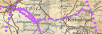
19. Straiton - Kirkmichael - Dalrymple (R 3-4; A3)
Roy
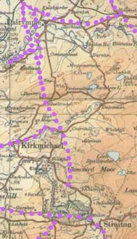 This
left the Maybole road just beyond Blairquhan and took
a very direct route past King's Hill and Barneil and
then on to Dalrymple. Near to Stepends Bridge, a significant
name, there is a track at grid reference NS364093. The
1925 1" O.S. map shows part of it and Thomson shows
the complete stretch to Guiltreehill.
This
left the Maybole road just beyond Blairquhan and took
a very direct route past King's Hill and Barneil and
then on to Dalrymple. Near to Stepends Bridge, a significant
name, there is a track at grid reference NS364093. The
1925 1" O.S. map shows part of it and Thomson shows
the complete stretch to Guiltreehill.

Although
the straight line of the modern road leading up to Dalrymple
looks tempting, in fact the Roy road ran past Cassington.
It crossed the stream north of here, keeping east of
it to near present Burnbank where it divided. It is
quite difficult to make out where the two tracks then
crossed the river. Keeping strictly to the streams the
western branch would have crossed downstream from the
confluence which would make it near present day Lindsayton.
There is in fact a distinctive meander that suggests
the crossing point was near to NS350135. The other track
would have crossed near to Barnford and Holms where
the Purclewan Burn joins the Doon. At this point Roy
has Dalrymple marked on the map but this may just refer
to a farm prior to the formation of the village, which
today is 300/400 metres away from this confluence.
Once over the Doon the western branch ran northwards to pass on the west side of Carcluie Loch where it joined a road running from Hollybush on the Dalmellington road. The eastern road went up perhaps near Carcluie where it joined this road. From here it took a direct line to Alloway so is very likely to have passed through Barrhill and Doonholm. Near to Alloway it split, with one branch following the river to meet the road to the south, the other continuing to Alloway.
Armstrong
The map is imprecise enough to leave the first mile or so of the road north of Straiton in doubt. As he shows it running past Milton, Kenmore and Bishopland it could be the present day track between Milton and Bishopland Lodge, although it could just as well be the modern road.
North of Bishopland one is more confident it is the modern line running past Cloncaird and showing the distinctive junction at Aitkenhead. The present road has quite a few bends north of Cloncaird and both he and Thomson show a straighter line so these bends may be later improvements.
There is no indication of Roy's route to Dalrymple; however, he does show similar roads near Dalrymple. One went over to Hollybush and as it shows the distinctive junction at Rodinbain is probably the modern line.
At Rodinbain he shows an interesting road that ran over to Patna. On modern maps and on Thomson it is very straight, although oddly enough the 1925 1" map has a more sinuous course like Armstrong. It skirted Patna Hill and crossed the river to Downieston (his Downie) a couple of hundred metres north of the village. It joined the Ayr - Dalmellington road here. He shows the Straiton hill track joining the road just at the river and there would seem to be no need to doubt that its present course is what he is depicting.
In the other direction he shows this road with a different alignment on leaving Dalrymple but this may just be the mapping. Farther on, however, it is easier to interpret, passing near Carcluie and forming the track past present Barrhill, skirting the Doon and then passing Doonholm Farm to end in Alloway.
As said, this appears to be Roy's road. Armstrong also has a road running from Carcluie up past Mount Oliphant, Glengall and Whin Muir to meet the Alloway-Ayr road. This fits the line of the minor public road running up to High Corton. The stretch from here to Glengall and the Ayr road is now lost but it ran north of Rozelle Park and the Slaphouse Burn to come out near the old racecourse, now playing fields.
South of Dalrymple he has a short stretch of road running past Barnford to meet the road that ran past Cassilis and terminated on the present day Dalrymple - Kirkmichael Road. This may indicate that the main road, as shown on Thomson, originally ran on to join the Dalrymple - Kirkmichael road but that it has been realigned at Chapel Knowe to run north, close to Barnford. The terminus for Armstrong then is the Kirkmichael road and his spur to Barnford is now on the line of the realigned main road and the track to the farm from where it ran up to Dalrymple. The cut off portion of the Thomson road (300 metres) lies in the belt of trees near Chapel Knowe (NS355133).
20. Alloway - Cassilis - Dalrymple (A3)
Armstrong only
About a mile south of Alloway he shows a road leading off the turnpike and heading down the west side of the Doon terminating just past Cassilis near Dalrymple. It is difficult to tell its exact course from the map, even though it can only be 200 or 300 metres from the river at any time. Taking the farms and the streams into account (presumably Long Glen, Brae Glen and Sauchrie Burn) the best option would be the main road on the bend and heading between Nether Auchendrane and Blairston and heading past Whiteleys within 100 metres of the Doon. It would then have continued near the river to Monkwood (this is where the A77 crosses just before Minishant) and it is just possible that the farm track shows its line. South of this point Thomson has a road passing Monkwood Mains and Low Midton, now a farm track, and swinging over to the mill (Newmills of Monkwood) where Armstrong has a junction with a road to Maybole. The problem is that Armstrong shows a Midtoun well away from his road and as Midtoun is on the Thomson road his road must have been nearer the river. This is not impossible as there is some 500 metres between the Thomson road and the river where his road could have run up to near Monkwood.
From the vicinity of the mill, its line may be that of the tracks near Casillis shown on the 1:25000 OS map running through Lindsayston Farm to the main road. His road terminated just past this point although there was a spur north to Dalrymple, passing Barnford.
21. Maybole - Cassilis - Dalrymple (A3)
Armstrong only
The road Armstrong shows from Maybole to the mill near Cassilis must be on or close to the turnpike shown on Thomson as far as High Smithston bridge. From here he had a road going past Smithston and Corriehill to the mill (still farm tracks). From the general alignment there can be little doubt this is the Armstrong road. The only variation is that Thomson in 1828 shows the A77 line, introduced by the 1805 Turnpike Act, whereas Armstrong has his road leading off the Kirkmichael Road near the present St John's Cottage.
22. Maybole - Kirkmichael (R 3-4; A3)
Roy
 This
is initially the Crosshill road as far as Attiquin (see
above). At this point, probably near present Littleton,
it ran along the ridge on which Attiquin farm stands,
passed south of the farm and made directly for present
Auchencairney and Hillhead. From here to the junction
with the north-south road at Dryrock Hill it is identical
with, or at least on the same line, as the modern road.
This
is initially the Crosshill road as far as Attiquin (see
above). At this point, probably near present Littleton,
it ran along the ridge on which Attiquin farm stands,
passed south of the farm and made directly for present
Auchencairney and Hillhead. From here to the junction
with the north-south road at Dryrock Hill it is identical
with, or at least on the same line, as the modern road.

He shows another road near Maybole that ran between Heart Loch and the Ayr Road.
Armstrong
The Kirkmichael road itself is clearly not the Thomson road which is the modern line. The best fit seems to be from the area of St John's Cottage, skirting the top of the loch just above Heart Loch which was much smaller then. It would then have headed for the area of Harkieston bridge to skirt the top of larger Chapelton Loch. He shows it skirting Barlaugh (Barloch) and then Chaple (Chapleton) which to an extent seems quite a diversion. There is however an interesting feature just north of Auchenairney that runs towards Chapelton and looks very like an abandoned road. From this point the map suggests a similar line to the modern road to Kirkmichael.
23. Maybole - Ayr (R 3-4, 3-3; A3)
Roy
 The
route is the same as the B7024 running up through Culroy.
This became the turnpike road. Armstrong and Thomson
show it as well.
The
route is the same as the B7024 running up through Culroy.
This became the turnpike road. Armstrong and Thomson
show it as well.

Armstrong
He has the same line as Roy. Once past Alloway it ran past Rozelle Park. Some realignment work has been done at some time on the sharp bend near Maryland, south of Alloway.
Just north of Maybole he shows a road leading off the Ayr road into the Carrick Hills. He has it leaving this road far too soon as it is the minor road about a mile and a half north of Maybole that leads up to Sauchrie. Going by the rivers and farm positions it would appear to be on the line of the present road as far as the Sauchrie Burn and Culroy Burn bridges. From there, as Thomson shows, it would have headed uphill to the right hand side of Sauchrie Burn to terminate a little farther on, perhaps at the summit.
24. Turnberry - Ayr (R 3-4, 3-3; A3)
Roy
 The
road ran from Milton at Turnberry, through the present
Lands of Turnberry to the shore at Maidens. Once over
the Hogston Burn it ran almost directly past Culzean
Castle to skirt the beach near present Goatsgreen Cottage.
From here it ran up to Dunure Mains, Kilbride and Largs
farm. It may, using clues from Armstrong (showing the
same road) have run a bit higher up the hill, perhaps
shown by the track at Dunduff Farm.
The
road ran from Milton at Turnberry, through the present
Lands of Turnberry to the shore at Maidens. Once over
the Hogston Burn it ran almost directly past Culzean
Castle to skirt the beach near present Goatsgreen Cottage.
From here it ran up to Dunure Mains, Kilbride and Largs
farm. It may, using clues from Armstrong (showing the
same road) have run a bit higher up the hill, perhaps
shown by the track at Dunduff Farm.

As it passed slightly below Largs, it was probably near here that it started to descend towards the shore. It is interesting to see that unlike Armstrong he routes it through the holiday camp to come out at the Deil's Dike at Greenan Castle and then on into Ayr. Armstrong has it hitting the shore just after the Heads of Ayr and running along the beach to Greenan. After crossing the Doon, it ran into Ayr.
Armstrong
He has the same line as Roy to Goatsburn Cottage except at Maidens where his road ran on the beach.
Northwards from Goatgreen Cottage (or wherever the road hit the coast) there was a clear run of at least a mile over the sands to Croy Bay caravan park from where it climbed to the high ground. It passed Dunure Mains but then climbed higher to Kirkbride. From there it may be the path running from here to Fisherton, and then on the line of the modern road past Gateside ("roadside") and Genoch. It then seems to have run downhill in a fairly straight course to the beach at the former Butlins holiday camp. From there it turned inland below Greenan Castle and farm to cross the Doon at Doonfoot and so run into Ayr.
25. Maybole - Culzean (A3)
Armstrong only
He shows a road from Maybole to Culzean. This is the same as the Kirkoswald road as far as Whitefaulds. It headed past West Enoch and followed a similar line to the modern road to the north of Mochrum Hill. It then made for the coast north of Culzean but its course is hard to tell. One possibility is that is has the line of the minor road from Balchriston Lodge down to Goatsgreen Cottage. The other is that it headed towards Whiteston and then followed the present track past Bowmanhill Cottage to Goatsgreen Cottage and the sands.
26. Cumnock - New Cumnock - Sanquhar (R 4-5; A4)
Roy
 Unsurprisingly,
this avoided an unnecessary crossing of the river so
headed out past the football ground. It then swung south
keeping quite close to the river before cutting through
Netherthird near the school and lining up with the present
road near the Skerrington estate. Borland is shown.
In fact a road ran from the town centre to Barshare
Farm before the Barshare estate was built and this appears
on Thomson's map so is likely to have been Roy's road.
Unsurprisingly,
this avoided an unnecessary crossing of the river so
headed out past the football ground. It then swung south
keeping quite close to the river before cutting through
Netherthird near the school and lining up with the present
road near the Skerrington estate. Borland is shown.
In fact a road ran from the town centre to Barshare
Farm before the Barshare estate was built and this appears
on Thomson's map so is likely to have been Roy's road.
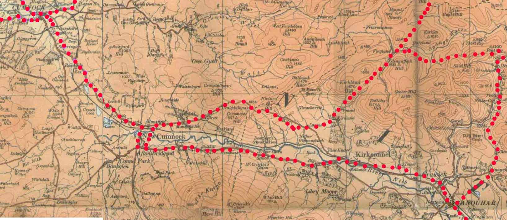
From Braehead to New Cumnock its line was very close
to the present day road that, apart from some modern
realignments, is built on the turnpike. Interestingly
if one compares the bends on his road with the modern
road they are identical although there is a straighter
line near the bridge as it nears New Cumnnock. Another
indication of a deviation is his having the road east
of Lowes (presumably Lochhill).
From the present day bridge, one could get to the Kirk and the Mill on the west side of the Afton. Strangely enough the present day ford is not marked. At the Mill, as today, the road headed for Dumfries. There must be a reason for this distinctive deviation from the bridge over the Nith down to the mill. One can only speculate about the effect the castle and the mill might have had on the road, or indeed the higher ground on the way out of the town.
Again the bends fit the modern road very well as far as the county border at Marchburn. The only exceptions are the suggestion that on leaving the town it went slightly north and then south of the present road before Polquhirter and that there was a straighter line at Polshill.
Armstrong
One interesting change is that the new turnpike, which he is showing, took a straighter line south of Cumnock, effectively up the present Glaisnock Road. Apart from that the road looks very like Roy's. The implication is that the line of the earlier road and perhaps its construction was sound enough to incorporate into the turnpike.
27. Drove Road (R4-5, 5-4)
Roy only

From New Cumnock this had the course of what is now the road north of the Nith. At Glen it ran to the north of
Corsencon Hill to head down by still existing tracks to Kirkland a mile or two north of Kirkconnel. From here it ran to Fingland and made its way over towards the Crawfordjohn area. Older O.S. maps show much of its course.
28. New Cumnock - Glen Afton (A4)
Armstrong only
Interestingly he shows a road running up Glen Afton. Apart from an odd misalignment at the start this is the same as the present day road that finishes at Craig. From here it is only about 5 miles to another public road in Dumfriesshire that runs south to join the Carsphairn - Moniave road. The course was past Montraw then over the county boundary just east of Alwhat to run down between Ewe Hill and Lairg Hill to near Lairg.
29. Cumnock - Kilmarnock (R 4-5, 4-6; A2,4)
Roy
The stretch to Auchinleck is clearly the modern road although there is a hint of straightening here and there. North of Auchinleck there have been considerable improvements in recent years. However, the road prior to these improvements, effectively on the turnpike line, shows little deviation from Roy. Exceptions are a bend to the left on crossing the Dippol Burn, then a suggestion of a slightly different line beyond here. The line at the old Howford Bridge over the River Ayr seems the same as the turnpike. A bridge is marked on the map.


Once past Mauchline the road is very similar to the modern line. Beyond the present Crosshands where a road heads for Galston, it ran to the west of Rodingford House and crossed the river at Bridgehouse. From there it curved to the right to reach Woodhead, near Crossroads.
It then aligned directly with Hurlford so is presumably a couple of hundred yards east of the present road. From Hurlford it continued into Kilmarnock by the present London Road. It may be significant that the road makes for Hurlford and Kilmarnock rather than Riccarton as happened with the roads shown on Moll in 1718 and Bowles in 1735 that ran west of this line. This may reflect the growing importance of Kilmarnock in relation to Riccarton that would make part at least of this road post-mediaeval.
Armstrong
His line is similar to Roy, although he does not show the bend above the Dippol Burn and has a straighter line at Old Howford Bridge. This was still the main road until recent years when the Howford Bridge and associated approaches were opened. It has now been removed from the list of public highways.
Above Mauchline he shows the Crosshands junction, with a still existing Loch Brown, and that of Crossroads. The major change of alignment was at Bargower where the road ran directly to Bargower and can still be seen in the fields. Interestingly there was a later change prior to the present course and it can be easily seen on the other side of the road. Thomson has a Gateside a little off the turnpike and this may indicate an earlier road. There is also a Craigenconner (possibly from Gaelic conaire, a path) nearby.
North of Bargower the road ran directly to Hurlford (Whiteford in Armstrong and Whirlford in Thomson) on what is now the B7073 north of the roundabout at the prison. From there it went straight along London Road into Kilmarnock.
30. Cumnock - Muirkirk; Muirkirk towards Sorn (R 4-5, 5-4; A4)
Roy
 Although
crossing near to the old bridge at Logan, the distinctive
bend that used to be here is not shown. Beyond this
point it had the same course as the later turnpike except
at Stonebriggs and Boghead where it passed to the south
of the farms. It probably crossed the Ayr at or near
to Wellwood Bridge although the river has changed hereabouts.
The stretch into Muirkirk and then to the county boundary
had much the same line as the modern road but is less
straight than this. At Airdsgreen it crossed to the
south side of the river and ran up past Darnhunch to
Parish Holm on the Lanarkshire border where it continued
on the south side of the stream unlike the modern road.
Although
crossing near to the old bridge at Logan, the distinctive
bend that used to be here is not shown. Beyond this
point it had the same course as the later turnpike except
at Stonebriggs and Boghead where it passed to the south
of the farms. It probably crossed the Ayr at or near
to Wellwood Bridge although the river has changed hereabouts.
The stretch into Muirkirk and then to the county boundary
had much the same line as the modern road but is less
straight than this. At Airdsgreen it crossed to the
south side of the river and ran up past Darnhunch to
Parish Holm on the Lanarkshire border where it continued
on the south side of the stream unlike the modern road.

Although he shows what is now the Sorn road that leaves the A70 at Wellwood, it terminates at Greenockmains on the Greenock Water. This left a gap of about five miles to Sorn from where there was a road to Mauchline.
Armstrong
The Cumnock to Muirkirk Road also had the modern line except for the bridge below Logan and some small realignments. However, he shows the road passing just south of Boghead whereas Thomson and the modern road pass to the north of it. South of the farm there is a double field boundary that may be significant. It is likely that it is the same as Roy's road.
There is however a degree of confusion at the Sorn Road where he has a road running up to Woods (Netherwood) and then continuing north to Plewlands in Avondale parish. From his positioning of March (near to present Entryhead) and Wellwood, shown on Roy as just east of the Sorn Road and the fact that his Dalfram is not on the present road between Netherwellwood and Netherwood it is likely that he is showing Roy's Cumnock and Sorn roads.
The road to Netherwood and Plewlands is confirmed by the same track being shown on Arrowsmith in 1807. Using both maps for clues it must have headed north from the junction of the Sorn Road (not the present day minor road nearby) to pass west of Burnfoot and Middlefield Law. It would have crossed the headwaters of the Polkebock Burn and then have gone over Bibblon Hill to High and Laigh Plewland. These are just north of the present day Glengavel reservoir.
Interestingly, modern maps show stepping stones at Netherwellwood but they do not link to Roy so may be of local use.
Continuing through Muirkirk he has the modern line near to Airds Green but like Roy his road then went up to Darnhinch and over to Parisholm. There are still stretches of track between these points. There was a branch up to Glenbuck House but this may now be under the loch. Thomson shows the modern line of the road.
31. Mauchline - Sorn (R 4-6; A4)
Roy

Despite the gap on the Muirkirk side, there was a road from Sorn to Mauchline. It left Sorn castle and ran up to Burnside on the Burn O'Need. Once over the river it ran about 200 metres south of the present road heading for East and West Walton and may be the present day track here. It then ran up to the eastern edge of the town.
32. Muirkirk - Sorn - Mauchline (A4)
Armstrong
Unlike Roy, he shows a continuous link between Muirkirk and Mauchline, apparently on the modern line. The start of the Sorn - Galston road is shown as far as the Wealth of Waters (he displaces Meadowhead).
33. Sorn Area (A4)
Armstrong
South of Sorn he shows the old bridge near the church, and the road leading up to Gilminscroft. At this point there is a straight stretch to the right that must be the road leading past Laigh Logan. Above Gilminscroft he shows what became known as the Heilar Road, although his road was straighter than the modern map shows. It seems to have crossed the river near Mid Heilar and made its way up to the Muirkirk Road near Burntshields.
34. Cumnock - Ochiltree - Ayr (R 4-5, 3-3; A4,3)
Roy

The road crossed the Glaisnock near the present bridge on the Tanyard. It then went on the south side of the river (the course has changed near the Academy) to line up near the present roundabout with the avenue in the grounds of Dumfries House. This track may well be the old turnpike perhaps built on Roy's road since the Earl of Dumfries asked for it to be moved away from the house in 1827. (4)
Near Dumfries House Mains Farm there is a distinctive bend southwards where it looks to have taken up the line of today's road as far as Ochiltree.
Beyond Ochiltree it has the general line of the later turnpike but it is difficult to say how exact a match it is. On the one hand it is tempting to say the turnpike (effectively the A70) is based on it as is the case with other roads. A made road would make their work easier. In addition, one or two of his place names are on the turnpike line. Against this is his depiction of a fairly winding road (unlike the turnpike) with a very distinctive bend near to Coalhall, which given his surprising accuracy has to be taken seriously. In addition, place names have changed and one or two farms that have implications for the course of the road such as his Tarelgin are nowhere near the road.
Assuming his mapping is accurate there would have been a slightly winding road out as far as Killoch (which fits his Torbeghill better than the present High Tarbeg). However, there may have been a deviation from the turnpike line where his road would have run north of this to above West Tarelgin (his Elgdon?) then swung down and along to Coalhall.
Beyond here he goes just south of Macoshton, crosses the Coyle near the present bridge and passes just north of Duchray. His placing of the road in relation to Barngore, Gallowhill and Corbieston Byres serves to confirm it was on or very near the later turnpike. From Corbieston Byres there was a straighter line than the modern road suggests (there has been a major realignment here which can be seen on modern maps); so it was even more pronounced. There is in fact a track north of the present road that meets the alignment. Again, the road has been straightened just before the Old Toll, which fits the bend he shows. From here it ran past Holmston into Ayr although it followed the river up to the old town, unlike the modern road.
At Coylton a road ran down to Raithhill from near Hillhead and part of it may have been on the line of the Dalrymple Road (B742). Beyond Gallowhill he shows another road to Barquhey and the river with a bridge that fits the present road perfectly. Once over the river it continued in the direction of Raithhill.
Just above Gateside near to NS375214 he shows a road running to Craighall and then across the river to St Quivox.
Armstrong
So far as the Ayr to Cumnock road goes, he shows it as a turnpike. Apart from the modernising of the road there are no changes, except for the stretch of a mile or so west of Ochiltree that has been replaced by a new road. West of where the Littlemill to Stair road joins it, he has a road leaving it at Arthurston that ran up to Bridgend where the Water of Coyle is crossed. A minor loop ran off this up past Sundrum. From the river it went to Stair passing to the south of Dalmore. There are no clues to its route between these points. It may have gone up to Broadwood and then right past Springs to Dalmore and Stair. This Broadwood stretch was part of a turnpike approved in 1774 from Coylton and Galston. The stretch might have been in existence before the turnpike and incorporated in it but its line seems unnecessarily long for a route to Stair. The alternative would be for an earlier river crossing at or near the turnpike bridge and a more direct line, perhaps passing the suggestively named Gatefoot that is shown on the 1:25000 map as a small enclosure at NS424214.
Immediately north of this he shows a road starting at Gadgirth, crossing the Ayr and running up to the Mauchline road. This seems to have the course of the turnpike and the modern road over Gadgirth Bridge, past Annbank to Mossblown (B742).
Near to Ayr another road cuts northward past Auchincruive and St Quivox to end at the Galston road. At first glance it looks like the B744 at Belston but in fact is the track that starts at the point marked Old Toll at NS366208 and runs up past Gateside to Auchincruive. He shows a definite crossroads at the Mauchline road - as there was a staggered junction here prior to the roundabout that opened in 2003, there has been a fairly extensive realignment at some time.
The remainder of the road to Ayr is the modern line.
35. Ochiltree - Mauchline (R 4-6, 4-5; A4)
Roy
 Returning
to Ochiltree, Roy shows the road that runs up past Barturk
and Auchenbay to Roddenloft. At Roddenloft it took a
straight line past the south east corner of a rectangular
precursor of the plantation here and ran up to the River
Ayr. He shows the distinctive turn once over the bridge
but it made its way over to Haughyett and the Cumnock
Road rather than the straighter line of today. Various
driveways are shown on the Barskimming Estate.
Returning
to Ochiltree, Roy shows the road that runs up past Barturk
and Auchenbay to Roddenloft. At Roddenloft it took a
straight line past the south east corner of a rectangular
precursor of the plantation here and ran up to the River
Ayr. He shows the distinctive turn once over the bridge
but it made its way over to Haughyett and the Cumnock
Road rather than the straighter line of today. Various
driveways are shown on the Barskimming Estate.

36. Ochiltree/Auchinleck/Mauchline area (A4)
Armstrong
Ochiltree - Auchinleck
The Ochiltree to Auchinleck road is shown (Barony Road) although it should be noted that it went over the old bridge and then parallelled the modern road about 200 metres west of it (still a track). The distinctive sharp corner is still there, only displaced 200 metres to the west. From there it ran directly to Auchinleck.
Auchinleck Old House;Dumfries House - Auchinleck
He shows a number of roads in the policies of Auchinleck Old House which still exist as farm tracks. Similarly Dumfries House had a road running west of the House past Temple and up to Dalsalloch near the new Auchinleck primary school. There are present day farm tracks on this alignment, including The Avenue which may well be the traces of this road.
Mauchline Area
South of Mauchline, the road down to the River Ayr at Barskimming Old Bridge is shown on what looks like the modern line, unlike Roy who, as said, routed it via Haughyett. It terminates at present day Crosshill. This is where the turnpike to Drongan, authorised in 1774, bends sharply south. This could mean he was showing work in progress although equally the turnpike could have used the existing road. The start of the Ballochmyle road is shown - this is the minor road that leaves the A76 near Kingencleugh (NS508206).
Just north of the creamery he has a road running to Old Barskimming Bridge. Just short of the bridge another road ran up to the Ayr road and this is probably the track running through Highland and Muir.
37. Dalmellington towards New Cumnock (R 4-5; A4)
Roy
 He
has a road shown by a single line, which perhaps denotes
a track, which ran south of the river for about a mile
then crossed and ran up past Pennyvenny and Clawfin.
Thus far it is very close to the line of the later turnpike
but it then headed northwards keeping to the west of
the Nith and terminated just beyond present day Upper
Beoch.
He
has a road shown by a single line, which perhaps denotes
a track, which ran south of the river for about a mile
then crossed and ran up past Pennyvenny and Clawfin.
Thus far it is very close to the line of the later turnpike
but it then headed northwards keeping to the west of
the Nith and terminated just beyond present day Upper
Beoch.

Armstrong
The road to New Cumnock is that of the modern road and is easier to follow on Thomson. The only exception is the first mile which kept to the south of the burn. As said, Roy had his road running near to Upper Beoch and fading out there.
38. New Cumnock - Littlemill (A4)
Armstrong only
At Bank (present Craigbank or Bankglen, near to New Cumnock) he has a road leading over the hills to Bonnyton, near Littlemill. It ran between Farden and Whitehill over to Burnston. Thomson doesn't show this track and although there are odd tracks here and there on later maps none seem to fit. In any case much of the route passes through opencast workings so is totally lost. From Benston it passed over or near to Tappet Hill, Burnockhead (his Burnhead) and then over to Old Polquhairn. It is on this stretch that Newall and Lonie identified what is very likely to have been this road at NS512148 which is just past Burnhead although they followed it to Auchencloigh. There was no definite sign of the road on aerial photographs.
It is hard to tell from the map what the course was after Old Polquhairn. He shows it joining the turnpike near Littlemill close to a road which ran to Ochiltree past Belston Loch. From Thomson this looks very like the present road to Sinclairston, although it terminates there. This would mean Armstrong's road cut across in an almost due westerly direction to this junction with no readily identifiable track on Thomson or later maps to link it with. A more straightforward alternative would have been the track shown on Thomson running from above Old Polquhairn through Drumbowie and Waterton to Littlemill. This still exists as a road between Drumbowie and Littlemill. The topological fit, however, is poor.
A possible solution is that Amstrong's Ochiltree road is shown by the linear enclosure opposite Craigbrae Cottages on the 1:25000 map. This also appears on Thomson. The reason this fits is that it is north of Bonnyton whereas the present Sinclairston road runs to the south. That would then allow the road from New Cumnock to join the turnpike near to there (and north of Bonnyton) which is more consistent with the map as Thomson has his Sinclairston and the modern road south of Bonnyton.
39. Littlemill - Ochiltree (A4)
Armstrong only
The implication here is that Armstrong's route to Ochiltree is not the same as Thomson, albeit only as far as Sinclairston. In general terms, this is an interesting route as it has indications of being very early. One hint is given by a Glenconner being on the path, conaire being a Gaelic word for "path", another is that there is a farm called Rottenrow near to Glenconner. One theory has this to mean Route de Roi, or King's Highway.
The best fit for the route would be to start near Craigbrae Cottages, running along a ridge of high ground to Belston and then following the course of the present road south of Barlosh and Plaid Loch (which was more extensive then) before swinging north through Rottenrow to Glenconner. From there it would have gone up through Holehouse and Findlaystone to join the turnpike just west of Ochiltree. It is unlikely the present day track from Rottenrow to Barlosh fits as it runs north of Plaid Loch.
40. Dalmellington - Ayr; Dalmellington - Carsphairn (R 4-4, 4-5, 3-4, 3-3; A3,4,6)
Note: This road is dealt with in more detail in the Miscellaneous section of this website - see the Ayr - Kirkcudbright Road
Roy
 In
the chapter on Roman Roads we referred to MacDonald's
paper on the course of a putative Roman road from Dalmellington
to Ayr (first proposed by the historian George Chalmers
in Caledonia and based on information from the antiquarian
Joseph Train) which he identified with Roy's and Armstrong's
roads. In that article he reproduced Roy's road alongside
the current OS map of the same route to show it was
the same as the "Roman Road". Although we
are not concerned here with his argument that the road
was an early parish road rather than Roman it is of
interest to see what course he thought the Roy road
took.
In
the chapter on Roman Roads we referred to MacDonald's
paper on the course of a putative Roman road from Dalmellington
to Ayr (first proposed by the historian George Chalmers
in Caledonia and based on information from the antiquarian
Joseph Train) which he identified with Roy's and Armstrong's
roads. In that article he reproduced Roy's road alongside
the current OS map of the same route to show it was
the same as the "Roman Road". Although we
are not concerned here with his argument that the road
was an early parish road rather than Roman it is of
interest to see what course he thought the Roy road
took.

First it is worth recounting the course given by Chalmers, viz: Burnhead - Chapmeknowes - Polnessan - Smithston - Cube - Boreland - Mains Hill - Causeway - Purclewan Mill - Brae - Lindsayton - Cockhill - Whitestanes - Ayr. The road ran past Sillyhole on to the high ground above the Doon Valley and continued on to where the Drongan road is now. MacDonald shows tracks from the OS map that are probably the road although Roy's Sillyhole - Burnhead line is straighter than MacDonald suggests. Roy's map tends to confirm that from Burnhead the road took a relatively straight line as far as the Drongan Road rather than leaving the Rankinston road a mile or so further on as shown on Armstrong - this would have called for a distinct change of alignment on Roy.
North of Smithston, Roy's road matches the track MacDonald shows (it can be seen on the 1897 1"OS map) which passes Newfield, skirts the modern road west of Boreland and runs to Mains. North of Mains the course is actually marked on the 1897 map as a Roman Road. Chalmers and MacDonald have it going through Purclewan Mill and along the attractive old road with its double hedgerows that can be seen
 |
today from the Dalrymple road but this would have shown up as a major deviation on Roy. It is more likely that it just ran straight, more or less following the realigned modern road to line up with the stretch of the A713 north of the Dalrymple road where MacDonald has it rejoin after his Purclewan Mill deviation.
A mile north of here, the 1897 map shows the "Roman Road" again. It started at the slight bend just after the industrial estate, went through Cockhill Wood and crossed the A713 at Ailsa Hospital to become the farm track on modern maps which runs past Braston. It then passed to the west of Castlehill and ran directly to the centre of Ayr.
South of Dalmellington (not examined by MacDonald), two roads are shown. The westerly one split soon after leaving the town with one route to Barrbeth (the farm track to the east of Bellbank) and one down to Carsphairn and Kirkcudbright (the track 200 metres south of Bellsbank Farm). The easterly road is not shown on modern O.S. maps but appears on older editions. It ran over the Town's Common close to the present A713 before cutting down to join the previously mentioned road just west of Mossdale. From here it made directly for Bryan's Heights and Cairnennock close to the county boundary. Its course can be followed south of here on the older O.S. maps as the "Old Pack Road".
Armstrong
From Dalmellington south (not examined by MacDonald) the course of the old pack route is shown as on Roy above. The modern road follows the later turnpike. The road north to Ayr is not shown by Armstrong as a turnpike so it is likely to be the same as that shown by Roy.
The only major change from the modern road is near the crossroads with the Dalrymple - Coylton road (B742). Heading north there is a minor road to the left just past Benston. The turnpike ran along this for about 300 metres and then looped north past Boneston (now a farm track) and then headed for Boghall Cottages where it turned left to a point over the other side of the A713 opposite the old road to Purclewan Mill when it took up its line for Ayr again. The road has been considerably modernised hereabouts but it is still on the old turnpike line.
41. Mauchline - Ayr (R 4-6, 3-3; A3,4)
Roy

This road is either on or close to the later turnpike line. Places match up as do the bends in the road. At Carngiling (present Carngillan Cottages) a road went south past Yett to Stair and north to Tarbolton. The Stair stretch is shown as
less winding than the modern road but is very close to its line. It does not appear to continue south of Stair. The northward stretch shows the distinctive bend at Strandhead so is probably the modern road. It did not continue north of Tarbolton.
Beyond Carngillan the course to Ayr lines up very well with the turnpike and the modern road although there is a suggestion of later straightening here and there. It joined the Galston - Hamilton road at Whitletts and ran into Ayr on the north side of the river.
Armstrong
This is shown as a turnpike and matches well with Roy.
42. Mauchline - Irvine (R 4-6; A1,3,4)
Roy

This is shown as the road from Irvine to Sanquhar and Dumfries. From Mauchline it left the Kilmarnock road just north of the Burns memorial and ran past East and West Mossgiel to Skeoch so presumably its course is partly in the fields here before it takes the modern line. It then went past a farm called Fencedykes which Thomson shows on the turnpike about a mile west of Skeoch. At this point the road seems to have left the later line and headed up to Millburn and Boghead. It then skirted Adamhill on its east side to make its way to present day Caldrongill which he and Thomson show as High Caldrongill. His line is straight from Boghead so it may not be the minor road running past Plewlands although it cannot be far from it.
It then follows the present day line as shown by the placing of Craigie Castle and Syke and its general alignment. It crossed the then Ayr to Kilmarnock road but surprisingly this is the road running up through Symington, that is, the A77 line did not exist then. Beyond the crossroads at Dyke it still has the modern line as far as the bend at Muirhill. From here it carried straight on as the minor road for 500 metres. Its course is then shown on modern maps by the plantation which runs west for 100 metres then runs north past Newfield Mains Farm.
Rather than continuing northwards it cut across towards Dundonald then ran north to Drybridge and Dreghorn. It is tempting to associate his road with the present one but his line is straighter and passes the distinctive meander at Drybridge some distance to the west. Conceivably his map is consistent with a line running about 100/200 metres west of the present road and still aligned with the ford at Holmford. North of here there is a distinct bend lining up on the kirk so it may not be the same as the modern road, i.e. it went east of this then curved round to line up on the church.
43. Crosshands - Galston (R 4-6; A2,4)
Roy
 It
first crossed at Lawersbridge and followed the modern
road as far as the bend at Millside. From here it passed
west of Millrig to line up on Old Walls and then ran
past Sparnelbank to the Ayr road as it leaves Galston.
Curiously enough there is a track from Sparnelbank which
meets the Ayr road almost exactly where Roy shows it
but this is not shown on Thomson so may be a later track.
It
first crossed at Lawersbridge and followed the modern
road as far as the bend at Millside. From here it passed
west of Millrig to line up on Old Walls and then ran
past Sparnelbank to the Ayr road as it leaves Galston.
Curiously enough there is a track from Sparnelbank which
meets the Ayr road almost exactly where Roy shows it
but this is not shown on Thomson so may be a later track.
Armstrong
He shows the road on its modern line, as always much clearer on Thomson but with a major difference near Galston. Thomson shows the modern line, passing Gauchalland Farm and joining the Ayr Road on the outskirts of the town. Armstrong also shows this but as a minor road. The main route carried straight on to the centre of the town. It is not clear what the course was, possibly past Sparnelbank and straight down the hill to the road just south of Galston primary school but there are no definite traces on later maps.
44. Ayr - Galston (R 3-3, 4-6; A2,3,4)
Roy
Leaving Ayr the line is very close to that of the later turnpike. It went up past Whitletts, St Quivox and Sandyford on a line now covered by the bypass and then followed the line of the A719 which leaves the A77 at Sandyford. Lady Kirk and Brownhill are shown and the bends of both roads match up very well. It may have passed a little closer to Brownhill.


At Fail there was a road running to Mauchline. This ran past Mosside and is probably on the line of the minor road and the track beyond which is lined up on the Mauchline - Irvine road described earlier which it joined a few hundred yards south of Millburn.
North from Fail there was a junction at or very near to where the B730 leaves the A719 today. The left hand road went up to Riccarton and effectively followed the line of the present Craigie Road. However it seems to have cut across country past Caldrongill and up to High Langside where it lined up with the Craigie Road. It is interesting to see that he has a Gateside and a Gatehouse marked on the map.
The Galston road continued from this junction, formed a crossroads with his Irvine Road just past Adamhill and crossed a stream at Townend. However, after this point there is a major change in alignment from the modern road. Just before Fairwells there was an old track shown on the earlier OS maps which went up near Maintree, shown by Roy as High Trees. The road then went past Mosside which fits East Mosside and lined up with Shaws Mill, close to the present bridge. There is a minor road between Maintree and East Mosside and part of it may be on Roy's line. From East Mosside there is a drop of 200 feet on a regular downward slope which would have been very difficult for carriages. The turnpike line which was like a "bowstring" from Shaws Mill bridge, cutting out the later bend, reduced the climb to about 100 feet.
Once over the river it ran to the Kilmarnock- Cumnock road which at that time went through Woodhead. From here to Galston its line is almost entirely modern.
Armstrong
The Mauchline and Galston roads diverged at Whitletts at the traffic lights heading into Ayr from Whitletts roundabout. The first part of the Galston road has been lost under the A77 although it has the same line. It can be followed from the traffic lights up to the retail park where it continues on the other side of the road as a lane. It then takes the line of the A77 but remains as a layby accessed on the northward carriageway. It re-emerges at the Galston turnoff. As an aside it is interesting to see that Sandyford had been a crossroads (although not in Armstrong's time) with a road leading to Monkton. Part of this remains on the far side of the A77 but it is eventually lost under the runways.
From Sandyford to Galston it is essentially the same as the present road. There has been some realignment at Fail where Armstrong suggests, and Thomson shows, a definite corner rather than a bend as shown on later maps. This in turn has been superseded by a modern alignment - the old road can still be seen on the east side of the road.
Another realignment is at Carnell where originally the road came in a direct line from Shaws Mill Bridge for about 700 metres crossing the Cessnock near Airds Farm. The track is still there. As it is mentioned in the 1878 list of highways it was still in use at that time. This stretch replaced that shown on Roy which went up past Maintree and Mosside - presumably to lessen the gradients.
From the Galston road he has a short road leading to Ladykirk, presumably the present day track and a mile or so further on, a link to Tarbolton past Torcross, which is still a road. He also has a link from Tarbolton to the Mauchline road emerging at Coilfield. This may be the present day track running just west of King Coil's Grave.
45. Kilmarnock - Galston - Darvel (R 4-6; A2)
Roy
After running along present day London Road it crossed at Hurlford and ran along south of the river to Galston. From the map it appears to have ran closer to the river than the present road for much of its length but against this impression is the fact that this is a low lying area subject to flooding.

Whatever the case, it crossed to the north side of the Irvine and ran up the valley to Newmilns and Darvel with essentially the same line as the turnpike and the A71 although there have been some improvements over the years. Loudoun Castle had an extensive network of driveways at this time. There is a significant change from the modern line however at Priestland beyond Darvel where it ran up by Gorsebraehead and Coathill to cross the county boundary. Its course may in part be shown by the present day minor road south of the A71.
It is interesting to note that he has a Gateside (still existing) up the Glen Water although no road is shown.
Armstrong
He shows a road running along the line of London Road, crossing at Hurlford (his Whirlfoord) and then, by now a turnpike, taking a very similar line to the A71. It seems to have gone along the wynd at the Mill Shop in Galston. It then crossed the river and its course through Newmilns and Darvel seems straightforward.
At Newmilns, the road which branches off at the old Co-operative building is shown as far as Dalwhatswood. He shows two bridges in Newmilns and one may be that shown on Pont. East of Darvel there is a major difference from the present route from Priestland onwards where as the "Old Edinburgh Road" it routed itself through Gorsebraehead and Coathill, as on Roy's map.
Another road went north of the river back into Kilmarnock. He shows it clearly as running south of Loudoun Kirk so we must assume a lost stretch between the roundabout and the Kirk. From here on it is clearly the minor road running through Milton and Templeton Burn until the sharp bend at the old Crookedholm school where it continues as a path. The track up to Ralstonhill is shown, as is a short stretch of the road that runs towards Grougar Mains.
46. Galston to Glasgow Road (R 4-6; A2)
Roy
The
road ran almost directly north to what is now Howletsburn
and then took a distinct turn to the north west where
it took up the modern line. There has been a change
in recent years near Alton where the turnpike ran over
Alton Bridge on the minor road and it may be that this
was the line of Roy's road.
North of this point the road can be followed easily enough up to Waterside and has the modern line although there has been a realignment north of Moscow. Beyond Waterside it does not appear on the map. This does not necessarily mean the road did not exist at that time as in some instances the Military Survey omitted roads - this may have happened here especially as the road finishes at the edge of a map sheet. The main Glasgow road is shown clearly enough.
Armstrong
The line seems very similar to Roy and the modern road and is shown as a turnpike.
47. Kilmarnock - Irvine (R 4-6; A1,2)
Roy
This is essentially the same road as the turnpike and the old A71, prior to the new dual carriageway to Irvine, which ran through Dreghorn, Springside and Crosshouse.
Armstrong
This is the same road as Roy. From the roundabout west of Springside it continues as the present main street in Dreghorn as far as the roundabout just after the secondary school and continues on the far side into Irvine.
At Crosshouse there are two short lengths of road to the south. One is shown taking the line of the present road to Gatehead and then leaving this to go past Windyedge Cottages to terminate at Moorfield; the other ran down to the Gatehead to Springside Road to terminate there - there had been a mill at this location.
North of Crosshouse his road to Kilmaurs is that which runs up through Knockentibber (B751). Just before Dreghorn he shows a road running to near the old church at Perceton past Muirhouses and Capringstone. There are footpaths now at both ends of this road.
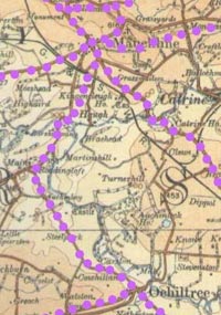
48. Kilmarnock - Kilmaurs; Kilmarnock - Stewarton (R 4-6, 4-7; A1,2)
Roy
 Initially
this is the one road. It is on the line of the modern
road that runs behind the railway station, past the
Johnnie Walker distiillery, up to the roundabout at
Hillhead. Beyond this, it follows Kilmaurs road to the
junction about a mile up the road.
Initially
this is the one road. It is on the line of the modern
road that runs behind the railway station, past the
Johnnie Walker distiillery, up to the roundabout at
Hillhead. Beyond this, it follows Kilmaurs road to the
junction about a mile up the road.
The more westerly road ran to Kilmaurs on the modern line and although a wide main street is shown, it didn't extend beyond the town. The other road ran to Stewarton, again on the modern line. There is a staggered junction where it crosses the Kilmaurs to Fenwick road.
Armstrong
Both these roads are not shown as turnpikes and look very like Roy's roads, as described above. He shows a short stretch (B751) running from Kilmaurs to join the Stewarton road south of Shaw Bridge. Another road led over to Cunninghamehead. It looks very like the modern road except for a straighter line on the approach to Cunninghamehead. Another short length of road, although longer than Roy, is shown north of Kilmaurs ending just past Covershaw.
49. Ayr - Monkton - Symington - Kilmarnock (R 3-3, 4-6; A1,2,3)
Roy
Once over the river, it ran in a very direct line to Monkton on a course almost identical to the modern road running through Prestwick. Its course through the airport is now lost but is easily seen on earlier OS maps.
From Monkton the road went east for a short distance and then changed its alignment through a couple of distinct bends to the north-east, i.e. towards Kilmarnock. There are few clues to its course on the map but it passed very close to the monument and then ran about 100 metres or so north of the A77, making for Stockbridge Farm and Symington. It appears as the road running through the village up past Knockendale to Dyke where it crossed the Irvine Road.
From here it ran directly to Fortacres so must be close to the present road. It then went up to the south of Caprington Castle. The best fit for this stretch (despite his placing of Earlston and the missing stream) might be up to Earlston then about 200/300 metres east of the Todrigs Burn to reach the river 300 metres or so west of the present bridge. There is in fact a field boundary along the putative line of the road between Fortacres and Earlston. It then ran along the river bank to stop just past the Kilmarnock Water at a point where there were stepping stones.
Armstrong
He shows the turnpike which replaced Roy's older road through Symington. It ran from Monkton up to the Dutch House roundabout and from there is now overbuilt by the new road. There is, however, a short stretch at Spittalhill just north of Bogend Toll where half a mile of the old road remains. From this point, it continues as the Ayr Road (B7038) running to Riccarton and Kilmarnock.
50. Ayr- Irvine (R 3-3, 4-6, A1,3)
Roy
The course from Ayr to Monkton was outlined above. From Monkton it headed north for a few hundred yards but then swung west towards Monktonhill. It then swung east again to line up on Crossburn, Colellan, and Gateside. This is an
indication that on leaving Monkton the road may have headed from near Townhead Bridge over to the White House and followed the road to Fairlees to join up with the B746 south of Crossburn.
It then had the line of the old A78 as shown by the B746 through Loans and then the minor road that parallels the dual carriageway north of Gateside.
Armstrong
The road is shown as a turnpike and passed through Prestwick and Monkton. North of here there is a minor deviation from Roy, the road taking a more direct line to Loans but after this point both roads seem to be the same.
It is in this area that Armstrong has his well-known warning about quicksands. This referred to the alternative road over the sands, viz. "There is a dangerous quicksand on the road at the Foot of Powburn to avoid it keep as near to the sea as the tide will allow." There was a toll near present day Heathfield Road from where it cut across sand dunes past the spittal at Kingcase to reach the sands at Bensfield. From there, there would have been three miles of easy walking to Troon where travellers could cut across the neck and then have another three miles or so along the beach to beyond Gailes from where it was a short distance to Irvine.
51. Dalmellington - Rankinston - Stair - Tarbolton - Irvine (A1,3,4)
Armstrong
North of Dalmellington he shows a route running over the hills west of Benquhat Hill to Littlemill and Stair. Beyond Stair it passed through Tarbolton and then ran up to the A77 near Symington. From Dalmellington there is still a public road as far as Craigmark. Beyond this point the road is closed due to opencast coal workings although it is opened one day a year to allow locals who lived in the former village of Benquhat to visit the old village. From Burnhead, south of the site of Benquhat village, his road continues north in a more or less straight line to emerge at Rankinston a couple of miles further on. Another road is shown just north of Burnhead running over to the north of Polnessan.
From Littlemill, the course is that of the modern road and it is interesting to see the old milestones by the side of the road. Rather confusingly when it reaches the Ayr-Cumnock road he has it join east of the Stair road when Thomson and the modern road have it to the west. This may simply be a mistake but the plantations shown on his and later maps suggest that there was a road or track running from near present day Carston up to Drongan House and the Ayr Road and it may be he was showing this. North of here his course is correct to Tarbolton and Fail (see 53 for continuation to Irvine).
52. Cumnock - Dablair - Crawfordjohn (A4)
Armstrong
He shows a road that left Cumnock at Lugar and ran up to Dablair and eventually to Crawfordjohn. He follows the modern line up to near Whiteholm where the river was crossed. It then continued north of Dornal to line up with the track north of Dalblair. There are stretches of farm track between these points which may be his road.
 |
Beyond Dalblair it is easier to follow the route on modern maps as it is essentially a well made unsurfaced road. He routes it past Glenmuirshaw and Penbreck. Surprisingly, it is not shown on Thomson, who also has a curious northwards displacement of a mile or so for the whole of the Glenmuir Water.
Near Whiteholm looking east
53. Tarbolton - Irvine continued (A1,3)
Armstrong
As said earlier, the Irvine turnpike ran through Tarbolton and Fail and its course beyond that is the same as the B730. It crosses the A77 at Bogend Toll near the garden centre and continues on the B730 line to Dundonald. The sharp bend 1� miles from the A77 is shown with a road going straight on past Newfield to the Kilmarnock road. He also shows the present road which runs through Symington and rejoins the A77 just south of the village.
54. Dundonald Area (A1,3)
Armstrong
A road is shown from Dundonald to Loans and it seems to be the present back road over the hill. Another road ran from Dundonald over to the Irvine Road. This has the course of the A759 to near the quarry. At this point it leaves the present main road as a track and carries on past Hillhouse to the Irvine Road.
His roads just north of Dundonald are slightly confusing. What appears to be the present day Kilmarnock road (A759) is in fact the minor road � mile to the north running past Ploughland and Harperland to a junction with the straight road past Newfield mentioned earlier. From this point, one would assume it took the line of the present Kilmarnock road but a better topological fit would be for the road to have run up past Fairlie and then aligned itself with the river to pass through Old Rome towards Caprington. It would have ended near the confluence of the Irvine and Kilmarnock Water.
From the Harperland Road, he has a route running towards Dreghorn although he shows it terminating short of the Irvine, presumably Drybridge. Cutting across this is another road leading from near Girtry past Shewalton and Mains. It crosss the Irvine south of Warrix and joins the Kilmarnock Road. He also shows a loop above the Haperland Road up to the Warrix Road. Much of this area is now heavily industrialised (see also sheet 1).
55. Irvine - Glasgow (R4-6, 4-7; A1)
Roy
This is marked as a cart road which no doubt implies it was not a main road even then. It ran north from Irvine town centre on the main Kilwinning road for half a mile and then headed up to and through the grounds of Eglinton. From

Eglinton (where it joined a road running up to Kilwinning on the line of the B785) it passed just south of Benslie then ran directly to Laigh Patterton and Auchenharvie. At this point it was joined by the road running up from Irvine. On this stretch the road is almost certainly lost although there is a sinuous field boundary on Laigh Patterton farm. The next stretch is now a public road. It ran past a Gateside (this no longer exists) to Crossgates where a short branch led to the Glazert near Kennox. The main road then crossed the Glazert at Gallowayford and then forked just before Irvinehill, a branch going to Stewarton, the main road continuing up to Dunlop House.
The Stewarton branch is now lost. It may have headed over north of Gillmill Farm and Kirkmuir Farm but if the plantation seen today at Anderson's Mount is the feature shown on Roy, west of Lainshaw House, then his road may be identical with the present road between here and Stewarton.
His main road that heads towards Dunlop House can be seen today as a trackway with double hedgerows that runs between Irvinehill and North Kilbride and then continues as the present minor road up towards Dunlop House. Once past Dunlop House it ran past Titwood, Newmills, Tailend and Craignaught.
The Irvine - Glasgow road near North Kilbride, facing south
 |
Although it follows the line of the road here, there are deviations. Thus it ran from present High Gameshill to Sidehead, ran north of Dunlop House to Titwood and then Newmill. The present day track here may be the road. From Newmill it ran slightly west of Tailend and Craignaught. Near to present Glebe Knowe, a branch led past Nether Carswell and Harelaw and Glanderston and eventually Darnley and Pollock. The other more northerly branch went close to the present road up towards Commore, Neilstonside and eventually Neilston.
Armstrong
Like Roy, he has a road running from the outskirts of Eglinton past Patterton to near Auchenharvie. This left a road that ran up from Irvine, skirted Eglinton on the east side and carried on to Kilwinning (like Roy) on the line of the B785. Although, through its imprecision, the Glasgow Road appears to have a different course from Roy, there are enough similarities to think it is the same. Like Roy, it joins a road running from Irvine and Stanecastle up to Dunlop House and Neilston. At Crossgates he has a road running to a place called Westhod - this may be the modern road here but at that time it went no further than Bloomridge.
Just past Gallowayford, he has a road looping north and west to come back out at Auchenharvie opposite the stretch to Westhod. The best fit for this is the public road up to the B778 then left past Wardlaw and the Old School to the present Hill of Fergushill. The map suggests a continuation to the crossroads at Barnton and then down to Caven Mill although the 1897 OS map shows a short direct link between Fergushill and the mill. From the mill it ran to Auchenharvie and present Crossgates - presumably part of its course is now lost.
South of Caven Mill, he shows a road leading over to Eglinton, probably near South Fergushill and close to the road running past Patterton to Auchenharvie. The course is now lost. From Fergushill he shows a road past Patterton (perhaps Laigh Patterton) to south of Auchenharvie but its course is also lost. Again, from Fergushill a road went down to Irvine on the outskirts of Eglinton and still exists as a track today and another road ran to Kilwinning on the line of the B785. Eglinton itself had an extensive network of drives and paths.
Continuing north from Gallowayford, his road is clearly that of Roy, running on the track past Irvinehill up to North Kilbride where there is a branch to Stewarton. It is not clear if this was the same as the present road - certainly there would have been a difference near to Stewarton as he shows it joining the Dunlop Road at Pointhouse Cottage where some realignment work has been carried out.
From here onwards the place names suggest his course is the same as Roy. Interestingly his road runs west of Hillend, present Tailend, suggesting like Roy a deviation from the present day road in this area.
56. Irvine - Glasgow via Stewarton and Pollokshaws (R 4-6, 4-7; A1)
Roy
Throughout its length this is essentially the same as the modern B769. It was later turnpiked. The road has been greatly improved in Irvine itself, of course, but still has the same line except for a short stretch beyond the roundabout at Stanecastle.
At Stanecastle, he has a road heading north to join the "cart road" to Glasgow mentioned above. It joins it just before Auchenharvie. This is undoubtedly the road that runs 500 metres west of the A736, passing West Balgray and Knowehead.
Armstrong
He shows the road as a turnpike and it is clearly the same road as shown by Roy. He also has the road which runs from Middleton past Braehead to the minor road that goes up to West Balgray. It is interesting to note place names relating to roads on this route, viz. Causeyhead at Stewarton, Kingsford, Croshouse (now Corsehouse) which may derive from Gaelic croisgh, a crossing and Windygate (now Windy Yett).
57. Irvine - Stevenston (R4-6, 4-7, 3-2; A1)
Roy
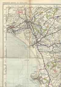 He
shows a road leaving the more westerly Irvine - Kilwinning
road (identical to or close to the B779) at a point
near to Nethermains Bridge (the river had very large
meanders here and this area was land within a large
meander at that time).
He
shows a road leaving the more westerly Irvine - Kilwinning
road (identical to or close to the B779) at a point
near to Nethermains Bridge (the river had very large
meanders here and this area was land within a large
meander at that time).
It skirted the river on its north side, running south of Bynehill and just north of Bog to the lower end of Stevenston. It is easier to follow the route on older maps as the area is now so built up but its approximate course was south of Todhill Farm Training Home, along the old railway, then through the roundabout in Ardeer to the junction south of the railway station. From here, a road ran up to the centre of town and is very probably the existing road. It then continued directly to Saltcoats and its course may be shown by the track and road on older O.S. maps on this alignment. It is very close to the modern railway line.
Armstrong
Initially his road may have been the same as Roy's but he goes nearer to Bogside and has a more westerly crossing point, perhaps � mile west of present Nethermain Bridge. Once over the river, it is the same as Roy. It terminated at Ardeer but the section to the centre of Stevenston is shown.
Just east of Stevenston, he shows the present day minor road that loops up past Castlehill and back down to the town.
58. Irvine - Kilwinning (R 4-6, 4-7, 3-2; A1)
Roy
He
shows two routes to Kilwinning. One is identical with
the present road running past the hospital; the other
left this road near the Town Moor and follows the course
of the B779 up to Kilwinning. If not identical to this
road, it is very close to it. The course of the river
has changed considerably hereabouts and the crossing
point was perhaps 400 metres south of today's crossing
at Nethermains Bridge.
Armstrong His road is identical to the present main road.
59. Kilmarnock - Glasgow (R 4-6, 4-7; A2)
Roy
The line is that of the present road through Beansburn towards Fenwick. However, part of it has been converted into a slip road for the A77. Once through Fenwick (the A77 here is based on a 1930's bypass) it has the line of the A77 as far as the Eaglesham Road. The only changes of note are that it crossed and recrossed the Kingswell Burn near Rathburn a couple of times before Kingswells so that its course here is to be found just south of the A77 for some distance.

North of the Eaglesham Road, the A77 is new and Roy's and later roads went to Kingswells (where Thomson shows an inn) to split into the Eaglesham road and the Glasgow road. The latter had the line of the minor road to Floak Bridge and continued to Glasgow by Mearns Kirk - this is now the minor road leaving the A77 nearer to Glasgow. There are suggestions of a more sinuous course which would be consistent with its improvement when it became a turnpike. The Eaglesham road split into two just after Ballageich Hill and rejoined just before the village. It is marked as the road to Hamilton.
Armstrong
The road is sufficiently consistent with Roy for us to assume he is showing the same road.
60. Fenwick Area (A2)
Armstrong only
Near to Fenwick, some minor roads are shown. One ran up towards Rowallan and is presumably the straight stretch running past Little Mosside. Another ran south from Waterslap in Fenwick as far as the sharp bend at Marchbank. It then continued past Craufurdland Castle (see present day track) and swung round to rejoin the main road just south of Borland. There is a short stretch at Aitkenhead, and Kirkton Road can be seen. He shows an interesting double line over the Craufurdland Water near to the Galston Road and this is likely to be the well defined ford or even a bridge at present day Bruntland Bridge (NS 479428).
61. Stewarton - Dunlop - Beith (R 4-7; A1)
Roy
The line is modern as far as Dunlop although there is a suggestion of a later realignment in Dunlop near the railway. Beyond Dunlop, it had a sharp turn at the Kirk like the modern road with a hint of a straighter line as far as the next distinctive bend at Oldhall. Beyond this point, the road is identical to the modern road as far as Beith even to the extent of a distinctive bend at Windyhouse near Beith.

(note: Roy roads in purple)
On this route he has a short stretch of road running to the right at Oldhall, as far as Longton - this is the present minor road at this point. At Burnhouse he shows a road running down to Kilwinning, identical to the A736, as far as Sidehead, a couple of miles south of Burnhouse.
From there it is hard to say if it relates to modern roads although it is certainly close to them. It went past Auchentiber, Greenlea, Dykeneuk, Clonbeith and Hollerhill to terminate at Redston on the outskirts of Kilwinning. Its course may be shown by a long field boundary south of present Sydhead through Bentfauld and Auchentiber on which there are short stretches of track. In fact, the 1897 1" OS map has a ford at Auchentiber and a continuous track to Bentfauld.
It then seems to have cut across the fields just above Greenlea to Dykeneuk and it may just be identical to the minor public road that runs down past Clonbeith towards Hollerhill. If not, it must be within 100 metres of it. Beyond Seven Acres Wood there is a wooded linear feature 400 metres in length with links to a track at Hollerhill. From here to Redston (3/4 mile), there is a hint of a road in the field boundaries.
He shows another road off the Dunlop-Beith Road at Barrmill. It too ran down to Redston at Kilwinning where it met the road described above. Its course is identical with the modern minor road past Drumbuie as far as Waterside. There is then a stretch of about 2� miles where its course is uncertain before we can pick it up again near present day Jameston Moss. It may have the line of the modern road as far as the crossroads at North Auchenmade but could equally lie 100 metres or so west of this and be making for the present day South Auchenmade. From here it would have made its way fairly directly to just south of Jameston Moss to become the track running past High and Laigh Gooseloan and Monkreddan to Redston. The distinctive bend Roy shows, where this track leaves the B778, suggests he is showing the B778 as far as this point.
Armstrong
Although much less precise than Roy there are enough clues to say that the Stewarton - Dunlop - Beith road he shows is the same as Roy's road.
He doesn't show the road running between Burnhead and Kilwinning but he does show the road between Barrhill and Kilwinning. Again, its course is imprecise but when looked at in conjunction with Roy, it is the same road.
He has a couple of roads leading off this road which are not shown on Roy. One left Redston and ran up to Blair. On his map it ran up to the house, with a parallel drive to the east running up beyond the House. Today there is a distinct dogleg where these two have been joined a few hundred metres south of the house. The road to the east was joined by the other road that branched off the Barrhill Road somewhere near Jameston Moss, ran past Blair Mill and then joined up with a loop off the Dalry to Beith Road. This loop skirted the top of the Blair House estate and then went back up to Highfield.
The Beith Road here (i.e. the one he shows running between Dalry and Beith) looks like the turnpike and so the A737. In fact, there is a strong chance that it is the minor road that runs from Highfield up past Langmuir of Auchengree and Auchengree Bridge to become the B777 (see his Broomhill and Auchengree). There has been a modern realignment of the B777 at Willowyard Industrial Estate.
His Dalry to Kilbirnie Road probably had the line of the modern road although there are a couple of bends that do not fit well. Just north of Dalry he has a branch off this road at Middleton that went up to join the Kilbirnie to Largs Road. This went past Hind Dog and Gowanlee and up over Greenhill. On the 1897 O.S. map much of it is shown as a track.
62. Beith - Neilston - Darnley (R 4-7; A1)
Roy
East of Beith his road followed the present B777 past Gateside and Langside. From there it went to Coldstream and Shutterflat (presumably the present Townhead of Shutterflat) and then Greenend. It may be the present minor road here but it is hard to say for certain. One slight clue is that the 1897 1" OS map has a North Highgate at the bend south of Eastend of Shutterflat (NS398543).
(note: Roy roads in purple)
From Greenend it went to Bowfield, perhaps directly, although his orientation suggests it went across to where Whitehouse is marked on the 1:25000 map and then oriented itself with the present road and track to Bowfield (unlike Armstrong, Roy's changes in orientation may well be accurate). From here it almost certainly ran along the top of the ridge above Loch Libo where there is still a track today. His placing of Greenside, Finnibrae and Banklug below the road supports this.
Armstrong
There is nothing inconsistent with Roy's map and it is reasonably certain he is showing the same road. At Whitehouse he has a junction with three roads, the middle of which looks like the Roy road over to Bowfield. The southernmost road went down past Caldwell House and then to the south of Loch Libo. His northernmost road, aligned towards Rigend (present Rigfoot) might suggest his track went to the left of the present road up towards Bowfield.
63. Beith-Paisley (R 4-7; A1)
Roy
(note: Roy roads in purple)
The road as far as Clark's Bridge (which Roy shows) is the same as the modern road. Once into Renfrewshire, the line is the minor road past Bourtrees and Middleton.
Armstrong
His line is that of Roy. It is interesting to note indications on the modern map of realignment work at Clark's Bridge.
64. Beith - Lochwinnoch (R 4-7; A1)
Roy (see above map)
This is the same as the present day minor road to East Kerse. From there, its course is shown by the track up to West Lochhead.
Armstrong The best fit is that he is showing Roy's road to East Kerse. The branch to Lochwinnoch is then the same as Roy. In the other direction it headed to Lochridge and Kilbirnie with a link, probably shown by the existing track, between Kerse Bridge and Lochridge. He also had a road running north for a couple of miles to Ladyland, which looks very like the minor public road on the same line. South of Kilbirnie, he shows a short road ending near Lochend. Going by the position of the Manse this looks like the modern road.
65. Beith - Crawfield (R 4-7; A1)
Roy (see above map)
This is a short stretch to the south west of Beith terminating near Crawfield. Its course must now be mostly built over.
66. Kilwinning - Dalry - Kilbirnie (R 3-2, 4-7; A1)
Roy
No road is shown
Armstrong
The route seems identical to the modern A737.
67. Kilwinning - Beith (R 4-7; A1)
Roy and Armstrong
This has been dealt with under the Stewarton - Dunlop -Beith road (no. 61).
68. Saltcoats - Kilwinning (R 3-2, 4-7; A1)
Roy
This is almost certainly on the line of the A738. It runs through Stevenston.
Armstrong
He has the same line as Roy. A road is shown running from just west of Kilwinning up to the Dalry - West Kilbride Road (see separate entry for no. 71)
69. Saltcoats - Dalry (R 3-2, 4-7; A1)
Roy
(note: Roy roads in purple)
This is now the present day road that runs up from near the station past Girthill to Dalry. Armstrong shows only a section of this road.
70. Kilbirnie - Largs, Dalry to Kilbirnie - Largs Road (A1)
Armstrong only
West of Kilbirnie a road to Largs is shown. At first glance it looks like the turnpike/modern road but is not, only aligning with that in the middle section.
Leaving Kilbirnie, it probably left the Dalry road as a continuation of the sharp bend here (this fits his placing of the manse and a church). It then ran south of Kilbirnie House, crossed a stream running to the west of the House and then crossed the Pitcon Burn just below the confluence 400 metres west of Boag.
From there it made its way up to join the route coming up from Dalry past Hindog somewhere near North Hourat or South Camphill at the reservoir. This latter route is almost certainly that shown by the minor road to Gowanlee and the track beyond it.
This suggests a course for the Kilbirnie - Largs route over towards Boag, crossing the Pitcon and then running northwards for about a mile to join the route from Dalry. It looks a difficult route because of the valley but Armstrong shows it with dotted lines which may indicate a track rather than any attempt at a made road so it wouldn't make much difference to someone on foot or horseback unlike someone travelling by cart or coach.
As the reservoir didn't exist then - he only shows marshy ground and not a loch - it is likely that the track ran where the reservoir is, north of the Rye and crossed it just past Routedaneburn. As an aside, it is interesting to see that the modern road ran nearer to the reservoir for � mile in this area. From Routedaneburn, it must have been close to the modern road for it passed Blair Park as well as the present day track in the grounds of Kelburn which can be seen just west of Fechan. Nearer to Largs, the road took a line to Killingcraigs where it joined the coast road (see Thomson's map).
71. Dalry - West Kilbride (A1)
Armstrong only
West of Dalry, a road ran to West Kilbride. Again it looks like the present day road but there are differences. It ran past Kirkland (near the cemetery) where a short stretch of road ran up to Broadlie (now a minor road).
Beyond Giffordland Bridge, he has the road north of the river which suggests a straighter line through Giffordlandmill towards Minnoch than shown by the course of the present day road. This must be identical to the track between these places that is shown on the 1897 and 1925 1" O.S. maps.
From Minnoch, it went south of one unnamed hill (probably Blackshaw Hill) and north of Law Hill, skirted some ruins and ran straight in to the old town. This would identify it with the present day track south of Blackshaw Hill and then a sinuous field boundary north of Law that passes Law Castle. Near Minnoch, he shows a stream crossing close to Gill but the topology is not inconsistent with a crossing near Minnoch. This would bring it in line with the path from the south that he has joining above Edward - presumably Knockewart.
72. Kilwinning - West Kilbride Road (A1)
Armstrong only
This road (or as he shows, more of a track) ran down to Kilwinning from near the Munnock Burn past Knockewart (his Edward) From there it went via Meikle Ittington and Muislaught Farms, then along the Auld Clay Road past Auchenkist and Whitehirst to join the main
 |
The Auld Clay Road
road near the railway. There seems to be no reason to doubt that it is on the line of minor public roads between these places,as well as the Auld Clay Road. Tinkler Hill near Meikle Ittington may refer to cadgers. This route was never turnpiked.
73. Saltcoats - Largs (R 3-2, 3-1)
Roy
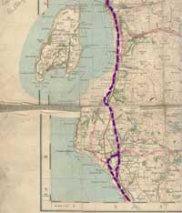 If
the modern coast road (as far as West Kilbride) hasn't
been built over Roy's road, it must at least be very
close to it.
If
the modern coast road (as far as West Kilbride) hasn't
been built over Roy's road, it must at least be very
close to it.

Even at Bank and Chapelton, south of West Kilbride, the junction is shown. The eastern branch went into West Kilbride, the other is the next main road leading through the centre of the town and then becoming the minor road running past Bushglen. It is hard to be absolutely certain but the positioning of Woodside helps to confirm that it ran to the east rather than the west of Dalmilling Hill.
It then went past present north Kilruskin (where there is a typical 90 degree alignment of the modern road under the railway to save expense in the building of the railway bridge) and made its way across to south of Poteath. North of here there have been major landscape changes at the ore terminal but the modern road used to be just yards from the shore and this is where Roy's road runs up past Fairlie to Largs.
(note: Roy roads in purple. No roadswere shown on Roy's map of Cumbrae)
74. Stevenston - Largs (A1)
Armstrong
 |
| Armstrong shows the road running along the beach here |
The coast road north from Stevenston left the town centre
to join the A78 and follows this line past Ardrossan
(which didn't exist at the time).
A road from Saltcoats ran up to join the main road near where Ardrossan Academy is, and another road ran up to Dalry on the line of the modern road but ended near the Glen Burn. The road initially had the Roy line but then took to the sands on the clear stretch east of Montfode where it ran for a mile or so before coming back on shore at Glenhead.
The road, as on Roy, splits here, and it must have been on or close to the line of the two modern roads which diverge at this point. One ran in to West Kilbride presumably on a straighter line near the town to bring it into alignment with the Main Street. From there it had the line of the modern minor road through Bushglen and Kilruskin. The other ran up through present day Seamill and over towards Portencross near to Ardneill.
From there it went north through Campbelton and west of Hunterston Castle. It then rejoined the other road near the roundabout at Hunterston Power Station, i.e near Poteath. He also shows the stretch Roy has from Seamill into West Kilbride which Roy continues through Kilruskin.
North of here he is more or less the same as Roy as far as Fairly. Towards Largs the road may have been further inland, closer to Kelburn, beyond which the Kilbirnie Road came in (no.70).
75. Largs - Greenock (R 3-1; A1)
Roy
North of Largs, the road took a higher line which is still the minor road reached at the Netherhall Estate. North of Wemyss Bay, it is now a farm track from Kelly Mains northwards.
Armstrong (A1)
The line appears to be the same as Roy.
76. Largs - Brisbane Glen (A1)
Armstrong
Also shown is the Brisbane Glen Road along the same course as the modern hill road to Greenock, but terminating at Outerwards. Interestingly, even on the 1925 O.S. 1" map this was where the public road ended although by that time there was a track to the south end of Loch Thom where it became a public road again.
Conclusion
The Roy maps in particular offer us a unique view of a landscape in process of transition. There were no turnpikes as yet but the first enclosures can be seen and these reflected the changes in agriculture that helped create a more populous and prosperous society. As part of this process the need for improved roads became apparent and over the next 50 or so years, many of the above roads were made up into turnpikes. Technologically these were an enormous improvement on what had come before so that although the network shown on Roy was almost as extensive as the turnpikes there was hardly any comparison to be drawn. Many of the roads looked at above must have been paths or tracks or poorly made roads whereas the turnpikes had firm surfaces that were well drained and did not break up. As we shall see in the next chapters they played an essential part in the considerable changes occuring in Scotland at that time.
1. Strawhorn, Ayrshire at the Time of Burns, AANHS Collections, Vol. 5, 1959
2. Aaron Arrowsmith, Map of Scotland constructed from original materials, London, Arrowsmith, 1807
3. John Thomson, Northern Part of Ayrshire, Southern Part, Edinburgh, J Thomson & Co., 1828
4. Rev. John Warrick, The History of Old Cumnock, Paisley, 1899
Main libraries in the west of Scotland may have black and white copies of the Roy maps for their area. However, a subscription service offered by SCRAN (£30 pa in early 2007, £20 per 6 months) allows online access to digital copies for the complete survey of Scotland. These can be enlarged and are in colour. Thumbnails of individual sheets can be viewed on the site. Main libraries may have public access to Scran and individuals working in education may be able to get access through their institution.
The maps have recently been added to the National Library of Scotland website (2007) where they can be viewed free of charge. The maps are supported with detailed information on the Military Survey.
Top
Next (The Turnpike Era)
|
|