|
Note:
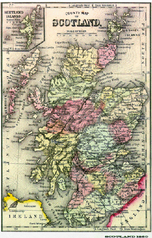
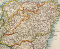
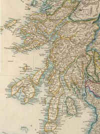
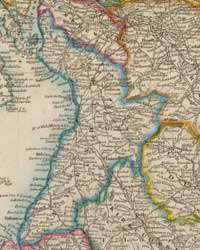
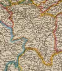
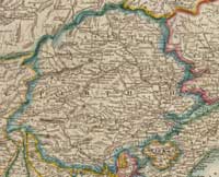
The county maps are from Arrowsmith's
map of Scotland dated 1846; Orkney and Shetland from
Alexander
Johnston's map of 1861. Images courtesy of David
Rumsey Historical Map Collection. The images are
copyright Cartography Associates but have been made
available under a Creative
Commons license for non-commercial use.
ABERDEENSHIRE
Alexander MacKie 1911
 In
the past the main route to the south was the old South
and North Drove Road, which ran from Fettercairn in
Kincardine over Cairn o Mounth, passed the Dye and Whitestones
on the Feugh to reach the Dee at Potarch. It then went
by Lumphanan to the Bridge of Alford, from where it
ran to Clatt and Kennethmont and then Huntly. In
the past the main route to the south was the old South
and North Drove Road, which ran from Fettercairn in
Kincardine over Cairn o Mounth, passed the Dye and Whitestones
on the Feugh to reach the Dee at Potarch. It then went
by Lumphanan to the Bridge of Alford, from where it
ran to Clatt and Kennethmont and then Huntly.
A road that is thought to be Roman came up from Stonehaven
to cross the Dee at Peterculter, then by Skene, Kintore
and Inverurie to Pitcaple. From there it went to a possible
Roman camp at Glenmailen, then by the Corse of Monellie
and Cobairdy to the fords of the Deveron below Avochie.
There was another ancient road that went into the Grampians
from Blairgowrie to the Spittal of Glenshee, then over
the Cairnwell to Castleton of Braemar. From there it
used the valleys of the Gairn and Avon to reach Inchrory,
then ran to Tomintoul into Speyside.
After the 1745 rising General Wade used the southern
part of this route for his military road from Blairgowrie
to Fort George. However he turned east at Braemar to
follow the Dee valley to Crathie then went over the
hills to Corgarff in Upper Strathdon from where he went
over the �Lecht� to Tomintoul. The road was completed
in 1750.
On the old North and South Drove Road, the Bridge of
Alford over the Don was built in 1810-11 and the bridge
of Potarch over the Dee in 1812-13 where previously
there had been fords. A new road was built to connect
them.
The main roads in the turnpike era were:
• The first turnpike, made in 1796, was from the
Bridge of Dee to Aberdeen, finally completing the post-road
from Edinburgh
• The North Deeside Road which went through Aboyne
to Ballater and Braemar where it joined the ancient
road coming from Blairgowrie
• The Aberdeen to Tarland road running by Skene
and Echt. A branch left Skene for Alford, later being
extended to Mossat and Corgarff to meet Wade�s road
(Blairgowrie - Braemar - Corgarff)
• The Aberdeen to Inverness post road by Kintore,
Inverurie, Huntly and Banff. There was a branch to Portsoy
from Huntly and an alternative route from Huntly to
Banff
• The Strathbogie Road from Huntly to Donside -
this is still used as the mail route to Strathdon The
Aberdeen to Banff Road which left the Inverness Road
at Bucksburn and went through Dyce, Old Meldrum and
Turiff.
In the east of the county the main roads were:
• Aberdeen to Peterhead which crossed the new Bridge
of Don and ran by the coast. It continued to Banff
• A coast route between Peterhead and Fraserburgh,
which was extended into Banffshire.
Prior to the 1800�s only a few main roads had been
made. Before that time wheeled vehicles were almost
unknown. By 1765 judges were able to travel to Aberdeen
by chaise rather than horseback and by 1798 the mail
coach started to run, taking 21 hours to travel from
Edinburgh. Passenger coaches ran to Huntly in 1811,
and farmers were able to use carts to take their goods
to market rather than horses.
The roads were maintained by tolls and toll-bar houses
can still be seen, sometimes with windows on the right
and the left from where the tolls could be collected.
Tolls were abolished in the county in 1865.
ARGYLL
& BUTE
Peter MacNair 1914
Argyllshire
 Until
the early 1800�s travel was difficult in the county
but this became much easier with the advent of steam-boat
communication. Until
the early 1800�s travel was difficult in the county
but this became much easier with the advent of steam-boat
communication.
The roads usually run in the glens and as watersheds
are generally low do not reach any great heights. Exceptions
are the road between Glendaruel and Otter Ferry (1026�),
Lochgoilhead and St Catherine�s (727�) and Glencrow
and Cairndow (860�).
On this last road, constructed by General Wade after
the 1715 rebellion, there is a stone at the top of a
difficult and tiring climb, inscribed with the words
�Rest and Be Thankful�. Wordsworth, who used the road,
wrote: "Doubling and doubling with laborious walk, Who
that has gained at length the wished-for height, This
brief, this simple wayside call can slight, And rests
not thankful?"
BUTESHIRE (Bute and Arran)
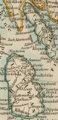 On
Bute a tramway runs between Rothesay and Ettrick Bay.
There is a good network of roads on the island. On
Bute a tramway runs between Rothesay and Ettrick Bay.
There is a good network of roads on the island.
There is a coast road (�a good carriage road�) round
Arran with two other roads crossing the island.
AYRSHIRE
John Foster 1910
In the mid-1700�s there was hardly a usable road in
the country, with pack horses in widespread use and
stage coaches only able to use a few roads and then
only at 6 or 8 mph. This had changed by the end of the
century and roads were recognised as important for progress.
In Ayrshire the two northern districts were soon opened
up by new roads. McAdam began his experiments in road
making in Ayrshire and now all the roads are constructed
by proven methods. In Ayrshire the roads are macadamised
either with whinstone or limestone.
There are three main roads from Glasgow:
• By Paisley, Beith and Kilwinning to Irvine
• By Barrhead and the Lugton valley to Irvine
• By Fenwick to Kilmarnock
A shore road runs from Skelmorlie and Largs to Irvine
and then to Monkton and Ayr.
 Roads
from Kilmarnock are: Roads
from Kilmarnock are:
• up the Irvine valley through Galston and Darvel
• Mauchline and Cumnock into Dumfriesshire
• Symington and Monkton to Ayr
• Crosshouse and Dreghorn to Irvine
• Kilmaurs, Stewarton and Dunlop to Lugton where
it joins the Irvine - Glasgow road.
Roads from Ayr are:
• Mauchline and Muirkirk
• Dalmellington towards Kirkcudbrightshire
• Maybole to Girvan, Ballantrae, Glenapp to Wigtown
• A shore road to Girvan by Dunure and Turnberry.
There are numerous minor roads. What may be a very old
route is that between West Kilbride and Dalry which
passes Law Hill.
BANFFSHIRE
W Barclay 1922
 A
long description is given of the main lines of road,
which can easily be seen on a map. The author notes
that much of the country is now accessible by motors. A
long description is given of the main lines of road,
which can easily be seen on a map. The author notes
that much of the country is now accessible by motors.
BERWICK AND ROXBURGHSHIRE
W S Crockett 1926
 The
main Roman routes were Watling Street, undoubtedly Roman
where in England but not so certain when it passes into
Scotland where it is more like a ridgeway. It has been
traced to Cappuck Camp on Oxnam Water and to Jedfoot
Bridge and Ancrum. From Newstead it ran to Melrose and
Darnick and is said to have then ran north by Blainslie
and Lauder to Soutra Hill and onwards into Mid Lothian.
It has also been called Derestrete, a name mentioned
in charters and undoubtedly the Roman road. The
main Roman routes were Watling Street, undoubtedly Roman
where in England but not so certain when it passes into
Scotland where it is more like a ridgeway. It has been
traced to Cappuck Camp on Oxnam Water and to Jedfoot
Bridge and Ancrum. From Newstead it ran to Melrose and
Darnick and is said to have then ran north by Blainslie
and Lauder to Soutra Hill and onwards into Mid Lothian.
It has also been called Derestrete, a name mentioned
in charters and undoubtedly the Roman road.
There is a reference in a charter of Melrose Abbey
to a via regia running from Annandale to Roxburgh. This
ran up Liddlesdale and crossed into Jedwater, on which
stretch it was identical with the Wheel Causeway, then
by Rulewater and Swinnie Muir into Jedburgh by the present
day road called the Loaning.
From Jedburgh it went to Roxburgh and then up the Tweed
to Lauderdale - from near St Boswells it would have
been the road called Dere Street. There is in fact a
good chance that Watling Street, Dere Street, the via
regia and Malcolm�s Road were different names for the
same road.
There were several "herring roads" that crossed the
Lammermuirs into Berwickshire. An ancient road called
the Girthgate ran through Channelkirk to Soutra. It
may have gone down to Melrose but the name suggests
its destination was the girth or sanctuary at Soutra.
Today the roads and bridges are well kept and much money
is spent on them, with considerable grants from the
Government. Very large quantities of stone and sand,
and barrels of tar-bitumen are used each year.
The main roads in Berwickshire are:
• The Great North Road from London to Edinburgh
which runs by Lamberton, Ayton, Grantshouse and Cockburnspath
• Berwick to Kelso by Swinton, Leitholm and Eccles
• Coldstream to Kelso, close to the Tweed
• Coldstream to Haddington by Duns and Longformacus
• Coldstream to Lauder by Greenlaw
• Eyemouth to Lauder by Ayton, Chirnsyde, Duns
and Westruther
• Kelso to Edinburgh by Earlston and Lauder.
 The
main roads in Roxburghshire are: The
main roads in Roxburghshire are:
• Hawick to Jedburgh and Kelso by Crailing
• Hawick to Newcastle by the Carter
• Hawick to Liddlesdale by Limekilnedge
• Hawick to Teviot head
• Jedburgh to Liddlesdale by Note (or Knot) o�
the Gate
• Hawick to Selkirk
• Kelso to Earlston by Smailholm and also by Maxton
and St Boswells
• Earlston to Galashiels by Gattonside
• Earlston to Melrose by Newstead.
Before 1764 the Tweed was bridged only at Melrose and
Kelso: the Teviot was bridged at Hawick and Ancrum.
Now all rivers are bridged. There are several ferries
on the Tweed. Motor conveyances run between some of
the towns.
CAITHNESS
& SUTHERLAND
H F Campbell 1920
Caithness
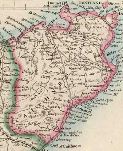 Caithness
now has about 300 miles of excellent roads. Before 1800
the towns and villages were connected by horse tracks,
and communications with the south of Scotland were by
sea. Caithness
now has about 300 miles of excellent roads. Before 1800
the towns and villages were connected by horse tracks,
and communications with the south of Scotland were by
sea.
The first road of any significance was between Thurso
and Latheron and was built between 1785 and 1790 by
statute labour. In 1800, bridges were built at Wick
and Thurso.Under the Highland Roads Act of 1803, the
Inverness to Thurso road was completed by 1811. Half
the cost of this road was raised locally, including
statute labour which had been commuted to a monetary
payment in 1793. Other roads were built between 1806
and 1860, and existing roads maintained.
The mail coach service, which already ran to Tain,
was extended in 1818 to Wick and Thurso by Bonarbridge
and the Ord. This allowed through communications with
the south of the country. In 1860 the County Road Act
created a County Road Trust under which the leading
highways were placed. The older statutes were still
in place and allowed repairs to be met from tolls. Tolls
were abolished under the 1878 Roads and Bridges Act,
funds being raised by a roads assessment. In 1889 Road
Boards were formed under the County Council to manage
the county roads.
In the early 1900�s the popularity of John o�Groats
as a destination for motor traffic led to the roads
needing frequent repair. The Development and Road Improvement
Funds Act of 1909 helped to alleviate this, and to improve
the roads.
Topography is important in the county: even today (1920)
there are hardly any roads west of a line from Latheron
to Reay.
The mail coach �Defiance� is no longer: mail and passengers
are conveyed by motor power.
Sutherland
 Before
1807 there were no roads in Sutherland and only one
bridge, at Brora. A horse track ran from the Meikle
Ferry along the coast, and other tracks linked Strathnaver
and Assynt with ferries at Portinlick and Bobar. There
were no wheeled vehicles in the county. Access to the
county from the south of Scotland was mostly by sea. Before
1807 there were no roads in Sutherland and only one
bridge, at Brora. A horse track ran from the Meikle
Ferry along the coast, and other tracks linked Strathnaver
and Assynt with ferries at Portinlick and Bobar. There
were no wheeled vehicles in the county. Access to the
county from the south of Scotland was mostly by sea.
On the mainland the county could be reached by Meikle
Ferry (G. Port a' Choltair), Bonar Ferry (G. Am Bhannath)
and Portinlick (G. Port na-Lice). Cattle for the Falkirk
trysts and other market swam across at these ferries
- there was a belief that if an animal took readily
to the water it would fetch a good price at market.
That part of the Inverness - Thurso road that runs
through Sutherland was completed in 1812-13 as was Bonar
Bridge over the Kyle. Some 400 miles of road were built
in the next 20 years, as follows:
• Bonar to Scourie and Durness by Lairg
• Lochinver by Oykell Bridge and Inchnadamph
• Helmsdale to Melvich by Forsinard
• Melvich to Durness by Bettyhill and Tongue
• Bonar to the Mound by Loch Buidhe
• Lairg to Rogart and from Rogart to Brora by Sciberscross
• Scourie by the Kylescu ferry to the Lochinver
road at Skiag Bridge.
These roads were very adequate for the needs of the
time and of great benefit in making the county accessible.
A mail coach between Tain and Thurso started in 1819.
The roads proved unsuitable for the great increase
in motor traffic and much work was done to strengthen
them. The amount spent on the roads increased fourfold
between 1900 and 1915 and is now �12,000 per annum.
Since 1910, the Road Board has made grants to the county
but even with these, the funds available are insufficient
to fully maintain the roads.
Although the coming of railways helped the eastern
part of the county, the west and north had to depend
on horse drawn transport for mails and passengers until
the coming of motorised transport. There is now a service
from Lairg station to Scourie and Tongue, and along
the north coast from Thurso.
CLACKMANNANSHIRE
& KINROSSSHIRE
J P Day 1915
Clackmannanshire
 Roads
and centres of population are interdependent in the
sense that roads may have developed to connect towns
but roads themselves may attract settlement. In Clackmannanshire,
it is generally the roads that have influenced the location
of the towns rather than the other way around. Roads
and centres of population are interdependent in the
sense that roads may have developed to connect towns
but roads themselves may attract settlement. In Clackmannanshire,
it is generally the roads that have influenced the location
of the towns rather than the other way around.
From Stirling roads lead towards the Fife peninsula
along a narrow stretch of flat ground between the Ochils
and the River Forth. Further east this narrow stretch
widens but is split by the Cleish Hills. This has resulted
in there being two routes from Stirling into Fife; one
north of the Cleish hills that runs through Kinross,
and one to the south through Dunfermline.
The towns are found spaced along these two main roads:
the position of those on the north or Kinross road has
been influenced by their having to be close to burns
to serve their woollen industry; to the south the Dunfermline
road leaves the direct line to include Alloa which is
located where the Forth ceases to meander and was therefore
suitable for the establishment of a port.
There are link roads between the two main roads.
Kinrossshire
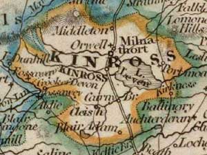 This
is a farming district with many farms and small villages
scattered across the plain. Such a district needs a
market town conveniently sited for all and Kinross,
centrally situated, has developed to meet this need.
It is also important as it was about half-way between
Edinburgh and Perth on the Great North Road and served
as a staging point between these places. This
is a farming district with many farms and small villages
scattered across the plain. Such a district needs a
market town conveniently sited for all and Kinross,
centrally situated, has developed to meet this need.
It is also important as it was about half-way between
Edinburgh and Perth on the Great North Road and served
as a staging point between these places.
The only other large town is Milnathort. It too is
on the Great North Road and has roads from Cupar, Leslie,
and Dollar.
DUMBARTONSHIRE
F Mort 1920
 Roads
are determined by the need for communication between
places and by the topography. In this county the north-west
is mountainous and the south-east flat. This is seen
where the road from Glasgow to Stirling, the railway
and the Forth and Clyde Canal all run close to each
other through the Kelvin valley in the east of the county.
In the north-west, roads keep to the coast or lochsides
or the valleys, although some older roads run higher
up. Roads
are determined by the need for communication between
places and by the topography. In this county the north-west
is mountainous and the south-east flat. This is seen
where the road from Glasgow to Stirling, the railway
and the Forth and Clyde Canal all run close to each
other through the Kelvin valley in the east of the county.
In the north-west, roads keep to the coast or lochsides
or the valleys, although some older roads run higher
up.
Although these routes have been used for centuries,
properly made roads are relatively recent. Most trade
used pack horses, even carrying goods to Glasgow from
Dumbarton and Port Glasgow.
The passing of the Turnpike Roads Act in 1751 marked
the beginning of a new era; and good roads gradually
replaced the old horse tracks. A further improvement
was heralded by the establishment of County Councils
in 1889, and the transference to them of the care of
the roads. In recent years the development of fast motor
traffic has presented a new problem to road authorities
; and it may be that we are but at the beginning of
an altogether new phase of road construction rendered
necessary by "the modern craze for speed".
A national Road Board was formed a few years ago and
receives the taxes from motor-vehicles and fuel;. It
gives grants to County Councils for the improvement
of roads but not their maintenance.
In its heyday around 1830 the Forth and Clyde canal
carried many passengers, for example, some 20,000 each
year from Kirkintilloch. The canals declined with the
coming of the railways.
DUMFRIESSHIRE
James King Hewison 1912
 There
were a number of Roman roads in the county.These were: There
were a number of Roman roads in the county.These were:
• From Carlisle to Longtown
• At Longtown the road divided with a branch to
Netherby, Liddel Moat, Castle O�er and Raeburnfoot and
thence to Trimontium
• Another branch crossing the Sark near Gretna,
passing by Kirkpatrick Fleming, Birrens and Hoddom to
Gallowberry near Lochmaben
• From Gallowberry the main road continued north,
up Annandale, passing the Devil�s Beef Tub to reach
Crawford
• Also from Gallowberry, a branch went westward
to Nithsdale, passing Tinwald, Duncow, Closeburn, Thornhill
and Durisdeer to join the main road at Crawford
• Some smaller branches traversing Kirk Michael,
Glencairn and Tynron.
Before the Turnpike Act of 1777, the roads had been
poorly kept under the previous legislation of 1686.
Great progress was made under the turnpike system. The
main turnpikes were:
• Glasgow, Beattock, Lochmaben, Annan and Carlisle
• A road through the vale of Carron to Elvanfoot
• Moffat to Nithsdale
• Springkel to Kelhead
• Carlisle to Dumfries and onward to Portpatrick.
There were many old drove roads such as that at the
Enterkin Pass and these were used by people on foot,
pack horses and sledges. At an estate in Closeburn,
stone causeways were used on steep gradients.
Apart from the many fords a large number of bridges
have been built in Dumfriesshire. In 1812 there were
6 over the Nith, 5 over the Annan and 5 over the Esk.
There is a very old bridge in Dumfries although no proof
has been found that it was built by Dervorgilla. Nevertheless
it points to a very old route into Galloway. There is
a fine bridge at Drumlanrig, also said to be very old.
A bridge at Boatford near Thornhill was built in 1777
and there was one in Moniave in 1560. Another bridge
over the Dalwhat dates from the 1600�s. A new bridge
in Dumfries, completed in 1794, has recently been widened;
and a bridge was built at Annan in 1826.
The Craigengillan coach ran through Carsphairn and
Moniave on the journey between Glasgow and Dumfries,
taking thirteen and three quarter hours for the journey.
There were also other coaches, called roaring dillies,
to Edinburgh and Glasgow.
EAST LOTHIAN
T S Muir 1915
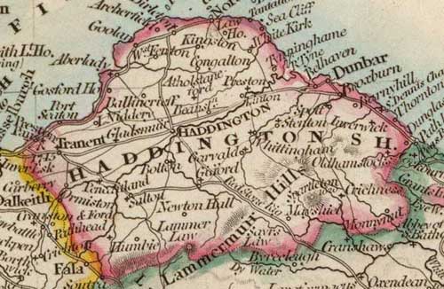 Routes
in East Lothian are strongly influenced by the terrain.
Thus the road and railway line are very close south
of Dunbar, and roads from Gifford and Garvald meet on
the Whiteadder. Sometimes these constraints are ignored
as seen by the road from Haddington to North Berwick
which crosses high over the Garleton Hills, as does
the road to the old port of Aberlady. Routes
in East Lothian are strongly influenced by the terrain.
Thus the road and railway line are very close south
of Dunbar, and roads from Gifford and Garvald meet on
the Whiteadder. Sometimes these constraints are ignored
as seen by the road from Haddington to North Berwick
which crosses high over the Garleton Hills, as does
the road to the old port of Aberlady.
There are three routes east of Edinburgh:
• The coastal route
• To Berwick by Tranent to Haddington then East
Linton, where the road runs on the flanks of the Garleton
Hills, and Dunbar. South of Dunbar the coastal sill
is followed to the boundary and a fine bridge over the
Dunglass Burn.
• Another road by Drem which has the same line
as the railway.
Haddington is very much a centre for routes with several
roads running to the town. Interestingly the bridges
do not carry main routes.
Little is known about the ancient roads. Blaeu�s map
of 1654 shows a road from Musselburgh to Preston where
it strikes inland with a branch to Haddington and then
crosses the Tyne at Linntyn briggas continuing on to
Dunbar.
There are a number of drove roads across the Lammermuirs.
The Herring Road runs from Dunbar over its Common to
the Whiteadder; another runs from Innerwick to Abbey
St Bathans; and a third runs from the old Gifford road
to Longformacus.
Several old bridges still exist. In Haddington there
is the Nungate Bridge which may date from the 12th century.
It is very narrow, and very steep at both ends. Hardly
anything is left of Edincain Bridge over the Thornton
Burn. There are remains below the Dunglass and Pease
bridges which show that the road crossed the streams
at a lower level.
FIFESHIRE
Easton S Valentine 1915
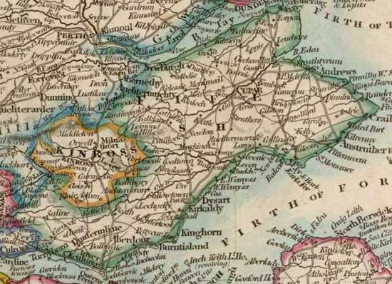 A
major factor influencing routes is the topography: one
would expect the early routes to have run east and west;
north and south through gaps in the Ochils, Lomonds
and other hills; as well as a route close to the coast. A
major factor influencing routes is the topography: one
would expect the early routes to have run east and west;
north and south through gaps in the Ochils, Lomonds
and other hills; as well as a route close to the coast.
Another factor is that there would be a need for communication
between the early settlements in Fife such as Culross,
Dunfermline, St Andrews and Newburgh; and with towns
outwith Fife such as Edinburgh, Stirling, Perth and
Dundee - these would require the early construction
of bridges or establishing ferries.
These factors can be clearly seen in the roads of Fife.
Of the east to west routes there are:
• Perth to Newburgh, Lindores, Cupar and St Andrews
• Stirling to Kinross then by the Howe of Fife
to Cupar
• A coastal route from Stirling leading to Culross,
Dunfermline, Inverkeithing, Burntisland, Kirkaldy etc
to St Andrews.
Of north to south routes there are:
• Perth to Dunfermline and Inverkeithing by Kinross
and the Wicks of Baiglie (a route described by Scott
in the Fair Maid of Perth - he regrets the easier Glenfarg
road is used rather than the old track which climbed
the Ochils and gave magnificent views)
• The royal residence at Dunfermline to the hunting
grounds of Falkland either by going west of Loch Leven
or more directly through Leslie and Markinch then crossing
a saddle to Kettle
• Kirkcaldy to Cupar, Kilmany or Leuchars, and
the Tay ferries via Markinch
Edinburgh was reached by the Queensferries and Pettycur,
and Dundee from ferries at Balmerino, Woodhaven, Seamylnes
(Newport) or Ferry-port-on-Craig. Old milestones show
distances from Pettycur. Boats ran between the coast
towns of Fife and the Lothians.
Walter Scott in The Antiquary evokes coaching days
when the �Hawes Fly� broke down causing travellers to
miss the ferry at Queensferry. Forced to stay the night
they made up lost time by hiring a post-chaise to take
them to Arbroath at the rate of eighteen pence a stage.
The journey took one and a half days.
In his account of the agriculture of Fife written in
the late 1700s, Dr John Thomson of Markinch notes the
bad roads as a major obstacle to the improvement of
the county. Around that time however things started
to improve: four roads districts were formed and good
management along with a ready supply of road-making
materials resulted in Fife having an excellent network
of roads. The road money had been raised by tolls but
campaigns led eventually to their being abolished under
the road act of 1878. The money is now raised by a general
assessment.
There are two major tramway systems in the county:
at Kirkcaldy and Dunfermline and these reach well into
the surrounding districts.
FORFARSHIRE
Easton S Valentine 1912
 Early
tracks generally followed the courses of rivers and
streams. Where there are side streams entering a main
valley it is very common to see castles sited there
as a defence and also towns in more settled times. Where
a district adjoined the coast there would usually be
a coast road. Early
tracks generally followed the courses of rivers and
streams. Where there are side streams entering a main
valley it is very common to see castles sited there
as a defence and also towns in more settled times. Where
a district adjoined the coast there would usually be
a coast road.
The Roman road from central Scotland entered Forfar
near Coupar Angus. It ran past Kirriemuir to Battle
Dykes (3 miles north of Forfar). From there it crossed
the South Esk near Noran Water, ran past Brechin to
cross the North Esk at Kingsford and then entered the
Mearns. Traces of the road can still be seen and the
modern road still follows it near Kirriemuir. There
are camps at regular intervals along the road. A subsidiary
route may have gone from Cater Milly (near Invergowrie)
to Haerfaulds (five miles south-east of Forfar) to allow
supply from the Roman fleet.
Although there were no made roads until recent times
there would have been tracks leading to fords and bridges.
Until the end of the 1700s the main road through Strathmore
crossed the bridge at Brechin.
The constant need for communication between such centres
as Dundee, Forfar, Glamis, Brechin, Arbroath, and Montrose
led to tracks that would later become roads. This is
clearly seen in Dundee where the main roads are those
that led to the nearby burghs. The abbey at Arbroath,
the cathedral at Brechin and the palaces at Forfar made
these important places.
There was an interesting road between the fishing village
of Usan and Forfar along which fish were carried each
day to the court. This was the King�s Cadger�s Road
- it was the width of a mill wand such as was used to
trundle a mill stone to its destination.
Pack horses were used and could carry heavy loads such
as slates and paving slabs from Glen Ogilvy to Dundee.
Later rough sledges took over from panniers, which in
turn were replaced by primitive carts called tumbrils.
The main roads are:
• Perth to Aberdeen by Coupar Angus, Forfar and
Brechin
• Dundee to Perth
• The coast road from Dundee to Arbroath, Montrose
and beyond
• Arbroath to Forfar and Kirriemuir
• Brechin to Arbroath and Brechin to Montrose.
There are roads from Dundee to Coupar Angus, Meigle,
Kirriemuir and Forfar. There are many minor roads and
all the glens have at least one good road.
KINCARDINESHIRE
George H Kinnear 1921
 The
county is on the direct route between south and north.
The earliest routes led generally in those directions,
often taking the high ground which was driest but sometimes
taking a direct line if this was practicable. The roads
here, as elsewhere in the north were very neglected
well after the Union of 1707. With no wheeled vehicles
there was no need for good roads and bridle paths for
the pack horses were sufficient. The
county is on the direct route between south and north.
The earliest routes led generally in those directions,
often taking the high ground which was driest but sometimes
taking a direct line if this was practicable. The roads
here, as elsewhere in the north were very neglected
well after the Union of 1707. With no wheeled vehicles
there was no need for good roads and bridle paths for
the pack horses were sufficient.
The Roman road from the Tay to the Dee is no doubt
the oldest. It ran between camps, probably a day�s march
apart. From Ardoch it ran north and north-easterly passing
the camps at Mains of Fordoun, Raedykes near Stonehaven
and Normandykes at Peterculter to reach the Dee. At
Marykirk there was a branch to the royal seat at Kincardine
but this may not have been Roman.
Beyond the Dee it continued to the pass of Cairn O�Mount,
later to be the last of the military roads built by
Wade. Many branches led from the Roman road, or later
roads on its line. These went into the hills and were
used by drovers heading south to the great trysts and
also down to small ports on the coast along which coal
and lime were brought.
Until the Roads and Bridges Act of 1878 roads were
either turnpike or statute labour. The first type were
originally financed by subscription and then from tolls,
the second by a rate paid by heritors and others. Under
the Act a road rate was paid by householders, and since
then the roads have gradually improved and are now quite
adequate for modern needs.
There are three main roads running north:
• The main road from Edinburgh running through
Brechin, Laurencekirk and Stonehaven to Aberdeen
• A parallel road near to the hills that passes
through Fettercairn, Fordoun and Glenbervie to join
the first road at Stonehaven
• A road near the coast running from Montrose to
Stonehaven.
These three roads are connected by many cross-roads,
making travel to all parts of the county easy.
There is a fine road along the south side of the Dee
from Aberdeen to Maryculter, Durris, Banchory and Strachan.
Three cross-roads join this from the coast.
KIRKCUDBRIGHT AND
WIGTOWNSHIRE
William Learmonth 1920
 There
were hardly any roads in these counties before 1780,
just tracks that were often very hilly as they avoided
boggy ground. The roads were maintained (badly) under
the statute labour system with individuals required
to do 6 days work each year. The Old Military Road from
Dumfries to Portpatrick took the course of the original
tracks and was consequently very hilly. Sections of
this road can be seen as far as Glenluce but not west
of this. There
were hardly any roads in these counties before 1780,
just tracks that were often very hilly as they avoided
boggy ground. The roads were maintained (badly) under
the statute labour system with individuals required
to do 6 days work each year. The Old Military Road from
Dumfries to Portpatrick took the course of the original
tracks and was consequently very hilly. Sections of
this road can be seen as far as Glenluce but not west
of this.
About 1780 a roads act was passed that allowed for
roads to be built and maintained by an assessment. Consequently
the roads were much improved and took a more level course.
Many of the old tracks had their origin in smuggling.
One route used by the smugglers or ling-tow-men as they
were called was from Portpatrick up to Clydesdale. This
went by Loch Inch, New Luce, House of the Hill and Nick
of Balloch. Edinburgh could be reached from House of
the Hill, and Ayrshire by Nick of Balloch.
Routes from several landing places converged on Kirkcowan.
From there Glasgow could be reached by Minnigaff, Loch
Trool, Loch Doon and Dalmellington. Edinburgh was reached
by Curriedon, Moniave and Penpont then through the Dalveen
Pass and Elvanfoot.
Smuggling was common in the 18th and early 19th centuries
with brandy, silks and lace landed on the Galloway coast
from the Isle of Man. A note in Scott�s Guy Mannering
mentions upwards of 200 men moving inland with the contraband.
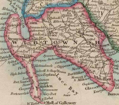 There
are now excellent roads in Galloway. The main roads
in Wigtownshire are: There
are now excellent roads in Galloway. The main roads
in Wigtownshire are:
• Newton Stewart to Ayrshire by Bargrennan and
Straiton; also by Barrhill
• Newton Stewart to Port Patrick - this is joined
at Glenluce by one from the Barrhill road and one leading
from Girvan
• A coast road from Glenluce down to Port William
and Glasserton then to Isle of Whithorn. From here there
is a road up to Newton Stewart. Beyond Glenluce the
Port Patrick road runs directly there across the Rhinns
but there is a branch to Stranraer and then up the coast
to Ayrshire
• Roads from Stranraer to Corsewall Point and the
Mull of Galloway.
In Kirkcudbrightshire the main roads are:
• Maxwelltown to Newton Stewart by Crocketford,
Castle Douglas and Gatehouse of Fleet
• Maxwelltown to Dalbeattie; also south to New
Abbey, Kirkbean and Rushcliffe - from here there is
a branch to Dalbeattie
• Dalbeattie to Kirkcudbright by Castle Douglas;
also by Palnackie and Dundrennan
• Crocketford northwards to New Galloway
• Castle Douglas northwards to Dalry, Carsphairn
and Dalmellington
• Kirkcudbright through Ringford and Laurieston
to New Galloway and the Dalmellington road
• A hill road between New Galloway and Newton Stewart.
There are many minor roads and hill tracks.
LANARKSHIRE
Frederick Mort 1910
 Historically
Clydesdale has been an important communication route
with the south, with a pass over Beattock Summit giving
access to the valley of the Annan. Glasgow is centrally
situated and a route to the east has long been established.
Ayrshire is easily reached by the low valley that runs
past Paisley, Beith and Lochwinnoch and another valley
by Neilston and Barrhead. Clydesdale is connected with
Tweeddale by an easy valley at Biggar with two more
difficult routes into eastern Ayrshire by Strathaven
and Douglas. Historically
Clydesdale has been an important communication route
with the south, with a pass over Beattock Summit giving
access to the valley of the Annan. Glasgow is centrally
situated and a route to the east has long been established.
Ayrshire is easily reached by the low valley that runs
past Paisley, Beith and Lochwinnoch and another valley
by Neilston and Barrhead. Clydesdale is connected with
Tweeddale by an easy valley at Biggar with two more
difficult routes into eastern Ayrshire by Strathaven
and Douglas.
All these routes are clearly affected by the valleys.
Although these routes have long been used for travel,
roads are fairly recent. With wheeled travel being almost
impossible, trade was by pack horse. Coaches only started
running between Glasgow and Edinburgh in the mid-1700�s,
and to London in the late 1700�s. Before the Clyde was
deepened goods were brought to Glasgow from Dumbarton
and Port Glasgow by pack horse. The roads in Glasgow
were in poor condition with only two men employed in
their care until 1777.
The Turnpike Roads Act of 1751 changed all this. In
Lanarkshire the Glasgow to Carlisle road, built by Telford,
became a model for such roads. Of note is his viaduct,
130 foot high, at Cartland Crags.
The main roads are:
• Two roads from Glasgow to Edinburgh, one by Bathgate,
the other by Shotts and Mid Calder
• Lanark to Edinburgh via Mid Calder
• Roads from Dumbarton and Renfrew on both sides
of the Clyde, running into Lanarkshire through Glasgow
• Roads to Ayrshire through Avondale and Douglas
• Roads to Nithsdale by Elvanfoot, Leadhills and
Wanlockhead and by Powtrail Water and the Dalveen Pass
• Road to Tweeddale from Symington via Biggar and
Peebles.
There is a huge network of minor roads.
MIDLOTHIAN
Alex McCallum 1914
 Until
the first turnpike (1750) roads were little more than
beaten tracks. The survival of two great Roman roads
in southern Scotland reflected on their engineering
skill but in the middle ages such skills had been lost.
Even at the beginning of the 18th century the roads
were so bad that it could not be guaranteed to drive
a coach from Glasgow to Edinburgh and back in under
six days. Until
the first turnpike (1750) roads were little more than
beaten tracks. The survival of two great Roman roads
in southern Scotland reflected on their engineering
skill but in the middle ages such skills had been lost.
Even at the beginning of the 18th century the roads
were so bad that it could not be guaranteed to drive
a coach from Glasgow to Edinburgh and back in under
six days.
Routes around Edinburgh are determined by the topography.
Of routes to the east and west, there are:
• The coast road to Berwick which goes through
Portobello, Musselburgh, Prestonpans, North Berwick
and Dunbar. A major branch leaves this road at Levenhall
and using the 100 foot raised beach runs through Tranent,
Haddington and East Linton to Dunbar.
• The road to the ancient Queensferry over the
Forth - this was the main route to the north-east of
Scotland. Scott in The Antiquary mentions the �Hawes
Fly� or Queensferry Diligence noting that it was "green
picked oot wi' red ; three yellow wheels an' a black
ane."
To the south, using the river valleys and skirting or
crossing the Pentlands, Moorfoots and Lammermuirs, there
are several routes:
• Edinburgh by Dalkeith and Soutra Hill to Greenlaw
and Coldstream - there was a church and hospital on Soutra
Hill founded about 1164 for pilgrims
• A road by Gilmerton, Eskbank and Soutra to Lauder,
thence to Earlston and Jedburgh and crossing Carter Fell
at the border - this continued to Newcastle
 |
| Crichton Castle looking south.
Borthwick Castle is one mile to the south. |
• A road following the valleys of the Esk, Gore and
Gala to Galashiels and Hawick. The castles of Borthwick
and Crichton are located on this route
• A road to Peebles that follows the Esk to Penicuik,
thence to Leadburn and the Eddleston Water. From Peebles
the road goes by Tweedsmuir and the Devil�s Beef Tub to
Moffat • Two roads to Clydesdale, running on either
side of the Pentlands. On the north side the road runs
through Currie, along the Lang Whang to Carnwath and Lanark.
On the south side the road goes by West Linton to Biggar.
• A road to Lanark by the three Calders, Wilsontown
and Forth
• Three routes to Glasgow: the old road through Mid
Calder and Shotts, another by Bathgate and Airdrie, and
a third by Linlithgow and Falkirk
• A road to Stirling and the north that runs from
Falkirk
In addition there is a complex network of minor roads.
MORAY
AND NAIRN
Charles Matheson 1915
Moray
There
are two main routes to the south. The more direct route
heads north from the Tay by the Tummel and Garry valleys
to the Pass of Drumochter (1500�) then descends by Glen
Truim and Badenoch to the Spey. The other route is to
the east of the Grampians where it uses the valleys
of the Ury and the Deveron.
Another route leads from Strathmore to the valley of
the Dee. It then runs north-westwards across Banffshire
to the Spey and then to Elgin by the Glen of Rothes.
This route was followed by Edward I in 1296 when he
returned from Elgin - on his journey north he came to
Banff by the Glen Ury route.
Nairn
Routes are as described for Morayshire. A mail coach
was started between Nairn and Aberdeen in 1805; prior
to that time there was a riding post which was the only
means of communication with the south.
ORKNEY
& SHETLAND
J G F Moodie Heddle and T Mainland 1920
Orkney
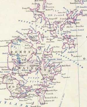 In
the past, those travelling south would take a ferry
to Huna in Caithness and then travel on foot or horseback,
or more rarely, would sail to Leith if a vessel was
available. In
the past, those travelling south would take a ferry
to Huna in Caithness and then travel on foot or horseback,
or more rarely, would sail to Leith if a vessel was
available.
A steamboat service to Leith and Aberdeen started in
the 1830�s and today there are regular services to Scrabster
in Caithness and many other places. Several motor and
horse conveyances run daily between Kirkwall andStromness.
Most of the roads were built under the authority of
the 1857 Orkney Road Act and later local acts as well
as the Roads and Bridges (Scotland) Act of 1874. Progress
was slow in the 1880�s because of the local economy
but at the turn of the century the Congested Districts
Board made grants available that allowed more roads
to be completed. In general the islands are now well
provided with good roads.
Shetland
 Prior
to the mid-1800�s there were hardly any roads. Goods
and persons went by water or travelled on tracks by
foot or on horseback. During the potato famine of 1846
and the following years, the food and money sent by
the Board for the Relief of Destitution in the Highlands
allowed labour to be hired for road-making. Some 120
miles of road were constructed between 1849 and 1852.
These ran from Lerwick to Dunrossness to the south,
Scalloway and Walls on the west and Lunna, Mossbank
and Hillswick on the north. A road, 17 miles in length,
was constructed in Yell. More roads were built under
the Zetland Roads Act of 1864. Prior
to the mid-1800�s there were hardly any roads. Goods
and persons went by water or travelled on tracks by
foot or on horseback. During the potato famine of 1846
and the following years, the food and money sent by
the Board for the Relief of Destitution in the Highlands
allowed labour to be hired for road-making. Some 120
miles of road were constructed between 1849 and 1852.
These ran from Lerwick to Dunrossness to the south,
Scalloway and Walls on the west and Lunna, Mossbank
and Hillswick on the north. A road, 17 miles in length,
was constructed in Yell. More roads were built under
the Zetland Roads Act of 1864.
Nowadays all roads and bridges are under the County
Council (a long description of the road network is given
at this point).
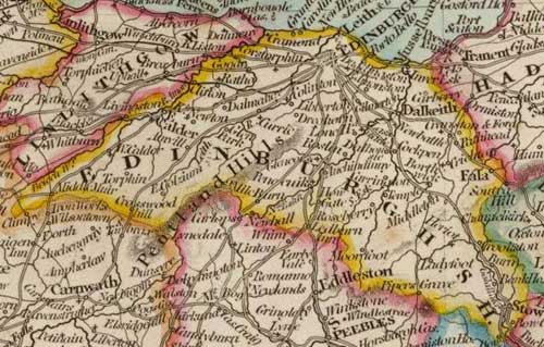
PEEBLES AND SELKIRK
George C Pringle 1914
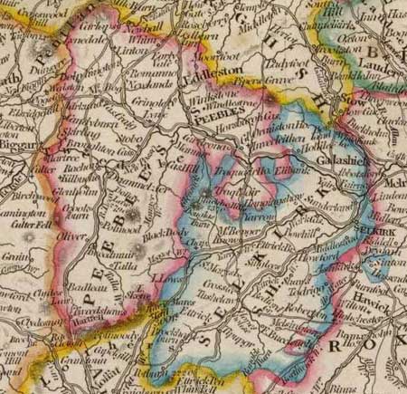 In
early times tracks followed the line of valleys. Thus,
starting from Galashiels we have routes running up the
valleys of the Tweed, Yarrow and Ettrick and crossing
watersheds into Annandale, Eskdale or Clydesdale. In
early times tracks followed the line of valleys. Thus,
starting from Galashiels we have routes running up the
valleys of the Tweed, Yarrow and Ettrick and crossing
watersheds into Annandale, Eskdale or Clydesdale.
These are:
• Galashiels to Peebles and Broughton then up Tweedsmuir
to cross to Moffat in Annandale
• Galashiels to Moffat by the Yarrow to Tibbie
Shiel�s inn and Cappercleugh
• Galashiels to Carlisle by the Yarrow valley to
Selkirk then across the watershed to Ashkirk and Hawick
• A route up the Ettrick to Tima Water then crossing
into Eskdale to reach Langholm.
Cross roads connect these valleys:
• Tweed, Yarrow and Ettrick
• Tweed and Forth
• Ettrick, Teviot and Solway
• Yarrow and Ettrick.
Besides these valley routes there were others that
ran on higher ground, perhaps because they were drier
or safer. Among them are:
• A road to Nether Horsburgh from Pirn Hill
• The Peebles to Edinburgh road by the Eddleston
water. It ran to higher ground at Venlaw House keeping
to this as much as possible until it reached Mid Lothian.
Four horses were need to draw a vehicle at a rate of
3 mph. The present day road was made in 1770
• The old Neidpath road climbed from Peebles to
Jedderfield and Edderston then descended to the level
of the present road. The difficulties of this road and
the lack of bridges on the Lyne may be the reason the
old route from Tweedale and Clydesdale came by Broughton
and Drummelzier. There was a ford over the Tweed above
Drummelzier and the road continued through Manor parish
to cross the Sware and then reach Peebles.
• The Minchmoor road ran from Traquair to cross
the watershed from the Tweed into Yarrow and then onwards
to Selkirk. Today the route to Selkirk is along the
Tweed to Caddonfoot and Yair Bridge. The Minchmoor road
had branches to Yarrowford and to Ashiesteel. It passes
two places of interest - Wallace�s Trench and the Cheese
Well, said to be haunted by fairies. The road was used
by millers from Peebles to take meal by pack horse to
Selkirk. In 1769 a bridge was built over the Quair.
There a number of hill roads that cut across the grain
of the country, mostly in a north south direction. These
include:
• The Drove Road, having first negotiated the Cauldstane
Slap to reach Linton, crosses Hamilton Hill north of
Peebles to pass through the town by the Gipsie�s Glen.
It continues along a ridge between the Tweed and Glensax
and from thence to Yarrow and England. Such roads were
outwith the parish (statute labour) and turnpike systems
and passage along them was free. In Peebles they paid
a small fee to rest the cattle or sheep on the Kingsmuir.
• The Manor Road runs directly up the Manor valley
to Shielhope, Norman Law and Bitch Craig over to St
Mary�s Loch. There are other roads of this type.
• The Thief�s Road is a well defined track that
was used by Border thieves in Ettrick and Tweedale.
From Merecleugh Head or Rodono Hill it goes by Dollar
Law and Scrape to Stobo, with a branch to Drummelzier.
It crossed the Tweed near Stobo and is thought by some
to have ran into Mid Lothian. South from Rodono Hill
it went into Ettrick where it is called the Bridlepath
and may have continued into Liddesdale. James V used
the route on one occasion, hence it is sometimes called
the King�s Road.
In early days the roads were poor or non existent.
Boston remarks that roads in Ettrick in the mid 17th
century were like the beds of rivers, impassable on
horseback or by carriage. Improvements were made under
the statute labour system where the able-bodied worked
for six days in the year on the roads but they, and
the bridges, were not made properly until the turnpike
era.
The first bridge over the Ettrick was at Ettrick Bridge
End. This was built by Wat o�Harden after a captive
child was drowned when he returned from one of his raids.
Part of the bridge fell in 1746 and it was swept away
by a flood in 1777. A new bridge replaced it nearby.
Peebles bridge was originally of wood, dating from the
late 1400�s. A stone bridge was built a century later
, widened in 1834 and rebuilt in 1890. For many years
it, and the bridge at Berwick were the only bridges
over the Tweed. There is a large bridge at Ashiesteel.
Manor bridge at Manorfoot dates from 1702 and Selkirk
bridge in 1778.
PERTHSHIRE
Peter MacNair 1920
 There
is evidence of Roman roads in Perthshire. At Gask, the
road from Ardoch to Orrea runs along a high ridge -
it is 20 foot wide, of rough stones and has stations
along its length. Orrea was near the confluence of the
Tay and the Earn according to W F Skene. Traces have
been found near Meigle of the road leading from Coupar
to Battle Dykes. It passed near to the camp at Cardean. There
is evidence of Roman roads in Perthshire. At Gask, the
road from Ardoch to Orrea runs along a high ridge -
it is 20 foot wide, of rough stones and has stations
along its length. Orrea was near the confluence of the
Tay and the Earn according to W F Skene. Traces have
been found near Meigle of the road leading from Coupar
to Battle Dykes. It passed near to the camp at Cardean.
Dr James Browne gives the course of the road from Ardoch.
It crossed the Tay by a wooden bridge, 2 miles north
of Perth, and ran on the east side of the river to the
camp at Grassy Walls. From here it ran by Gallyhead,
Invertrust, Nether Collin and Byres. It then ran north-easterly
past Blairhead and Woodhead to Newbigging and Gallowhill.
From there it passed Leyston-moor to reach a camp at
Coupar Angus, eleven and a half miles from Orrea.
After the 1715 rebellion, General Wade, as a result
of his inquiry into the condition of the country was
tasked with creating proper roads in the Highlands.
Some of these, such as Glen Ogle, were in Perthshire
and can still be traced today though in a much deteriorated
condition.
These roads made communications much easier as noted
in the well-known lines: " Had you seen but these roads
before they were made You would have held up your hands
and blessed General Wade." The roads and bridges today
are in fine condtion.
The main routes are:
• Roads to Perth from Glasgow, Edinburgh and Dundee
• A road to Perth from Comrie, Crieff and Methven
• The road north, running by the valleys of the
Tay, Tummel and Garry through Dunkeld, Pitlochry and
Blair Atholl. This road was planned by Telford
• Perth to Forfar and Aberdeen by way of Coupar
Angus
• Coupar Angus to Braemar by Blairgowrie and Glen
Shee.
There are many side roads.
There had been several ferries on the Tay between Perth
and Dunkeld but these have been or are being replaced
by bridges. One at Kinclaven was worked by chains and
could carry light vehicles.
There were also small harbours between Perth and Dundee
that were used to take goods across the Tay and then
by various routes to the towns in Strathmore. These
harbours were at Kingwoodie, Powgavie and Port Allan
near Errol and are now silted up.
RENFREWSHIRE
Frederick Mort 1912
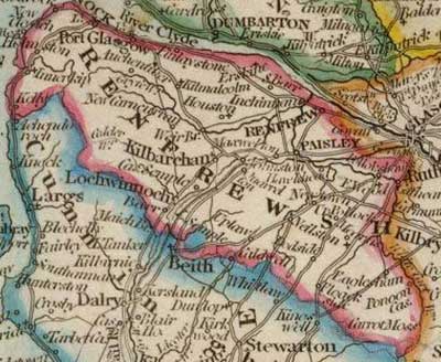 Given
the need for communication between Glasgow and the Ayrshire
plain and the fact that there are three tracts of hills
with two valleys between Glasgow and Ayrshire, it is
natural enough to find that routes run through these
valleys, viz. the Lochwinnoch Gap and the Loch Libo
Gap. A coastal route is also used and makes convenient
use of the raised beach. Given
the need for communication between Glasgow and the Ayrshire
plain and the fact that there are three tracts of hills
with two valleys between Glasgow and Ayrshire, it is
natural enough to find that routes run through these
valleys, viz. the Lochwinnoch Gap and the Loch Libo
Gap. A coastal route is also used and makes convenient
use of the raised beach.
Although these routes have been used for centuries,
proper roads are relatively recent. Most goods were
carried by pack-horse, for example between Dumbarton
and Port Glasgow to Glasgow. A stage coach between Glasgow
and Edinburgh only started in the mid 1700�s and only
travelled at 3 or 4 miles an hour. Roads improved with
the passing of the Turnpike Act in 1751, and more recently
with the passing of responsibility for roads to the
county councils in 1889.
Although it is long disused, the Glasgow to Paisley
canal was very busy in its time with some thousand passengers
using it each day. In 1805 an Act was passed permitting
the construction of a canal between Paisley and Ardrossan
but due to lack of finance it only reached as far as
Johnstone. It was later filled in and used as a railway
line.
ROSS AND CROMARTY
William John Watson
 Wheeled
vehicles were used in Scotland in early times, e.g.
on Caledonian chariots and Roman waggons. Early roads
however were tracks and this was the case in Ross until
the late 1700's when people walked or rode and carried
goods on horseback. Wheeled
vehicles were used in Scotland in early times, e.g.
on Caledonian chariots and Roman waggons. Early roads
however were tracks and this was the case in Ross until
the late 1700's when people walked or rode and carried
goods on horseback.
There are mentions of early bridges and ferries: the
"brigg of Alness" in 1439 and in 1649 when
it was to be repaired. At much the same time Dingwall
wanted to build a bridge. There were ferries at Ardersier,
Kessock, Invergordon, Cromarty and Portincoulter (the
Meikle Ferry).
The Wade roads did not continue north of Inverness
although his successor Major Caulfeild built a road
from Contin to Poolewe in 1761. The Taylor and Skinner
map of 1775 has a road from Inverness to Beauly and
Tain, and then the Meikle Ferry, with a branch from
Dingwall towards Strathpeffer, one from Nigg to the
Cromarty ferry, and one to Tarbat.
The Black Isle had a road from Kessock Ferry to Tarradale,
Contin and Fortrose, and one from Conon to Cromarty
with branches to ferries at Rosemarkie and Invergordon.
A road ran by Glenshiel and Loch Duich over Mam Ratagan
to Glenelg. An Act was passed in 1803 and resulted in
much work between 1807 and 1821 under Thomas Telford.
The road from Garve to Ullapool was built about 1812
and the old Bonar Bridge dates from this time. There
was also a road between Garve and Strome Ferry. The
roads further west date from much later.
A coach ran from Inverness to Tain in 1809 and the
journey from Edinburgh to Carrol in Sutherland could
be done in just over 47 hours. In 1818, Edinburgh to
John O'Groats could be done without using a ferry or
ford or drag chains on a descent. There was tolls on
the roads until 1866 and some of the toll houses remain.
Coach services were affected with the introduction of
the railways in the 1860's although these did not reach
Cromarty, Gairloch or Ullapool.
Shipping was important with, for example, boats arriving
at Dingwall in 1792 from London and Leith. In 1839 steamers
started sailing from Leith to Inverness and Invergordon.
Good roads run throughout Lewis from Stornoway and
there are good bus services. Boats sail to Mallaig and
the Kyle of Lochalsh where there are railway stations,
as well as to Glasgow with many intermediate calls.
STIRLINGSHIRE
William Douglas Simpson 1928
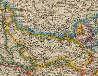 The
primitive hunting paths and trading routes of the early
inhabitants were superseded by the roads built by the
Romans. A major road came from the south past Newstead,
Inveresk, Falkirk and Camelon where it went north to
cross the Forth near Sirling and continue to the forts
at Ardoch and Strageath in Perthshire. Another road
is thought to have branched off from the western road
from Carlisle at Carluke and joined the Antonine Wall
at Castlecary. The
primitive hunting paths and trading routes of the early
inhabitants were superseded by the roads built by the
Romans. A major road came from the south past Newstead,
Inveresk, Falkirk and Camelon where it went north to
cross the Forth near Sirling and continue to the forts
at Ardoch and Strageath in Perthshire. Another road
is thought to have branched off from the western road
from Carlisle at Carluke and joined the Antonine Wall
at Castlecary.
After the departure of the Romans and throughout the
middle ages the roads declined and communications in
Scotland were very poor. Most of the roads were tracks,
called "green ways" though there were "king's
ways", "highways", and "causeways"
that were presumably of a higher standard. The "king's
way" was under royal protection with heavy penalties
for any crimes committed on it. Trade was mainly carried
out by pack-horse. There were few bridges though there
was one at Stirling in the 13th century. Ferries may
have existed at an earlier date.
A Robert Spittal who died in 1557 and was tailor to
James IV and his Queen funded several bridges in Stirlingshire,
viz. at Bannockburn, over the Devon at Tullibody, and
the Teith near Doune. All are still standing.
A description of the main roads in the county follows
- these can be seen on the map.
WEST LOTHIAN (Linlithgowshire)
T S Muir 1912
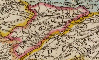 The
county has no natural centre to act as a focus for routes
although in early days Linlithgow and Bathgate formed
convenient stopping places on the way to Stirling and
Lanark from Edinburgh. The
county has no natural centre to act as a focus for routes
although in early days Linlithgow and Bathgate formed
convenient stopping places on the way to Stirling and
Lanark from Edinburgh.
In Roman times a road ran from the south to Cramond.
The Roman wall with its associated road ran from Carriden
over to the Clyde. It is likely that Cramond and Carriden
were joined by a road.
The road from Carriden or more properly Bridgeness
ran five miles to Inveravon where it forded the Avon.
It was 17 feet wide and constructed with a base of large
stones with smaller stones above with a cambered surface
although there were no kerbs. Less is known about the
Cramond road and it cannot now be traced.
In the middle ages, bridges dating from before the
12th century existed over the Almond at Cramond and
over the Avon near Linlithgow, an indication that there
must have been rough tracks. Transport was primitive
with hurdles or wicker sledges used for short journeys
and pack horses for longer ones - wheeled vehicles were
rare.
In the 13th century the monks of Newbattle Abbey negotiated
rights of way with various landowners between the abbey
and their lands in Lanarkshire. The route was past Broxburn
and Bathgate.
Several road acts were passed in the 17th century,
mostly requiring tenants and cottars to work on parish
roads each year, with assistance from landlords if necessary.
This was changed later to allow a payment to be made
instead. There was legislation in 1633, relating to
the visit of Charles I, requiring the roads to be widened
again as people had been encroaching on their limits.
In 1751 the first turnpike road in Scotland was constructed
between Edinburgh and Queensferry. Some of the toll-houses
still exist. In the early 1800’s the new methods
of road making developed by Telford and Macadam greatly
improved the roads. Turnpikes continued until 1883 when
the local authorities took over the roads. Burghs are
now responsible for their roads and streets and county
councils for all other roads.
The roads on the two main valleys that run east and
west are generally very level - these are to Stirling
by Linlithgow and Glasgow by Bathgate. There are however
steep hills near Cramond Bridge and at Hawes Brae near
Queensferry. By contrast the north south routes are
very hilly.
As there are very few coastal towns, the only road
on the coast of any note is from Bo’ness to Grangemouth.
There is an ancient ferry at Queensferry where it is
only a mile over to Fife. It is mostly used by cars
and vans. Motor buses run there each day from Edinburgh,
as well as to Broxburn and Uphall.
Top
|