|

Old Statistical
Account The OSA links below are mostly to GoogleBooks
or in some cases to the EDINA site. On EDINA site go
to "browse scanned image" to see appropriate
page.
New Statistical
Account The NSA links below
are to this point where the original accounts can be
accessed on Google Books. Use the back button on the
browser to return to parish account. Alternatively see
the EDINA
site or the Internet
Archive.
Avondale or Strathaven
OSA
Vol.9, p.393ff A Roman road runs on the south side of
the Avon and can be followed for several miles. There
are also three chapels in the same area, which were probably
serviced by the priory at Lesmahagow. Several carriers
run to Glasgow each week. The glebe, of four acres, is
of little use since two turnpike roads have been built
across it. There is a weekly market and several annual
fairs.
The writer complains about the roads from Hamilton to
Strathaven and the turnpike to Muirkirk, Sanquhar and
Dumfries, particularly the latter, saying that its course
is badly planned and has cost three times the sum originally
estimated, leading to very high tolls. To prevent this,
proposed road bills should be circulated beforehand and
surveyors work out the best route and contractors submit
estimates. There would be benefits if the government took
over the turnpikes and if the military were to be employed
on the roads it would make them "more hardy and less
debauched".
Of the three bridges, one is on the line of the Muirkirk
road and was built in the early 1700's by the Duchess
of Hamilton. The other two were built by county and parish
funds. The statute labour is commuted and the sum raised
should be sufficient to keep the roads and the smaller
bridges in good order.
NSA p.301
p.303 A Roman road runs through the parish.
p.308 Parochial Economy Excellent roads.
There are turnpikes to Ayr and to Muirkirk and about
60 miles of parish roads - these cost about £300
per year, as well as 30 bridges, mostly too narrow.
A person is employed to oversee all roads operations
and has done excellent work.
p.309 Means of Communication There are good
communications with Edinburgh, Glasgow, Ayr and Hamilton
in contrast with 16 years ago (1819) when travel had
to be by horseback or cart or obtaining a post chaise
from Hamilton. A new road between Edinburgh and Ayr
has been built since that time and there are frequent
coaches to these places as well as many post horses
and vehicles.
p.313 Miscellaneous Observations The
Duke of Hamilton has been planting hedges along the
side of the Ayr and Muirkirk roads.
Bertram Shotts
OSA
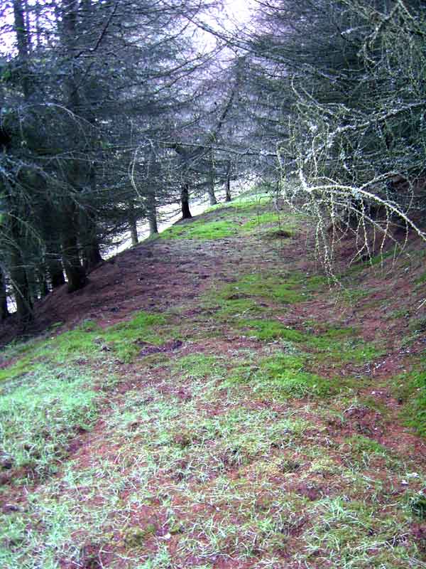
 |
| One of the parish
roads (Fortisset Road at NS8663) |
Vol.15, page 54 The land on either side of the great
road, approaching from the east, is now enclosed and
improved. The road, which runs from Edinburgh to Glasgow
is straight but with difficult inclines though the trustees
have improved this in places, particularly by diverting
past the Hirst. There is a new bill which will allow
a road between Glasgow and Edinburgh to go via Airdrie
and Bathgate, and a road which will leave the Shotts
road at Bellshill and rejoin it near Whitburn. Forty
years ago the journey from Glasgow to Edinburgh took
two days and now just 5 or 6 hours. Horses can also
draw greater loads. The statute labour money is insufficient
in such a large parish to keep the parish roads in good
order.
NSA p.624
 |
 |
| Kirk
O'Shotts |
The
old turnpike near Kirk O'Shotts and just a few yards
from the later A8. An earlier road ran past the
Kirk O'Shotts itself. The M8 has now superseded
these three earlier roads. |
p.631 There is a penny post at Shotts Works and another
may be opened at Sallysburgh (Salsburgh) through which
the mail coach passes. There are 17 miles of turnpike
in the parish and 20 public coaches drive through it
each day.
p.634 Fairs There are two fairs where horses
and cattle are sold, and a weekly market.
Inns Many of the inns are used by travellers
on the journey between Edinburgh and Glasgow.
Biggar
OSA
Vol.1 page 335 Great improvement to the roads. Thirty
years ago when the statute labour had to be done in
person, the roads were bad as the work was done reluctantly.
Now it has been commuted they are much improved. The
one turnpike in the parish is beginning to be accepted
as its advantages make themselves felt; for example,
a cart carrying lead from Leadhills can now carry nearly
double the load it used to.
NSA p.354
 p.359
Reference is made to a battle between Wallace and Edward
I at Biggar and to an engagement at a bridge in Biggar
itself over which Wallace made an escape. The bridge
is now called the "Cadger’s Brig". Other
instances of armies passing through Biggar are given:
before the battle of Roslin in 1302; when Edward II
was advancing from Selkirk to Renfrew in 1310; in Cromwell’s
times in 1651; and during the rising of 1715. p.359
Reference is made to a battle between Wallace and Edward
I at Biggar and to an engagement at a bridge in Biggar
itself over which Wallace made an escape. The bridge
is now called the "Cadger’s Brig". Other
instances of armies passing through Biggar are given:
before the battle of Roslin in 1302; when Edward II
was advancing from Selkirk to Renfrew in 1310; in Cromwell’s
times in 1651; and during the rising of 1715.
p.366 Parochial Economy Biggar has a market,
a right dating from 1451.
p.367 Means of Communication The town has
a post office.
Coaches run from Edinburgh to Dumfries and Glasgow to
Peebles, with carriers to Edinburgh and Glasgow, as
well as carriers from Hawick to Glasgow and Dumfries,
Sanquhar and Wigton to Edinburgh.
The Dumfries - Edinburgh turnpike runs through the parish,
with another branching off it to join the Edinburgh
- Moffat turnpike. £1500 has been spent on it
in the last year.
Fourteen miles of excellent parish roads - they cost
about £40 a year to maintain.
 A
new road to Broughton would be a benefit especially
if it was to continue through Dreva and Craigend to
the Crown ford and Peebles as this would avoid the hilly
country near Ellsrighill and Corsincon. A
new road to Broughton would be a benefit especially
if it was to continue through Dreva and Craigend to
the Crown ford and Peebles as this would avoid the hilly
country near Ellsrighill and Corsincon.
There is a need to avoid the steep inclines on either
side of the ford over the Carwood burn on the road to
Carnwath.
p.371 Fairs There are three fairs.
Inns The writer complains about the practice
of allowing toll keepers to supplement their income
by selling drink, noting that in one case a toll-keeper
who had his certificate of character refused by the
Minister was still able to obtain a licence.
p.372 Fuel Coal is brought mostly from
Douglas parish, a distance of 14 miles; and sometimes
from Wilsontown but carriage costs are high.
Based on the 1935 OS
Map. With thanks to Ordnance Survey
Biggar
and the House of Fleming, William Hunter, 1867
p. 16 Details of the nearby Roman road.
p. 96 Cadger's Brig
p. 97 Nearby bridge built in 1823 on the turnpike to
Dumfries.
p. 128 Wide road led to Castle of Boghall (see also
Carnwath below)
p. 277 Mention (late 1700's) that Elsrickle lay a little
to the east of the direct road. The Military Survey
shows the line of the older road running from Newbiggingmill
over to the Biggar road neaer to Townhead and Bank.
p. 302 "An ill made and badly kept road led to
the kirk hamlet of Kilbucho.." (Kilbucho was split
in 1794 between Culter (Lanarkshire) and Glenholm &
Broughton (Peeblesshire).
p. 460 Royal pilgrimages to Whithorn in late 1400's/early
1500's (Margaret, Queen of James III, James IV, V) -
probably stayed at Boghall (1/2 mile South of Biggar)
and Couthally (1 mile NW of Carnwath) Castles and passed
through Biggar. James VI also visited Biggar several
times.
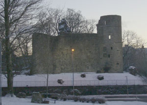
Blantyre
 |
| Bothwell Castle from the Priory |
OSA
Vol. 2, page 220 Ironstone is brought from the River
Calder to Glasgow. Coal comes from Cambuslang. There
was a priory, dating from before 1296, that was linked
to Jedburgh.
NSA p.314
p.315 Ferry-boat at the Blantyre works.
p.325 Distances from Hamilton, (East) Kilbride, Glasgow
and Eaglesham are given. Three miles of turnpike and
20 miles of excellent parish roads.
Note: See some fine photos of Blantyre
here
Bothwell
OSA,
vol 16, page 300 - see also page 308 and Roman road
page 325
The great road from Glasgow to Edinburgh runs through
the parish. It crosses the Calder, then climbs a very
steep hill, though this is to be improved. The Glasgow
to Carlisle road enters on the west, a little below
the Edinburgh road, crosses the Calder and runs through
the village to cross the Clyde at Bothwell bridge. A
mail coach runs on it daily. Branches lead from the
Edinburgh road: three to Hamilton, one to Lanark, and
two to Airdrie. There are many statute labour roads
paid for by the commutation money which amounts to �80.
In all there are about 50 miles of road, 22 of which
are turnpike. Bothwell bridge is old and narrow but
is to be widened. Two bridges cross the North Calder
and three on the South Calder. A small bridge over the
South Calder is thought to be Roman and be on the line
of Watling Street which was clearly to be seen in its
course from the east but is now largely destroyed by
the plough.
NSA p.765
p.779 At the time of the Battle of Bothwell Bridge (1679),
the bridge was narrow and had a portal in the middle
with gates.
p.789 Bothwell
Bridge is very old. There is an act dating from
1647 for repairs to the bridge. A few years ago its
width was increased from 12 feet to 32 feet.
Near to Bothwellhaugh there is a bridge over the South
Calder, thought to be Roman and on the line of Watling
Street.
p.794 Among the trades carried on in the parish in 1836
there were 27 carters, 4 toll keepers, and a few horse-keepers,
road-makers, coachmen and carriers.
p.797 Hamilton is the nearest market town and there
are post offices in Bothwell, Bellshill and Holytown.
Means of Communication Seventeen miles of
turnpikes and 33 miles of parish roads. A list is given
of the statute labour conversion money over the previous
15 years. Annual expenditure was about £350.
There are regular coaches to Glasgow, Carlisle, Edinburgh,
Hamilton, Lanark and Strathaven. A railway is being
built at present.
Cadder
OSA
Vol.8, page 475 There is much whin rock in the parish
which is very suitable for making roads. Four miles
of the Edinburgh to Glasgow post-road runs through the
parish, and a new turnpike has been made to Cumbernauld
and Falkirk which is much shorter than the road by Kirkintilloch
and Kilsyth and more level. The statute labour rate
is now set at 18/- per ploughgate and 2/- for each cottager.
Bishop Briggs mentioned. There are 284 carts in the
parish.
NSA p.398
p.407 The name of Bishopbriggs or bridge dates back
to the time when much of the parish was ecclesiastical
property.
p.410 Means of Communication Post offices
used are at Glasgow and Kirkintilloch.
Two good turnpike roads run through the parish: the
Inchbelly road, via Kirkintolloch and the Cumbernauld
road. There are 5 bridges, two of which are over the
railway.
Details are given of the Forth and Clyde canal and the
two railways running through the parish, viz. the Kirkintilloch
railway and the Garnkirk and Glasgow railway.
There are 35 miles of parish roads - they are in poor
condition, badly routed, hilly and narrow, and not properly
run despite £10 per mile being spent on them each
year.
Cambuslang
OSA
Vol.5, page 259 Dung is brought in from Glasgow and
lime from (East) Kilbride for the purposes of manuring
the land. Glasgow is by far the greatest market for
the surrounding parishes.
There is a great contrast between the parish in 1750
and 1790. Thus the roads were narrow and rough and could
hardly be used in the summer by carts, and almost impassable
in winter with horses unlike 1790. Now there are about
170 large well-made carts, unlike 1750 when there were
only a few small carts with wooden wheels. There has
been much effort and expenditure on roads.
The Glasgow to Hamilton road was originally made under
the statute labour system but it was improved a few
years ago and is now maintained by a toll near Glasgow.
There are two statute labour roads, running north-south
and used for the carriage of lime, coal and ironstone
and some bridges over small streams, with two over the
Calder. An old bridge called Prior bridge is thought
to have been connected with the Priory in Blantyre.
There were a number of ruined buildings near the summit
of Dechmont Hill, but in the past ten years the stones
have been used for building dykes and roads. The owner
of the land observed the foundations of a circular building,
24 feet in diameter on the summit. Given the commanding
views it might have been a watch-tower.
Details of the Cambuslang Wark of 1742 are given, when
huge crowds came from all over to attend a religious
revival.
NSA p.416
p.425 The "Cambuslang Work", a notable religious
revival in 1742, is detailed. This was attended by people
from all over central Scotland and further afield.
p.431 There was a spittal in the east of the parish.
p.437 Means of Communication Rutherglen
is the nearest market town and well attended by people
from Cambuslang. There is also a market in Hamilton
which is further away.
The Glasgow - Hamilton and Glasgow - Muirkirk turnpikes
run through the parish. There are 12 miles of parish
roads.
The rent paid in 1835 for the Greenlees toll was £425
and for the Cambuslang toll was £575. There are
two coaches each day between Hamilton and Glasgow and
three times a week to (East) Kilbride and Strathaven.
There are 7 bridges in the parish.
p.442 The growth of Glasgow has helped the local economy.
Cambusnethan
OSA
Vol.12, page 573 Although the Glasgow to Lanark road
runs through it is likely that traffic will diminish
once a new road on the south side of the Clyde is finished.
The statute labour money has been spent mostly on roads
in the lower part of the parish. The parish was formerly
attached to Kelso abbey.
NSA p.608
p.609 The new Edinburgh - Ayr road, built 12 years ago
(1822) crosses this parish from Breich Water to Garrion
Bridge.
Historical
Sketches of the Parish of Cambusnethan, Rev. Peter
Brown, 1859
Preface x The north turnpike road from Glasgow to Lanark
passes through the centre of Wishaw About the year 1790,
favourable terms offered for feus on the line of the
public road.
11. Details of the Roman road. Branch northwards to
Castlecary fort.
12. Stones from a tumulus near Garrion bridge used when
the road was being constructed.
29. Remark made in 1649 on "the wretched, impassable
state of the roads in the lower part of the parish,
especially in winter."
142. In Covenanting times "a road ran along the
vale, near the old church, onward past Cam'nethan house,
and towards the Law of Carluke".
116. Covenanting times - ford at Carbarns.
124. Covenanting times - Clyde fordable at an unspecified
location near Hamilton - ale house nearby.
Carmichael
OSA
(Vol.13, page 368 - also 365)

About half a mile from the western end of Tinto there
is a narrow passage about 7 feet wide which although
natural seems to have been altered to make passage easier.
Produce used to be taken to markets in Glasgow and Edinburgh
but the roads to both places were so bad in winter and
spring that they were taken on horse back.
 |
 |
| Possible holloway |
Howgate looking south |
 |
 |
| Possible terrace just beyond
holloway |
Milestone (Lanark 8 miles-see
6" map) |
Now ready markets have been found in Lanark and Douglas
with the setting up of cotton-works in those places.
There is a fine bridge over the Clyde and roads are
now suitable for carts throughout the year. Two turnpikes
pass through and the statute labour is partly commuted
and partly raised in kind.
NSA p.517
p.531 The market town is Lanark where there is a post
office. There are about 7 or 8 miles of turnpikes and
20 miles of well-kept parish roads along with bridges
- these are partly paid for out of county funds.
p.534 The writer complains of the two toll keepers having
a licence to sell drink, noting that this enables the
road trustees to be paid a higher rent.
Note: The narrow passage mentioned
above is the Howgate which may have been on a Roman
road ; see (4) From Castledykes (Corbiehall) to Crawford,
Radford, C.A.R., Reid, R.C., and Truckell, A.E., Dumfries
& Galloway Natural History and Antiquarian Society,
III 31 30 (brief
details). The route is shown on the Military Survey
maps of c.1750. The RCAHMS (NMRS
NS93SW 34) considered it as part of the mediaeval
and later road system between Lanark and Upper Clydesdale.
From its appearance the main track looks to be a parish
road but the photos on the left just west of the main
track could be of an older track - these are mentioned
in the above paper.
Carluke
OSA
 |
| Memorial to General Roy at site
of his birthplace near Carluke. The plaque reads
"Here stood Miltonhead the birthplace of Major-General
William Roy 1726-1790 from whose Military Map of
Scotland made in 1747-1755 grew the Ordnance Survey
of Great Britain." |
Vol. 8, page 135 A road is soon to be built on the
south of the Clyde which will run between Hamilton and
Lanark. Many farmers in their old age build houses on
the main roads or in the villages through which these
roads run. The Glasgow to Peebles turnpike passes through.
It is well made and although it has toll bars there
are none in this district. A branch road, made by the
statute labour, runs from Carluke to Lanark. The statute
labour is commuted which has helped improve the parish
roads. The remains of a wooden bridge are to be seen
at Milton which had been built for the farmers required
to use the mills here, a requirement that may have applied
from the middle ages. The Roman road, Watling Street,
passes through and is still visible, especially at Killcaigow-Law
(Kilncadzow). Major General William Roy was born in
the parish. Where the soil is made up of clay, the roads
need constant attention.
NSA p.563
p.580 Mention is made of the Roman road and its course
(as in the Carstairs entry above) towards the western
end of the Antonine Wall. A stretch at Dyke (NS 856512)
was still in good condition.
From Belston, there was a branch to the north passing
Hyndshaw and Shotts towards Camelon.
Another road is supposed to have ran from Lanark across
the Mouse (the "Roman" Bridge), the Lee Valley,
Chapel, Braidwood to Carluke.
p.582 A bridge has recently been built at Milton Lockhart
(near Rosebank on the Clyde Valley road, A72) modelled
on Bothwell Bridge.
p.592 Means of Communication There are more
than 35 miles of parish roads, costing £300 each
year. The Stirling - Carlisle road and the Glasgow -
Carnwath road run through the parish. There are no stage
coaches (presumably on roads other than the foregoing
turnpikes is meant) but the railway may be extended
to Carluke. A gig brings the mail from Airdrie and Lanark.
Great progress had been made in recent years - it was
not so long since there were no roads and sledges and
horses were used to move goods.
p.596 There are 2 fairs each year, where dairy cows
are sold.
Note: Wilson (Roman Penetration in
Strathclyde South of the Antonine Wall, Glasgow Archaeological
Journal, Vol 19, 1994-95, p. 4 ) discusses the possibility
of a branch route at Belston both to the north and down
to the Clyde and there is a brief mention in the RCAHMS
Lanarkshire Inventory, p 142.
Notices,
Historical, Statistical, & Biographical, relating
to the parish of Carluke, Dr Daniel Rankin, 1874
21. Details of the Roman road.
46. Mention of a couple of crosses sited at crossroads.
210. Story dating from 1681 when some Ministers returning
from Glasgow to Tweeddale by Carluke and Kilncadzow
found some brandy that had fallen off the pack horse
belonging to the carrier at Biggar.
225. Details of the burgh boundaries. In the past, on
market days, collectors of the market dues were stationed
on roads leading to the market, viz. on the Carnwath
road by the large ash trees; on the Lanark old road,
before it was closed, at the bridge; on Maudslie road
in Clyde Street; on the Glasgow old road at the junction
of Whiteshaw or Castlehill lands with market place;
on the Belston road at the march of the Castlehill lands
and the common muir.
226. The market place was north of the "Wornway",
now High Street. Amusing account of self-important Burgh
Officer opening the market.
230. Mention of the old road to Lanark (see Ross
1773) - it ran a few hundred yards east of the turnpike
that dates from 1819 and can be easily seen on the early
OS maps.
254. Mention in 1786 of the Glasgow and Carnwath turnpike
trust.
Carmunnock
OSA
 |
| Carmunnock village
- note the old signpost |
Vol. 18, 167 The Glasgow to England road that goes
through Kilbryde, Muirkirk and Dumfries passes through.
Another road joins this near Kilbryde for Paisley, and
a road will run from this to Carmunnock and Glasgow.
The remains of a Roman road have been found on the estate
of Castlemilk.
NSA p.597
 p.601
A Roman road runs through Castlemilk. p.601
A Roman road runs through Castlemilk.
p.605 There are 7 fairs in the village and the nearest
market town in Rutherglen although most produce is sent
to Glasgow. There is a penny-post to Busby.
A turnpike runs through the parish but there is no public
coach. However, coaches run on the Glasgow - Muirkirk
road at the east end of the parish.
Parish roads in generally good order.
Note: The Roman road referred to is
probably the old road to East Kilbride (see photo) which
left Rutherglen as Mill Street and ran up beside Castlemilk
estate to Cathkin Braes and then continued past the
old reservoir and Rogerton to come out near the Heritage
Park at Stewartfield. The road is discussed by Wilson
in Roman Penetration in Strathclyde South of the Antonine
Wall, Glasgow Archaeological Journal, Vol 19, 1994-95,
p. 6. A trial excavation
was carried out in 1997 but no conclusive evidence for
it being Roman was found.
Carnwath
 |
 |
 |
| Carnwath |
Cross with distances |
Click for larger
image |
OSA
Vol.10, page 338 - also placename
page 326
Wath means a ford and the little stream on the west
side of the village is not easily forded on horseback
for quite a long way above and below the village. There
are iron works at Wilsontown from where the iron is
carried to Borrowstouness and Leith. A new line of road
will reduce the journey to Leith by 6 miles. It is said
that there used to be an avenue from Couthalley Castle
to the village, perhaps suggested by the name. The Edinburgh
to Lanark and Ayr road passes through and was finished
a few years ago; the Glasgow to Peebles road is now
nearly finished. Coal can be obtained at Wilsontown
and Clempy, both about 6 miles away but peat is also
used by some.
NSA p.76
p.76 The name means cairn at the ford, wath being the
Saxon word for a ford. The likeliest location was at
the west of the village.
p.88 Means of Communication The roads are
much improved. Five years ago (c.1829) a float was instituted
between Carwath and Pettinain which were often cut off
from each other by floods. The float runs on a chain
and can carry carts - this has helped in the movement
of coal and lime although link roads to the float need
to be improved - see Thomas Reid (Fords,
Ferries, Floats and Bridges near Lanark, PSAS, Vol.47,
(1912-13)- see also Pettinain)
p.91 There are 5 fairs each year and a weekly market
p.92 The writer laments the number of whisky houses
- a particular problem was that the 6 toll houses in
the parish had licences to sell drink to supplement
their income, yet were often close to an existing inn.
Carstairs
OSA
Vol.18, page 180 There is a Roman camp in the south
of the parish with a causeway leading to it which can
be traced for several miles.
NSA p.547
p.553 Antiquities Details are given of the
Roman forts and roads in the area. Researchers had identified
the camp at Little Clyde (near Crawford) with Ptolemy’s
Colonia and the 9th Roman Iter’s Gadanica. From
this the next station on the Iter, Coria, has been identified
with Castledykes (Corbiehall). From here another road
ran to the west, crossing the Clyde near Lanark and
running over Stonebyre Hill to cross the Nether (Nethan).
Traces of it are still to be found west of that point.
The Iter (known as Watling Street) continued from Castledykes
to Cleghorn, where there was another camp and went by
Collylaw, Kilncadzow, Belstane past Carluke.
p.560 Market Towns Lanark and Carnwath are
the nearest market towns.
Means of Communication The Lanark - Carnwath
- Edinburgh road, the Glasgow - Peebles road, and one
to Edinburgh by Wilsontown (leading to the present day
A71) pass through the parish and are in excellent condition.
The statute labour roads are likewise in good condition.
Coaches run to Lanark and Edinburgh.
Notes: The reference to the Ninth
Itinerary suggests that the researchers had been influenced
by the forged work "De Situ Britanniae" credited
to Richard of Cirencester as it only appears there.
It was actually compiled by a Charles Bertram who convinced
the leading antiquary William Stukely of its authenticity
who then introduced it to the antiquarian world. For
a considerable time it had a great influence on studies
of Roman Britain, even finding its way on to older OS
maps. See Caledonia
Romana by Robert Stuart (1852) and Rivet and Smith,
The Place-Names of Roman Britain, Book Club Association,
1981, pps. 182-184. For Bertram's text, see Richard
of Cirencester (the Appendix containing the Itinerary
is on page 472, the Itineraries are detailed from p.
480 onward and the Ninth Itinerary is on p. 489)
Although the identifications given are very probably
incorrect, none of this affects the existence of the
actual Roman remains referred to. The course of the
road is correct.
Covington and Thankerton
OSA
Vol.1, page 193 Coal is brought from 9 miles away. There
is a bridge at Thankerton, built in 1778 by subscription
and now maintained by the county. The road are maintained
by the statute labour which is commuted.
NSA p.872
p.875 There is a bridge at Thankerton, built by public
subscription in 1778. Post is brought three miles from
Biggar and coal comes from nine miles away.
Crawford
 |
| Ford at Crawford with castle
in trees to the left |
OSA
Vol. 4, page 507 Two Roman roads are found in the parish.
Many strolling beggars pass through. At the time of
the border reivers, watches were set on the hills.
The road from Douglas Mill to Moffat was built about
10 years ago and is a great benefit.
Carriers go to Glasgow and Carlisle each week and for
three years there has been a daily mail coach. Wool
is sent to England and to Leith.
NSA p.327
p.327 The name has been thought to mean passage of blood
perhaps relating to the Roman road that crossed the
Clyde at the village.
p.331 The Roman roads from Moffat and from Dumfries
join in the parish and continue up towards Lamington.
 |
| This bridge on the old A74 just
north of Elvanfoot replaced an earlier bridge nearby
and itself has been superseded by the M74. The plaque
on the left commemorates 37 workmen killed in the
construction of the Caledonian railway and who are
buried here. |
p.335 Mining District of Leadhills These
mines have been worked for hundreds of years and there
is a possibility that they were discovered by the Romans.
p.337 Parochial Economy Moffat
and Biggar, both 15 miles away, serve as the market
towns. A mail coach runs each day to Glasgow and Carlisle
and a heavy coach between Edinburgh and Dumfries on
the excellent turnpike roads. Leadhills has a daily
post.
p.338 Means of Communication The
turnpikes are very good. A bridge at Newton was built
in 1824, and a chain bridge at Crawford in 1831 - this
helps school and church attendance. There is a chapel
at Leadhills.
p.339 Fairs There are two fairs at Leadhills.
Inns Crawford has two inns and Leadhills
one inn.
Fuel Peat, where it can be found, is used.
Coal has to be brought 14 miles or so from Douglas and
is expensive.
Crawfordjohn
OSA
Vol.6, page 277 The road from Glasgow to Carlisle runs
through the parish as well as one from Edinburgh to
Leadhills. There are several parish roads on which the
statute labour work is carried out each year.
NSA p.497
 p.504
The rebel army passed through on their way to Glasgow
in 1745. p.504
The rebel army passed through on their way to Glasgow
in 1745.
p.511 Parochial Economy Some business
is done at Douglas which is 6 miles over the moor and
8 miles by road but the main market towns are Biggar
and Lanark. Letters come daily by Douglas and Leadhills
and coal carts can be taken to Leadhills nearly every
day. There are two turnpikes in the parish: the Glasgow
- Carlisle road and the Biggar - Leadhills road (Edinburgh
- Dumfries), each with daily coaches. There is a bridge
over the Duneaton on the Glasgow road and two on the
way to Crawford and Roberton over the Duneaton and Glengonnar.
There are 33 miles of parish roads which cost about
£80 each year to maintain, individuals paying
3/ in statute labour rates. There are no roads in the
upper part of the parish.
p.511 Ecclesiastical State In the
middle ages there was a chapel both here and at Roberton
which were serviced from Wiston, all three belonging
to Kelso Abbey (which had a priory at Lesmahagow.)
p.514 Fairs Although there is no commercial
fair (the right to have a weekly market and an annual
fair had been granted in 1688), an annual gathering
is held during which horse and foot races are held.
Fuel Peat and coal are used. Coal is cheap
and is brought from Glespin and Ridgeside in Douglas
parish.
p.516 The writer suggests a coal road be made along
the side of Glespin lane (Water) up to the main parish
road at Eastertown, and says that this would allow the
old coal road to fall into disuse - this seems to have
run through the farms of Crawfordjohn, Mosscastle and
Andershaw. He also suggests a stone bridge over the
Duneaton on the way to Leadhills and another over the
Blackburn with a better road to run to the main Glasgow
road.
Notes: It is not clear what the route
of the old coal road was. It may be that on Forrest's
map
of 1816 which shows a road running past Mosscastle to
(another) Glespin and then heading up the valley of
the Glespin Burn on its west side to the coal works
at Glespin (Thomson in 1820 also shows this road). The
present day minor road between the village of Glespin
and the Crawfordjohn - Sanquhar road is also shown.
Link
to Crawfordjohn Heritage Venture
Culter
 OSA
OSA
Vol.6, page 75 There is no bridge over the Clyde which
is often impassable. Sheep and black cattle sold to
Lanark, Hamilton and Glasgow, as well as at Biggar.
Coal comes from Douglas, 11 miles away.
NSA p. 340
p.350 Biggar, three miles away is the market town and
has a post office.
Means of Communication The turnpike between
Edinburgh and Dumfries runs through the parish and crosses
the Clyde by a fine bridge. There are 10 miles of good
parish roads.
p.352 Fuel Coal is brought 11 miles from
Douglas.
Miscellaneous Observations There is
a new bridge over the Culter Water.
Dalserf
OSA
Vol. 2, page 373 There is a ferry over the Clyde near
the parish church and one on the Avon at Millheugh.
There are no bridges. The great road from Glasgow to
Carlisle runs through. There are two chapels.
NSA p.719
A chapel at Chapelburn was close to the old road from
Hamilton to Lanark.
p.748 Market Town The nearest is Hamilton.
There used to be a ferry at Dalserf which went into
disuse after Garion Bridge was built about 1820.
There is a post office in Larkhall.
p.749 Means of Communication
The Glasgow - Carlisle, Glasgow - Lanark and the new
Edinburgh - Ayr roads run through the parish and have
been of great benefit. The Carlisle road was improved
about 20 years ago and this gave employment to local
people during two hard years. The Lanark road was made
about 40 years ago and although picturesque could be
improved.
For years, due to debt, the parish roads were bad but
these are improving. Farm and service roads, however,
are very bad and almost impassable in winter.
At Bent a new road between Lesmahagow and Dalserf parishes
for carrying coal and lime has been made by subscription.
Another road has been built by the Duke of Hamilton
through Overton farm to connect his colliery at Netherburn
with the Lanark road.
The Statute Labour Act has deficiencies and needs to
be revised
There are coaches to Edinburgh, Ayr, Glasgow, Lanark
Stonehouse and Strathaven.
Bridges mentioned are Garion
Bridge, built in 1817; Milton Bridge; Millheugh
(other images),
at the Gander near Stonehouse, and various smaller bridges.
Milton Bridge is private and modelled on the old bridges
at Bothwell and Hamilton.
Dalziel
OSA
(Vol.3, page 463); Watling
Street (Vol.3, page 458)
There is a turnpike road from Lanark to Glasgow and
one from Edinburgh to Hamilton. Both have bridges over
the Calder, and there is another bridge on a minor road.
Plots of land have been leased alongside roads and a
number of houses have been built there and two settlements
grown up.
Watling Street, which runs across the parish is now
much defaced by ploughing and stone clearing as well
as the turnpike being laid along part of its course..
There is however one spot where it has been preserved
by placing a cross stone on top of it and planting trees
around it- there are still cinders from Roman iron workings
here. At the western edge of the parish, the road led
to a camp and a bridge which is thought to be Roman.
NSA p.443
p.451 A Roman road (Watling Street) runs from east to
west through the parish. The Glasgow - Carluke - Lanark
road follows its course but much has been obliterated
in recent years.
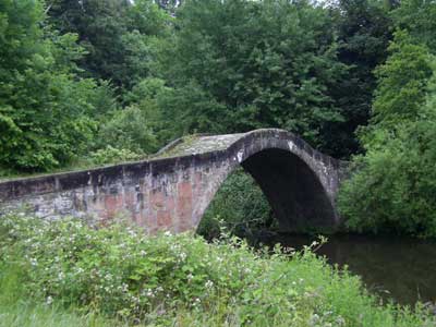 |
| The "Roman Bridge" |
There is a very old bridge over the Calder, called
the Roman bridge, which allowed passage into Bothwell
parish.
p.457 There are 6 miles of good parish roads maintained
at a cost of £45 yearly through the Statute Labour
funds. There are 3 bridges.
p.463 Fruit is mostly taken to Glasgow. They leave at
midnight in time for the market opening at 5 am.
p.464 Means of Communication Hamilton has
a market and a post office. There is an Edinburgh -
Hamilton coach that passes through Dalziel three times
a week. The main roads are Glasgow - Carluke - Lanark
and Hamilton - Edinburgh.
p.467 Fuel Coal is obtained locally and
carried by donkey cart.
Dolphinton
OSA
 |
| Dolphinton church |
Vol.14, page 107 The Edinburgh to Leadhills
road runs through. Very poor coal from eight miles away.
NSA p.49
 p.61
In the 1700’s there was a weekly market and two
annual fairs, various mills and two inns but now there
is nothing. There are 2½ miles of turnpike and
5 miles of parish roads. The line of road between Glasgow
and Berwick would be improved by directing it by the
Tairth and Medwin rather than Ellsrighill and Corsoncone. p.61
In the 1700’s there was a weekly market and two
annual fairs, various mills and two inns but now there
is nothing. There are 2½ miles of turnpike and
5 miles of parish roads. The line of road between Glasgow
and Berwick would be improved by directing it by the
Tairth and Medwin rather than Ellsrighill and Corsoncone.
Notes: The map covers both the Dolphinton
and the Dunsyre accounts. The main road had the line
of the present day A721 through Elsrickle; Corsoncone
is on the county boundary. His suggestion, perhaps related
to the Dunsyre comments (they were adjacent parishes),
was for the road to be routed up the valley of the South
Medwin to Dolphinton and then across towards Blyth Bridge
and the Tairth Water en route to Peebles.
Map based on
1935 OS map. With thanks to Ordnance Survey
Douglas
OSA
Vol. 8, page 81 The Glasgow to England and Edinburgh
to Ayr roads pass through. Eighteen years ago Lord Douglas
paid for 30 miles of the first and 20 miles of the other.
They are kept in repair by the statute labour work but
this is not sufficient for the purpose. The people were
initially very unhappy at having to pay tolls on these
roads.
NSA p.477
p.489 Roads The Edinburgh to Ayr road,
via Carnwath and Muirkirk and the Glasgow - Carlisle
road run through the parish and are in excellent condition.
The Ayr road is not as busy as the new road opened north
of here.
The late Lord Douglas funded 20 miles of the old Glasgow
road and 30 miles of the Ayr road.
There are a number of statute labour roads, payment
towards which is given grudgingly.
p.496 Coal is obtained locally although peat is used
in the more distant parts of the parish.
Dunsyre
OSA
Vol.1, page 337 No mention of roads. Oats, sheep and
cattle sent to Glasgow markets.
NSA p.64
p.64 Gypsies used a large cave on Craigengar
Hill, in the north-east of the parish, as a meeting
place.
p.69 A Roman road runs through
a natural pass (the Garvald) on its way to the camp
at Cleghorn.
p.72 There are three local market towns, Carnwath, Biggar
and (West) Linton.
p.75 The writer suggests that the main road of the parish
should be continued through the Garvald to join the
Edinburgh - Biggar road near Linton rather than by the
present roundabout route.
Notes: See Dolphinton above. His comment
about the Roman road is confusing. Assuming the Garvald
pass runs for a mile or so north-westwards from Dolphinton
towards Garvald House (NT0949) then the Roman road did
not run through it but rather, across it on the line
of the main road running through Dolphinton. It crossed
another road a couple of miles to the south which led
to Cleghorn (close to the junction of the A702 and A721).
As the main road of the parish in his day was probably
the one running from Dunsyre to Roberton Mains and thence
to the Biggar - Edinburgh road just south of Dolphinton
(see Forrest's map -
north sheet) his suggested route would certainly have
been more direct although it would still have been 3
miles short of West Linton. In view of this there is
a slight possibility that he was referring to a route
(shown on Roy between Dunsyre and West Linton as well
as by Forrest and Ainslie)
that ran through a pass between North Muir and Mendick
Hill - this is now the track that runs towards North
Slipperfield (NT1251).
East Kilbride
OSA
Vol.3, page 423 The roads are in bad condition. Two
turnpikes were built just last year, one leading by
Muirkirk and Dumfries into England, the other from Ayrshire
to Edinburgh by Bothwell Bridge, or by Hamilton. The
statute labour rate is raised on 446 horse gangs at
3/9d each.
 |
|
East Kilbride Village
|
NSA p.877
p.879 The most direct road from Glasgow to Strathaven
passes through Kilbride, running from Nerston to the
bridge at Torrance. The road is wide and in good condition
though hilly.
p.889 When a plague had taken hold in Glasgow the inhabitants
took their produce only as far as a hill (known thereafter
as Market Hill) just north of the village on the old
road to Glasgow where people from Glasgow could buy
goods.
p.898 Means of Communication There is a
post office in the village which receives mail from
Glasgow. The Strathaven - Glasgow coach passes through
on the turnpike between these places crossing the Calder
at Torrance by a recently improved bridge. Other turnpikes
are one to Eaglesham and one to Busby and Carmunnock.
Parish roads are in good condition.
Glasford
OSA
Vol. 7, page 142 No mention of roads.
NSA p.294
p.299 The Strathaven -East Kilbride - Glasgow and Strathaven
- Hamilton turnpikes both run through the parish and
there are stagecoaches to East Kilbride and Stonehouse
and beyond. There is a bridge over the Avon at Glasford
Mill but it is narrow and in poor condition - the one
over the Calder at Crutherland is better.
Glasgow
OSA Barony of Glasgow Vol.12,
page 124;
The roads in the north of the city are hilly The bridge
over the Kelvin was completed in 1791. It has a span
of 400 feet and is 83 feet high and is "one of the most
stupendous works of the kind perhaps in the world."
City of Glasgow Vol.5,
page 489 - deepening of Dumbuck ford. Until recently
only small vessels could sail up the river to Glasgow,
it being so shallow, but this has recently been remedied
by deepening the channel. In the time of Queen Mary,
many hundreds of people from Glasgow, Dumbarton and
Renfrew camped at Dumbuck Ford for 6 weeks where they
tried unsuccessfully to deepen the ford.
NSA p.101
p.106 Glasgow had a market and fair as early as the
1100’s.
p.196 Considerable details are given of the efforts
to make the Clyde navigable as far as Glasgow. It was
a shallow river with several fords along its length.
Efforts were made in the mid-1500’s to remove the
Dumbuck and other fords, allowing small boats to make
their way up to Glasgow.
The main outlet for merchandise was in north Ayrshire
but as carriage was expensive merchants looked for alternatives
at Dumbarton and Troon, finally settling in the 1660’s
on what became Port Glasgow.
A little later a quay was built in Glasgow to allow
goods to be transported to and from Port Glasgow. In
the mid 1700’s initiatives were undertaken to deepen
the river and mention is made of the Pointhouse ford,
the Marlin ford, shoals at Kilpatrick and Nushet Island
with only two feet of water, and Renfrew ferry.
p.205 The first stage coach in Scotland dates from 1678
and the first service to London from 1788 which took
65 hours at 6 mph; at the present time (1834) it takes
41 hours. The Edinburgh service started in 1799 taking
6 hours to do the 42 miles (now 4 hours).
At the present time about 60 stage coaches ran each
day to London, Edinburgh, Paisley, Hamilton, Lanark,
Perth and Stirling and 22 other towns.
Alternatives to road travel were steamboats on the Clyde
and boats on the Forth and Clyde, Paisley and Monkland
canals, as well as the Glasgow - Garnkirk railway.
p.218 There are four bridges in Glasgow: Stockwell
Bridge, Jamaica
Street Bridge, Hutcheson’s Bridge, and a timber
bridge at Portland Street. There is a nearby bridge
on the way to Rutherglen.
Stockwell Bridge (reference) replaced the one built
by Bishop Rae in 1345, which itself replaced an earlier
timber bridge. Over the years it has been steadily improved.
Jamaica Street Bridge was started in 1768 and Hutcheson’s
Bridge in 1794 but a flood destroyed the bridge before
it was completed. Work on a new bridge at the same location
started in 1829 to a design of Robert Stevenson.
The Timber Bridge is also by Stevenson and dates from
1832.
In 1833 work started on a replacement for the Jamaica
Street Bridge.
p.221 Details of the extensive postal system are
given.
Gorbals
OSA
(no entry for NSA)
Vol. 5, page 542 Formerly known as Bridge-end, the village
has grown to its present size from a few houses by the
side of the road running south from the bridge in the
early 1700's.
Govan
OSA
Vol.14, page 282 The parish lies on both sides of the
river which when swollen renders the passage by the
ferry boat near the mouth of the River Kelvin difficult
and dangerous. The ferry itself is in a bad condition
and the quay on the north side is silted up because
of the deepening of the Clyde. It is hoped to obtain
a ferry boat similar to that used at Renfrew and this
should improve matters. Four branches of the King�s
Highway run through the parish.
NSA p.668
p.670 There was a ford at Braehead, called the Marline
ford, another near the ferry, and one at the east of
the village (see image).
p.680 Mention is made of a journey by coach between
London and Edinburgh in 1615 that took 17 days to complete.
p.699 There is a regular penny post service to Glasgow
and 2 omnibuses that travel frequently to Glasgow.
The Glasgow - Paisley road runs through the parish and
is 48 feet wide with footpaths. There is also a road
to Kilmarnock and Ayr, one to Renfrew, Port Glasgow
and Greenock and another (on the north side of the Clyde)
that runs to Dumbarton.
There is a ferry
at the village which connects the part of the parish
north of the river. Glasgow can be accessed by 4 bridges.
One of these was rebuilt and opened in 1836 - Thomas
Telford was the architect. When it was being rebuilt
there was a temporary wooden bridge and it can still
be used by pedestrians. There was another wooden bridge
at Crown Street but this was replaced in 1834 by a stone
bridge.
Railways to Ayr and Greenock will be completed within
the next year.
Details are given of the tolls raised on the turnpikes
over several years. The revenues of the Renfrew road,
formerly very busy with traffic, have fallen considerably
since steamboats were introduced to the Clyde.
Hamilton
OSA
(Vol.2, page 211); also bridges
(Vol.2, page 179)
There are two bridges over the Clyde: one at Bothwell
Bridge and one just below the Avon, built in 1780. There
is a bridge built before the 16th century which crosses
the Avon on the road to Carlisle, and another bridge
on the Avon built last year, mostly for the convenience
of a gentleman in the locality. The Carlisle road and
the Edinburgh to Ayrshire road run through the parish.
Both are turnpike though their upkeep on the soft ground
of the parish is difficult and expensive. The advantages
of the turnpikes are seen such as allowing far heavier
loads to be drawn though they are often too steep. The
many cross roads are starting to improve and most streams
are bridged. Although the statute labour is commuted
some argue that people are now so aware of the advantages
of good roads that they would now work more diligently
that they used to if the old system was re-introduced.
The streets in the town are very good. There are a number
of carters in the town and horses are for hire.
NSA p.249
p.250 In describing the extent of the parish, mention
is made of the Carlisle road, Bothwell Bridge and Millheugh
Bridge.
p.257 Coal is mostly mined at Quarter and taken from
there to Hamilton and Avondale parishes by horse and
donkey carts.
p.284 Details of the town’s revenues are given:
there was an income of £55 5s from the bridge
and mention is made of streets and public lamps. £46
was spent on roads.
p.285 Means of communication Fifteen miles
of turnpikes and 30 miles of parish roads. The London
- Glasgow road passes through and a road between Ayr
and Edinburgh, made in 1755.(see Taylor and Skinner)
Another road to Ayr has lately been built (A71).
 |
| Old Avon Bridge (other
image) |
Two new bridges have been built in the town lately,
one over the Cadzow (beside Hamilton Library) and one
to the south of the town (on the A74). The old bridge
upstream from this was said to have been built by the
monks of Lesmahagow. Hamilton Bridge, over the Clyde
was completed in 1780 but pontage has to be paid. Bothwell
Bridge is very old but has been improved over the years.
The mail coach to London passes daily and mail can be
sent to Glasgow, Edinburgh and Strathaven. There are
7 coaches to Glasgow each day and another 7 to places
south of Hamilton.
p.292 In the past Hamilton was a major market
for lint and wool and was attended by many traders but
this has now declined. Five fairs are held each year.
p.293 Post chaises are kept by two of the town’s
inns and outgigs and cars can be hired at one of the
inns.
Lanark
OSA (Vol.15,
page 25); also Romans (Vol.15,
page 10)
 |
| Old Bridge at Lanark |
There are Roman camps at Cleghorn and Castledykes and
Watling Street passes from Castledykes across Lanark-moor,
goes over the Mouse just east of Cleghorn Bridge, then
runs by Colly-law, Killcadzow, Coldstream, Zuilshields
and Belstane and thence to the wall.
There is an excellent turnpike to Edinburgh but the
Glasgow road is very bad and has to negotiate very steep
climbs on either side of the Mouse. A new road is to
be built to Glasgow which will cross at the old bridge
and run along the south bank of the Clyde on a more
level course and through picturesque scenery. It would
be a benefit if it were continued by Howgate mouth to
the south, making the distance to Carlisle shorter and
making Lanark more accessible. It would also be an advantage
if the old road by Carluke which is used for the carriage
of coal and lime were to be improved. The old bridge
was built in the late 1600�s, and the Hyndford Bridge
a few years ago. The Mouse has three bridges at Cleghorm,
Lockhart-ford on the Carluke road and Mousemill.
Seven fairs are held at Lanark. The Lammas fair used
to supply sheep to the Highlands but this trade has
fallen off.
NSA p.1
p.4 A fine bridge has been built at Cartland Crags.
p.5 The Clyde can be forded at various places even by
children .
p.13 There are two Roman camps nearby with an associated
Roman road.
 |
 |
| Old bridge, Lanark
(see also other image) |
Hyndford Bridge |
p.24 Means of Communication
Communications good with 15 miles of turnpike roads.
There are regular stage coaches to Edinburgh and Glasgow.
The old bridge over the Clyde dates to the mid-1600’s
- to the south of town there is an elegant bridge at
Hyndford.
The Mouse has 5 bridges: Cleghorn, Lockhartford, Cartlands
Crags (written as Cartlane in the account) and two at
Mouse
Mill. The Cartlands Crag bridge is by Telford and
was built in 1822 and is 125 feet high. One of the bridges
at Mouse Mill dates from the mid-1600’s.
p.29 There are markets twice a week and several fairs
during the year. One fair was held a few days after
the Falkirk tryst.
Coal is brought from a few miles distance.
Notes: see T. Reid (Fords,
Ferries, Floats and Bridges near Lanark, PSAS, Vol.47,
(1912-13) for details of the bridges.
The Tillieford was used to bring
coal in from Douglas.
Lesmahagow
 |
| One of the bridges today |
OSA
Vol. 7, page 434 There is a bridge over the Clyde and
three over the Nethan. One bridge is on the Glasgow
to Carlisle post road which also crosses the Ponicle
on the boundary with Douglas parish. There are several
other small bridges. Generally the roads are hilly and
the line they take could have been better planned. The
new road from Lanark to Hamilton on the south bank of
the Clyde will be of great benefit.
 |
 |
| Two views of what
used to be the main road to the south. It is shown
on the Military Survey c.1750 and later as a turnpike.
It was superseded by the new Carlisle to Glasgow
Road built in the 1820's (the A74). The first view
is just south of Brocketsbrae, the second near Righead
- although at this point it is not a public road
it is still surfaced. As is usually the case with
major routes, three or more roads from different
periods can often be seen close together. |
NSA p.30
p.32 A fine cannel coal used for making gas, is
sent to Glasgow and other places.
p.33 A Roman road runs through a part of the parish
but has been destroyed by ploughing.
Many cairns have been destroyed, their stone being used
for roads and fences.
p.38 Means of Communication
The Glasgow - Carlisle and the Glasgow - Lanark roads
run through the parish with regular coaches and carriers
to Glasgow as well as a postal service to Glasgow. There
are more than 80 miles of parish roads maintained by
the Statute Labour conversion money - at least 50 miles
of these are in very good order. There are numerous
bridges.
p.40 Miscellaneous Observations
Since the last Account roads have improved greatly (they
were "mere tracts" at that time) and these
have greatly helped agricultural improvements.
Notes: The RCAHMS (Lanarkshire. An
Inventory of the Prehistoric and Roman Monuments, HMSO,
1978, p.137-140) discusses the route this road might
have followed. From Castledykes it went through Lanark
then crossed the Clyde at Kirkfieldbank. From there
it ran 1 km SSE and then ran parallel with the river
at a distance of approx.1km. The route here was through
Nether Affleck and Hallhill. From there it descended
to a ford over the Nethan at Corramill (NS816459), ran
to Fence and then trended in an almost straight line
past Draffan and Gill to the stretch marked on the OS
maps south of Stonehouse.
Libberton and Quothquan.
OSA
Vol. 2, page 247 There are 2 bridges over the Methven.
The roads which were all made by the statute labour
in kind are poor although there has been some improvement
since it was commuted. However, further improvements
are unlikely unless the heritors agree to pay more themselves.
Turnpikes are seen as advantageous although in this
parish there is only the Peebles to Glasgow turnpike
which is just being built.
Coal from Douglas and Carnwath parishes.
NSA p.41
p.46 Means of Communication
The Glasgow - Peebles turnpike passes through the north
of the parish. There are 30 miles of parish roads, mostly
bad as there are not enough funds to keep them in good
condition.
p.48 Coal is brought from Douglas and Carnwath parishes,
about 10 miles away.
New Monkland (East Monkland)
OSA
Vol. 7, page 275 Up to 1772 when the statute labour
was commuted the roads were extremely poor. Since then
they have greatly improved and nearly all streams have
been bridged. An act has been obtained for a turnpike
road from Glasgow to Edinburgh by Airdrie and Bathgate
and this will run through the parish for many miles.
There is a weekly market in Airdrie and four annual
fairs. At Kipps there was a ruin of a chapel where the
monks of Newbattle Abbey held annual courts in relation
to the land they held here. The chapel has now been
demolished by a "more than rustic" farmer.
NSA p.242
p.246 There is a post office in Airdrie.
Means of Communication The Edinburgh - Glasgow
and Carlisle - Stirling turnpikes run through the parish
and have helped improve the surrounding lands.
p.248 There are two fairs each year and a weekly market.
Parish roads have improved and more roads built; this
has helped in the transport of lime and manure.
Old or West Monkland
OSA
Vol. 7, page 379 In the parish there is one coach, 5
chaises, and 5 phaetons. The roads are excellent and
maintained by the statute labour commutation money.
The turnpike from Glasgow to Edinburgh by Whiteburn
runs through and the toll-bar on this is worth a great
deal. Another turnpike runs from Glasgow to Airdrie
for 7 miles through this parish - it has a toll bar
at Langloan. It is soon to be extended to Edinburgh
by Bathgate and will be the shortest and most level
route between Glasgow and Edinburgh. Pig iron is brought
from Muirkirk.
NSA p.635
p.636 In his description of Old Monkland the writer
mentions the bridge over the Calder at Carnbroe.
p.649 Malcolm IV granted the Monklands to Newbottle
(Newbattle) Abbey. The monks set up a grange at Drumpellier
and obtained the right for free passage between the
Monklands and the Abbey (at Dalkieth, south of Edinburgh).
Note: See here
for possible route between Newbattle and Drumpellier.
p.650 A local tradition says that the Old Monkland church
was built at the spot where a pilgrim, told to carry
a stone as a penance from Glasgow and build a church
when he could go no further, could make no further progress.
p.652 In listing the results of a survey of inhabitants
in each part of the parish for the Church Commission,
the writer mentions roads in describing the parts of
the parish. These are:
Parish road from Breadiesolme avenue head to Edinburgh
turnpike, near Balliestone Toll
Parish road starting at the end of Longmuir road, passing
Breadiesholme avenue and running to Balliestone Toll
Narrow parish road opposite Breadiesholme gateway, crossing
the turnpike near Rhins, then on to Seving Bridge, then
by Netherhouse, Commonhead, Cuilhill, Longhmuir, Dykehead
and ending at Mainhill.
Blair Bridge road
Road from Luggie Mill bridge towards Old Monkland Kirk.
Elsewhere mention is made of a road between Chryston
and Cuilhill colliery, one from Gartsherrie to Blair
Bridge, and another from Merriston Bridge to the new
Edinburgh road.
p.664 Parochial Economy Airdrie is
the nearest market town. There are 44 miles of parish
roads and 10 miles of turnpikes. The roads money is
£500 pa but due to competition from the canal
and railways for the carriage of coal some of the roads
are very bad. Details are given of the canal and railways
- the writer notes that there was no public conveyance
to Glasgow 20 years previously.
Pettinain
OSA (Vol.
12, page 30); see also page 41
In the upper part of its course in the parish the
Clyde has several fords though these can become impassable.
If these cannot be used there is a bridge to the east
at Thankerton, two and a half miles away, which was
built about 14 years ago at a cost of 700L. Hyndford
Bridge gives easy access to Lanark and beyond. Coal
is brought from Ponfeigh, 7 miles away. The roads are
much improved in the last 20 years but the soft materials
available break up easily so the roads need frequent
repairs - some cross roads are very bad. The statute
labour money is about 12 L which used carefully will
lead to improvements.
NSA p.535
p.544 An account is given of the new float (Lampits
Float, see Thomas Reid (Fords,
Ferries, Floats and Bridges near Lanark, PSAS, Vol.47,
(1912-13), see also Carnwath)
which was installed a few years ago (1827). This is
capable of carrying animals and carts and has cut the
distance to Carnwath from 9 miles to three. Local gentlemen
funded it. (image)
p.545 A short stretch of the Carlisle - Stirling turnpike
runs through the parish. The parish roads are in good
order.
p.546 Coal is brought from Carnwath and Douglas parishes.
Rutherglen
OSA
Vol. 9, page 10 The roads are excellent. The turnpike
to London by Kilbride, Muirkirk and Dumfries passes
through, with one toll bar in the parish. Rutherglen
Bridge, on the way to Glasgow, was built in 1775 and
has no pontage. Six fairs held each year. Eighteen carters
in the town.
NSA p.373
p.396 There are several fairs.
p.398 A bridge was built by subscription at Shawfield
in 1775.
Another bridge was built in the last few years along
with a line of road to shorten the distance for carrying
coal into Glasgow. The bridge is of timber and has a
pontage.
Stonehouse
OSA
Vol. 2, page 231 The roads are in bad repair, being
damaged by carts carrying coal and lime and poor materials
for their repair at hand. There are no turnpikes. Two
bridges over the Avon were swept away in a flood in
1771 but have now been replaced.
NSA p.468
p.472 The writer refers to the Roman road from Ayr to
Edinburgh, known locally as the Deil’s Causey.
Stretches remain but much has been destroyed with the
stones being reused for fences and roads.
p.474 Village The main street is a mile
long and has been macadamised.
Means of Communication The new Edinburgh
- Ayr turnpike runs through Stonehouse and has made
travel east and west of the village much easier. There
is now a fine bridge over the Gander water on this road.
The Glasgow - London road lies a mile east of Stonehouse.
p.475 Fairs There are three well attended
fairs each year.
p.476 Miscellaneous Observations Prior
to the new road opening a few years ago it was rare
to see carriages in Stonehouse. Now there are regular
coaches to Glasgow, Edinburgh, Ayr and Strathaven, as
well as a carrier to Glasgow. There is now a post office
in the village.
Symington
OSA
Vol. 8, page 585 No mention of roads. Forty four carts
in the parish.
NSA p.867
p.871 The nearest market and post town is Biggar, 3
miles away. There are four miles of turnpikes and a
coach runs from Edinburgh to Dumfries. The Lanark -
Biggar road crosses the Clyde at a bridge. Coal comes
from Douglas and Carmichael parishes, ten miles away.
Walston
OSA
Vol. 7, page 116 No mention of roads
NSA p.846
p.862 Markets at Biggar and Carwath.
Means of Communication There is a postal
service from Roberton. The Dumfries - Edinburgh and
the Carnwath - Peebles turnpikes run through the parish
and have regular coach services. A carrier goes to Edinburgh.
The bridges are small and one is dangerous, though it
is to be improved.
p.866 An inn has been established on the Edinburgh -
Dumfries road. Peat and coal are used, the coal coming
from 10 miles away.
Wandell and Lammingtoune
OSA
Vol. 6, page 549 No mention of roads. One carrier in
the parish. Roman camps mentioned.
 |
| Clyde's bridge, hidden by a modern
bridge. It was built in the early 1660's at an important
fording point over the Clyde. See Reid for details
(p.210ff). There is a stone dated 1769 on the bridge
which probably indicates when it was improved -
see Glasgow
Herald feature 21.1.1967, page 8. |
NSA p.805p.810 The
writer mentions a ford near the old castle of Lamington
which was dangerous in flood. A particular incident
in 1830 when two young couples were drowned led to a
bridge being built in 1836 near to Lamington. Prior
to that time there had been no bridges between Clyde’s
Bridge to the south (in Wandel) and Wolfclyde to the
north, some 9 miles.
p.818 A Roman road enters the south of the parish at
Arbory Hill and can be traced for some distance.
p.820 Historical Notices An account is
given of the alarm caused in 1715 by some 400 Highlanders
returning home. They split into two parties at Erickstane
(above Moffat) with one party heading towards Douglas
by Crawford-muir and the other crossing the hills towards
Lamington. The Lamington party were captured and taken
to Lanark.
p.822 There is a public house in Lamington where carriers
often stay. A new inn is being built in the village
and the writer recommends it to anglers in Edinburgh
who would be able to arrive by the Dumfries coach and
enjoy excellent fishing.
p.835 Market Towns The Edinburgh - Dumfries
turnpike comes through Biggar and runs via Abington,
Leadhills and Sanquhar: Moffat and Thornhill can also
be reached via Crawford. The Glasgow - Carlisle mail
coach passes at Abington so postal services are good.
Carriers from this area as well as from Nithsdale and
Galloway travel to Edinburgh.
Biggar is the local market town.
p.844 The writer refers to the evil effects of allowing
drink to be sold at the toll at Hartside, just south
of the village, saying that this allows the Justices
to gain more money from the rent.
Coal comes from Douglas and Carmichael parishes.
Wiston and Roberton
OSA
Vol.6, page 306 The Glasgow to Carlisle road passes
through the head of the parish. A good road made by
the statute labour runs across the parish which allows
access to coal. The other roads are bad.
NSA p.93
p.93 Some think that Wilston was formerly Woolstown
and was a substantial market for wool.
p.98 Means of Communication The Stirling
- Carlisle turnpike runs through the parish and has
been of great benefit to it. There are no bridges of
note.
p.100 Coal is brought about six miles from Carmichael
and Douglas parishes - carting costs 10d a load.
Top
|