|
Roman
Roads
This section will give a brief overview of the known
network and look in a little more detail at gaps in
this network and also at references to Roman roads in
the antiquarian literature.
The
Road to the Monklands - Newbattle Abbey to The Monklands
 |
| Based
on 1935 quarter-inch OS map. With thanks to
Ordnance Survey |
|
The Abbey of Neubotle, founded in
1164 near Dalkeith, just south of Edinburgh, was given
a grant of land of what is now known as the Monklands,
near Airdrie. They successfully reared sheep and grain
on the land and engaged in coal mining. To help move their
produce they are said to have built a road to the Monklands.
As they negotiated rights of way with landowners, we can
trace its approximate course.
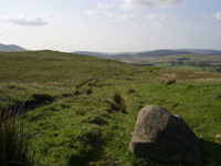
The Ayr
to Kirkcudbright Road
Older Ordnance Survey maps show a
Roman road running south from Ayr to just beyond Dalmellington.
It then continues as a "Pack Road" towards Carsphairn
and Dalry. We trace the course taken by this road and
look at why it might have been built.
Mediaeval Roads: Evidence
from Monastic Charters
 |
In
mediaeval times abbeys and other religious houses
received grants of land where they conducted activities
like farming and mining. They kept a record of these
lands in their chartularies and these frequently
mention roads. This section explores these charters
and tries to identify the roads they refer to. |
References
to Roads in Chalmer's Caledonia
George Chalmers (1742-1825 ) was an eminent Scottish
historian who wrote a major work on the history of Scotland,
titled Caledonia. The work contains some useful references
to roads, both historical and contemporary with his
times. Details of these are given with links to the
original volumes on the Internet Archives.
References
to Roads in MacFarlane's Geographical Collections
Walter MacFarlane was an antiquarian who collected a
wide range of materials relating to Scotland. Among
these, the Geographical Collections consist of accounts
of the topography, history and antiquities for many
parishes and districts in Scotland. There are many references
to roads, bridges, fords and ferries dating mostly from
the 1720's but with some from the 1600's which provide
valuable clues for the reconstruction of the road network
of the time.
The
Toll Points of Ayr and Rutherglen: Implications for
Routes
The early burghs of
Ayr and Rutherglen were allowed to levy tolls on goods
before these could be traded in their respective jurisdictions.
The names of the locations where these tolls were raised
or that defined a trade precinct provide useful clues
to routes in west and central Scotland in the early
middle ages.
The
Military Roads of Scotland
These roads were built in the 1700's to ensure that
government troops could deploy easily to strategic locations
in the Highlands in the event of a Jacobite uprising.
Over 250 miles of road were built by General Wade, and
some 800 miles by his less well-known successor, Major
Caulfeild. There was also a road from Carlisle to Portpatrick
to allow easy access to Ireland.
Rambles
on Old Roads: Newsletter
March 2009 pdf,
Works
April 2009 pdf,
Works
June 2009 pdf;
Works-pages1&2;
pages 3&4
August 2009 jpeg;
MS Works
October 2009 jpeg; MS
Works
December 2009 jpeg;
MS Works
March 2010 jpeg; MS
Works
June 2010 jpeg; MS
Works
September 2010 jpeg; MS
Works
February 2011 jpeg; MS
Works
May 2011 jpeg; MS
Works
September 2011 jpeg; MS
Works
February 2012 jpeg; MS
Works
July 2012 jpeg; MS
Works
February 2013 webpage;
jpeg
April 2013 webpage
September 2013 webpage
February 2014 webpage
July 2014 webpage
(Note: Works may require you to save first then open.)
|

