|
Hold cursor over road

Based
on Hawick & Eskdale 1" map, Sheet 85, Popular Edition,
published 1945. With thanks to Ordnance Survey
Moffat
to Selkirk, Melrose and Kelso
 This
is named as the road from Moffat to Selkirk, Melrose
and Kelso. It closely follows the line of the existing
Moffat - Selkirk road except at St Mary's Loch where
it ran up the east side of the loch from Tibbie Shiels
Inn onward. This
is named as the road from Moffat to Selkirk, Melrose
and Kelso. It closely follows the line of the existing
Moffat - Selkirk road except at St Mary's Loch where
it ran up the east side of the loch from Tibbie Shiels
Inn onward.
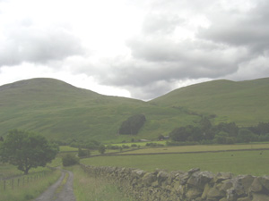
Heading towards St Mary's Loch.
Moffat
- Ettrickbridge - Selkirk
The more northerly track where it leaves
the main road
 Two
branches leave the Moffat Selkirk road near Roundstonefoot
(NT 140085) to run for about 2 ½ miles to Potsburn
on a no longer existing track. From Potsburn it runs
along the Ettrick Water Valley on the existing track
for about 6 miles to join the B709 Selkirk - Langholm
road at Ramsaycleugh (NT 274145). Two
branches leave the Moffat Selkirk road near Roundstonefoot
(NT 140085) to run for about 2 ½ miles to Potsburn
on a no longer existing track. From Potsburn it runs
along the Ettrick Water Valley on the existing track
for about 6 miles to join the B709 Selkirk - Langholm
road at Ramsaycleugh (NT 274145).
From this point it runs north-east more or less on
the line of the main road (B709 and B7009) to Ettrickbridge
and Selkirk. Two miles beyond Ettrickbridge End it leaves
the B7009 to make its way by a minor road and a track
to rejoin the main road at Howden just outside of Selkirk.
It may be significant that Roy’s route passes the
site of a Roman fort and camp on this stretch.
Moffat - Hawick
The road leaves the above road where the B711 turns
off the B709 just south of Crosslee (just beoyond top
of map). From there it follows the approximate line
of the B711 to Hawick. There is a significant deviation
from the B711 near Craig Hill (NT3216) where it cuts
directly over to Delorainesheil. Boyond Bellindean Rig
(NT3715) it deviates significantly from the B711 line.
Craik Cross - Hawick
This is shown as running from Craik Moor (NT3105) up
through Craik and Roberton to Hawick. A Roman road is
now known to have run from the fort at Raeburnfoot (NY2599)
up through Craik Cross to the north-east. Wilson (Roman
Penetration in E Dumfriesshire and Beyond, Allan Wilson,
TDGNHAS, III, 73, 17) discusses the probable course
of the road routing it up the Borthwick Water to head
north of Roberton and across to Dere Street.
The track shown by Roy is identical to or very close
to the Roman road as far as Burnfoot near Roberton.
Throughout its course it keeps to the north of the Borthwick
Water unlike stretches of the modern minor road. The
area can be accessed by the public road to Craik where
there are Forestry Commission parking facilities.
Langholm - Hawick
The road leaves Langholm on a slightly different course
from the A7 but takes up the A7 line about two miles
north of Langholm near Terrona. Its course is close
to the A7 line but as can be seen from the map is not
always identical to it.
Although not shown on Roy it is worth noting that Commonside
Moor (NT4108) was used as an assembly point by drovers
and that they crossed the Teviot at North house (NT437080)
from where they made their way over to the River Liddel.
Hawick - Jedburgh
This road ran from Cauldmill (NT 520152) two miles
east of Hawick, up by minor roads and a track to Denholm.
From there it had the line of modern roads to near Ruecastle
(NT6120) from where it ran across country to Jedburgh.
There is a noticeable gap between Cauldmill and Hawick.
It is rather odd that Stobie’s Roxburghshire
map of 1770 should have the modern line between Ruecastle
and Jedburgh and also the A698 through Denholm although
he does have the Cauldmill stretch which he terminates
at Cavers. However, this was the period when parish
roads and turnpikes were being built (the Act for the
turnpike route followed by the A698 was obtained in
1768) so it may be the case that there was no through
route between Jedburgh and Hawick in the 1750’s.
See John James Mackay, Border Highways, 1998 for further
details, p.127. There is also the possibility that the
unfinished look of the Military Survey maps of this
area could indicate that some roads, including the continuation
to Hawick were missed out.
From Newcastleton
On Stobie’s map this road runs between Newcastleton
and Jedburgh. On the Military Survey, the road is very
isolated shown as starting at Kershopefoot, 3 miles
south of Newcastleton and heading up the Liddel Valley
to terminate near Caldroun Rig (NY5799) on the B6357
(3 miles beyond eastern edge of above map).
Again, it is puzzling that the Military Survey does
not show the full extent of this road as Mackay (Border
Highways, p.126) notes that Thomas Gardner’s road
map of 1719 mentions the road as between Carlisle, Jedburgh
and Berwick. The route was used by Bonnie Prince Charlie
and his army in 1745. It is highly likely that it was
no more than a track as the OSA
(go to non-subscribers - browse scanned pages) in 1791
states that no roads had been formed in the parish until
recently.
Eskdalemuir -towards Langholm
This is shown running by mostly no longer existing paths
down towards Langholm but terminating several miles
short of the town. It is hard to imagine why this should
be so, as also with the Waterhead road that terminates
nearby on the south side of the River Esk. The natural
assumption must be that the Military Survey omitted
these roads. Wilson (Roman Penetration in E Dumfriesshire
and Beyond, Allan Wilson, TDGNHAS, III, 73, 17) discusses
the possible course of Roman roads in this area, one
of which from Langholm through Bentpath to the fort
at Raeburnfoot could link in places to this route.
Waterhead - towards Langholm
Apart from ths road terminating, like the one above,
several miles short of Langholm it is slightly puzzling
why this farm should have linked to Langholm at least
12 miles away when Lockerbie was only 7 or 8 miles away.
Crossdykes - towards Langholm
This is a two mile long spur from the above road down
to a farm called Crossdykes, and was presumably no more
than an access track.
back to Military Survey
main page
|
