|
Introduction
There is a certain degree of confusion
about an old road running south from Ayr to Dalmellington
and beyond. On the early Ordnance Survey maps it is
shown as a Roman road as far as Cairnennock, south of
Dalmellington though beyond that point it is called
a pack road. On the Military Survey maps of the 1750�s
it is shown as the road from Kirkcudbright to Ayr.
It is natural enough to think
that if it is Roman it would have ran down towards the
Solway coast, perhaps to a harbour near Kirkcudbright
or to the Roman fort at Glenlochar near Castle Douglas.
Yet the historian Chalmers, who was the first to talk
of it being a Roman road (based on information provided
by Joseph Train and others) does not say this. He has
the road branching off the main Nithsdale road, passing
the Doon of Tynron, then crossing the Shinnel at Stenhouse
and running to Drumloff in Glencairn. It then followed
the Cairn-Water, passed Conrig and then Altrie to Holm
in Carsphairn parish. From there it ran across the Polwhat
ridge towards Dalmellington. This seems to be the reason
the early OS maps mark only the Dalmellington to Ayr
stretch as Roman. Interestingly the Maxwelltown 1st
edition 1� map shows a short stretch of �Roman road�
near Holm (Nether Holm of Dalquhairn) and the 1853 6"
map shows the line from Holm to Polwhat Rig.
This means that the �pack road�
south of Dalmellington was seen as separate from the
Roman road. Chalmers� road would have approached Dalmellington
from the east by Windy Standard and not from the south
as the pack road does. It has to be said that nothing
has been found between Dalmellington and Polwhat Rig
that could be the road.
James MacDonald, an eminent archaeologist
of his day was sceptical about the Roman provenance
of the road and argued that between Dalmellington and
Ayr it was identical to the road shown on the Military
Survey and in fact an early �parish� road. He also looked
at the route reported by Chalmers in Dumfriesshire and
Kirkcudbrightshire and although he confirmed there was
a road did not think it was Roman. However, he makes
the interesting suggestion that it might have been a
via regia mentioned in an early charter of Melrose Abbey
that had not been identified at that time.
Other attempts have been made
to trace this road and notably Clarke suggests that
there could have been a Roman patrol track in this area
although the course he gives is different to that given
by Chalmers.
So far as the pack road goes,
it seems clear enough that it was in use in the middle
ages when the monks of Vaudey Abbey who owned the lands
of Keresban (Carsphairn) used it to reach the Solway
coast. At a slightly earlier period, Melrose had a grange
here as well as at Dalmellington. The fact that they
built roads elsewhere is suggestive.
We will look at the issues raised
above under three headings:
- The road between Ayr and Cairnennock. This is the
stretch marked as Roman on the OS maps and which MacDonald
thought was a parish road;
- The various attempts to trace a Roman road running
from the Nithsdale road (a well-established Roman road)
through the Penpont and Moniave areas over towards Dalmellington
from where it would continue as the Roman road
above;
- The road south of Cairnennock which is marked as a
pack road as far as Stroangassel, north of St John�s
Town of Dalry but which then continued southward
to Kirkcudbright though not marked as a pack road.
The �Roman Road� - Ayr to Dalmellington
 |
| Based on 1914
OS map. With thanks to Ordnance Survey. The roads
shown in this and the maps below are from the Military
Survey. The Ayr-Kirkcudbright route runs via Dalmellington,
Carsphairn, New Galloway and Laurieston. |
Although Chalmers
(1) is vague about the course between
Polwhat Rig and Dalmellington, a distance of 8 or 9
miles, he is clearer about the course between Dalmellington
and Ayr. The course he gives is Polwhat Ridge, Dalmellington,
bridleroad to Littlemill, Burnhead, Chapmeknowes, Pennason
(Polnessan), Smithston, Cube, Boreland, Mains Hill,
Causeway, Percluan Mill, Brae, Lindsayton, Cockhill,
Whitestanes, Ayr. On the route just before Ayr, there
was a place called the Foul Causeway and old people
called the road the Pict's Road and others the Roman
Way.
The course is marked on the early
1" OS maps
(NLS site) and in general is fairly close to the A713
Ayr - Dalmellington road. An exception is immediately
north of the town where it ran on the high ground a
mile or so east of the present road up to near Polnessan.
In 1893, James MacDonald
(2) published a paper that cast doubts
on the road being Roman. He noted that the Ayr-Dalmellington
road had been built in the late 1700's and had superseded
an earlier road. This earlier road is shown on the maps
of both Armstrong
(1775) and the Military
Survey (c.1750) and is so close to the line of the
road detailed by Chalmers that it must be the "Roman"
road. The entry for Dalmellington in the New
Statistical Account refers to a section being dug
up about 1830 on Burnhead farm - it was 10 or 11 feet
wide with a row of large kerbs on each side, filled
between with smaller stones.
To determine how old it was he
examined a stretch on the farm at Smithston and found
that it had kerbstones with a bottoming of stones which
was covered with smaller stones and then gravel to the
depth of 4 or 5 inches. He says that this does not conform
to the way Roman roads were built and as it is close
to a description given by Macadam on how roads were
built prior to the turnpikes, he concludes that it is
not Roman.
There are in fact a few discrepancies
in MacDonald�s identification of the �Roman� road with
that of the Military Survey. In his paper he reproduced
Roy's road alongside the current OS map of the same
route. Thus Roy's Sillyhole - Burnhead line is straighter
than MacDonald suggests and Roy's map tends to confirm
that from Burnhead the road took a relatively straight
line as far as the Drongan road rather than leaving
the Rankinston road a mile or so further on as shown
on Armstrong - this would have called for a distinct
change of alignment on Roy.
 |
| The
road leading to Purclewan Mill |
North of Smithston, Roy's road
matches the track MacDonald shows which passes Newfield,
skirts the modern road west of Boreland and runs to
Mains. North of Mains the course is actually marked
on the early OS maps as a Roman Road. Chalmers and MacDonald
have it going through Purclewan Mill and along the attractive
old road with its double hedgerows that can be seen
today from the Dalrymple road but this would have shown
up as a major deviation on Roy. It is more likely that
it just ran straight, more or less following the realigned
modern road to line up with the stretch of the A713
north of the Dalrymple road where MacDonald has it rejoin
after his Purclewan Mill deviation.
A mile north of here, the early
OS maps shows the Roman Road again. It started at the
slight bend just after the industrial estate, went through
Cockhill Wood and crossed the A713 at Ailsa Hospital
to become the farm track on modern maps which runs past
Braston. It then passed to the west of Castlehill and
ran directly to the centre of Ayr.
Such discrepancies do not however
negate MacDonald's arguments. There is hardly any doubt
that before the turnpike to Dalmellington, there was
only the one road and its course is shown accurately
on the Military Survey map. If there was a Roman road
it would have to be this road yet as he argues it does
not show signs of Roman construction nor is there any
tradition that it was Roman before Train and Chalmers
suggested this when early antiquaries like Gordon, Maitland
and Roy took note of such traditions elsewhere in Scotland.
In 1953, a field study group
was set up by the Ayrshire Archaeological and Local
History Society to study the route.
(3) Various sections of the road
were followed, viz. Castlehill to Bank farm, the county
boundary towards Dalmellington, Dalmellington by Craigmark
to Burnhead and Benquhat, Rankinston, Kerse Square up
Dunstan Hill, Smithston to Newfield and Holehouse Junction
and Perclewan Mill towards the Dalrymple and Coylton
road.
They found further traces on Balgreen
Farm and a possible ford over Boreland Burn although
nothing was found over the Muck Water near Dalmellington.
In several places they had difficulty in identifying
the road. They concluded that although recent archaeological
work (early 1950's) was supportive of the notion that
a Roman road may have ran through the Ken and Doon Valleys,
it could not be proved that this particular road was
Roman.
In 1974, Newall and Lonie
(4) traced an old road along part of
this route. It appeared to be earlier than the "Roman"
road which is still visible as a holloway north of Dalmellington
but which is accompanied on stretches by a 7 metre wide
mound just to the west of it. This mound is crossed
by the holloway near Craigmark Hill (NS470080).
At Dunaskin Burn, there is a hollow
with heavy kerbstones beside it that they suggest may
be the stretch dug out in 1830. From this point, the
"Roman" road would head towards Polnessan. The older
road was traced northward past Kilmein Hill to the pass
between Bow Hill and Ewe Hill along the line of the
later proposed turnpike to Rankinston.
Allan Wilson
(5) discusses a possible route north
of this point. An older road diverges from the B730
turnpike at Drongan and crosses the Taiglum Burn at
NS452182. From there, it probably headed to Stair, Tarbolton
and Fail. Beyond the A77, Roy has a road on the same
alignment running towards Irvine.
Although McDonald's arguments
are powerful, there still remains some doubt about this
road as shown by later researchers continuing to try
to establish that it was Roman. Even if it was improved
in statute labour times it could still be Roman, or
as Wilson (5) says its construction
could be Roman - this was by no means as uniform as
is often said.
Nithsdale to Dalmellington
 |
| Tynron
Doon on right of picture - Shinnel Water on left |
As said, Chalmers has the road
branching off the main Nithsdale road, passing the Doon
of Tynron, then crossing the Shinnel at Stenhouse and
running to Drumloff in Glencairn. It then followed the
Cairn Water, passed Conrig and then Altrie to Holm in
Carsphairn parish. From there it ran across the Polwhat
ridge towards Dalmellington. The Ordnance Survey show
a mile or so of the road on the 1"
Maxwellton sheet at Black Hill (4� 5� W; 55� 16�
N) and its continuation west of Holm of Dalquhairn on
the 1853
Kirkcudbrightshire 6" map (sheet 2). This is
useful as it allows another four miles of the road to
be identified. It is shown running north of Mid Hill
of Greenhead, south-west of Windy Standard and Trostan
Hill and directly onto Polwhat Rig. Its course is shown
to about 1 kilometre south of Dun Hill.
Another writer, William
Wilson (6), suggests a route up the
Shinnel Water, roughly parallel to the Cairn Water but
three miles to the east. Initially the route is the
same as Chalmers to near Stenhouse but it then runs
up the east side of the Shinnel by Craigturra, Auchengibbert
and Killiewarren. It continues directly to Shinnelhead.
In places it is identical to a �Deil�s� dyke.
John Shaw (7)
casts doubt on both these routes and considers that
although the remains are impressive in places they are
in fact head dykes.
MacDonald (8)
examined the stretch of Roman road marked on the Maxwellton
1" OS sheet (4� 5� W; 55� 16� N) and found
it to be more of a path than a road although some minimal
work had been done on it. However, he makes the interesting
suggestion that the Glencairn road could be that mentioned
in an early charter of Melrose Abbey. The road is very
close to the Southern Upland Way and can be accessed
from Polskeoch to the east (c.3 miles) or Lorg to the
west (c.4 miles)

Reproduced from Sheet 31 (half-inch series),
published 1914. With thanks to Ordnance Survey.
The route was looked at by Clarke
in his paper Upper Nithsdale in Roman Times
(9) where he refers to a road that
can be traced from Colt Hill (NX698992) past Black Hill
and Coranbrae Hill. This would make it identical to
the road MacDonald examined, i.e. to the road marked
on the Maxwellton map. Interestingly, it may have marked
the county boundary here. Although its course across
the valley of the Ken was not apparent it reappears
on the Mid Hill of Greenhead and Windy Standard and
from his description it is clear that this is the road
shown on the early 6" OS map. Clarke noted that
it was about 10 feet wide with some metalling on its
surface which was covered with peat about one foot deep,
and had cuttings and causeways in places. He suggested
that it might be Roman in origin but used for cavalry
patrols rather than standard troop movements. If there
was a Roman road from the Nith it would have made much
more sense for it to have gone through Moniave to either
Carsphairn or Dalry to link up with a north-south route.
Allan Wilson
(10) notes Clarke�s findings and discusses
the possibility of a road through Carsphairn and Dalry
over to the fort at Newton Stewart.
Newall and Lonie
(11) examined what seems to have been
in part the �Roman� road of the Maxwellton sheet both
on the ground and on pre-forestation aerial photographs.
It was traceable from Colt Hill to Trostan Hill to the
east and from Coranbae Hill down to the farm of Carlae.
As this western stretch is on a different alignment
from that examined by Clarke it is likely to be a different
road. To the east however, it could easily be a continuation
of the �Roman� road examined by Clarke and MacDonald
and is little more than a mile from Shinnelhead on the
line suggested by William Wilson.
In summary we can see how unsatisfactory
the evidence is for a Roman road running up either the
Shinnel or Cairn Waters where the road or roads have
been confused with head dykes, where separate tracks
are involved and much of the putative route is so vague,
especially between Polwhat Ridge and Dalmellington,
a distance of 8 or 9 miles. The road first examined
by MacDonald holds more promise but even here its origin
and purpose is obscure.
The Pack Road
 |
 |
| Based
on 1914 OS maps. With thanks to Ordnance Survey |
South of Dalmellington, two roads
are shown on the Military Survey map. The westerly one
split soon after leaving the town with one route to
Barrbeth and one down to Carsphairn and Kirkcudbright.
The easterly road is not shown on modern O.S. maps but
appears on older editions. It ran over the Town's Common
close to the present A713 before cutting down to join
the previously mentioned road just west of Mossdale.
From here it made directly for Bryan's Heights and Cairnennock
close to the county boundary. Its course can be followed
south of here on the older O.S. maps as the "Old Pack
Road".
A mile or so beyond Cairnennock
it has the same alignment as the A713 (the former turnpike)
as far as Carsphairn. South of Carsphairn it runs by
Bardennoch Hill to the deserted village of Polmaddy
and then over Stroangassel Hill to merge with the modern
road a mile further on. From here to Kirkcudbright it
is either on the modern line or deviates only slightly
from this. The main deviations are just north of Dalry
and generally south of Laurieston though it is never
far from the modern road. It is not marked as a pack
road south of Stroangassel.
 |
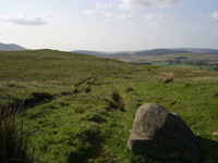
| Near
Cairnennock |
Near to Cairnennock, the road
has made features and kerbstones on one stretch though
the work does not seem extensive in some places. It
is noticeable how it holds to the high ground. At Bardennoch
Hill near Carsphairn it has been used by tractors but
reverts to its natural state further up the hill. Again
work has been minimal. Sections exposed by tractor tracks
indicate it may have had coverings of river pebbles
but these seem to thin out further up the hill. Crosses
(NMRS) have been incised on rock slabs near the pack
road. These may date from the time that Vaudey Abbey
held the lands or relate to pilgrims journeying to Whithorn.
 |
|
 |
| The
Pack Road at Bardennoch Hill |
|
Lower
down the road has been used by tractors |
 |
|
 |
| Section
lower down the hill |
|
Section
higher up with far fewer pebbles |
In the middle ages Thomas Colville
who was lord of Dalmellington and Keresban (Carsphairn)
leased the lands of Carsphairn to Melrose Abbey in about
1190. It seems that it was too remote for them for they
let the land go in exchange for grazing rights in the
Lammermuirs.
Colville then granted the lands
to Vaudey Abbey in Lincolnshire. This too was Cistercian.
There is a record of 1220 that they received permission
from Henry III to import grain from Ireland which can
only have been brought in from the coast, almost certainly
by the pack road. Eventually the monks found the area
too dangerous and relinquished their holdings back to
Melrose (12,
13).
Given that the Military Survey
notes it as the road between Ayr and Kirkcudbright,
it was probably most in use when these two towns became
well established in the middle ages.
 |
 |
| The
Inn at Polmaddy |
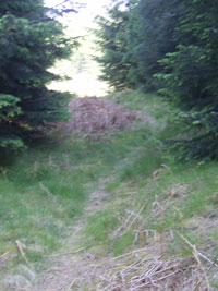
The
Pack Road just north of Polmaddy |
The well-known settlement of Polmaddy
lies on the route. This was a fermtoun that went into
decline in the late 1700�s perhaps as a result of the
land being turned over to sheep farming. Although little
is recognisable today a number of the buildings can
be seen on the old 6�maps. There was an inn, right on
the packhorse route. Polmaddy had a long history as
Robert the Bruce is recorded as staying the night.
 |
| Based
on 1935 1/4 inch OS map. With thanks to Ordnance
Survey |
As said, south of Stroangassel
the road continued to Kirkcudbright. Apart from one
or two tracks that seem the same as the Military Survey
road, nothing is shown on the early OS maps which indicates
that it fell out of use presumably when roads were built
in the late 1700�s.
In earlier times it would have
provided a route between Aeron and central Galloway,
both of which were part of Rheged. At a later date it
could have provided a route from the Anglian settlements
in the New Galloway area up to their settlements in
the vicinity of Maybole, and some researchers would
place the toll point of Laicht Alpin near to Dunaskin,
north of Dalmellington.
Conclusion
The only definite facts known about this road are that
it was in use in the middle ages and may have been improved
along parts of its route, probably by statute labour.
It was also known as the route between Ayr and Kirkcudbright
at the time of the Military Survey around 1750. It has
suffered greatly from agricultural improvements, from
mining and from afforestation and from being replaced
by modern roads, and is now only traceable as a rough
track in a few places.
As to the general problem as to
why the road exists and when it first developed, several
possibilities suggest themselves:
- that it was in fact Roman and being a natural communication
route would have been used in the Dark Ages when Aeron
was part of Rheged and later by the Angles to reach
their settlements in Carrick. An alternative possibility
has to be noted, however, which is that such a road
would most likely have originated from Glenlochar and
have ran on the east side of the Dee and only joined
the Ayr - Kirkcudbright road somewhere near Carsphairn;
i.e. it would have been a different road from the pack
road south of Carsphairn but would have continued into
Ayrshire as the "Roman" road (5)-
this means that the pack road would have developed independently
despite being noted on the Military Survey as a continuous
road between Ayr and Kirkcudbright;
- that either the whole road or only the "pack
road" had its origins in mediaeval times where
Melrose Abbey had granges in Dalmellington and Carsphairn
which would have required the transport of produce,
as was also the case when Vaudey Abbey had Carsphairn
and are said to have imported grain from the coast as
well as transport materials to the south;
- that the whole road developed as a trading route between
Kirkcudbright and Ayr in the middle ages as well as
being used by Melrose and Vaudey;
- that although it was in existence at least in mediaeval
times (as evidenced by the monks) it could have been
improved in some parishes under the statute labour system
from the late 1600's onwards. This could explain why
the road seems to have been well made in Ayrshire and
less so further south.
Such speculations have their
difficulties of course but they do suggest possible
lines of enquiry that will prove or disprove any one
hypothesis. Until then we will have to be satisfied
with the little we do know about this road.
References
(1) George
Chalmers, Caledonia, 1824, Vol iii, pps 236-7; 448-9
(2) James
MacDonald, Notes
on the "Roman" Roads of the One-inch Ordnance Map of
Scotland, PSAS, vol.27, 1893, pp.417-43
(3) AANHS Collections,
2nd Series, Vol 3, 1955, pps 30-33
(4) Newall
and Lonie, Discovery and Excavation in Scotland,
1974, p26
(5) Allan Wilson,
Roman Penetration in Strathclyde South of the Antonine
Wall -Part 1 - The Topographical Evidence, Glasgow Archaeological
Journal, Vol.19, 1995, pps 1-30 (see pps.12 & 13)
(6) William Wilson,
Tynron, Dumfriesshire from the Mists of Antiquity, and
Verse, Dumfries, 1957
(7) John Shaw, Tynron
Glen, 1995 - see also website
(8) James MacDonald,
Notes
on the "Roman" Roads of the One-inch Ordnance Map of
Scotland, The Dumfresshire Roads, PSAS, vol.28, (1893-94),
pp.298-320
(9) J Clarke, Upper
Nithsdale and Westwards in Roman Times, TDGNHAS, 3rd
series, 30, 1951 - 1952, pps 111-120
(10) Allan Wilson,
Roman Penetration in West Dumfries and Galloway, TDGNHAS,
A Field Survey, III, 64, 7 (see p.13)
(11) Newall
and Lonie, Discovery and Excavation in Scotland,
1990, p.11
(12) Bill Blyth,
Kars Castle, Carsphairn, p.4
(13) Carsphairn
Heritage Group, Carsphairn, p.6
Top
|


