The
opportunity afforded by Google Books to quote extracts
from books on their site has been taken here, so that
the text below contains some original text as well as
summaries - the summaries are given in italics. Links
are given to relevant parishes.
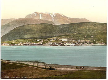
The old photographs of Inverness,
Fort William and Ben Nevis are from the Detroit Publishing
Company's Views of Landscape and Architecture in Scotland
- see thumbnails on Library of Congress site here.
Additional information about parishes
can be found on the Vision
of Britain site and on Scotland's
Places.
Overview
At
the time of the OSA, the road sysytem in Inverness-shire
was just starting to be developed. The Wade roads were
still in use giving a communication to the south and
along the Great Glen to Fort Augustus and Fort William,
although the Bernera road had deteriorated badly. The
only other mention of a military road was of a projected
road from Duthil north to the Bridge of Dulley (the
minor road running directly north from Duthil).
There were main roads running north to Ross-shire and
east into Moray to towns like Elgin and Forres, as well
as Aberdeen.
The
eastern parishes were generally better served by roads
as the statute labour was carried out in quite a few
parishes in contrast to the west and the islands.
Cattle
droving is mentioned frequently and stretched as far
as the Hebrides and Skye. Major cattle markets were
held at various places where the cattle were bought
by dealers for the journey to the south.
There
are frequent mentions of duns, some of which must have
been brochs, and which were generally ascribed to the
"Danes". Also mentioned are old chapels and
burying grounds, probably entailing "coffin roads".There
are the usual complaints about inconveniently sited
post-offices, the time needed to gather peats, and the
prevalence of whisky-houses. There are interesting references
to timber being floated down the Spey and other rivers.
The
situation had greatly improved by the 1830's with even
the island parishes reporting good roads. This was partly
due to statute labour being commuted and implemented
more thoroughly but mostly because of the work of the
Commission for Highland Roads and Bridges. Coach services
and the use of wheeled vehicles were now commonplace,
and the introduction of steamers was having an impact
on the islands.
Other
sources
Virtual
Hebrides
An
interesting item on the "Golden Road" in Harris.
Roads
and bridges in the Scottish Highlands: the route between
Dunkeld and Inverness, 1725 -1925,
G R Curtis, PSAS, Vol 110, (1978-80), pps 475-96
Guide
to the highlands and islands of Scotland, including
Orkney and Zetland, George & Peter Anderson, 1851
Use contents page to navigate to desired area - gives
some details of the roads
Roads
in 1859
This links to the 1859 Report of the Commissioners for
Inquiring into Matters relating to Public Roads in Scotland
and gives an overview of roads in Invernessshire at
that time.
Commission
for Highland Roads and Bridges
The annual reports, which can be found on the Am Baile
site, give considerable details of the roads
in the early 1800's.
The Wade Roads
An overview of the military roads built by General Wade.
Beauly,
The Aird and Strathglass Place-Name Survey (North-East
Inverness-shire)
This place name survey by Simon Taylor contains many
references to roads, bridges, fords, ferries etc in
several parishes of Inverness-shire and will be found
useful for detailed local work.
Geograph
Photos of areas of interest can easily be accessed through
the Geograph site.
Highland Highways: Old Roads in Atholl, John Kerr, John
Donald, Edinburgh 1991
Grampian
Ways, Robert Smith, John Donald, Edinburgh 2002
Abernethy
& Kinchardine
OSA
(vol.13,
p.129)
 |
| General
view of the Grampians - the Raiders Road ran across
this terrain |
About
the year 1730, a branch of the Yorkbuilding Company,
in developing a timber industry here, built roads through
the woods. Trees were floated down the Spey to the coast.
He describes the excessive time taken to obtain sometimes
poor peats.
Roads
and Bridges.—It
was only about the year 1764, when the present proprietor
Sir James Grant entered to the estate, that roads were
begun in this part of his estate, called Strathspey,
which is about 30 miles in length. Since which period,
he has made above 130 miles, when the whole is added
together. The roads in this parish are remarkably good,
and going on yearly, by means of the statute-labour.
The great roads are made through these parishes by Sir
James Grant and the Duke of Gordon. Cross-roads are
now going on, which will prove highly serviceable. The
Duke of Gordon has made one uncommonly good cross-road,
from Glenmore to the Spey, for his English Company.
There is one excellent bridge, built about 25 years
ago, by Sir James Grant on the river Nethy, at his own
expense, and 2 smaller bridges to the east by him, with
some assistance from the county of Inverness. Another
bridge is begun, on a very troublesome rivulet, near
the church of Kinchardine on the Duke of Gordon's property,
with assistance from the county of Inverness. The heritors
of the county of Inverness assess themselves, with much
spirit, for building bridges, &c. which cannot indeed
be said for the proprietors of the low parts of Elgin.
Sir James Grant has lately made about 7 miles of a very
difficult and expensive road, from Castle-Grant, past
his own march in the hills to shorten the way, at least
to open new communications with Forres and Elgin, and
this at his own private expense.*
|
*And
yet, the people concerned in the trade of these
towns (Forres and Elgin), and the numerous proprietors
of the lower estates, seem to be in danger of
forgetting to come forward to meet him. They have
hitherto done nothing of their part of it; and
while they continue so inactive, his great expense
and labour will be lost. The time was when Highlanders
were said to be averse to have any roads made
in or to their country. But it is a little singular
to see the inhabitants of the west of Morray,
who always pretended to superior civilization
to the highland people, so outdone here. It is
hoped therefore they will come forward next season
to save their reputation. The advantages and satisfaction
of the private roads here, and of the King's high
road from Fort George to Perth, through the east
end of the parish, with its numerous bridges,
are so many and so sensibly felt, when contrasted
with the state of the country some years ago,
that it is unnecessary to take up room here in
relating it.
|
Progress
of Civilisation - Cattle raiding was common up
to the mid-1700’s.
Mention
of a bridge at Billimon in the early 1700’s (Ballimore,
1 km north of Nethy Bridge i.e. Abernethy).
NSA
By the time of the NSA, the parish had been transferred
to Elgin. However, there is no particular mention
of roads. (NSA
V.13, p.92).
 |
| Line
of supposed Roman road, looking south. The modern
road is on the line of the Braemar to Fort George
military road which changes direction towards the
right of this photo |
For
further information see chapter
XXV of In the Shadow of Cairngorm, Chronicles
of the United Parishes of Abernethy and Kincardine by
Rev. W. Forsyth, Inverness, 1900. In this chapter he
refers to the tradition of a Roman road in the line
from Braemar to Burghead but thinks it more likely that
such traces of roads can be referred to the movement
of cattle or to the Church. A "via regia"
is mentioned in charters as is a road near Findhorn.
He also gives details of the Military Roads and those
built by the Commissioners for Highland Roads and Bridges.
See also page 124 for mentions of bridges and page 212
for a mention of Rathad-Nam-Mearleach, the Raider's
Road, that could be traced from Lochaber to the east
coast. He says that "entering from the heights
of Rothiemurchis, it skirts the south side of Loch Morlich,
passes out at the Green Loch, then by the Sleighich,
the Eag-Mhor, and the Crasg, into the lowlands of Banff
and of Moray."
Alvie
OSA
(v.13, p.375)
Reference to the “great road leading from Inverness,
Fort George, &c. to Edinburgh.”
Many horses are needed to bring in the peat which for
those on the north of the Spey has to be done on horseback.
The situation is easier on the south.
They sell small parcels of wood in the market towns, 40
miles away, and obtain necessary items there.
NSA
Parochial Economy.
Market-Towns, Etc.—The nearest is Inverness,
35 miles away. Means of Communication.—
The parish has a communication by post with the south,
three times a-week, by Kingussie, Blair-in-Athol, and
Perth; and also with the north by Grantown, Forres,
and Inverness. There is no post-office in the parish;
but there is a receiving-house or sub-office, at Lynviulg.
Public Roads and Carriages.—The great public
road from Edinburgh to Inverness passes through the
whole length of this parish; but although toll-gates
have been lately placed upon this road, it is in some
places so narrow as scarcely to admit of two carriages
passing abreast. The only public carriage that travels
on this road is the Caledonian, or, as it is commonly
called, the Highland coach. It runs three times a-week
for nine months of the year, and for the other three,
only twice a-week.
Ardrosser
or Ardersier
OSA
(v.4, p.88)
As in the NSA, the derivation of the name is explained.
Those who can afford it use coal; others use peat and
turf. The roads are very good; the statute labour is exacted.
NSA
The name may mean "the height of the carpenter"
referring to a vague tradition that several carpenters
were drowned on the ferry when crossing over to work
on the cathedral of Chanonry.
In
1508 James IV passed through on one of his pilgrimages
to Tain. Among the expenses are the following: "October
20, Item, to the freiris of Ardoseir 13s." "
Item, to Robert Mertoune, for passing ower the water
with the goshawk, 10s."
At
the ferry of Fort George, which connects the eastern
part of Inverness with Ross, and the northern counties,
the steamers from London and Leith to Inverness land
and take in passengers and goods (p.472).
They
carry in creels on their back to great distances immense
loads of fish; and they carry their husbands to and
from their boats, when, from the state of the tide,
they cannot get in or out dry-shod. This latter duty
influences the fashion of the costume of the females,
which, as regards their lower garments, is of peculiar
brevity (p.473).
Parochial
Economy.
Campbelton is the only village and market-town in the
parish. Inverness is distant ten miles, and Nairn seven
miles. …There is a post-office in the village,
and, besides the mail, two stage-coaches pass daily
to the south and north. The great post-road from Inverness
to Aberdeen passes through the village, as does also
the military road from Fort-George to Perth, projected
by General Wade, and begun in l753.
A
harbour is needed as the shore has to be used for moving
coal, lime, wood and grain.
Fairs.—A great annual fair, the " Lammas
Market," is held at Campbelton on the 12th of August,—being
the only fair in the parish, and, its object and advantages
being of a varied character, masses of people congregate.
Numerous reapers, chiefly females, come from Ross-shire
and the surrounding country, and they are readily hired
for the harvest, by farmers from Moray and Nairnshire,
as well as from distant parts of this county. There
is usually a good show of lambs from Strathnairn, Stratherrick,
and Strathglass; some sheep and milk cows, and a few
horses. Wool and homespun plaidings, cheese, and fruits
are among the commodities of the country offered for
sale.
Inns, Etc.—There are 10 in Campbelton
- this is far too many.
Fuel.—Coal from Sunderland and Newcastle
is landed on the beach. There are storage yards for
coal. Peat is brought in on carts from Cawdor, and fire
wood is also available.
Barray
OSA
(v.13,
p.326)
Drovers
come here to buy cattle which then have to be ferried
to the mainland at some risk and expense.
Antiquities and Curiosities.—Of
the several duns in the parish, eleven were built by the
Danes; other older duns by the natives. The Danish duns
are in sight of each other to allow warnings to be passed.
The native duns are all on fresh water lochs.
Fish caught is taken to Glasgow.
The writer describes the journeys he has to take in attending
his duties. Some are over long distances which have to
be walked or sometimes ridden, or involve long and expensive
journeys by sea. He mentions a ferry of one mile over
to Watersay and a ferry of 8 miles on the way to North
Uist. He sometimes takes the passage boat from North Uist
over to Dunvegan on Skye.
He describes the excessive amount of time needed to bring
home the peats and how the farmers need more servants
and horses for this purpose than they need to run the
farm. If the tax on coal was removed, this would help
greatly in allowing more useful work to be done.
Miscellaneous
Observations
Kelp is sent to Liverpool and Leith and fish and
oil to Glasgow. Two hundred or more cattle are sold
to drovers and 100 carcases to Glasgow or the nearest
part of the mainland.
NSA
The currents and tides between the neighbouring islands
are very dangerous.
Numerous
watch-towers are over the whole of the islands of Barray,—as
also Duns upon every lake in the place, supposed to
be built by the Scandinavians, when in possession of
these islands. There are likewise many Druidical circles,
as they are designated; but a Danish gentleman, who
lately visited these parts as historiographer to the
King of Denmark, maintains that they are of Scandinavian
origin, and were intended by these people as places
for their heathen worship.
Parochial
Economy.
Market-Town.—The nearest is Tobermory in Argyleshire,
50 miles away.
Means of Communication.—Post has to go
to Dunvegan in Skye via the sub-office in Lochmaddy
from where a boat leaves one or twice a week. The journey
to Lochmaddy involves a ferry crossing to South Uist
and a journey through South and North Uist, about 100
miles in all.
The Commissioners for Lights employ a small vessel from
Barray Head Lighthouse, to sail to Tobermory once a
month with the monthly returns, as a quicker conveyance
than by Dunvegan. The country boats, too, ply at all
seasons of the year to Glasgow with cattle and such
other articles as the country produces; so that the
communication with the mainland is pretty frequent.
Markets.—Two
annual markets for the sale of cattle and horses to
mainland dealers.
Inns.—Three inns in the parish.
Fuel.—The only fuel used in Barray is peat,
which is procured from a distance at great expense and
trouble.
Miscellaneous Observations. Since the last
Account, excellent statute labour roads are made on
the main island, and will now allow further progress.
Boleskine
and Abertarff
OSA
(v.20, p.19)
He describes the journeys the people would make to
their sheilings when it was common to see “an infant
in one creel, and a stone on the other side of the horse,
to keep up an equilibrium”
He
refers to the proprietor of the lands of Gortuleg using
lime from the quarries of Mr Fraser of Foyers to manure
his ground and says that “from the ruggedness of
the road, he is obliged to lead the lime-stone on horses
backs to his farm, or places nearly contiguous thereto…”
He
refers to “the celebrated fall of Foyers and the
beautiful ride from Inverness to this cascade, amidst
a smooth road, cut through tremendous rocks…”
He
describes a sheiling called Killin (the flat stretch
of ground to the south of Loch Killin): “ on the
north side it is so steep that it is denominated Eakin,
or Necessity, implying the great difficulty of passing
that way; on the south-side called Craggin, or Rocky;
and notwithstanding all the attempts by the inhabitants
to render it passable, it in some parts only contains
a path of two or three feet in breadth; and if a horse
stumbles, or is in the least affrighted, it tumbles
down by a precipice into the deepest part of the lake,
and melancholy instances of this kind have sometimes
occurred. When we come to the end of this curious path
we are struck with amazement; behold a valley covered
with all species of verdure, a computed mile in length,
and a half mile in breadth, bisected by a river flowing
in a meandrous course, composed of a variety of streams
descending from the hills at the wester end…. “
He also says that “the lives of infants, when transported
thereto in manner above described” are in danger.
There
is a reference to how useful a canal would be along
the Great Glen.
Antiquity.—There
is a tradition that fortifications on hills were watch
towers where fires could be lit to give warning of an
enemy.
NSA
Fall of Foyers. - There are two cascades known
as the Fall of Foyers. In front of the upper there is
a bridge which allows fine views of the cascade. Before
this was built the chasm above the upper cascade was
bridged by a log which the “more courageous foot-passengers”
used as a bridge. He refers to the tradition “that
a person who resided in the heights of the country,
while in a state of intoxication, passed on horseback
along the log bridge in a moonlight night; and that,
having gone afterwards to the place, he was so horror-struck
at the peril he escaped, that he returned home, went
to bed, and soon after died.”
He
notes that there are several vitrified forts in the
Great Glen, all called “Dungeardal” which
signifies “a protecting eminence, or a guarded
fortified hill.”
Across
the hill of Suidh-Chuiman is the great Military Road
from Inverness to Fort-Augustus; and on its very summit,
within two yards of the road, there is a small cairn,
such as is commonly found where persons have perished
from the inclemency of the weather, or died suddenly.
Parochial
Economy. The nearest town is Inverness, 21 miles
away.
Means
of Communication.— There is a post-office at
Fort-Augustus, to which there is a post from Fort-William
thrice in the week, and a daily one from Inverness,
which travels alternate days by the south and north
side of Loch Ness, and passes within a mile of the manse.
At present, there are no turnpike roads but the old
Military road. It runs through the parish on the south
side for about twenty-two miles; it is under the management
of the Parliamentary Commissioners for Highland roads
and bridges, and is kept in good repair.
The county have lately come to the resolution of placing
toll-bars on this road; but it is not supposed that
the proceeds will suffice to defray the necessary expense
of erecting the bars, &c. With this road a branch
of one of the Parliamentary roads on the west side of
the parish unites at Fort-Augustus.
A branch of a county district road, extending about
three miles, commencing at the east boundary of the
parish, passes by the manse, and joins the main road
half a mile to the west of it. There are other two district
roads across the country: these are not kept in such
good repair.
With one exception, the bridges on the great lines of
road on both sides of the lake are kept in good condition.
There has been, time immemorial, a wooden bridge on
the river Tarff, close to the walls of Fort-Augustus,
kept in constant repair and rebuilt when requisite by
government; but a few years ago, it was greatly damaged,
and is now in a most ruinous state, so that it has become
hazardous even to foot-passengers.
Fairs.—There
are two fairs held annually at Fort-Augustus, in the
beginning of June and end of September, for the sale
of cattle chiefly. Pedlars and shoemakers from various
quarters attend to dispose of their merchandise. There
are besides occasional trysts, in spring and autumn,
for black-cattle.
Written September 1831.
Revised February 1835.
Bracadale,
Isle
of Skye
OSA
(v.3, p.245)
Productions.—This parish produces black cattle,
sheep, and horses. Black cattle is the main staple, of
which numbers are sent to the English markets every year;
from the returns of which the people pay their rents,
and supply themselves with necessaries.
Miscellaneous Observations.—There are no turnpike
roads nor bridges in the parish. There have been some
attempts to make a general road through the parish, partly
by statute labour, and partly by raising money; but the
roads are still, for the most part, in a wretched state.
NSA
Parochial Economy.
Means of Communication.—Post-office at Struan.
The Parliamentary road runs through the parish, some
20 miles; it and the bridges are in good condition.
There is an annual tryst.
Alehouses.—Five licenced and other unlicensed
whisky houses.
Fuel.—The only fuel used in the parish,
except in gentlemen's houses, is peat.
Miscellaneous
Observations.
The most striking variations betwixt the present state
of the parish and that which existed at the time of
the last Statistical Account, are, 1. The formation
of a Parliamentary road, which goes nearly over its
whole length…….
Calder
(Cawdor)
OSA (vol.4, p.349)
Much oat-meal, cattle and sheep are supplied to Inverness,
Nairn and Fort George. Barley is sold to distillers, two
of these being in the parish.
Miscellaneous Observations One inn in the parish,
and 2 or 3 ale-houses, not much used by locals but convenient
for travellers.
The roads are in a tolerable state, being kept in repair
by the statute-labour, which is exacted in kind. The bridges
are in good order, being so kept by Government, as the
military road passes through the parish.
The tenants have not as yet got any of the large shod
wheel carts and waggons; they use the ancient and still
common sort of sledges and carts
Peat is the most common fuel. Wood, furze, broom, &c.
are also used.
NSA
By the time of the NSA, the parish had been transferred
to Nairnshire.
NSA
Vol.13, Page 19
Page 22 In relating a story from the time of Charles
II he says that there was no bridge over the river of
Nairn.
Page
25 Parochial Economy. — Nairn, six miles
away, is the nearest place where the main roads to the
south and east can be reached. There are no coaches
in the parish. The roads are adequate.
Means of Communication.— Penny-post in the
village of Cawdor.
Inns.— One inn, and two licensed spirit-shops.
Fuel.—Peat, and coal from Nairn.
1841/42
Cromdale
OSA
(v.8, p.251)
Timber is floated down the Spey through the parish.
Roads, Wages, Fuel, Etc.—The statute work
goes on very punctually, without the smallest murmur.
Stone bridges are erected over almost every rivulet, either
by the proprietor or the county; and of course, the roads
are in the highest order.
Fuel is every where to be had, on easy terms, and of the
best quality, through the whole of this country.
Taverns.—Many public houses, by the general
resolution of the counties concerned, have of late been
suppressed; and there are at present only 4, besides those
mentioned in Grantown. Two of these are on the turnpike
road, for the accommodation of travellers.
NSA
During a military campaign in 1690, the Spey was
forded near the church of Cromdale (p.434).
Parochial Economy. Market-Town.— Grantown is
the only market-town in the parish. It was founded in
the year 1776.
Means of Communication.—There is a post-office
in Grantown, through which there is a daily communication
with Carr bridge, Forres, and Ballindalloch. The roads
leading to these places are excellent, and kept in thorough
repair. There are also regular carriers from Grantown
to Forres and Inverness every week. Aberdeen carriers
come to Grantown weekly.
There are six inns or public houses. Four markets are
held in Grantown during the year, besides a number of
cattle trysts. The fuel chiefly used is peat.
1841
For further information see Harpers
Bridges for details of a suspension bridge built
in 1881.
Croy
and Dalcross
OSA
(v.11, p.560)
No particular mention of roads.
NSA
Mention of the high road from Kilravock to Aberdeen
(p.455).
Planting.—About
100 years ago, a large area of moor was planted. Due
to the want of roads, “the fir plants were carried
from Perth in creels, suspended from crook saddles.”
Daviot
and Dunlichity
OSA
(v.14, p.67)
Mentions “the Watching Stone” as for NSA.
Time that would otherwise be used to improve the farms
is spent in obtaining peat. Much of this is taken 4
or 6 miles to Inverness on a regular basis. It is likely
that there will soon be a lack of this fuel as the mosses
are running out.
NSA
On its summit (Dun-le-Catti) is a large upright stone,
called the " Watching Stone." There are also
unequivocal marks of its having been used as a place
of rendezvous, or for making signals, according to the
manner that prevailed among our ancestors in remote
ages.
In
describing the parish he says that the roads from the
district to Inverness pass over Drummossie Moor. He
mentions the bridge of Daviot on the Highland road.
Part of Daviot (Culloden’s lands) is part of Nairnshire
which means inhabitants there have to travel 13 miles
to the Sheriff-court of Nairn to conduct any legal business
when Inverness is much nearer.
Parochial
Economy. Market-Town.—The royal burgh of Inverness
is the port and market-town to which the produce is
sent for sale, distant from some part of the parishes
from five to twenty miles.
Means
of Communication.—The parish of Dunlichity
and part of Daviot enjoy a good district road to Inverness.
In the east end of the parish of Daviot, the Great Highland
Road, from Perth to Inverness, passes through it for
nearly three miles, upon which there is one toll-bar
in the parish. The Highland coach, from Inverness to
Perth, travels on this road. The Inverfarigag road,
under the charge of the Parliamentary Commissioners,
formed about twenty-four years ago, branches off from
the Great Highland Road, near to the church of Daviot,
runs through the parishes to the westward for nearly
thirteen miles, and continues on through the parish
of Boleskine to Inverfarigag Pier at Lochness, a distance
of six and a half miles.
The bridges in the district are kept in good order….
For
further information see the Strathnairn
Heritage Association site
Dores
OSA
(v.3, p.479)
Roads.—The roads of communication are properly
attended to by the gentlemen concerned, and annually repaired.
The statute labour is converted into money.
Antiquities.—He refers to there being a
string of forts in the Great Glen which could be used
to warn of the approach of the Danes and Norwegians.
NSA
No mention of roads.
Durinish.
Isle of Skye
OSA
(v.4, p.130)
Mention of ruins of chapels and of duns. No mention
of roads.
NSA
Extent.— The extreme length of the parish from
Unish to Idrigil is 19 miles; breadth, from Vaterstein
to Lynedale, 16 miles. Its extent in square miles is
about 100. But these distances convey no idea of the
difficulty of traversing it, it being intersected by
arms of the sea, by hills and morasses, which render
travelling through it a very arduous task.
Antiquities.—He
refers to some 15 duns or forts, all sited beside the
sea and describes their construction.
Parochial
Economy
Market-Town, Etc.—Portree is the nearest
market-town, some 24 miles away.
Means of Communication.—There is a post-office
with three services a week. There are about 35 miles
of turnpike road.
Fairs.—A small fair for black-cattle
is held each year at Fairy Bridge, 3 miles from Dunvegan.
Inns.—There are two inns and three dram-houses
or ale-houses….
Fuel.—The only fuel used by the common people
is peats.
Miscellaneous Observations.
Twenty-five years ago, there was only one bridge in
the parish, and not a mile of carriage road. Now, there
are lines of excellent road traversing it in various
directions, and every stream that crosses these lines
is spanned by a bridge. The district of Glendale is
the only part that is yet left in its original inaccessible
state.
Initially, the common people would not use the new
roads, saying they bruised their feet and wore down
their shoes, and continued to use the original uneven
and boggy paths. Since they have become used to the
new roads the old paths can now hardly be seen.
Duthil
& Rothiemurchis
OSA
(vol.4, p.308)
 |
| The
military road between Duthil and Dulsie Bridge passes
over what must have been bleak and forbidding terrain
- looking south |
Roads and Bridges.—These are maintained by
statute labour, exacted in kind. The 13 miles of the Grantown
to Aviemore road was widened from 12 to 24 feet in 1779.
As 9 miles of this road is in the southern part of the
parish, it is of more benefit to the public than the parish.
The bridges had originally been built by the proprietor.
One built in 1700 over the Water of Dulnan was replaced
last year (1791).
A military road between Duthil and Dulleybridge is underway
and promises to be of a high standard. Its line is more
convenient and shorter than originally planned thanks
to the careful surveys of Colonel Montgomery, Inspector
General of military roads.
Miscellaneous
Observations. - He gives a graphic description
of a major famine circa 1680 (page 316).
There are two rocks called Craig-Elachie, ‘Rock
of Alarm’, 30 miles apart at either end of the
district of Strathspey (at Aviemore and near Charlestown
of Aberlour). If an enemy approached a signal was sent
between them calling for all able to bear arms to assemble
at a particular place. The Grants motto is 'Stand fast
Craig' Elachie.'
There is an inn at Aviemore. There are no ale-houses
but there are 10 houses in which whisky ("a beverage
which seems fit only for daemons") is sold.
NSA
By the time of the NSA, the parish had been transferred
to Elgin - see entry for Duthil
and entry for Rothiemurchis.
Glenelg
OSA
(v.16 p.265)
Over the sound of Kylrea the black cattle annually driven
to market from Sky, and part of the Long-island are made
to swim; and though the current is so very strong, yet
few accidents happen. The number cannot be exactly ascertained,
but in general they may be reckoned about 2000.
Mention
of the barracks at Bernera and of the remains of towers,
two of which are in good condition.
Fuel: Much time spent in bringing peat from
some distance - it is often affected by the weather.
Now that the duty on coal is removed they may start
using this.
Miscellaneous
Observations The roads are bad. The military
road from Fort Augustus to the barracks at Bernera,
was built after 1745, with local contractors building
the bridges and the military the road. The contractors
selected bridging points where materials could be had
most cheaply but this made the road longer and more
hilly. The road itself was not "made sufficient,
or of proper dimensions."
 |
 |
| The military road can
be easily followed on both old and recent maps.
From O.S. sheet 41, Glen Shiel and Glen Garry, 1929
showing a stretch above Loch Cluanie, and Mam Ratagan.
With thanks to Ordnance Survey. |
In
1792, Provost Brown of Elgin and a country gentleman,
surveyed the road and made a report which it is hoped
the Government will act upon. The line is the shortest
way from the capital to Skye and the Long Island, and
expenses would be less as the bridges are already built.
As it stands, the road is unrideable and travellers
have to come by sea from Argyleshire at great expence.
If the new road is built it needs to have a stage-house
on it.
NSA
View
Larger Map
Image of Dun Telve (use mouse to navigate through image)
Antiquities.— There are two of the “ancient
Beorgs, Burghs, or Dunes, usually called Pictish Towers“
in Glenbeg. It is thought that they were not built by
the Celts but rather by the Danes or Norwegians. The
stones were brought more than a mile from a nearby mountain
- the stones dropped on the way can still be seen where
they lie.
Parochial Economy.
Means of Communication, Etc.—Inverness is
the nearest market town, some 70 miles away. The Parliamentary
road to Skye goes through the principal glen to the
ferry at Kyle Rhea; it and the bridges are in excellent
order. It goes over the stupendous pass of Mam Rataan.
View
Larger Map
Image of Mam Ratagan (use mouse
to navigate through image)
The Kirkton of Glenelg is a picturesque village and
is quite large. There is also a village at Arnisdale.
The nearest post-office is Lochalsh, 20 miles by road,
although the ferry of Loch Duich is used by parishioners
at some expense to reach this place - it is hoped this
situation will improve.
Fairs.—In this parish are held three fairs;
to correspond with the great fairs in the south; in
the months of May, July, and September respectively.
Inns.—Three
Fuel.—Mostly peat and turf; some of the
wealthier sheep-farmers use coal from Glasgow or Liverpool
though it is expensive.
Miscellaneous
Observations.
The most striking variation betwixt the present state
of the parish and that which existed at the time of
the last Statistical Account, consists in its being
opened up by the road which runs through it; and by
the hebdomadal visits of a steam-boat, regularly paid,
save during the stormy months of winter.
Harris
OSA
(v.10
p.342)
In
the South Isles there is a shell sand that would make
a good manure but the nature of the terrain and the lack
of cart roads would prevent its use.
Sea-ware
is carried on people's backs to the fields; the ground
is so rugged that even the country gearrans would be unable
to make their way along the paths.
They
are sold in small lots from each farm to drovers, who
ferry them to the Isle of Sky in the month of July; and
from thence they are driven to market, sometimes to the
S. of Scotland, but more frequently to England. Though
there may be in all Harris about 900 milk cows, supposed
a breading stock, yet the number annually sold to drovers
does not exceed 200. (p.356)
The gathering of peats takes an excessive amount of time.
Description of the trade in kelp.
Antiquities
(p.374&ff).
Mention of the Danish forts, so sited as to give warning
between them, the Temple and Well of Annat, many chapels
and a religious house at Rowdill.
Ecclesiastical
State (p.379).
Seven stated places of worship, the furthest being
36 miles apart. One previous Minister, on a visit to the
island of Pabbay, was storm-bound for seven weeks.
NSA
Fairs.�The
annual cattle-tryst takes place in the month of July.
Inns.�There are two licensed inns in the parish.
They are seldom frequented by the natives.
Fuel.�Peat is the only fuel used by the inhabitants.
Inverness
OSA
(v.9 p.603)
Stores are taken to a King’s galley on Loch Ness
which then takes them to Fort Augustus.
The
Town.—A royal burgh, its first charter was
granted by Malcolm Canmore. It has always been loyal
to the Crown and has defended against incursions from
the west as shown by some place names, viz. “Pallfaire,
that is ‘The Watch Town;' a hill, Tomnafaire, '
The Watch Hill;' and a large stone, Clachnafaire, '
The Watch Stone.' “
Seven
vessels belong to the harbour and sail to London with
local produce and return with useful materials.
Roads
and Bridges.—There are 2 military roads which
pass through this parish; and which are kept in good
repair by Government. The other roads are equally well
attended to. The statute-labour is partly commuted.
There are 3 bridges, the principal of them is the bridge
over the Ness, a beautiful structure of seven arches.
It was built in the year 1688. It is a toll-bridge,
by act of Parliament, and makes a good addition to the
revenue of the town.
Miscellaneous
Observations
Too much time is spent in cutting and bringing home
peat from 5 miles away, which affects the farming. The
removal of the coasting duty on coal and setting up
a coal yard in the town to ensure a supply in winter
would be a great benefit.
He refers to the benefits that would result if a navigable
canal was to be built to Fort William.
About
30 years ago there was only one chaise, a four-wheeled
one; but at this time, there are 2 coaches, 12 four-wheeled
chaises, and 1 two-wheeled; 6 of the four-wheeled chaises
are let for hire by innkeepers. The principal inns in
town were indifferent till of late; they are now commodious
and comfortable…
Antiquities.
Three cairns which appear to have been sepulchral
monuments, lie in the Beauly Firth, and one is accessible
only at low water - this suggests that they once stood
on dry land and that the sea encroached on it after
the erection of these cairns. (See NMRS
records - these have been identified as crannogs)
NSA
A guard used to be stationed on high ground above
Clachnaharry (which means the watchman’s stone)
to watch for any hostile advances from Rossshire or
Strathglass.
He
mentions an oblong square, with rounded corners and
a ditch, sited at Loch Dochfour and thought be a Roman
encampment (Chalmers Caledonia
I,63). The remains no longer exist and may not have
been Roman - see Scotlands
Places. Recent work however suggests that there
may have been wooden forts in Moray and at Tarradale
on the north side of the Beauly Firth - see The Last
Frontier, The Roman Invasions of Scotland, Antony Kamm,
2004 & 2009, page 79.
Parochial
Economy. Market-Town.
Inverness. In 1831 the streets and pavements were
relaid. There is now gas lighting.
Coaches
and Public Conveyances
The mail-coach from Aberdeen to Dingwall, Tain, and
Thurso passes through each day, and there are two coaches
each day to Aberdeen by Elgin and the coast road. Coaches
also run to Perth by the great Highland road, and Diligences
to Strathpeffer and Cromarty. Steam and sailing vessels
call in regularly.
Roads.—
The principal roads are managed by the Parliamentary
Commissioners for Highland roads and bridges and form
parts of the following roads:
1. The great south road to Aberdeen via Fort George
and Elgin
2. The Highland road south to Perth
3. The Old Military road south of Loch Ness to Fort
Augustus and Fort William
4. The road on the north side of Loch Ness to Urquhart,
Glenmoriston, Glenshiel, and Skye
5. The great north road to Beauly, Dingwall and Tain
6. The road to Kessock Ferry that gives access to Ross-shire.
All
these roads were either military roads improved by the
Commissioners, or built by them with contributions from
the county. They continue to be funded jointly by Government
and the county, the latter receiving tolls from some
of the roads. Repairs to the roads near Inverness cost
between L.10 and L.15 per mile.
Local
roads are managed by district trustees and are funded
by a general assessment originally authorised under
local statutes and now consolidated in an act of Parliament
passed in 1830.
 Bridges.—There
are two bridges across the River Ness. One of stone
with seven ribbed arches, erected in 1685 by contributions
throughout the kingdom, at a cost of L.1300; and one
of wood, finished in 1808, from public and private subscriptions,
and which cost L.4000. A pontage is levied at both bridges
from strangers. Bridges.—There
are two bridges across the River Ness. One of stone
with seven ribbed arches, erected in 1685 by contributions
throughout the kingdom, at a cost of L.1300; and one
of wood, finished in 1808, from public and private subscriptions,
and which cost L.4000. A pontage is levied at both bridges
from strangers.
Two small but beautifully wooded islands in the Ness,
a mile above the town, are now in course of being connected
with the opposite banks by airy chain suspension bridges,
the interior being laid out in walks; and when this
improvement is completed, (one of the bridges has been
in existence for many years, and funds have been recently
collected for the other,) Inverness can boast of a set
of public promenades almost unequalled for extent, variety,
and beauty of scenery, by those of any town in the kingdom.
Fairs.—At
present there are four major fairs in Inverness though
the establishment of shops has made them less important.
There are several cattle trysts held near Inverness
and a major wool-market each July which is attended
by wool merchants from the south of Scotland and England.
Sheep are also bought and sold. There are also two weekly
market-days and a hiring fair.
Inns.
- There are 52 in the burgh and 19 in the landward
part of the parish. There is an excellent hotel in Inverness,
the Caledonian, which can cater for more than 80 people,
and has a large coaching and posting establishment.
Fuel.—The
main fuel is coal from Sunderland and Newcastle, and
some from the Forth. Some peat is used, mostly for kindling.
January 1835
Kilmalie
OSA
(v.8 p.407)
Language (p.430, footnote). - Corpach, a place close
to the shore, on an angle of Locheile, is a compound,
signifying the field of corpses. It is well known, that
men of note were anciently interred in Iona. Such as were
brought from the north of this parish, were kept in state
at Corpach for a night, or perhaps longer. Hence the original
of the name. Ochinich is another place upon the shore
of Lochleven, where the dead, brought from Perthshire,
were embarked for the consecrated ground of Iona, and
means a groan, or deep conflicting sigh of lamentation.
Churches Etc. Nine places of worship in the
parish.
Antiquities. Description of an ancient fortification
called Dundhairdgall near Inverlochy.
Proposed Improvements.— Refers to the feasibility
of building a canal along the Great Glen and the benefits
that would arise from this.
 Miscellaneous
Observations.—There are 2 four wheel chaises,
one of them belonging to the vintner at Fort William,
which he lets to travellers: There are other 3 kinds of
machines of two wheels each; one of these also belongs
to the same vintner. There may be about two dozen carts. Miscellaneous
Observations.—There are 2 four wheel chaises,
one of them belonging to the vintner at Fort William,
which he lets to travellers: There are other 3 kinds of
machines of two wheels each; one of these also belongs
to the same vintner. There may be about two dozen carts.
Sledges are chiefly used in leading home hay and corn.
Peats, for the most part, are carried in creels upon horseback.
There are between 80 and 100 boats in the parish. Of these,
60 belong to Maryburgh; where there are also 4 sloops,
from 20 to 40 tons, and 1 brig of 200 tons.
There are 8 stated ferries; 5 of which are on the salt
water.
Bridges and government roads are in a good state; but
the country roads, which are carried on at the expence
of the counties, have been, and still are, much neglected.
The statute labour is commuted at 6d. per day.
Two inns, many whisky houses.
 NSA NSA
The view from the top of Benevis is very extensive;
but it is a Herculean labour to reach its top, and the
attempt should not be made but by able bodied and healthy
persons, with a proper guide.
A fine road runs through “a mili dorch”
or the “dark mile”, a picturesque valley that
lies between Loch Lochy and Loch Arkaig. There is a
bridge at Mucomre and a ferry on the Spean, two miles
from Fort William. With busy roads on both sides of
the river, however, a stone bridge would be better.
Those travelling by steam-boat on the canal would also
find it of benefit in getting from Banvie Locks to Fort
William.
Parochial Economy.
Fort William is a market-town; but the market-day is
scarcely distinguished from another day, so little business
is doing. The village of Corpach, at the south end of
the Caledonian Canal, is the only other village in the
parish.
Means of Communication.—There is a regular
communication with Inverness and Glasgow by steam in
summer twice a-week, and in winter once a-week, besides
a daily post from the south and from Inverness; also
three times a week to and from Arisaig. There is a penny
post-office established lately at Corpach.
Fairs.—There
are two annual fairs at Fort William at which much business
is done.
Inns.—There are three inns in the parish;
and dram-houses without number,—some of them licensed
to sell spirits, some selling without license.
May 1835.
For
further information see the Electric Scotland site for
chapter
IX of Antiquarian Notes, Historical, Genealogical
and Social (Second Series) Inverness-Shire, Parish by
Parish by Charles Fraser- Mackintosh. He refers to a
map of Lochaber drawn up in 1803 that shows the roads
in the area.
Kilmonivaig
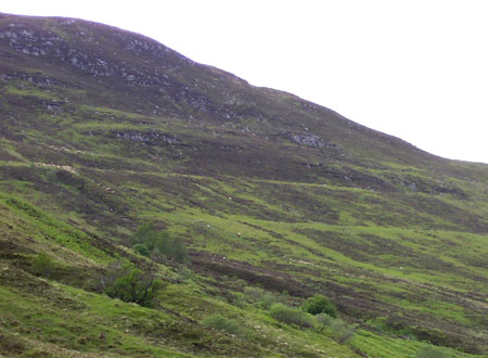 |
| The Parallel Roads |
OSA (v.17 p.543)
Antiquities—The parish contains the ruin of
the Castle of Inverlochy. There had been a thriving burgh
once, near the castle, called by early historians the
Emporium of the west of Scotland but nothing remains except
some paving which may be the streets of this borough.
Interestingly, when talking about the Parallel Roads
of Glen Roy he thinks that they were roads and that they
were either built by the Kings of Scotland, who were residing
in Inverlochy at that time or by the Fingalians. The purpose
was thought to be for hunting deer. For an explanation
of how they were formed, see here.
NSA
Ecclesiastical State.—There is a mission established
on the Royal Bounty embracing the districts of Brae
and Lochaber, in this parish, and Locharkaig, in Kilmalie.
The missionary officiates in rotation, and as often
as circumstances admit, at various stations within his
bounds.
1842
Kilmorack
OSA
(v.20 p.401)
No local market. Many black-cattle are sold.
Manufactures.—The only manufacture carried
on in the parish is that of wood. Many thousand fir-trees
are annually cut in Lovat's, the Chisholm's, and Struie's
woods. These are sawn into square timber, planks, deals,
&c. for the home and English markets.
Post-Office.—Until
a few years ago mail was delivered from the nearest
post-town of Inverness by a privately appointed runner
when Colonel Fraser of Belladrum was successful in his
representations to have a post office established in
Beauly.
NSA
Navigation.— There are only two small vessels
belonging to the parish. A great number of vessels,
however, from other quarters, trade to the place with
coals, lime, &c.: and in return, they are supplied
with cargoes of wood.
Parochial Economy.
Market-Town.—The nearest is Inverness,
11 miles away. Communications are excellent as the Parliamentary
road runs through the parish.
The village of Beauly has had a post-office for 50
years and the north mail passes through each day; foot-runners
take the mail to various districts.
The principal bridges in the parish are, the handsome
granite one, of five arches, erected some years ago
near the influx of the Farrar into the Glass; and the
Lovat Bridge, built in 1810, across the Beauly. This
latter bridge was built at an expense of nearly L.10,000.
Fairs.—The
most important cattle fair in the north of Scotland
is held on the Muir of Ord and is attended by dealers
from the south, and elsewhere. Eight markets are held
between April and November.
There are also four fairs held in Beauly, though of
little importance.
Inns.—One main inn, and 9 public houses.
Fuel.—Peat, coal and wood.
Kilmuir,
Isle of Skye
OSA
(v.2 p.547)
Mention of remains of chapels and as in the NSA, the
“Danish forts.“
No bridge in the parish. The roads were neglected till
recently but this improved when many of the principal
persons were made Justices of the Peace. At first statute
labour was exacted in kind, but commutation was found
more efficient.
NSA
There are six forts in the parish viz. Dun-Scuddeburgh,
Dun-Liath, Dun-Bhannerain, Dun-Barplacaig, Dun-Tulm, and
Dun-Deirg. They are thought to be Danish except Dun-Deirg
which seems to have been built by the Druids. They are
all in sight of each other, no doubt to give warning of
an approaching enemy.
As
they have few or no carts, they are under the necessity
of carrying manure, peats, potatoes, and all such commodities
in creels upon their backs. So little do the women care
for the weight of the creel, though full of peats or
potatoes on their backs, that, while walking with it,
they are engaged either at spinning on the distaff,
or knitting stockings.
Parochial
Economy.
Portree, 24 miles away, is the nearest market town.
A considerable portion of the parish has not the advantage
of a road. Along the south-east boundary of Kilmuir,
a road of about nine miles in length was formed, ten
years ago, to the district of Steinscholl. As yet, however,
it passes through but a small portion of that district.
To this most important means of communication, a little
is annually added by statute labour, and it is anticipated
that in a few years the three districts composing the
parish will be supplied with roads.
The
nearest post-town is Portree with a sub-post-office
in Kilmuir district 2 miles from its southern boundary,
and about 21 from Portree. There is a runner three times
a week. A private runner takes letters to Kilmaluag
and Steinscholl districts.
Inns.—The number of small inns in the parish
is 3, one in each district.
Fuel.—Peat.
Kiltarlity
OSA
(v.13 p.507)
Caplach lies three miles from the school by very bad
road.
In a list of occupations there are 4 chapmen or small
merchants and 3 drivers.
Unlike 50 years ago when there was only one wheel-carriage,
there are now 376 carts, 40 coups or small wagons, and
361 sledges. Sledges were used by all classes for the
peats and on the farms. The sledges were used to carry
manure in creels called keallachs - many are still used
in the upland areas.
A missionary preaches in 4 remote places in the upland
areas of this parish and Kilmorack.
Manufacturies.—Lint mill, waulk mill and
dye-house as well as 8 distilleries that supply Lochaber,
Kintail, and Strath-glass.
In referring to a saw mill he says trees are cut into
logs about 10 or 12 feet long and carried by horses up
to two miles to the rivers Glass, Cannich and Beauly and
then floated 30 or 40 miles to the saw-mill. From there
they are carried 3 miles on land as the fall on the river
is too steep. They are then floated on rafts a few miles
more to a wood-yard in Lovat where they are loaded onto
boats for Leith and London.
Miscellaneous Observations: Those living close
to peat are well supplied, others more distant have to
spend much time and effort in obtaining them.
The road from Inverness to this parish, divides into two
branches, near the church; the one branch leading to Urquhart,
Fort-Augustus and Fort William; the other, to Strath-glass
and Kintail, along the south side of the Beauly and Glass;
this last road is not yet finished, it has only come the
length of Strath-glass. It is an excellent road, made
at a considerable expense. The statute-labour has been
lately commuted in this and the neighbouring parishes,
which, it is hoped, will have a happy effect in keeping
our roads in good repair, and in making new roads and
bridges where these are necessary. A number of bridges
have been erected within these few years past over all
the rivulets that cross these roads.
NSA
The Parliamentary road which intersects the parish from
east to west is upwards of 40 miles…
About
a mile above their junction where they become the River
Beauly, the rivers Glass and Farr are crossed by two
excellent bridges.
The
River Beauly, although not navigable beyond the village,
is used to transport timber.
The
road on the north, or Kilmorack side, (of the River
Glass) is that generally used by travellers, and is
confessedly one of the most romantic drives in the Highlands.
The
Protector Cromwell used a great quantity of timber from
Strathglass, in the construction of his fortifications
at Inverness, and, in fact, until within late years,
wood was the only article exported from the parish
Parochial
Economy.
The nearest post-office is at the village of Beauly,
which is about two miles from the eastern boundary of
the parish, but there is a runner who daily traverses
a great part of the parish, and leaves the letters at
centrical receiving-houses.
Inns.—Two or three inns.
Fuel.—Peat and English coal, available
at Beauly.
Kingussie
OSA
(v.3 p.34)
With no village in the parish or district, most things
have to be brought in from 40 miles away; tradesmen have
no fixed place of business; and the development of enterprises
such as wool and flax is hindered as there are not enough
skilled people in the one area.
There
may have been a Roman camp on a moor between the bridge
of Spey and Pitmain. Although one has to be careful
of such claims, an urn full of burnt ashes was found
nearby (the Celts never burned their dead), as was a
Roman tripod which lends some weight to the theory (NMRS
record - no evidence could be found at the location)
NSA
There may be a Roman encampment on the moor between
Bridge of Spey and Pitmain.
Parochial
Economy.
Means of Communication, Etc.—The
nearest market town is Inverness, 46 miles away. Kingussie
has a post office, with a service three times a week.
The great Highland road between Perth and Inverness
passes through here for 16 miles. The Caledonian coach
runs on this and there are also weekly carriers from
Kingussie to Perth and Inverness. The road is busy in
summer.
A good bridge crosses the Spey, four miles above Kingussie.
Fairs.—There
are commonly five or six markets in the parish throughout
the year; the principal one of which is held in June
for selling wool, lambs, &c. Another is held in
November for settling accounts, and engaging servants;
and a third in February. Other three are held for buying
and selling cattle, at different times, so as to suit
dealers passing from the southern and northern markets.
Inns
and Alehouses.—Two inns and ten or eleven
ale-houses.
Fuel.—The
common fuel used here is peat, procured, at a very great
expense, from mosses in some places four and five miles
distant.
Miscellaneous
Observations
Since the last Account, roads have been made to several
parts of the parish and carriers now carry on a regular
service, as well as the above-mentioned coach between
Perth and Invernes.
Kirkhill
(Wardlaw & Farnua)
OSA
(v.4 p.111)
Vessels of 50 tons can reach as far as Beauly.
Antiquities In referring to some cairns he mentions
the public road to the north crossing the moor of Achnagairn
and running to the ferry of Beuly.
Miscellaneous Observations
Turf is used as fuel, the peats being nearly exhausted
and coal is too expensive due to the tax on it.
Of the 8 public houses, all were closed (because of their
bad effects) except two at convenient distances on the
public road.
NSA
Navigation.—A considerable number of vessels
land at two places on the Beauly Frith, viz. Fopachy
and Wester Lovat; but there is no harbour nor any proper
sort of landing-place. These import lime and coals,
and export timber and grain.
Laggan
OSA
(v.3 p.145)
No particular mention of roads. He gives some details
about the hunting noted in the NSA.
NSA
Historical Notices.—He notes a tradition
that the Kings of Scotland hunted at Lochlaggan.
Parochial
Economy. Means of Communication.—The nearest
market-town is Kingussie, distant ten mile; Fort-William
is distant forty to the west; Inverness, fifty-five
to the north-east. We have had a daily post for the
last three years. There is a regular intercourse with
these places, and also with Perth, by carriers; and
the Highland mail passes twice a-day north and south,
through a corner of the parish.
Roads.—Till
within the last twenty years, the roads in this parish
were very bad indeed. About that time, the Parliamentary
road from Fort-William, till it meets the Highland road
at the Bridge of Spey, near Kingussie, was made under
the direction of the late Mr Thomas Telford. This road
has been of very great advantage not merely to this
parish, but to the whole of Badenoch. There is a handsome
wooden bridge over the Spey, at the church of Laggan.
There is another stone bridge on the line of the military
road at Garvamore, one at the burn of Cluny, and two
over the Mathie.
Fuel.—Mostly peat but some find coal
cheaper even though it has to be brought 40 miles from
Fort William.
February 1839.
Moy
and Dalarrossie
OSA
(v.8 p.499)
Moy had been known as Starsach-na-gal, i.e. the Threshold
of the Gaels, or Highlanders, a reference to a narrow
pass that gave access to the south. As it was easily defended,
the local chieftan could raid the low country and defend
against pursuit. He also imposed a tax of cattle on others
using the pass.
Roads
and Bridges.—The road from Inverness to Perth
passes through this parish. It was made, and is still
kept in repair, by Government. Besides a large and useful
bridge on the river Findhorn, there is a number of smaller
ones on this road, within the parish, which were built
and kept in repair at the public expence. There are
roads of communication betwixt the different parts of
the parish, now forming by the statute labour; but there
is so much to be done in that way, that it will take
a considerable time before these roads can be completed.
Inns and Alehouses.—There are in this parish
2 inns, on the public road, and about 12 small public
houses that sell whisky.
Fuel.— Peat
NSA
Parochial Economy.
Markets, Etc.—Inverness is the nearest market
and post town, at 12 miles distance. The main markets
are held there each year. The mail may be brought closer
by the Highland road which runs through the parish for
10 miles. It has recently been improved and is now less
steep and shorter by 3 miles. The Perth to Inverness
coach passes through each day.
There are also district roads funded by the statute
labour conversion money. The bridges on these roads
are wooden and often swept away. There was a stone bridge
over the Findhorn that was swept away in 1829 - it has
been replaced by a bridge of wooden arches placed on
stone pillars. It cost L.2600.
Fairs.—Six
cattle trysts and a lamb market are held at the Inn
of Freeburn in the centre of the parish. They are held
at times that suit the dealers returning from the major
markets in the north.
Inns.—There are three inns in the parish;
two of the houses are good, and the third merely a dram-house.
They are all on the line of the Highland road, and are
in summer well supported,—the number of travellers
being then great.
Fuel.—The fuel used is peat which is
available locally though there is some expense in their
carriage.
North
Uist
OSA
(v.13 p.300)
There is a cattle fair in June attended by drovers.
The risk and expense of ferrying the cattle to Skye reduces
the price.
There are only 8 carts here - many more could be used
to advantage as the land is so level.
Fuel.—Peat is used but the time and manpower
used in gathering it is wasteful and could be used in
improving the farms.
Many Danish forts, some on artificial islands with a causeway,
others on high ground. Two are in sight of each other
to allow warning of any danger.
Miscellaneous Observations. When the tide is
out travel is very easy, otherwise the going is very difficult
there being “very bad steps, especially in winter
weather.” He notes, however, that statute labour
work was now being carried out.
NSA
Parochial Economy.
Goods are supplied by sea from Greenock and Glasgow,
some 200 miles away.
Lochmaddy
used to have a post office but it is now a sub-office
to Dunvegan, for no good reason. A packet runs from
Lochmaddy to Dunvegan, twice a week, if the weather
is good. It is supported by a small sum from the post
office and an assessment on the inhabitants. It only
takes 4 days for letters and papers to reach here from
Edinburgh.
The
situation has greatly improved with there now being
80 miles of good road, 50 of these being statute labour
and part-funded by an assessment on occupiers of land.
There are now 180 carts and it is reasonably anticipated
that soon all those who have a horse will have a cart
also.
Fairs.—Two
fairs for the sale of black cattle and horses.
Inns.—The inns in the parish are four.
One at the packet station at Lochmaddy, another at Carinish,
the opposite extremity of the island, and the other
two at proper intermediate distances along the road.
Fuel.—Peat.
Miscellaneous
Observations.
The plan for a steam-boat to sail up the west coast
of Skye and the Long Island opposite, as well as the
east coast of Skye and the nearby mainland, to collect
cattle and other produce for Liverpool and Glasgow is
very feasible and would be highly beneficial.
1837.
Pettie
OSA
(v.3 p.21)
Most of the black cattle here are brought from the
Highlands when young and then sold on to dealers for the
English market when unfit for work. Wool from the sheep
is used locally and the sheep are sold to butchers in
Inverness and Fort-George.
Fish, Harbours Fish caught here is sold in Inverness.
It is landed on the shore and a small harbour or two would
be useful.
Roads
and Bridges.—The military road from Stirling
to Fort George crosses this parish, that road with two
bridges on it within this parish, was made, and is kept
in repair by government. The military road from Fort George
to Fort Augustus, passes along the whole length of the
parish; there are four bridges on it. This road was made
about twelve years ago by the statute labour, but has
lately been repaired, and in some places altered in the
direction, and four bridges have been built upon it, at
the public expence. Both these roads are in excellent
repair. The county road from Inverness to Nairn goes also
through this parish ; it was made by the statute labour,
and had two or three bridges built on it at the expence
of the county.
Poor.—The poor are not numerous in this parish,
but it is much infested with beggars from other places
Ale-houses and their effects - He notes that
there are twelve - they have the usual pernicious effects.
NSA
On the old Nairn road, at the boundary line between
Petyn and Bracholy, is clachan-tuil, or holed stone,
the use of which is unknown; but the water collected
in it was imagined to cure wens.
He refers to there having been 4 mills in the parish
in the past.
A pier, to the erection of which the Fishery Board would
contribute so largely, would be an advantage, not only
to the fisher, but to the farmer, in the saving of strain
to his horses in drawing coals and lime through a soft
beach, without being obliged, as at present, to avail
himself of moonlight or daylight to suit the state of
the tides; and by facilitating the shipping of grain
or wood.
It is another disadvantage of which the fishers of this
coast complain, that, although their business be on
the great waters, they are obliged to pay road-money
on land. The fishers of Ross-shire are said to be relieved
from this impost; and there are perhaps twenty fishers
in Ross-shire for every one in Inverness-shire.
Parochial
Economy. Market-Town.— Inverness.
Two stage-coaches and the mail coach run daily between
Aberdeen and Inverness on the coach road which passes
through this parish. It is routed to pass near Fort
George through the village of Campbelton. A new road
has started on higher ground which will have much the
same line as the old Nairn road and will be less hilly,
save 2 miles between Nairn and Inverness, and make access
easier to Cawdor and Croy. It is hoped that a post-office
will also be a benefit of the new road; at present the
nearest post-offices are at Fort George and Inverness.
The only tryst held in the parish is the long established
and much frequented Campbelton market, held on the confines
of Pettie and Ardersier, at Lammas. It is here that
farmers from Morayshire and round Inverness engage their
shearers; a good deal of business is done in the sale
of lambs, cattle, horses, and small quantities of wool
not worth being offered at the Inverness wool market.
This
district, from its being traversed by the public road
to Aberdeen, is peculiarly infested by impostors, pretending
to be shipwrecked sailors, clerks, and schoolmasters
whose health has failed, and vagrants with forged or
out-dated passes, or begging certificates furnished
with too much facility. We expect a remedy to this evil
from the adoption of the Constabulary Act by the county,
and the rural police now in course of formation.
Fuel.—Coal (English chiefly) is the fuel
of the farmers. On Gollanfield and Culloden properties,
peats are a good deal used. The poorest classes avail
themselves of any brushwood which they can find.
Ale-houses.—There are two licensed dram-houses
on the old Nairn road, and two in the village of Stuartown.
Portree,
Isle of Skye
OSA
(v.16 p.138)
The river Sligichan has no bridge and is so violent
in spate that travellers dare not attempt to cross it
(p.143).
Two duns in the parish, thought to have been built by
the Danes or Norwegians as watchtowers and strongholds
(p.143).
Advantages Etc
…..it is also a considerable advantage, that
from Sconcer to Acersaid, and thence down to Snizort,
is the best piece of made road in all Sky. Here, too,
the latter end of every May and July, is held a well known
fair, to which all Sky, except the districts of Strath,
Heat, some from Uist and Harris, bring their cattle. ......The
numbers that, on these occasions, flock from all parts
to Portree, are immense; and though there is a large,
commodious, and well kept inn at Acerfaid, many, even
of the bed, are often put to their shifts for lodgings.
Five miles south from Acerfaid, at the meeting of the
three principal lines of road in Sky, is the public house
and post-office of Sconcer, from which, by means of two
runners, and the post from Inverness to Dunvegan, all
the letters of Strath, Heat, Troternish, and Mingnish
are distributed.
NSA
Parochial Economy.
Markets.—Market held in Portree for the
sale of black-cattle. There are several shop-keepers
and a steam-boat arrives weekly from Glasgow.
An excellent Parliamentary road runs through the
parish; it is kept in repair by an assessment on the
heritors in the county.
In the village there is a post-office, to which there
is a post three times a week.
Fairs.—Three
fairs, two for black-cattle, and one for hiring and
other business.
Inns.— Respectable public houses in Portree
and the district of Sconcer for travellers and those
attending the fairs.
Fuel.—Peat is used. It is cut when the
people would be doing no work so it costs them nothing.
Miscellaneous Observations.
On the surface of the parish, the greatest change has
been produced by the Parliamentary and other district
roads throughout the parish.
Sleat,
Isle of Skye
OSA
(v.16 p.534)
The gathering of peat takes too much time.
Mention of the sale of black cattle. Five duns, three
of which are Danish.
No made roads.
NSA
Parochial Economy.
No towns or villages in the parish.
Means of Communication.—A parliamentary
road runs through here from Armadale to Broadford, some
16 miles; there are also district roads. A steam-boat
from Glasgow to Portree calls weekly in summer, and
every three weeks in winter.
Fuel.—Good turf.
Miscellaneous Observations. Since the former
Statistical Account was written, various improvements
have taken place in the parish. Excellent roads have
been opened……
Small
Isles (Eigg, Muck, Rum, Canna)
OSA
(v.17 p.272)
Advantages and Disadvantages.—
Fort William, the post town, is 40 miles from Ardnafouran,
from where it is a further 11 miles by sea to Eigg. It
would be a great benefit if a post office was set up there
and a packet established between Arisaig and Uist which
could call in at Eigg and Canna (p291).
As it is so far from public markets, cattle has to be
sold to dealers who “think it their interest, to
appreciate advantages arising from the local situation.”
The roads are “almost in a state of nature.”
The statute labour has been used to build harbours.
In Inverness-shire it was found difficult to operate the
statute labour but the recent act may lead to proper attention
being paid to the roads. There are no bridges here - these
are much needed as the streams can become dangerous or
impassable in heavy rain, or when the snow melts (p.292).
NSA
Parochial Economy.
There are no villages; and no inns, excepting one in
the Island of Eigg. In each of the islands, there was
formerly an inn. There is no packet, nor any regular
means of communication with the post-office or main-land
from any one of the islands. For this and other reasons,
every person is under the necessity of keeping a boat
always in readiness for his own comfort and convenience.
The distance between the Island of Eigg and the nearest
post-office at Arisaig is thirteen or fourteen miles.
The other islands are at much more considerable distances.
A road has been carried across the Island of Eigg, by
the statute labour of the inhabitants.
Snizort,
Isle of Skye
OSA
(v.18 p.181)
There are at least 2500 cows, some of which are sold
at two fairs in Portree. The money pays for the rent and
some necessary items.
Mention of duns. Fuel used is peat.
NSA
Parochial Economy.
Means of Communication.—There is an excellent
road running through the whole length of the parish,
and affording an easy communication with Portree, the
nearest market-town; and there is a receiving-house
at Uigg, to which the Harris packet comes once a-week
for the mails.
Fuel.—The fuel is peats, which the women
carry home in creels on their backs, from a very great
distance.
April 1840.
South
Uist
OSA (v.13
p.292)
He gives details of the trade in kelp and black cattle
and also of the “Danish forts“.
No particular mention of roads.
NSA
Shipping.—Four small vessels take cattle
to Skye and the mainland, as well as kelp to Liverpool
and Glasgow.
Parochial
Economy.
There is a good road the whole length of the parish,
which is kept in repair by statute labour and commutation
money. The nearest post-office is at Lochmaddy in North
Uist, about sixty-six miles distant from the south extremity
of the parish. The county town, Inverness, is distant
192 miles from the parish; but the principal communication
is with Glasgow and Greenock.
Two fairs are annually held in the parish, at Ormaclet
and Benbecula, in July and September, for the sale of
black-cattle and horses.
There are three principal harbours, Lochboisdale, Loch
Eynort, and Loch Skipport,—to the first two of
which there are good roads.
Inclosures and drains are very much required; and good
roads to the moorland, through the different farms in
the parish, would be one of the most essential improvements
of which it is susceptible.
Strath,
Isle of Skye
OSA
(v.16 p.222)
As in the NSA, mention is made of the chapels and the
duns.
Miscellaneous Observations.—Peat is the
only fuel and much of the summer is spent in their digging
and transport. The roads are very poor. There is one inn
but whisky is brought from Ferrintosh and easily available.
Two cattle trysts are held.
There is a ferry at Keil on the post road to Inverness.
NSA
Antiquities.—The writer mentions the
remains of various probable Culdee chapels, holy wells,
and a burying-place. He also refers to the remains of
7 Danish forts or duns, noting that they were erected
within sight of each other for purposes of warning.
Parochial Economy.
Market-Town.— At Broadford three markets are
annually held for the sale of black-cattle and horses.
Means of Communication.—Broadford is likewise
a post-town, where the mails arrive and are despatched
three times a week. Within the incumbent's recollection,
letters from London took ten days in reaching Broadford,
but now they arrive there on the third night.
From Broadford the mails are carried across Kyleakin
ferry, by a runner to Lochcarron, whence they are conveyed
to Dingwall by a gig, having accommodation for the conveyance
of passengers.
About thirty miles of Parliamentary road, and ten of
statute labour, pass in different directions through
the parish. During the summer and harvest months we
have a regular weekly communication with Glasgow by
steam-boats; but in winter they ply only once a fortnight.
Not many years ago, the voyage from Skye to the Clyde
generally occupied from ten to fifteen days, while now
it is usually performed in about thirty-six hours.
Fuel.—Mostly peat, gathered at a time
when there is no other work required.
Inns.—There are three, and these are
needed for travellers.
Miscellaneous Observations
Improvements (since the last Statistical Account) are
that the mails have been accelerated - roads have been
formed in all directions - steamers and other packets
have been established. But although the benefits arising
from such modes of communication are great, yet some
of them are attended with disadvantages, as they are
the means of introducing into the country a variety
of vagrants, such as gipsies, rag-men, venders of crockery,
tinsmiths, eggdealers, and old-clothes-men. By characters
of this description, manners and habits, which were
formerly unknown to the lower orders, are gradually
introduced, such as tea-drinking, tobacco chewing and
smoking.
Urquhart
and Glenmoriston
OSA
(v.20 p.297)
Burying Places.—Mention of two burial places
in Glenmoriston, viz. Clachan an Inair and Clachan Merecheard.
Clachan is a name given to burial places, and comes from
clach, or stone.
Roads
and Bridges.— There are two principal roads.
The first is from Inverness to Fort-Augustus, on the
north-west side of Loch Ness. Work started around 1760
but progress was slow due to limited funds and the nature
of the terrain. With funding from the county and from
local proprietors the work progressed (with great difficulty)
through the "rocks and woods" of Aberiachan
to Drumnadreochid, 15 miles from Inverness and half-way
to Fort Augustus, and where a good inn was built. Carriages
can run on this section, but not on the remaining section
to Fort Augustus. The road continues up Strath Urquhart
as far as Corrimony and is suitable for carriages.
The
second road comes from Beauly over to Urquhart to meet
the first road at Drumnadreochaid.
There
are also two roads running through Glenmoriston. The
first is the military road from Fort Augustus to Bernera,
now in great disrepair as it is neglected by the Government.
The other, to the head of Glenmoriston has not been
completed for lack of funding but is passable on horseback.
There
are 50 miles of public and cross roads, funded by commuted
statute labour. A road from Inverness to Glenelg on
the west side of Loch Ness has been surveyed on orders
of the Commander in Chief in Scotland and would open
up easy communication to the west and the Hebrides.
Miscellaneous
Observations.—Before 1745 and 1746 this
parish suffered cattle raids from the west but these
have now stopped. There were no roads or bridges and
travel was difficult.
NSA
…Castle of Urquhart, one of the chain of fortresses
(several of them royal) which, from the earliest times,
stretched across the Great Glen from Inverness to Inverlochy,
and secured the country from foreign invasion, and the
excess of civil discord.
The
public burying-places in this parish were all probably
formed round the shrines of saints or ancient chapels;
and in Urquhart there is one at Kilmore, the great burying-ground,
within which the present parish church stands; one at
Cill-Santninian, near Temple; one at Cillmhichael, a
short distance west of Drumnadrochit; and another in
the height of the country at Corrymony, called Claodh
Churidan, the burial-place of Curidan. In Glenmoriston,
the sequestered and picturesquely lying burial place
called Claclian au Inair, that is, the burying-ground
of the lower district, is situated at the mouth of the
valley, and another higher up is denominated, in honour
of an old saint, Clachan Merechard, the word Clachan,
literally a stone, being the distinctive appellation
for a fane or church (note: see Urquhart
& Glenmoriston, MacKay, page 464 (below) for an
account of a funeral procession at which a violent disagreement
broke out as to which burying place the body should
be taken to).
Means
of Communication.—The roads here were very
bad up until about 1760 when work started on a road
between Inverness and Drumnadrochit. Funding difficulties
took some time to overcome but it was eventuallycompleted,
and in fact extended over the shoulder of Mealfaurvonie
into Glenmoriston where it ended. The Parliamentary
Commissioners for building roads and bridges in the
Highlands opened a road to the west through Glenmoriston
in the early 1800's.
Parts
of the old road can still be seen "winding along
the impending rocky cliffs above Loch Ness." He
says that few would wish to travel on such a road today
(he had noted that it was badly drained and lacked parapets
in places) but the day when three gentlemen were able
to ride three abreast from Inverness was still fondly
remembered.
A
branch of this road led to the top of the glen at Corrymony,
and another led over Coille Shallach to Glenconvinth,
where the Aird and the Ross-shire post-road could be
reached. Both were in good condition.
The
new Parliamentary road from Inverness runs on the north
side of Loch Ness, then passes through Glenmoriston
to Kintail and Skye. It has an excellent surface but
is sometime narrow and steep and needs continuous parapets.
In places it is cut through rock and supported in places
by walls and butresses.
For
further information see chapter XXII, page 454ff in
Urquhart
and Glenmoriston, William MacKay, Inverness, 1893
on the History
and Legends website.
On page 255 he gives the course of the road from Glen
Moriston to Inverness at
the time of the 1745 uprising as running
past Upper Drumbuie in Glenmoriston to Abriachan and
then Caiplich to Inverness. The course of the 1760 road
is difficult to determine with accuracy other than the
branches to Corrimony and Beauly. It may have had the
course of the later Parliamentary road or have ran a
little inland - there is no sign of a higher road on
the early OS maps except near Abriachan but these may
not be this particular road. Beyond Drumnadrochit there
is a road shown on some early maps running from Kilmuir
down to an inn on the lochside, which may be that referred
to as extending over the shoulder of Mealfaurvonie.
The Parliamentary road ran along the north side of Loch
Ness.
Top
|


