|
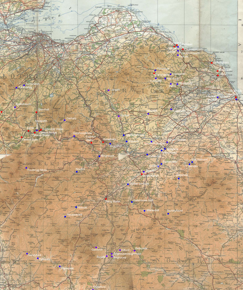
The map below covers the Eskdale, Lauderdale, Liddesdale,
the Merse, Teviotdale and Tweeddale sheets in the Blaeu
atlas and shows river crossings and placenames occuring
on the sheets.
There
is also a map showing routes suggested by text written
by or derived from Pont. This can be used in conjunction
with the route maps for other areas (Ayrshire,
Clydesdale,
Lothians)
to get a general impression of what routes there might
have been.
Overview
Map (click for larger map)
 Map
based on quarter-inch OS maps, published 1935 &
1945. Map
based on quarter-inch OS maps, published 1935 &
1945.
With thanks to Ordnance Survey.
Roads
suggested by Pont Texts
Routes
shown are approximate. See text for details.

Map based on quarter-inch OS maps, published
1935 & 1945.
With thanks to Ordnance Survey.
Top
|

