|
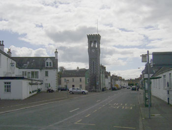
Kirkcudbright
Old
and New Statistical Accounts

Note:
The OSA links below are to the main Statistical Accounts
search page at the Edina site - click on browse scanned
pages. The page numbers refer to a recent reprint version
of the Accounts (Sir John Sinclair, The Statistical
Account of Scotland 1791-1799 Vol. V: Kirkcudbrightshire
and Wigtownshire, Wakefield, England: EP Publishing
Ltd., 1983.)
The
NSA links are to the Googlebooks site. Both sets of
links are usually to the main roads entry.
Some older photographs are from the Detroit Publishing
Company's Views of Landscape and Architecture in Scotland
- see thumbnails on Library of Congress site here.
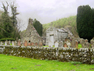
Anwoth
OSA
 Three
year old cattle are sold to drovers (p6) Three
year old cattle are sold to drovers (p6)
The great road from Carlisle to Portpatrick passes through
the parish. The other roads are "judiciously directed"
and in good condition.
Coal comes from Cumberland or Ayrshire. (p10)
Bridge in Gatehouse.
Vessels of 50 tons can come as far as Gatehouse.
NSA
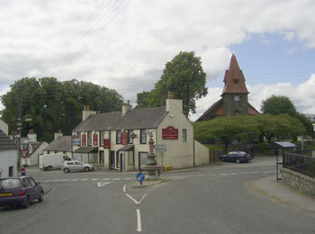
 Gatehouse
is the post and market town. Most of it lies on the
other side of the Fleet although some houses are on
this side. Gatehouse
is the post and market town. Most of it lies on the
other side of the Fleet although some houses are on
this side.
The Dumfries to Portpatrick turnpike runs through and
the mail passes daily. Until it was built some 40 years
ago, the road to Creetown was very hilly as it ran over
the Corse of Slakes at 800 feet high. The present road,
though 3 1/2 miles longer is quite flat and very picturesque.
Some parish roads are good, other poor.
Balmaclellan
OSA
The Wigton to Edinburgh road and the road from Carlinwark
and the south of the county cross here.
A proposed road between Dumfries and Newton Stewart
would shorten the distance by 10 or 12 miles, more Irish
travellers would pass through, and there would be economic
advantages.
NSA (bridge;
roads)
Two bridges were swept away in the past. The new bridge
built in 1822 has proved sufficiently strong. It has
5 arches and is 400 feet long.
The roads are excellent. Two more are to be made including
one from Troquhan to Minnibuie.
There is no market town in the parish but the roads
to Castle Douglas and Dumfries are excellent and used
by the farmers. There is a post office in New Galloway.
Peat is the most common fuel. Coal brought from Dalmellington.
Balmaghie
OSA
The Military Road runs through the parish although
it is both hilly and indirect, perhaps to ensure strategic
advantages.
A road from Kirkcudbright to New Galloway passes through
the parish but both it and the parish roads could be
improved.
Conversion rate for the Statute Labour is 15 shillings
per 100 Pounds Scots of valued rent.
A turnpike bill is to be brought to Parliament. (p33)
 |
| Castle Douglas, c.1900 |
NSA
Castle Douglas is the market town. There are two post
office branches here.There are 16 miles of turnpike.
The fences and bridges are in good repair. One bridge
is over the Dee at Glenlochar.
Peat used in some parts of the parish. Coal from Cumberland
can be obtained at Kirkcudbright, Tongland or Palnackie
but as costs are high many go to Dalmellington as this
is cheaper overall.
Borgue
OSA
No mention of roads. Kirkcudbright, 4 miles distant,
is the market town.
NSA
Markets at Gatehouse and Kirkcudbright; cattle market
at Castle Douglas.
The London to Portpartrick road passes through and like
the parish roads is in excellent condition. The roads
assessment is high because of a considerable debt.
Buittle
OSA
Farming produce is sent to England and Glasgow and
cattle to England.
The roads are poorly maintained and not much spent on
them although the effect is ameliorated because of the
hardness and dryness of the soil.
Lime for the parish is landed at Barlochan or Garden
Creek as well as at Munshes, on the River Urr. (p64)
NSA (early
1700s, markets
etc,
improvements)
Hopehead is on the line of the Old Military Road. William
III used the road here on his way to Ireland.
Cattle taken to Ireland.
A bridge in Buittle built by John Frew in 1722, fell
in1723.
In discussing a time of hardship in the early 1700s,
the writer mentions potatoes being introduced from Ireland
and taken on horse back to Edinburgh where they were
sold in pounds and ounces. At that time food was very
scarce; grain was brought to Dumfries from the "sand
beds" of Esk on tumbling cars. Sometimes they could
not make the journey due to flooding and there being
no bridges.
Castle Douglas is the market town. The only village,
Palnackie, is on the Urr and carries out considerable
trade with the north of England, Glasgow and Irvine,
and North America. Smaller vessels can reach Dalbeattie,
8 miles from the Solway.
A foot runner brings the mail each day from Castle Douglas.
Roads have greatly improved in the last 30 years with
new roads being built and the course of old ones improved.
As well as the turnpikes that pass through the parish
there are 18 miles of parish roads, funded by the statute
labour conversion money.
Carsphairn
OSA
Sheep are sent to the north of England markets and
to Edinburgh. Cattle are also sent to England. (p76)
NSA
 |
| Just south of Carsphairn |
Macadam was born in the parish.
The post office is served from Ayr. In summer there
are coaches between Ayr and Dumfries on alternate days.
The roads are fairly reasonable. The nearest market
towns are Ayr and Castle Douglas, both 26 miles away.
Coal is brought from Dalmellington.
The above was written in 1839. An addendum of 1844 notes
that coaches to Ayr and Dumfries now run daily and a
coach to Kirkcudbright every second day.
Colvend and
Southwick
 |
| Colvend coast from near Southwick
- there are mediaeval salt-pans on the coast |
OSA (1,
2)
There are frequent sailings to ports on the Cumberland
coast such as Whitehaven and Workington. Eight ton vessels
bring lime up the Water of Urr for about 8 miles. Another
river, the Water of Southwick can be navigated for 2
miles.(p82)
Fish are sent to Dumfries and other towns, and cattle
to England and mill stones quarried in the parish are
supplied to an extensive area, including Ireland.
Drovers bought on credit which could be a problem if
they were dishonest. (p94)
NSA
In the past smuggling was carried out, with brandy taken
on horseback as far as Teviotdale.
Coasting vessels bring in coal and lime from England;
grain is shipped out.
Crossmichael
OSA (1,
2,
3)
Drovers take cattle to Norfolk and Suffolk. (p109)
Grain produce sent to New Galloway and Dalmellington,
and also shipped from the Urr and the Dee to Liverpool
and Whitehaven and north to towns in Renfrew and Lanarkhire.
Military Road passes through parish. Work has started
on new roads - routes decided and some half-made. Statute
Labour commuted to 15/- per 100L Scots.
No turnpikes in Kirkcudbright and Wigtonshire.(p110)
At low tide the Dee can be forded but at some risk as
a number of people have drowned. There is a ferry at
the Boat of Balmaghie and at the boat of Livingston,
one mile to the north.
NSA (bridges
and ferries, roads)
A bridge was built at Glenlochar about 30 years ago.
Before that time there were several ferry boats over
the Dee which were inconvenient and sometimes dangerous.
There are two villages in the parish, Crossmichael and
Clarebrand; there is a penny post in Crossmichael. There
are 5 miles of turnpike in the parish.
Peat from 3 or 4 miles away is used as fuel.
Dalry
OSA
 At
the farm of Altyre there is a trench from where one
can see two roads at a considerable distance yet be
out of sight from people using the roads - this suggests
they may have been used by the Covenanters. (p127) At
the farm of Altyre there is a trench from where one
can see two roads at a considerable distance yet be
out of sight from people using the roads - this suggests
they may have been used by the Covenanters. (p127)
There are remains of a great road at the top of the
parish running from Ayrshire to Dumfries. (p128).
The roads are very poor although improved since the
conversion of statute labour into money.
There is a road from Kirkcudbright to Ayr and Glasgow
and one from Newton Stewart to Edinburgh through Moniave.
A bridge over the Ken leading into Kells parish would
be a benefit - the river is sometimes impassable even
in a boat. (p132)
NSA
There is a post office and daily coaches between Ayr
and Kirkcudbright.
Lime comes from 20 or 30 miles away and coal from Dalmellington.
Roads are now much better than they used to be. Numerous
people are involved in making dykes and roads.
Note: The great road between Ayr and
Dumfries is probably the "Roman road" mentioned
by Chalmers which does run across the northern part
of the parish - for details see here
Girthon
OSA
The Dumfries to Portpatrick road runs through the
parish. The inn at Gatehouse of Fleet is well frequented
and mail coaches run in each direction daily. Boats
of 80 tons can reach Gatehouse.
NSA (early
settlement, roads
& bridges etc)
Boats of 150 tons can reach Gatehouse of Fleet. There
is a market in Gatehouse.
There was an early settlement here, called Fleet, probably
at a fording point over the river where Gatehouse now
stands. Edward I stopped here for several days. There
is still a right to hold 8 annual markets which are
thought to date from the time Fleet existed. Gatehouse
itself dates from 1790 when two cotton mills were established.
There was an early bridge; an Act for rebuilding it
and charging tolls was obtained in 1661. The present
bridge has been widened twice.
There is a post office in Gatehouse and two mail coaches
pass each day. The Dumfries to Portpatrick turnpike
runs for two miles through the parish. The main parish
road runs towards Laurieston - all the parish roads
are good.
Kells
OSA (1,
2,
3)
The Edinburgh to Portpatrick and Glasgow to Kirkcudbright
roads cross at New Galloway. The country roads are bad.(p151)
The Edinburgh to Portpatrick road could be improved
and bridges be built over the Ken, especially at New
Galloway where the river can be impassable by ford or
even boat. The road from New Galloway to Dumfries via
Shawhead could also be improved.
Both these roads would shorten distances, the first
by 15 miles and the second by 10 miles and would attract
a great amount of traffic both from the south-west and
from Ireland, including the thousands of cattle on their
way to England.(p152)
The statute labour was converted in 1780 and stands
at L1 per 100L Scots although the work done under this
system is still inadequate.(p154)
There are 11 stone bridges in the parish. One of these,
over the Paharrow Burn, was a private donation and built
60 years earlier.
 |
 |
| Kings
Holm |
Between Kings Holm
and Dundeugh - the road would have been in the centre
of the picture |
Remains of a three mile stretch of road from the King’s
Holm to Dindcuck castle are still to be seen. (p157)
Note: Kings Holm is at NX 560863 in
the Forrest Lodge Estate and Dindcuck Castle is the
ruined Dundeugh Castle at NX 661 880 and 4 miles south
of Carsphairn.
NSA
Daily post. Carriages and post horses are available
in New Galloway. Roads and bridges are very good and
there is a fine bridge over the Ken.
The four annual fairs at New Galloway are well attended
but little business is done, exceept hiring. Cattle
markets have been established and are prospering.
Fuel, even peat because of its scarcity, is expensive.
Coal comes from Dalmellington, 24 miles away. Since
the last Account the roads are greatly improved and
a good network built up - at that time they were "mere
mountain tracks".
Kelton
OSA
Four miles of the Military Road runs through the
parish.
Grain is sent to north of England and west of Scotland.
An annual horse fair is held at Rhonehouse or Kelton
Hill that is attended by horse traders from England
and Ireland as well as the south of Scotland. Chapmen
and hawkers also attend the fair.
Marl is sent by flat bottomed boats from Castle Douglas
to New Galloway, a distance of 15 miles.
NSA (cattle,
roads)
Rather than being bred locally, cattle are bought in
from the Highlands, Ireland or the north of England
and sold on after a year for the English markets.
Mention that Agricola's route through Galloway passed
near Gelston.
Mention of old road between Castle Douglas and Kirkcudbright
on estate of Kelton.
Very large weekly market at Castle Douglas. The town
used to be called Carlinwark, and Causeway-end before
that.
Fourteen post offices are served from Castle Douglas
by daily runners. Mail coaches from Dumfries and Portpatrick
pass through each day. There is also a daily coach between
Dumfries and Kirkcudbright. There are frequent carriers
to Dumfries, Edinburgh, Glasgow, Kirkcudbright and Gatehouse.
Four miles of the great military road to Portpatrick
pass though the parish and five miles of the road from
Castle Douglas to Planackie where there is a port. The
old road from Dumfries to Kirkcudbright runs by Castle
Douglas and Rhonehouse. Another road comes from Dumfries
by Dalbeattie. There are also roads from Castle Douglas
through Rhonehouse to Greenlane and to Auchencairn in
Rerwick parish. All these roads are very good as the
stone is suitable for road making. They are Macadamized.
A fine bridge was built over the Dee in 1825. The old
bridge nearby is still standing.
Various fairs are held in the parish. Coal is shipped
from Cumberland to Palnackie and Tongland. When the
farmers are less busy they bring coal from Dalmellington,
36 miles away.
Kirkbean
 |
| Southernness - salt panning
was carried out here from the middle ages or earlier
- it is now a holiday resort |
OSA
Many of the inhabitants go to Lincolnshire to work
during the harvest.
Agricultural produce is sent to Dumfries, and shipped
to north of England and Clyde ports.
NSA
Two or three 50 ton vessels belong to parishioners and
trade with the Cumberland ports, Liverpool and Glasgow.
There is a market in Dumfries, 12 miles away, and a
turnpike road to the town. The post is delivered every
day, except Sunday. The main fuel is coal from Cumberland.
Kirkcudbright
OSA
There is a fine piece of invective directed at an
"ignorant Goth" who destroyed a Druidical
temple at Bombie, using the stones to build a "contemptible
bridge over an insignificant rivulet, called Buckland
Burn." (p210)
A map
of the parish, dated 1792, is included in the volume.
 NSA
(wooden
bridge, chain
ferry, means
of communication) NSA
(wooden
bridge, chain
ferry, means
of communication)
Old bridge at Tongland. Vessels up to 200
tons can reach the lower bridge of Tongland.
In her flight from Langside, Mary Queen of Scots is
said to have crossed the Dee by a wooden bridge near
Tongland, thought to have been Roman. The bridge was
broken down to prevent pursuit.
There is a chain ferry just above the harbour which
can hold 4 carts with horses or 2 carriages and a gig.
Considereable trade is carried out through the port.
There are daily coaches from Dumfries and carriers from
Edinburgh, Glasgow, Dumfries, Stranraer, Newton Stewart,
New Galloway and Gatehouse of Fleet. The London mail
comes twice a day.
There is a short length of very good turnpike and parish
roads are good.
The old bridge of Tongland was built about 110 years
ago; the new bridge in 1808.
Two hiring fairs are held each year and a fair for hay
and harvest workers. Coal generally comes from Cumberland.
Note: The Old
Kircudbright website contains interesting articles
and photos as well as old 6" OS maps of a large
area around Kircudbright.
Kirkgunzeon
 |
| Countryside near Kirkgunzeon
|
OSA
The principal road in the parish was made by the
statute labour commutation money - before commutation,
statute labour was ineffective.
It had been proposed that the Portpatrick road would
pass through the parish - 7 or 8 miles of new road and
a bridge over the Urr would be needed. (p217)
NSA
Lime is brought to Dalbeattie by boat.
There is a post office in Dalbeattie where there is
a daily post, but most people receive their mail from
Dumfries. Two carriers travel through on their way to
Dumfries twice a week.
The turnpike and the 3 bridges on it are very good.
There are coaches to Dumfries and Kirkcudbright each
day.
Kirkmabreck
OSA
 The
great military road passes through the parish. The
great military road passes through the parish.
Creeton, formerly the Ferry Town of Cree, can take vessels
of between 20 and 60 tons.
NSA
There was a spittal at Claens Mid-Spittal.
There is a very large quarry used by the Trustees of
the Liverpool Docks for building their port. The stone
is carried to Liverpool by schooners. Vessels between
20 and 50 tons use Palnure and Creetown ports.
Newton Stewart is the market town.
There was an old village here called Creth, known to
have existed in 1300. Later it was known as the Ferry
Town of Cree as there was a passage over the river.
There are 4 bridges in the locality.
There is a post office with mail for Dumfries and Portpatrick.
The turnpike between these places runs through here
for 9 miles and is very good - it has been Macadamized.
Apart from the mail coaches there are regular carriers
to Newton Stewart, Glasgow and Dumfries.
Coal and peat are used as fuel. Coal is brought from
Whitehaven.
Kirkpatrick
Durham
OSA (1,
2)
A Kirkcudbright - Edinburgh road and a New Galloway
- Dumfries road cross at the village. Not much has been
done to keep them in good repair but consideration is
now being given to improving them. Journeys to Edinburgh
would be 12 miles shorter than the route through Dumfries
and Moffat and facilitate movement of goods to and from
Nithsdale. (p246)
A very useful road has been made from the church to
the Urr at Dub of Hasson.
NSA
The nearest market town is Castle Douglas. There is
a post office in the village with a daily post to and
from Castle Douglas - this also carries goods. The Portpatrick
to Dumfries road runs through the south of the parish.
A heavy coach travels between Kirkcudbright and Dumfries
on weekdays and Saturdays. There is a road towards New
Galloway and the Glenkens but no coach.
The annual fair is much less busy than in the past.
As peat is now scarce, coal from Cumberland is used.
At the time of the last Account roads were just tracks,
now they are well-made.
Kirkpatrick
Irongray
OSA (1,
2)
As there is no magistrate in Brigend of Dumfries,
vagrants and sturdy beggars gather there.
A very picturesque bridge of one arch called the Routing
Bridge lies in the parish. (p257)
Coal is brought from Sanquhar, 24 miles away.
NSA
Mention of the Routing Bridge.
Until recently cattle would be driven to England to
be fattened for the markets there. Now farmers are starting
to fatten them at home and send them south by steam.
Dumfries is the market town. The parish roads and bridges
are good.
Peat used as fuel. Since the last Account was written
the roads and bridges are much improved.
Lochrutton
OSA (1,
2)
The writer suggests that the name comes from the
Gaelic and means loch by the straight road. It is unlikely
to be the military road as that was quite recent but
if correct there may be a suggestion here of a Roman
road.
The military road runs through the parish.
The statute labour money is being used to make "cross
roads" though much progress has still to be made.
(p267)
NSA
The nearest market and post town is Dumfries. The bulk
of cattle sold there are sent to England. Peat is used
as fuel.
Minigaff
OSA
The military road passes through the parish.
Boats can be taken to Chester, a journey of 18 to 20
hours.
Cattle passes through on its way to England.
Apart from the military road there are several other
useful roads, in particular, the Edinburgh road and
a new road being made to Ayr which will make travel
to that town much easier and shorter. (p278)
NSA
The Cree can be navigated by 80 ton vessels as far as
Carty, 2 miles from Newton Stewart.
Newton Stewart on the other side of the Cree is used
as the market town. Letters are delivered here twice
a day.
The Portpatrick road passes through the parish and a
new turnpike runs to New Galloway. A road to Straiton
and Ayr has been a great benefit. There are 23 miles
of turnpike and 30 miles of other roads in the parish.
Mail coaches run on the Portpatrick road as well as
the Ayr road and the road to Stranraer by Wigton, Garlieston
and Whithorn.
A 5-arch bridge has been built over the Cree. Roads
are much improved since the last Account and some new
ones made though some of the parish roads are not well
designed.
Newabbey
 |
| Village of Newabbey - Sweetheart
Abbey in background |
OSA
A public road passes through Newabbey. (p279)
NSAVessels
up to 70 tons can reach within a mile of the village.
Coal and Lime are brought in.
Dumfries is the market and post town. The post comes
daily and carriers go twice a week. There is also a
coach every second week between Dumfries and Carsethorn.
There are 2 miles of turnpike at the NW end of the parish
on which regular coaches travel to Kirkcudbright. There
are also four miles of turnpike in the SE of the parish.
A bridge was erected in 1715 at the north end of the
village on the Dumfries road.
Parton
OSA
The parish has no turnpikes. The principal road
that runs near the river is to be improved by the statute
labour conversion money, which totals £22 Sterling
per annum.
There are no proper roads to the mosses so people have
to bring their peat in on horseback. (299)
NSA
Market for grain and cattle in Castle Douglas. The road
from there to New Galloway passes through the west of
the parish with a daily post and the Dumfries to New
Galloway road passes through the east. A coach on the
first road links to one from Dumfries to Ayr.
Ports at Dalbeattie and Palnackie. Peat the most common
fuel.
There is a causey across the Dee just below the confluence
with the Ken. A lack of roads make it difficult to develop
a large area of waste land in the centre of the parish.
Rerrick
OSA
The high road runs near a bay in the north east
corner of the parish. (p301)
NSA
The writer notes that Herries' Historical Memoirs do
not confirm the story that attendants of Mary Queen
of Scots broke down a wooden bridge near Tongland.
Free ports at Balcarry, on Auchincairn Bay, Burnfoot
and Mulloch Bay. Vessels also use Rerrick.
Terregles
Parish map
OSA
No mention of roads
NSA
On the farm of Terregles-town (NMRS
record), one mile east of the church, there used to
be a village - the pavement of the street can still
be seen.
Tongland
OSA
There are 2 bridges over the Water of Tarf, one
on the military road and the other near the River Dee.
(p319)
NSA (Bridges,
Vagrants)
There was difficulty in building a new bridge. The foundations
were laid in 1804 and the design was by Telford. Unfortunately
flooding that August destroyed what had been done to
date, and later it became clear that the local contractors
would not be able to complete such a difficult task.
A new engineer was engaged and the bridge finally completed
in 1808 at a cost of L7710 when the original estimate
had been L2420.
The writer questions the need for the bridge noting
that it had been argued that the old bridge was "insecure
and tottering" yet was still sound. It was built
in 1737 when two other bridges were also built across
the Dee.
In 1832 a bridge was built over the Tarff beside an
older bridge which is still perfectly adequate.
Great trouble is caused by vagrant mendicants.
Troqueer
OSA
There are 6 wheeled chaisses in the parish.
The military road runs through the parish and roads
generally have greatly improved.
NSA
Maxwelltown is connected to Dumfries by two bridges.
The London to Portpatrick road and the London to Glasgow
and Edinburgh road by Thornhill and Elvanfoot pass through.
The mail coach runs on the first and there is a daily
coach to Glasgow and one three times a week to Edinburgh.
Coal is used as fuel; most is brought in from Cumberland
but some also comes from Sanquhar.
Twyneholm
and Kirk-Ghrist
OSA (1,
2)
There were no good roads in the parish in 1763 but
the military road which was built a little later helped
greatly in opening up the country.
After that a road running from the military road at
Twyneholm to Kirkcudbright by the bridge of Tongland
was built as was another road from Gatehouse to Kirkcudbright
by the ferry boat on the Dee. The statute labour money
is used to maintain these roads.
The best roads in the parish were built by Lord Daer
who bore the bulk of their cost. Two ran from the church
at Twyneholme to the Kirkcudbright ferry boat and to
a bay at the south end of the parish, and the third
ran along the Dee from the ferry to the bay.
Lord Daer had attempted to gather support for better
roads with more equitable sharing of costs but his plans
ran into severe opposition and had to be dropped.
If a road was built from the church up to Glengap (3
miles north of Twynholm at NX6559) it would allow manure
landed on the Tarf or Dee to be used on the barren land
in that area.
There are bridges over the Tarf, the military road near
the church in Twyneholm and two others. (p360)
NSA
There are markets at Kirkcudbright and Gatehouse. A
cattle market is held in Castle Douglas.
The Carlisle to Portpatrick road passes through. Although
the mail coaches run on it, mail has to be collected
in Dumfries. The turnpikes are excellent and the parish
roads are greatly improved.
Coal from Cumberland is brought to Tongland harbour,
2 miles away.
Urr
OSA
The Military Road passes through the parish but
on an unsuitable line.
Dalbeattie can be reached by vessels of 60 tons on a
spring tide. (p369)
NSA
No particular mention of roads. Grain and sheep are
exported to Liverpool etc. Lime is brought from Cumberland.
Wigtonshire
Old and New Statistical Accounts
Parish maps are based on the 1903 1/4"
OS map. With thanks

Glasserton
 OSA OSA
The roads are in good condition and funded by the Statute
Labour money. Cattle are sent to England. (p396)
NSA
In talking about manuring the land 70 or 80 years previously,
the writer notes that there were no carts at that time
and that the dung was carried in creels on horseback
or sometimes by a person.
Some sheep are bought at Falkirk or Minigaff and fattened
over winter on turnips before being sold on.
Arrangements have now been made for a mail coach to
run from Newton Stewart to Wigton, Garlieston, Whithorn,
Port-William and Glenluce to Stranraer - the road runs
through this parish from Whithorn to Monreith near Port-William.
The nearest market town is Whithorn.
Inch
 OSA
OSA
The Military Road brings swarms of Irish beggars to
the parish who, by threat or entreaty, obtain alms from
the local people. (p409)
`
NSA (stepping
stones; roads
etc)
A file of stepping stones run for a quarter of a mile
through a moss - they are called the "Stepping
Stones of Glenterra".
The market town is Stranraer. The Portpatrick and Glasgow
roads pass through the parish. Three mail coaches daily.
Cattle market held here during the summer months. Peat
used as fuel with some coal brought from Ayrshire.
Note: The Stepping Stones are now
thought to be the remains of a prehistoric boundary
dyke - see NMRS
(NX16SW 9; Map reference: NX 1439 6170)
Kirkcolm
 OSA OSA
No entry for roads.
NSA
Black cattle sold for the London market.
Peat used as fuel; some coal from Ayrshire.
Steam boats can be taken from Stranraer; the parish
roads generally are very poor.
Kirkinner
 OSA
OSA
Cattle are sent to England. (p420)
NSA
Many sheep are bought at Falkirk and fattened on turnip.
Black cattle sent to Liverpool.
Wigton is the market town. There is a penny post.
Port at Wigton; a harbour at Baldoor is used for grain
and coals.
Peat used as fuel; coal comes from Cumberland.
Kirkmaiden
 OSA OSA
The trustees are making efforts to improve maintain
and improve the highways. The Statute Labour commutation
rate is 1/8d per year for householders, excepting the
poor; and 15/- per 100L Scots for farmers. (p433)
NSA (description
of road; means
of communication; improvements)
The writer describes the line of road taken through
the parish.
Just a few years before, the roads were "in a scandalous
state, carelessly formed, or in many places not formed
at all, and as carelessly kept." Now the old roads
are improved and new ones have been or are being built
- all are in excellent repair. They are funded by the
statute labour conversion money which totals L75 Sterling.
There is no turnpike in the parish.
The nearest market town is Stranraer, 18 miles away.
Carriers go there once or twice a week from Drumore
and Port-Logan. There are penny post offices at regular
intervals between Drumore and Stranraer. Mail (and passengers)
are brought by a car from Stranraer to Port Logan -
the mail is then taken on foot to Drumore.
Coal is brought in from Glasgow, England and Ayrshire.
Some peat is also used.
Kirkcowan

OSA
The Military Road passes through the parish.
The commutation of the Statute Labour to a financial
payment has allowed a number of roads to be made and
this has helped to improve the countryside, for example,
by allowing fertiliser to be brought in by cart. (p436)
NSA
Roads are much improved.
Cattle are sent to Dumfries and from there to England.
Leswalt
 |
 |
| Leswalt Parish |
Lochnaw Castle |
OSA (1,
2)
There are several steep "pulls" for carriages
going to Lochryan. (p442).
Many Irish come through Portpatrick. (p444)
NSA
A fine road runs through the centre of the parish, passing
Lochnaw on its way to Portpatrick. Another branch goes
by the north of the parish to Stranraer.Market and post
office in Stranraer. Many cattle sent to England. Coal
and turf used as fuel.
New Luce

 |
| New Luce |
OSA
The roads are very bad and almost impassable by carriage.
Even the principal road is bad and only a part of it
has as yet been properly constructed. The poor condition
of the roads holds back the improvement of the land.
(p.450)
NSA
Mention of new roads to Glenluce and Stranraer and towards
the toll in Glenap and towards Barhill.
Road fund is about L30 yearly. Various roads made since
the last Account.
Post office in Glenluce and market in Stranraer.
New road from Glenluce to Curloch Toll in Ballantrae
parish which runs by New Luce; another by Miltonise
to Barhill (Colmonell parish). Bridge over the Cross
Water of Luce, 4 miles away.
Moss and turf used as fuel.
Old Luce

 |
 |
| Glenluce |
Glenluce Abbey founded
in 1191/92 |
OSA (1,
2)
There are three landing points on the coast: Auchenmalg
Bay, Kirkchrist Bay and Pooltanton. (p452)
Cattle are sent to England.
NSA
Small harbour at Burnfoot for coal and lime etc.
Cattle market in Glenluce.
Turnpike road from Newton Stewart to Stranraer passes
through - the mail coach runs on it. Bridge over the
Luce near the village.
Fair at Glenluce but most business conducted at Stranraer.
Peat used as fuel.
Mochrum
 OSA OSA
A road which ran along a gravel beach and then a steep
hill and which was almost impassable by carriage; has
been greatly improved in recent times. (p464)
There are now 170 carts in the parish whereas 20 years
ago there was only one. (p471)
Sheep are driven to Ayr and Glasgow. (p.473)
Irish beggars are much in evidence in the parish. (p475)
NSA
The mail coach passes through each day. Mail is delivered
to Port William.
Port at Port William.
Penningham
 OSA OSA
The Military Road passes through the parish. (p479)
Newton Stewart was founded about 80 years ago and a
bridge built about 40 years ago. (p480)
 |
 |
| Newton Stewart |
Looking towards
Minnigaff |
NSA
Harbour at Carty, just below Newton Stewart. Coal, lime,
freestone and merchant goods pass through.
James IV passed through on pilgrimage to Whithorn.
Market and post town is Newton Stewart.
Five miles of turnpike road between the Cree and the
Bladenoch and 9 miles between Newton Stewart to High
Bridge of Cree. Excellent network of about 30 miles
of parish roads.
Roads used to be of gravel but are now Macadamized.
The mail coach runs on the Portpatrick road; another
coach goes to Portpatrick by the Mahars and there is
a mail-gig to Girvan. There are regular carrriers to
Edinburgh, Glasgow, Dumfries, Stranraer, Girvan and
the southern part of the county.
Good bridges. One over the Cree at Newton Stewart replaced
one destroyed by a flood in the early 1800's. A new
bridge is being built over the Bladenoch to replace
a very old bridge.
Various fairs and markets are held in Newton Stewart.
Peat, wood and coal used as fuel; the coal mostly comes
from Cumberland.
Portpatrick
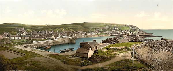
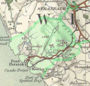 OSA OSA
Details of the development of the ferry service to Donaghadee
are given. At one stage passengers were often obliged
to travel in boats with cattle. (p486)
The Military Road ends at Portpatrick. (p494)
NSA
The nearest market town is Stranraer.
Far fewer Irish cattle pass through as steamers can
now take them directly to Liverpool or Glasgow.
Five miles of turnpike run through the parish. There
are mail coaches from Glasgow and Dumfries. The fares
to Glasgow are L1.8s inside and 18/- outside; Dumfries
L1.10s inside and L1.1s outside. It costs 3/- and 2/-
to Stranraer.
Peat is the most common fuel but coal is brought in
from Troon and Ayr.
Sorbie
 OSA
(1,
2) OSA
(1,
2)
There is a small port at Garlieston. (p497)
Roads have now improved, whereas in 1765 they were narrow
and unformed. (p498)
The Statute Labour has been commuted. (p510)
Good roads help in the improving of the countryside.
The Military Road has helped in this and mountains that
formerly appeared an insurmountable barrier are no longer
an obstacle to travel. (p511)
The roads now being made to Edinburgh in a more direct
line than through Dumfries and to Ayr through the mountains
will be of great benefit to the area.
Cross roads are now being made. (p512)
NSA
Harbour at Garlieston.
Market town is Whithorn. Penny post at Garlieston and
mail is delivered to Sorbie village each day from Wigton
post-office.
There is a good network of roads.
Peat is obtained from Kirkinner parish and coal from
the Cumberland ports.
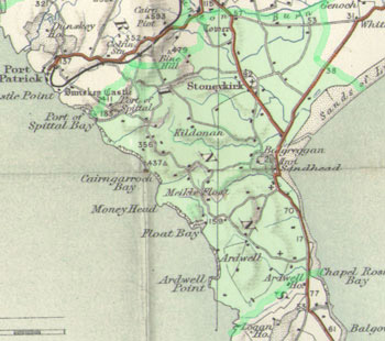
Stonekirk
 OSA OSA
The Statute Labour conversion rate is 15/- per 100 L
Scots or 1/8d for individuals.
NSA
Sandhead Bay used by coal and lime sloops.
Stranraer is the market and post town. Recently "petty
offices" have been set up in parishes for the mail.
Peat used as fuel.
The parochial road from Stranraer to Kirkmaiden runs
through for about 8 miles - the mail is brought on this
three times a week. Another road runs on the west side
of the parish allowing access to Kirkmaiden and Portpatrick.
Three other roads intersect these. There is however
a lack of roads in the north of the parish.
It is hoped that a new "posting car" will
run between Kirkmaiden and Stranraer.
Stranraer
 OSA OSA
The Military Road goes through the town. The government
maintains it and are funding some cross roads to improve
access from England and Ayrshire.
A mail coach arrives from London daily and a diligence
runs to and from Ayr three times a week.
Other roads are paid for by the Statute Labour money
which is 15/- per 100 L Scots - the principal roads
are in good condition. (p530)
NSA
Several fairs held each year for the sale of cattle
and horses. Coal is brought in by sea but is expensive.
Turf is also used as fuel.
Whithorn
 OSA OSA
There is a bridge in Whithorn. (p532)
NSA
Harbour at Isle of Whithorn with sailings to Cumberland
ports and occasionally to Liverpool.
Public roads from Wigton and Garlieston to Isle of Whithorn
and from Whithorn to Port William and Stranraer.
A mail coach passes through each day in both directions.
Main fuel is peat with some coal from Whitehaven.
Two fairs are held each year and a monthly cattle market
between April and January.
Wigton
 OSA OSA
The Statute Labour has recently been commuted to a monetary
payment. The rate is 15/- per 100 L Scots and 2/6d for
labourers and tradesmen each year.
The roads are improving.
Bridges are very good - these are paid from the county
funds. (p556)
 |
| Wigton |
NSA (standing
stones; fairs
& fuel)
Reference in Symson's
Description of Galloway written in 1684 of standing
stones 3 miles west of Wigton standing on
the "highway betwixt Wigton and Portpatrick."
Harbour with considerable trade. Five fairs each year
but little business is done at them. Peat used as fuel
as well as coals from Whitehaven.
Top
|


