|
|
|
Roads
and Tracks of Ayrshire
|
Back (The Turnpike Era)
TURNPIKE
ROADS
|
For
alternative navigation see maps below - 1767
and 1774 map; 1805
map
1.
Ayr to Irvine 2. Ayr to Kilmarnock 3. Irvine by
Stewarton towards Pollockstoun 4. Irvine to Saltcoats
5. Irvine to Kilmarnock 6. Kilmarnock by Kilmaurs
to Stewarton 7. Stewarton to Whitehouse 8. Stewarton
to Pollockstoun via Neilston 9. Ayr by Ochiltree,
Old and New Cumnock towards Sanquhar 10. Ayr by
Galston towards Strathaven
11.
Astonpapple east of Newmilns to Overmuir 12. Ayr
by Mauchline, Sorn and Muirkirk towards Douglas
13. Mauchline to Galston 14. Kilmarnock to Galston
15. Waterside of Loudoun towards Kingswell 16.
Kilmarnock by Kingswell to Flockbridge and 17.
from the march of the shire towards Eaglesham
to where it joins the road leading from Kingswell
to Flockbridge 18. Kilmarnock by Mauchline to
Old Cumnock 19. Galston by Sorn to Old Cumnock
20. Kilwinning by Dalry and Bieth(stet) to Clarksbridge.
21. Dalry to Maichbridge 22. Kilwinning by Bieth
to Caldstream bridge 23. Saltcoats by Largs to
Kellybridge 24. Irvine by Stair Bridge to Dalmellington.
25.
Stewarton to Beith 26. Fail to Riccartown 27.
Coyltown to Galston 28. Coyltown by St. Evox to
Munktoun 29. Mauchline by Millburn to Craigie
Castle 30. Mauchlineto Drongan.
31.
Muncktoun to Tarboltown 32. Kilmarnock by Dundonald
to Loans 33. Kilmaurs to Symington 34. Kilmaurs
to Cuninghamhead 35. Hurleford to Riccartown 36.
Finwicktown to Shawbridge 37. Old-Cumnock by Muirkirk
towards Douglas 38. Ayr to Dalmellington 39. Dalmellington
to New-Cumnock 40. Ayr by Maybole to Girvane,
one route by Kirkoswald and the other by Garpinebridge
and Daily
41.
Muirston to Barr 42. Ayr to Turnberry 43. Girvane
to the Confines of the County beyond Glenap, leading
to Stranraer; which Road consists of two Branches,
one of them going by Ballantrae, and the other
by Colmonel 44. From the Garpine-Bridge by the
Balloch to the Confines of the County leading
towards Wigton 45. The Balloch to Colmonel 46.
Old Daily by Penkill towards Colmonel 47. Maybole
to Girvane by Drumelland, Dalquharran and Killochan
48. Ladyburn by Drumgirnanford to join the Road
from Maybole to Girvane, near Dalziellely 49.
Maybole to Dalrymple-Bridge, and from thence to
Kirkmichael 50. Dalrymple-Bridge to Coyltoun.
51.Dalrymple
by Carclowie and Doonholm to Ayr 52. Maybolle
to Straitoun by Kirkmichael 53. Crosshill to Straitoun
54.Crosshill by Kirkmichael-Bridge to the Maybole
to Straitoun road 55. Straitoun to Dalmellington
56.Kilwinning to Dreghorn 57. Milnburn by Hygenshouse
to the West End of the Town of lrvine 58. Garranhill,
in the Parish of Muirkirk, towards the County
of Lanerk 59. Old Cumnock by Halglenmuir to Crawfordjoan
60. Stewartoun towards Kaimshill and Dunlop-House
towards Glasgow.
61.
Stone-Castle by Armsheugh, Auchinharvie, and Dunlop,
to the Glasgow to Nielstoun road 62. Middletoun
by Greenvale and Armsheugh to Kilwinning 63. Fail-Bridge
to Lochbrown and the Mauchline to Kilmarnock road.
1805
Act 30 roads throughout the County
|
In
this chapter we try to identify the course taken by
the turnpikes. Many of today's main roads are based
on the turnpikes but there are some significant differences.
Occasional references are made to maps by
Arrowsmith (1807)
(1), Thomson
(1828) (2) and
Ainslie (1821)
(3) for purposes of clarification.
Reference is also made to the 1878 List of Highways.
(4) Additional details are available
in McClure. (5)
Some older photographs are from the Detroit Publishing
Company's Views of Landscape and Architecture in Scotland
- see thumbnails on Library of Congress site here.
Turnpike
Roads 1767 and 1774 Acts. See
larger map

Reproduced
from the 1935 Ordnance Survey map. � Crown copyright
1.
Ayr to Irvine.
Most of this still exists on its original line. It goes
up through Prestwick as far as the roundabout at the
airport where a stretch has been lost under the airport
itself. It is picked up again at Monktoun where it becomes
the A78. The road has been greatly improved north of
here and a new stretch built from Fullarton into Irvine
but the old road can be seen as the B746 through Loans
and then the A759 as far as the first roundabout at
Shewalton where it runs as a minor road parallel to
the A78. From Newhouse it runs directly to Fullarton
and Irvine. Apart from a stretch north of Monkton, Roy
seems to show this line. Armstrong shows the turnpike
itself.
2.
Ayr to Kilmarnock.
Most of this route still exists. The route is the same
as the previous road to Monkton and then follows the
minor road up to the Dutch House roundabout. From there
it lies under the A77 as far as Spittalhill where it
exists to the west of the dual carriageway. It then
becomes the B7038 running straight to Riccarton and
Kilmarnock. It is shown on Armstrong but Roy has a different
line through Symington.
3. Irvine by Stewarton towards Pollockstoun.
This is now the B769. In Irvine itself it runs to Stanecastle
roundabout then to the north east for 500 metres before
turning right and running through Girdle Toll and Perceton
to Stewarton and the county boundary. Both Roy and Armstrong
show the road; Armstrong as a turnpike.
4. Irvine to Saltcoats.
Although greatly improved, this is still the main road
up to Kilwinning and then the A738 over to Stevenston
and Saltcoats. Both Roy and Armstrong shows the complete
route, although the latter does not show it as a turnpike
yet.
5. Irvine to Kilmarnock.
This is the road running through Crosshouse, Springside
and Dreghorn to Irvine. Roy and Armstrong show it, Armstrong
as a turnpike, and Pont has a river crossing at Crosshouse.
6.
Kilmarnock by Kilmaurs to Stewarton.
This is the present day A737. The earlier road shown
by Roy and Armstrong ran to Kilmaurs, with the Stewarton
road leaving this at Altonhill Farm and running up via
Low Byrahill to Stewarton.
7. Stewarton, to a place called Whitehouse.
This is the present day road to Dunlop and Lugton. There
has been some realignment at Pointhouse Cottage, two
miles north of Stewarton but otherwise it is the same
route. From Lugton, however, it takes the line of the
Beith road for a mile then heads up towards Hall on
the B775. Whitehouse is on a minor road west of the
B775. This is interesting as it is on the county boundary
and Armstrong shows three routes radiating from here.
Aitken's map suggests Paisley as the most logical reason
for there being a road to Whitehouse. Both Roy and Armstrong
show only the Dunlop stretch of this route although
they both pick it up again at Whitehouse on the Beith
to Neilston route.
8. The road which departs the Road
between Stewarton to Pollockstoun, to the March of the
Shire towards Neilston.
This is shown on Thomson (1828) as the present day road
which leaves the B769 near to Fulshaw a mile out from
Stewarton and then runs up to Fullwood and New Mill
and then the county boundary two miles short of Neilston.
The stretch south west of New Mill as far as the Stewarton
to Dunlop road was turnpiked later despite Roy and Armstrong
both having a road on this stretch. This shows that
not all turnpikes formed the basis of later major routes.
Roy and Armstrong show the road from New Mill to Neilston.
9. Ayr by Ochiltree, Old and New
Cumnock towards Sanqhuar.
This is the present A70 as far as Cumnock and then the
A76 south of here. The only changes are the new road
from Laigh Tarbeg to Ochiltree, and some realignment
between Cumnock and New Cumnock, e.g., the layby at
Borland. Roy shows a different line for a mile or so
out of Cumnock and then more or less has the same line
as the turnpike. Armstrong shows the turnpike.
10. Ayr by Galston towards Strathaven.
This is essentially the route of the A719 to Galston
and then the A71 to Darvel and beyond. In Ayr itself,
it is the road out to the traffic lights just short
of Whitletts roundabout. From there it runs north through
the retail park to come out on the line of the A77 where
it can still be seen as a layby. At Sandyford it heads
up to Fail where it routed past the houses themselves.
Just past Carnell it ran in a direct line through Aird
farm. At Galston it crossed the river and ran up to
the county boundary on the modern line. The same route
is shown on both Roy and Armstrong, the main differences
being a routing north of the present road between Fairwells
and Aird Farm on Roy, and both showing a more southerly
course beyond Priestland to the county boundary.
11.
Aston Pople, east of Newmilns to Overmuir, in the road
to Eaglisham.
This is the minor road that runs very directly past
Templehill (NS557385) to High Overmuir where it degenerates
into a poor track as far as Myres in Lanarkshire. As
it appears again in the 1805 Act and as it is not shown
on Arrowsmith's map of 1807 it probably hadn't been
built at that time. The 1878 List of Highways does not
list it as an ex-turnpike so although it was built this
would have been done by the parish under the Statute
Labour system. It is not shown on Armstrong or Roy.
12.
Ayr by Mauchline, Sorn and Muirkirk towards Douglas.

This
went through the Whitletts roundabout on the same line
as the present roads, i.e. A758, B743 and A70. One change
is where the B743 joins the A70 west of Muirkirk; another
is a minor realignment on the stretch into Muirkirk.
Armstrong shows this route and indicates the Ayr to
Mauchline stretch as a turnpike. Roy shows the same
road but has a gap between Sorn and Garpel, west of
Muirkirk, as well as a significantly different line
between Mauchline and Sorn.
13.
Mauchline to Galston.
This appears to have been exactly the same route as
today, viz. the A76 to Crosshands then the B744 with
the exception of a straighter line between Millands
and the A719 at Gauchallands (cf. Thomson). Armstrong
shows it as a turnpike. Roy also has the road but with
a straighter line between Millside and Galston.
14.
Kilmarnock to Galston.
This has the line of London Road to Hurlford, then the
A71 as far as the petrol station where the road made
directly to Galston - 200 metres or so is now lost but
the rest remains as Titchfield Street running into the
town centre. It is shown on Roy (possibly a bit closer
to the river) and on Armstrong, who has it as a turnpike.
15.
Waterside of Loudoun, where it departs the road leading
to Strathaven, towards Kingswell till it falls into
the foresaid Road from Kilmarnock, to Kingswell.
This is now the road from Galston to the A77 (A719).
There have been minor realignments with the old road
remaining as laybys and as a stretch of 400 metres just
north of Moscow. The junction with the present A77 used
to be much more of a Y junction than the present T junction
(further changes have been made since the motorway was
built). Roy shows it as far as Waterside and Armstrong
has it as a turnpike.
16.
Kilmarnock by Kingswell to Flockbridge and from the
march of the shire towards Eaglesham to where it joins
the road leading from Kingswell to Flockbridge.
 |
| The M77 from the
old A77 at NS 506 514. The pre-turnpike and the
turnpike lie in between. |
From Kilmarnock town centre this runs north through
Beansburn to Meiklewood where it is incorporated in
the A77 at this interchange. It re-emerges as the road
running through Fenwick. Further north the major change
is at Eaglesham road-end (B764) where it ran to Kingswells
and is now the minor road running north to rejoin the
A77 at the county boundary. Both Roy and Armstrong show
this road. The intervening stretch of the A77 was built
in the mid-19th century.
17.
From the March of the Shire, towards Eaglisham, till
it join the road leading from Kingswell to Flockbridge.
This is the one-mile stretch of the Eaglesham road
(B764) running to the county boundary. A road on this
line is shown on Roy but not on Armstrong.
18.
Kilmarnock by Mauchline to Old Cumnock.
This is effectively the present road. It ran along London
Road, through Hurlford as the B7073 and then as the
A76 to Bargower. Here it ran across the fields to rejoin
the A76 at Rodingdean. There was a winding stretch at
Howford Bridge south of Mauchline which is now closed
but the rest of the road is unchanged, running through
Auchinleck to Cumnock. Roy has a road along most of
this alignment and Armstrong shows the turnpike itself.
19.
 Galston
by Sorn to Old Cumnock. Galston
by Sorn to Old Cumnock.
There
appears to have been no changes to this road which is
the B7037 to Sorn. South of Sorn, it crosses the old
bridge near the church and runs up past Laigh and South
Logan to Auchinleck. There seems to have been a long
delay
in building it, as it does not appear on Arrowsmith's
map of 1807 nor on Ainslie's map of 1821, appearing
only on Thomson in 1828. The 1806 Act refers to a road
(q.v.) from Sornhill Toll Bar to Catrine
and then Auchinleck which may be a re-submission of
this road although it appears to have been built along
the
route mentioned here.
20.
Kilwinning by Dalry and Bieth (stet) to Clarksbridge.
This is the present A737, the only difference being
that it passed through the town centres. Armstrong shows
it in its entirety, although not as a turnpike; whereas
Roy only shows the one mile stretch from Beith to the
county boundary at Clark's Bridge.
21.
Dalry to Maich Bridge.
This is the present day route, viz. the Dalry - Kilbirnie
Road and then the A760. It is shown on Armstrong as
unturnpiked but does not appear on Roy.
22.
Kilwinning by Bieth to Caldstream Bridge.
The Kilwinning to Beith section of this road does not
appear on Arrowsmith's map of 1807 nor on Ainslie's
map of 1821. However, the Beith to Coldstream Bridge
section does, so this must have been built fairly soon
after the Act was passed. This section left Beith on
what is now the B777 (road to Lugton) to just past Overton.
From there it went by the minor road to what is marked
on the modern 1:25000 map as Coldstream Bridge No.1.
As
the 1805 Act mentions a road from Kilwinning via Auchenmead
and Marshalland Bridge to Beith and beyond to Kerse
Bridge, it is likely that this was a re-submission of
the road along its original intended route between Kilwinning
and Beith. The route is that of the modern B778 and
then the road up to Auchenmade and South Barr where
it turns and runs to Beith as the B706, and thereafter
to Kerse Bridge. This is a similar line to the earlier
road shown on Roy and Armstrong with the exception of
their routing along what are now farm tracks past Monkredden
and Gooseloan as far as Auchenmade.
23.
Saltcoats by Largs to Kellybridge.
This was a very useful road which gave good communications
as far as the county boundary and so to Greenock beyond.
Although Armstrong shows his road running over the sands
north of Ardrossan there seems no particular reason
why the turnpike would do this. It is probably safe
to say that the turnpike follows the line of the A78
as far as Bank Cottages where it becomes the B7047,
a minor road passing through West Kilbride. Certainly
this is the line shown on Ainslie (1830) as the main
road.
The
turnpike left West Kilbride by the road running up to
Kilruskin but the next two miles have been obscured
by the new main road past Hunterston. North of here,
the turnpike has the modern line. It is interesting
to note that the turnpike between Fairlie and Kelly
Bridge (Wemyss Bay) almost entirely replaces the earlier
road which ran through Kelburn and, north of Largs,
on the line of the minor road about half a mile from
the coast.
24.
Irvine by Stair Bridge to Dalmellington.
There have been major changes to the road network in
Irvine. However, the initial stages of this road can
be traced as a track and minor road a few hundred yards
north of the Shewalton roundabout which leads to a minor
road to Drybridge. From here it runs south as the B730
through Dundonald, crosses the A77 at Bogend and runs
through Fail where there has been minor realignment,
to Tarbolton. It continues through Stair and Drongan
to Littlemill when it carries up the hill into Rankinston
and then becomes a track leading to Dalmellington.
(6) It is
shown on Armstrong but not Roy.
25.
Stewarton to Beith, by the Old-Hall-Bridge
over the Water of Lugton.
This is the present Dunlop - Beith road and is shown
on Roy and Armstrong, though not as a turnpike on Armstrong.
26.
The Road from Fail till it joins the Road from Ayr to
Kilmarnock at Riccartown.
This leaves the B730 two miles north of Fail and runs
over to Craigie and then to Riccartoun, passing through
Shortlees on the way. A road on this line is shown by
Roy although it has a more direct line between Craigie
and Fail.
27.
Coyltown to Galston by Gadgirth Bridge and Tarboltown,
till where it joins the Road from Kilmarnock to Cumnock,
near Lawersbridge.
This is the B744 from Crosshands over to Tarbolton and
Annbank and then the B742 over Gadgirth Bridge to Coylton.
As this doesn't appear on Roy or Armstrong except for
a short stretch at Gadgirth on Armstrong it was a completely
new road. It is interesting to see that the significant
changes in orientation of the B744 indicate that this
numbering system, introduced in the early 1920's, was
partly based on the old turnpike routes
28. Coyltown by St. Evox to Munktoun.
This is now the A70 as far as Belston. It then runs
north for � mile as the B744 to Broadhead where it becomes
a minor road running through St Quivox to the A77. It
then turned north to run along the line of the A77 to
Sandyford then north-west past Shawhill, to Monkton.
Although much is now lost to the airport, a stretch
near the A77 remains. Strawhorn shows a 19th century
map of turnpikes in Ayr parish in his History of Ayr
- the road in question is marked as no.15. Armstrong
shows a two mile stretch of road from above Broadhead
to the A77 line, i.e. through St Quivox but to the south
his road continues down to Gateside. Curiously this
doesn't appear on the Ayr parish map as either a turnpike
or a parish road so predates the turnpikes. Roy shows
only a road between Coylton and Belston, i.e., the Ayr
to Cumnock road.
29.
Mauchline by Millburn to Craigie Castle.
This is the minor road which passes Mossgiel. At Barrmuirhill
it turns up past Millburn to reach the A719. It then
cuts across to Plewlands and Caldrongill to join the
Irvine - Dalmellington turnpike, viz. B730. Roy shows
a road on this line as far as Mossbog when it cuts across
country to Millburn. It is not shown on Armstrong except
perhaps a short stretch between Caldrongill and Craigie
Castle on his Fail to Symington route.
30.
Mauchline by the old Bridge of Barskimming till it joins
the Road at Drongan.
This is straightforwardly the minor road that goes over
Barskimming Bridge and runs over to Schaw on the B730
near Coalhall. Drongan is just a mile or so further
south. Armstrong has a road on the same line which runs
from Mauchline to Crosshill only. Roy's Ochiltree road
includes a stretch from Barskimming Bridge to Crosshill.
31.
Muncktoun to Tarboltown.
This is now the B739. The stretch from the A719 to Tarbolton
is shown by Armstrong but not Roy.
32.
Kilmamock by Oldroomford through Dundonald, till it
joins the Road from Ayr to Irvine near the Loans.
This leaves Kilmarnock as Dundonald Road and although
there has been some realignment at the roundabout near
the abattoir it picks up the line again as the road
through Gatehead. It forks to the left near Palmer Mount
to run into Dundonald. From there it is the hill road
over to Loans. Armstrong shows this stretch. It is not
shown on Roy
33.
Kilmaurs by Corsehousebridge and Oldroomford through
Symington, till it joins the Road between Ayr and Kilmarnock.
This is now the B751 through Knockentiber to Crosshouse
and Gatehead. It then runs along the Kilmarnock - Dundonald
Road (A759) for � mile and turns left to run past Peatland
to Symington. Although Roy and Armstrong show roads
on part of this, overall it was clearly a new route.
34. The Road from Kilmaurs till
it joins the Road from Irvine to Stewartown, near Cuninghamhead.
This still exists and no changes in alignment seem to
have been made. The road on this line shown by Armstrong
appears to cut out the bend on the approach to Cunninghamhead.
Nothing is shown on Roy.
35. Hurleford to Riccarton.
Although this stretch is less than two miles long it
is interesting to see the changes that have occured.
Initially it ran directly between the two places. Then
when the roundabout was built it ran directly to that.
Later still with the Irvine expressway it was routed
under the new road and was realigned on the far side
of the roundabout. It can still be seen on the north
side of the present road running into Hurlford. Neither
Roy nor Armstrong show the road.
36.
Finwicktown to Shawbridge.
This is the B751 running from the south end of Fenwick
over towards Kilmaurs. Shawbridge is one kilometre short
of the town. It is not shown on Roy or Armstrong.
37.
Old-Cumnock by Muirkirk to the Confines of the County
towards Douglas.
This is essentially the A70 although there have been
a few changes, viz. at the old bridge near Logan, a
couple of places where the road remains as a layby,
and near to Wellwood. Armstrong and Roy both show what
is presumably an earlier road on this line.
38.
Ayr to Dalmellington.
Although this is the present A713 there have been changes
over the years, already noted in respect to Roy and
Armstrong. A major realignment has been carried out
at the intersection with the Dalrymple - Coylton road
where it turned for 200 metres in the direction of Coylton
then down again towards Benston. Here, however, it looped
round the minor road to the right for over � mile before
taking up the modern A713 line again. Close to Smithston,
Armstrong's road divides into two: one branch follows
the A713/turnpike line, the other goes over by Lethanhill
and Burnhead to Dalmellington. Roy also shows this stretch
and then a similar line north to Ayr from Smithston.
South of Smithston he shows a different line from the
A713.
39.
Dalmellington to New-Cumnock.
The only major change from the modern line is that on
leaving Dalmellington the road ran south of the river
as far as Pennyvenie. The route was shown on Armstrong
but Roy's road, although initially the same, terminates
just past Upper Beoch Farm (NS521103).
40.
Ayr by Maybole to Girvane, which Road divides at the
Redbrae near Maybole into two branches, one of which
goes by Kirkoswald, and the other by Garpinebridge and
Daily.
The first stretch from Ayr to Maybole is now the B7024.
From Maybole the first branch mentioned is essentially
the A77 with some modern improvements, notably a one
mile stretch west of Maybole, and is different from
the lines shown on both Roy and Armstrong. The other
road is that running to Crosshill and then Dailly.
However, at Rowanston it took the Armstrong line down
the minor road to Ladyburn and then ran just above Kilkerran
House to take up the line of the modern road (B741)
again. The junction here (NS290024) is clearly seen.
By 1828, Thomson's map shows the modern road line replacing
this stretch. Another major change is that the road
ran through New Dailly, 300 metres north of the present
road. It then ran via Lady Farm, Bargany, Gateside and
Hawkhill to Old Dailly. The route can easily be seen
on the 1:25000 map. Roy and Armstrong show this stretch.
The rest of the road to Girvan is the modern road.
41.
The Road which departs near Muirston
from that Branch of the Road immediately above described
as leading by the Garpine-Bridge and Daily to Girvane,
and leadeth by Kilkerran-Mill to the Village of Barr.
This leaves the B741 at Moorston, one mile east of New
Dailly and runs to Barr. Older OS maps show that it
ran almost directly south for � mile from Delamford.
Armstrong shows the road, although he does not have
the stretch from Moorston to Lindsayton but rather has
it running directly from the latter to New Dailly. It
is not shown on Roy.
42. Ayr by the new bridge of Doon
at Greenan along the Coast to Cullean, and from thence
till it joins the Road from Kirkoswald to Girvane above
Turnberry-Houses.
This is the present A719 - there do not appear to have
been any changes from the original turnpike line. Both
Roy and Armstrong have what is very probably the one
road running from Turnberry to Ayr but it ran very near
the coast in the vicinity of Culzean Bay, took a higher
line near Dunure and ran down to the coast after the
holiday camp.
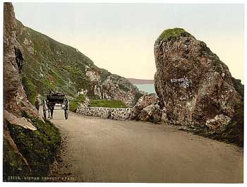 |
| Kennedy's Pass, 3 miles south
of Girvan. The turnpike ran higher up the hill here
but was later rerouted. |
43.
Girvane to the Confines of the County beyond Glenap,
leading to Stranraer; which Road consists of two Branches,
one of them going by Ballantrae, and the other by Colmonel.
The first road is the A77 to Stranraer. On the Girvan
to Ballantrae stretch there have been a couple of changes.
One is that for about two miles it took a higher line
near Pinbain Hill - the track can still be seen running
from Kilranny Bridge to approximately Pinbain Bridge
- this section is shown on Roy. Another change is that
by a curious twist it went through Meikle Bennane, was
later routed around Bennane Head and is now, with the
modern road, back to the original alignment. This can
be clearly seen on OS maps.
South of Ballantrae it went by the minor road from Lagganholm
to Coilingbridge and then ran through the grounds of
Glenapp Castle.
 |
| Ballantrae bridge, with Ardstinchar
Castle |
Near
to Auchencroish Farm it appears (cf. Thomson's map)
to be the track 100 metres west of the A77 which turned
from its present course near the loch to run to the
crossroads. The next major change is at Mark in Glenapp
where it crossed to the north side of the river, crossed
back over near its mouth and then took up the modern
line again to the county boundary. Both Roy and Armstrong
show a road which, if not identical to the turnpike
line along most of its length, is at least close to
it. The one exception is Glenapp where the turnpike
is significantly different from both.
The other branch is now the A714 as far as Daljarrock
near Pinwherry where it becomes the minor road over
to the B734 which then leads to Colmonell. There do
not appear to have been any changes in alignment on
the stretch. Armstrong shows this road although not
as a turnpike; but Roy's route leaves the A714 near
Pinminnoch and goes over the hills to near Pinwherry
where it takes up the Colmonell line.
South of Colmonell it crossed the bridge and then ran
west past Craigneil. It appears from Thomson that it
left the present road alignment just past Cairn Hill
and ran north of the Knockdhu Burn over to Sallochan.
It probably crossed at the ford noted on modern maps
to take up the modern line again to Heronsford, Auchenflower
and
 |
| The turnpike
between Colmonnel and Killantringan, south of Crailoch |
Crailoch.
From here to the A77 at Killintrangan, its course can
be seen as the track shown on modern OS maps. Both Roy
and Armstrong show this road although there are doubts
about the exact route they are showing.
44.
From the Garpine-Bridge by the Balloch to the Confines
of the County leading towards Wigton.
This is the hill road to Newton Stewart. Thomson's map
suggests a straighter line than at present but the only
changes that can be pointed to with certainty are that
it took a straighter line between Drumyork Hill and
Knockinculloch and perhaps on the approach to North
Balloch. Beyond here, there do not appear to be any
changes in alignment. Roy and Armstrong both show a
road on this line.
45.
From the Balloch by the Bar, till it joins the Road
from Girvane by Colmonell to the Confines of the County
towards Stanraer.
There is a minor road between Balloch and Barr but both
the Roy and Thomson maps (Armstrong doesn't show the
stretch from Balloch to Milton) suggest that the turnpike
lay higher up the hill slopes, at least between Knockeen
and close to Upper Barr. Leaving Barr, it is probably
identical to the B734 as far as Doularg. From here it
made towards the distinctive north-south stretch of
the river that runs down from Kirkland. It crossed the
river to run through Benan and then re-crossed at Pinclanty
Mill to take up the B734 line again to Pinmore Bridge
where it joined the Girvan - Colmonell road. Armstrong
shows a road on the south of the river, and so differing
in parts from Roy's road and the turnpike. There is
a major difference at Pinclanty where it ran over the
hills to Ballimore to come out eventually south of Pinwherry.
46.
Old Daily by Penkill till it joins that branch of the
Road from Girvane to the Confines of the County by Colmonel.
This starts as the B734 to Penkill and is then the minor
road past Tralorg, Tralodden and Tormitchell to Pinmore.
Neither Armstrong nor Roy have a road on this line.
47.
Maybole to Girvane by Drumelland, Dalquharran and Killochan.
This is the track a few hundred metres west of the minor
road running south from Maybole to Kilkerran just above
Dailly, where it becomes the B741. The track runs through
Springgarden and Craigfin Wood to come out on the present
road near Roan of Craigoch. Beyond Pathead it went on
the loop up to Drummochreen Farm and then down to Wallacetown.
From this point on it seems to have the modern line.
It does not appear on Roy or Armstrong.
48.
From Ladyburn by Drumgirnford to join the Road from
Maybole to Girvane, immediately herein before described,
near Dalziellely.
This is confirmation that the Maybole to Girvan road
through Crosshill (No 40) was different from the modern
line, Ladyburn being � mile east of this. This road
is to be identified with the minor road from Ladyburn
via Ruglen to Roan of Craigoch - Thomson's map suggests
a straighter line to Ruglen once the river has been
crossed. Interestingly enough, whereas the turnpike
between Rowanston and Woodend Bridge ran through Ladyburn,
Kilkerran and Maitland, Thomson shows (in addition to
the old turnpike) a new road which is the present day
road, viz. B741 so this must have been built after the
turnpikes (1774) and before the map (1828). The road
does not appear on Roy or Armstrong.
49.
Maybole to Dalrymple-Bridge, and from thence to Kirkmichael.
This is now the A77 as far as High Smithston Bridge
(or at least the older sections of the A77 which can
be seen beside the present road), and then the B742
to Dalrymple. At Chapelknowe, however, it ran directly
on to the minor road leading to Dalrymple. As it does
not appear on Arrowsmith's map of 1807 and is mentioned
again in the 1805 Act it probably had not been built
by that time.
So
far as the link to Kirkmichael goes, this does not appear
as an ex-turnpike in the 1878 List so must have been
built by the parish. This is the minor road going down
through Guiltreehill. Thomson shows a straighter line
in places but this may just be the mapping. Armstrong
shows only part of the route from Maybole to Dalrymple,
viz. a stretch of the A77 and then from Cassilis to
Dalrymple. Roy has no link to Dalrymple and although
he has a road heading south from near Dalrymple, it
is significantly different.
50.
The Road from Dalrymple-Bridge till it joins the Line
of Road from Ayr to Cumnock, near Coyltoun.
This is the B742 which runs up to Corsehill in Coylton.
The only change is at the junction with the Dalmellington
road at Boghall. Roy and Armstrong do not show any road
between these places.
51.
The Road leading from the said Bridge
by Cardowie and Doonholm to the Town of Ayr.
This appears to be the present road to the A77 as far
as Carcluie. It then went up through Barrhill and Doonholm
towards Ayr. Both Roy and Armstrong show a road on or
very close to this line.
52.
Maybolle to Straitoun by Kirkmichael.
This is now the B7045. There do not appear to have been
any changes except perhaps the series of bends near
Drumfad, one and a half miles east of Kirkmichael, where
Thomson's map suggests a straighter line. Armstrong
shows a route between Maybole and Straiton but with
significant differences between Maybole and Kirkmichael.
Roy does not show a road on this line.
53.
Crosshill to Straitoun.
There seems no reason to doubt that this is the road
running past Cloyntie and Blairquhan. Both Roy and Armstrong
have routes to Straiton but they seem to run more directly
to Blairquhan.
54.
The Road from Crosshill by Kirkmichael-Bridge till it
joins the Road from Maybole to Straitoun.
This is the present day road with no apparent changes.
It is shown on Armstrong but not Roy.
55. Straitoun to Dalmellington.
This is the present day road (B741) with no evident
changes. It is shown on Armstrong but not on Roy .
56. Kilwinning by Corsehill Chapel
and Milnburn to Dreghorn.
The first part of this road is easily traced as the
B785 running east of Kilwinning via Benslie to join
the A736. From here to Dreghorn, most of it has been
incorporated into housing estates in Irvine. From Sourlie
it continues as a distributor road to Stanecastle and
then through Bourtreehill to cross over the Irvine into
Dreghorn. Although stretches are shown on Roy and Armstrong,
they are part of other routes shown by them and not
a link between these two places.
57.
Milnburn by Hygenshouse to the West End of the Town
of lrvine.
This road is now hard to trace. It appears to have run
from the above road near Benslie through the grounds
of Eglinton to just north of Irvine on the Kilwinning
Road. Roy has a road on this line but not Armstrong.
58.
The Road which departs from the Road between Ayr and
Douglass at Garranhill, in the Parish of Muirkirk, and
leads from Garranhill aforesaid by Blackside and Waterhead,
and from thence to the Confines of the County of Lanerk.
This is the A723 leading to Strathaven. The only change
of note is the realignment in recent years at Greenock
Burn about two miles north of Muirkirk.
 |
 |
| Old
Track near Greenside and the modern A723 heading
towards Strathaven |
It
is worth noting that the well made track, visible from
the bend near Greenside (one mile north of Muirkirk),
that runs south to Tardoes, appears from map evidence
to be 19th century. Neither Roy nor Armstrong show any
link to Strathaven.
59. Old Cumnock by Halglenmuir to
Crawfordjoan.
This is the minor road to Dalblair and then the track
which continues beyond the road end. It starts as Barrhill
Road in Cumnock, running to the junction for Logan.
It had a much straighter line past Logan with the Muirkirk
turnpike running down to the old bridge over the river,
with a minor realignment where the railway used to be.
Curiously, Thomson has the road ending at Whiteholm
which may indicate it was never a successful route.
Armstrong shows the road but takes it north of the river
between Whiteholm and Dalblair. It does not appear on
Roy.
60.
From Stewartoun towards Kaimshill, and from that to
Dunlop-House, and from that to the Road leading to Glasgow.
This left the Stewarton to Dunlop road (No.7) near present
Pointhouse Cottage and ran up to join the road to Glasgow
which went via Fulshaw and Newmill. From the position
of Titwood on Thomson, it appears to have continued
on from High Gaineshill past Sidehead and Titwood to
New Mill. The course can still be traced on an existing
track and on field boundaries. Both Roy and Armstrong
have a road on this line.
61.
The Road from the Cockpitt near Stone-Castle
by Armsheugh, Auchinharvie, and Dunlop, till it joins
the Turnpike Road leading from Glasgow by Nielstoun
to Ayrshire.
This turnpike is on the course of an earlier road shown
on both Roy and Armstrong. It ran along what is now
a road through a housing estate up to High Armsheugh
and then followed this minor road up to Auchenharvie
and Crossgates. Once over the Glazert Burn it took the
fork to the right to Irvinehill. This stretch is now
a track and is quite attractive with its abandoned double
hedges. Once it reaches the B778 at North Kilbride it
runs up to join the new stretch (No.60 above) from Pointhouse
Cottage to Newmill.
62.
Middletoun by Greenvale and Armsheugh to Kilwinning.
This is a short link between the Irvine - Stewarton
Road (No.3) and the Irvine - Dunlop road (No.60) and
is the minor road up past Roddinghill and Millburnside.
Roy does not show it but it appears on Armstrong although
somewhat displaced.
63.
The Road from Fail-Bridge to Lochbrown till it joins
the Road from Mauchline to Kilmarnock.
This appears to be the road from Failford up to the
B744 near Mossbog and then along the B744 to Crosshands.
Loch Brown was south of this road where the railway
is. Neither Roy nor Armstrong show this road.
In
1805, another act was passed adding further roads to
the network.
Turnpike Roads 1805 Act.
See larger
map

Reproduced from the 1935 Ordnance Survey
map. � Crown copyright
A road to lead from the Road from
Irvine to Stewarton at the Girdle and to pass by at
or near Doura and Mountgreenan, and alongst the Lugton
to the extremities of Ayrshire, near Loch Libo, passing
through the parishes of Irvine, Kilwinning, Stewarton,
Dunlop and Beith.
The
1878 List of Roads, Highways and Bridges in Ayrshire
lists a Loch Libo Road for each of these parishes and
shows each stretch to have been a former turnpike. From
the routes given through each parish in the 1878 List,
it is clear that this is the A736.
A
road from Largs to Dalry by Haily, Redhall and Knockside
and a branch from that at or near Howrat to the bridge
at Kilbirnie passing through the parishes of Largs,
Kilbirnie and Dalry.
This
is the A760 between Largs and Kilbirnie, with the B784
branching off to Dalry.
A
road leading from at or near Kilwinning by Auchenmaid,
Marshland Bridge and Beith to the confines of the County
at or near Kerrsland Bridge passing through the parishes
of Kilwinning and Beith.
There is a possibility that this is the same road as
road 22 in the 1776 Act and that this had not been built.
The reason is that road 22 does not appear on Aitken's
map of Cunninghame (1806) nor on Arrowsmith's map of
1807. If so, its mention here would be a renewal of
permission to build the road with the opportunity to
extend the road to Kerrsland Bridge (modern Kerse Bridge).
A
road from the Road from Ayr to Cumnock at a point near
Bellston across the Water of Ayr at Enterkine Tar Kilns
and from thence till it joins the road from Gadgirth
Bridge to Tarbolton passing through parishes of Coylton
and Tarbolton.
This is the minor road that leaves the A70 about one
mile east of the A77 at Belston and runs via Tarholm
to Annbank.
A
road from the village of Old Cumnock leading past Benston
Limework to join the Dalmellington to New Cumnock Road.
This is probably the road from Skerrington (near the
roundabout south of Cumnock) which runs to Connel Park,
one mile west of New Cumnock. The 1897 OS map shows
this road running past limeworks, near to Benston.
A
road from near Stair Bridge by Dalmore and Old Bridge
of Kyle to the Ayr to Cumnock Road.
This leads off the Stair to Drongan road just south
of Stair and runs via Dalmore, Broadwood and Milncraig
to near Belston on the A70.
A
road from the Mauchline to Cumnock Road near Clews Farm
via farms of Catrine Daldorch Smiddyshaw and Barrs Parks
to the Ayr to Muirkirk Road near the Coal Ford of Gilminscroft
in Sorn parish.
The stretch between the A76 and Catrine (the B713) is
problematic as it appears to duplicate part of the road
mentioned later which ran from Catrine via Whiteflat
over to the Daljore Ford near Barskimming. From Catrine
onward however it is the modern B713 via Daldorch to
the new bridge in Sorn.
A
road from Riccarton either in present line or through
Riccarton Moss by Treeswoodhead, Fiveway Houses near
Cairnhill and by Longhouse to junction of line of road
from Galston towards Stairbridge through Park Muir.
This is the minor road which starts off as Treeswoodhead
Road and runs down to Cairnhill on the Galston - Ayr
road and then for a further two miles to near Rottenrow.
A
road from the new Bridge of Ayr by the back of the town
until it joins the road from Ayr to Dalmellington, within
the Parish of Ayr.
It is hard to tell from this description and available
evidence what the course of this road might have been.
Given that the Vennel and the High Street were in existence
at the time, it might be Miller Road across to the start
of the Dalmellington Road at the roundabouts near the
railway station.
A
road from the Sea Shore of Ayr between Black Burn and
Cunning Park around the Race Course and by Shawfield
Whinmuir Fisherton Sandyford Duphold and Holmston to
the Water of Ayr, at the Overmills of Ayr, within the
Parish of Ayr.
This is probably the road marked on McDerment's map
of Turnpike and Parish Roads in Ayr (1852). It ran along
Seafield Road, Racecourse View, Chapelpark Road, Ewenfield
Road, Belmont Road, Hillfoot Road and Overmills Road
to the Over Mill which now lies on the far side of the
A77. There are some fine stepping stones over the river
at this point. This route has been realigned at Hillfoot
Road/Dalmellington Road and at Holmston Road near the
roundabout on the A77.
A road from the south end of Mauchline
Village by Grassmilees and Ballamyle Smithy to Catrine
and from thence towards Sorn, by the Back of the Chapel
of Ease, passing through the Parish of Sorn and Mauchline.
This is the B705 from Mauchline past Ballochmyle
Hospital to Catrine and then the minor road up to the
Mauchline - Sorn road just west of Sorn Castle. It is
shown on a map in the Old Statistical Account for Sorn.
A road from Monkton through the lands
of Prestwick by Saint Evox to Coylton, passing through
the Parishes of Monkton, Saint Evox and Coylton.
Part of this road is now lost under Prestwick Airport
but it reappears at Highfield (near the A77) as the
B7035 running to St Quivox and then via Oswald's Bridge
to the old Broadhead Toll.
A road from Little Mill to the Weel
Foot of Dalharco, leading to Straiton, passing through
the Parishes of Dalrymple, Dalmellington and Straiton.
Initially, this is the B730 between Littlemill and Polnessan
(Dalharco was just south of here). In the 1878 List,
No.9 Patna Road in Straiton Parish and No.12 Patna Road
in Kirkmichael Parish are marked as ex-turnpike. These
are now the Patna - Kirkmichael road. Goosehill Road
in Kirkmichael Parish is described as leading between
the Patna and Straiton Turnpikes so giving a continuous
route between Littlemill and Straiton. Goosehill Road
ran between Stepends Bridge and Blackbridge. See below,
however, for a possible difficulty in identifying this
road.
A
road from Astonpople East of Newmilns to Overmuir in
the Road to Eaglesham, passing through the Parishes
of Loudoun and Fenwick.
A road was to have been built on this line under the
1767 Act yet as Arrowsmith in 1807 does not show such
a road it may not have been built and its inclusion
in the 1806 Act was in order to renew the proposal.
It appears on Thomson's map of 1828 but may have been
a parish road as it is not listed as an ex-turnpike
in the 1878 List. As a point of interest, Thomson shows
a projected line for a new road between Glasgow and
Cumnock that is very close to this road.
A road from Sornhill Toll Bar, by
the Farm of Bank to Newmills where it joins the Road
to Edinburgh and Glasgow by Eaglesham and also the Road
from Sornhill Toll Bar to Catrine and from thence till
it joins the Road from Kilmarnock to Old Cumnock at
the Village of Auchinleck, which Two last-mentioned
Roads pass through the Parishes of Loudoun, Galston,
Mauchline and Auchinleck.

This
had been proposed in the 1776 Act yet does not appear
on Arrowsmith in 1807 or Ainslie in 1821 (it is shown
on Thomson's map of 1828). In view of this, we must
presume there had been delays in building it. The stretch
from Sornhill Toll Bar to Bank and Newmilns seems never
to have been built under the Act although there is now
a road on this route (shown on Thomson) which must have
been built by the parish. There is a difficulty in fact
with the mention of Sornhill Toll Bar as it did not
exist at the time. It may be that the 1805 Act is referring
to the projected route shown on Thomson which, apart
from the Astonpapple stretch, was to have run from Newmilns
to Bank and Sornhill Toll Bar and then via Burntwood,
Auchenmillan, Grassyards, Catrine, Little Heateth, Auchinleck
and Cumnock. The route actually built seems to have
reverted to that given in the 1776 Act, viz. Galston
by Sorn to Old Cumnock. The 1878 List shows that the
road went via Sorn Old Bridge and Laigh Logan to Auchinleck.
 |
| Just east of the
old bridge (which hadn't been built at that time)
the road swung to the north. At a later date it
was rerouted eastward to what is now the B7036 and
headed up to the Barony Road. Later still the old
bridge was bypassed by a new bridge and a new stretch
of road. See map. |
A
road from Ochiltree by the Ford in the Water of Lugar
at Loganston and from thence to the Village of Auchinleck,
by the present road from Auchinleck House to the Church,
where it joins the Road from Mauchline to Cumnock, passing
through the Parishes of Ochiltree and Auchinleck.
This is very probably the B7036, i.e. the Barony Road,
between Ochiltree and Auchinleck. Thomson's map shows
that on leaving Ochiltree it ran nearer the river towards
Blackfauldhead and then turned very sharply into the
line of Barony Road some 300 metres west of the present
road. Tracks can be seen on part of this line today.
A road from Ochiltree by the aforesaid
Ford, and from thence by Blackfallhead, Drumfork and
Brakenhill, where it joins the road from Mauchline to
Cumnock, passing through the Parishes of Ochiltree and
Auchinleck. Following clues from Thomson, this appears
to have had the line of the previous road as far as
the Barony Road. Beyond this, there is a track today
leading to Blackfauldhead Farm which goes on to join
the road up to Drumfork and the A76. However, Thomson's
map suggests a line more from Auchinleck House.
A
road from Catrine through Whiteflat to the aforesaid
Road from Mauchline to Catrine and from thence through
the Farms of Clews, Willockstone, Syke, Martinshill,
Turnerhill and Willockshill to the Daljore Ford in the
Water of Lugar, near Barskimming and from the said Ford,
by Rodinglast, till it joins the Road from Mauchline
to Stair, and from thence continued through a Hollow
till it joins the Stair Bridge Road, passing through
the Parishes of Sorn, Mauchline, Auchinleck, Ochiltree
and Stair.
The course of this road can be traced with the help
of Thomson's map. The first section is the B713 from
Catrine to the A76. It continued as the road on the
other side of the modern A76 that runs down to the old
bridge over which the Mauchline - Cumnock road used
to pass. Before reaching this bridge it ran south past
present Low Clews and is seen here as the farm track
leading to High Clews. It then ran over to Long Avenue
and to Daljore Farm which was to the east of present
Roddenloft. From there it went to Schaw on the Stair
to Drongan road.
A road leading from the Town or Village
of Ochiltree to the Town or Village of Mauchline through
the Broom Farm, Muir's Mailling, Carwhallan, and by
Barturk and Auchenbay, all parts of the Estate of Ochiltree,
in the Parish of Ochiltree, and the Lands of Roadinglast,
belonging to Sir William Miller of Glenlee, where it
falls into the Road to Mauchline, already made.
This is the road leading north-westwards out of Ochiltree
which runs past Caston, Barturk and Auchinbay to Roddenloft.
A
road (Part of which is already made) beginning at the
Toll Bar on the Road from Dalmellington to Stair Bridge,
on the Lands of Bonnyton, where there is a Cross Bar,
near Bonnyton House, and by it, along the New Bridge
across Bonnyton Burn, through the Lands of Polquhairn,
by the Loch, the Lands of Drumjoan, and the Estate of
Ochiltree, till it terminates at the Village of Ochiltree,
and all lying in the Parish of Ochiltree.
There has to be a strong presumption that this is the
road from Bonnyton (just north of Littlemill) that goes
through Sinclairston as far as Burnton then turns north
towards Ochiltree. Indeed Ainslie's map of 1821 shows
this road. The situation is complicated, however, by
it not appearing on Thomson a few years later. The 1878
List shows the road between Bonnyton and Burnton as
not having been a turnpike. However, it has as a former
turnpike the present stretch of road up to Mote Toll
(one mile west of Ochiltree) and its continuation southward
to Auchlin and Burnock Bridge - this was known as the
Moat to Marchburn Road.
A Branch, or other Road, to go off
from the Road last described on the Estate of Ochiltree,
through Part of that Estate, then through the Lands
of Burnockston, and across the Water of Burnock, through
another part of the Estate of Ochiltree, all in the
said Parish of Ochiltree, till it joins a Road made
by the late Earl of Dumfries on his Estate on the March
of the Parish of Old Cumnock, leading to the said Earl's
Limework, and the Village of New Cumnock, where it terminates
and falls into the great Turnpike Road between Ayr and
Dumfries.
This is probably the road south from Burnton as mentioned
immediately above, running to Skares and continuing
on towards New Cumnock. The limeworks were near Benston
so the road would have terminated at the crossroads
and the parish boundary near here. As said this was
the Moat to Marchburn Road and noted as a former turnpike
in the 1878 List. Thomson (1828) shows this road (with
an interesting routing past Burnock Mill) but Ainslie
(1821) shows nothing in the area.
A
road from Maybole to Ayr, by Monkwood Bridge, and the
Foot of Barrhill, near to the March with Doonholm, through
the Lands of John Hunter Esquire, and the Lands belonging
to the Countess of Crawford, and from thence through
the Lands of Finnickland and so on through the Borough
Acres, until it joins the Road from Ayr to the Old Bridge
of Doon, near Culros Burn, passing through the Parishes
of Maybole and Ayr.
The existing turnpike ran through Culroy and Alloway
(B7024). The proposal was an improved line and follows
the route of the A77 (best seen on older OS maps because
of realignments here and there) and then the A79 (Maybole
Road and St Leonard's Road) into Ayr itself.
A
road from the inland Road between Maybole and Girvan,
from a Point between Dalquharran and Bargany, passing
near to or through the Farms of Blair, Threave, Chapelton,
High Park and so on in the Best Line to the Sea Shore
at Douglaston, lying in the Parishes of Dailly and Kirkoswald.
This is probably the road that leaves the B741 just
before that road runs down into Dailly. It runs up past
Glenlochrie and Farden to Drummuck. It then runs north
for several hundred metres to a crossroads where it
turns right to head north and east for Threave. Just
before the latter farm, Thomson shows a road running
north more or less directly past Craigenton Hill and
Knox Hill to join the present minor road 300 metres
south of the A77 near Croftengee. From Thomson the only
suitable road shown is that which leaves the A77 about
300 metres nearer to Kirkoswald and goes over to Glenronnie
on the A719. From here it is under a mile to Douglaston,
which is where Maidens now is.
A
road from Kierhill, to join the Road between Kirkmichael
and Maybole, passing through the Parishes of Straiton
and Kirkmichael.
This is the road running west from Patna (present Patna
Hill is shown on Thomson as Keir Hill) as far as Dalvennan.
From here it is difficult to tell from the description
if it is the continuation of this road into Straiton
or if it is the road that runs up to Fardenwilliam and
Guiltrehill and then down into Straiton. A few hundred
metres of this road have been lost between Fardenwilliam
and Guiltrehill. The 1878 List shows both these roads
as 1st and 2nd Patna Road and as a former turnpike.
From this it may be safe to presume that the more direct
road (1st Patna Road) is the one mentioned in the 1805
Act. It is hard to tell from the descriptions of this
road and the one above leading from
Littlemill to Dalharco if they are one and the same.
Perhaps the Littlemill road ended at Dalharco and the
Kierhill road continued the line to the Kirkmichael
- Maybole road.
A
road from Littlemill to Maybole, passing through the
Parishes of Dalrymple, Straiton, Kirkmichael and Maybole.
A turnpike between Maybole and Dalrymple had been proposed
in the 1767 Act (No.49) but there is a likelihood that
it had not been built yet (it does not appear on Arrowsmith's
map of 1807) and that its inclusion was to renew permission
to build it. It appears on Thomson's map by 1828 and
is noted as a former turnpike in the 1878 List. The
remainder of the route to Littlemill does not seem to
have been built as a turnpike - the 1878 List does not
show any of the linking roads as ex-turnpikes so these
were probably parish roads.
A road from Brae Toll Bar, through
Ballochtoul by Piedmont, to where it joins the present
Post Road to Ballantrae, and to make a Branch of the
Toll Road on the South Side of the Water of Girvan,
passing through the Parish of Girvan.
This is the minor road that links the B734 (Girvan -
Old Dailly) to the A77 at the roundabout south of the
town of Girvan.
A
road from the Water of Girvan, from a Point at or near
Loveston, to the Village of Bar, by Knockgiran, passing
through the Parishes of Dailly and Bar.
This is the B734 between Loveston, about � mile east
of Old Dailly, and Barr.
A
road from Girvan to Ballantrae, through Balkeachy, Knockdaw,
Carlton Mains and Corsclays, passing through the Parishes
of Girvan, Colmonell and Ballantrae.
Thomson shows a road from Pinminnoch (near Balkeachy),
two miles south of Girvan, running down to near Knocklaugh
Lodge. From here the road is presumably the present
day minor road running to Lendalfoot. At Carleton Mains
it would have been aligned with the route shown on the
Military Survey map that ran about a mile inland from
the coast down to Corseclays Farm.
A Branch of Road from Killantringan
by Balmeanoch, and Glendrishock to the Post Road which
passes the Finnart at the Mouth of Glenap, passing through
the Parish of Ballantrae.
Using Thomson as a guide, this road ran from Kilantringan
(3 miles south of Ballantrae and west of the A77) through
Low Ballochdowan and then by the present day track to
Balminoch, Shallochwreck and Craigans down to Glendrisaig
Farm. From here it must be the existing track past Turf
Hill and then have taken a more direct course to the
bridge at the mouth of Glenapp.
A
Road from Colmonell Bridge, on the South Side of the
Water of Stinchar, passing near Pinwherry, and from
thence along the Valley of Dusk to the March of the
County, towards Newton Stewart, passing through the
Parishes of Colmonell and Bar.
This is the road and track that runs south of the river
via Dalreoch to Pinwherry. Beyond that it forms the
A714 as far as Barrhill and then the B7027 to Loch Maberry
and Loch Dornal and ultimately Newton Stewart. The present
A714 south of Barrhill is not shown on Thomson (1828).
A
Road, from the New Road from Ayr to Maybole, by Woodston,
or near it, to Kirkmichael; and another Branch to be
continued, to intersect the Road from Maybole to Garpen
Bridge, and from the Road from Maybole to Girvan by
Drummellan, on the New Line, passing through the Parishes
of Maybole and Kirkmichael.
This is the B7045 which leaves the A77 just south of
Minishant. The other section is the short stretch leading
over to Ballochbroe on the Maybole to Crosshill road.
It
is remarkable just how dependent the present day network
is on the turnpike roads. Apart from minor roads practically
every other road is a former turnpike. Having said that
it should not be thought that the present day network
is just the old turnpikes with some minor realignments
here and there and a general resurfacing. Practically
every turnpike has been "improved" along its whole length,
not only laterally with an improved line but vertically
as well to eliminate gradients. This is not to deny
that the modern roads follow the turnpikes - they do-
and the old roads where replaced can be seen beside
them. Where this has not happened the turnpikes are
literally just under the surface, i.e. under a few inches
of modern surfacing, or in some rare cases are in their
original state. Old toll cottages can be seen at various
locations and even the milestones remain. They are in
fact still "official" milestones under Council care.
The
turnpikes therefore are still with us, although vastly
altered. It was a remarkable age and we can only salute
the energy that went into creating what were the beginnings
of a modern road system.
1.
Aaron
Arrowsmith, Map of Scotland constructed from original
materials, London, Arrowsmith, 1807
2.
John
Thomson, Northern Part of Ayrshire, Southern Part,
Edinburgh, J Thomson & Co., 1828
3.
John
Ainslie, Map of the Southern Part of Scotland, Edinburgh,
Macreadie Skelly & Co., 1821
4.
List of the Roads, Highways and Bridges in the County
of Ayr prepared under Section 41 of the Roads and Bridges
(Scotland) Act 1878
5.
David McClure, Tolls and Tacksmen, Ayrshire Monographs
No.13, AANHS, 1994
6.
J Strawhorn, Historical article in Among Thy Green Braes,
ed. J Moore, Cumnock & Doon Valley District Council,
1977
|
|
|
|
|
|
|


