|
Highland
Roads and Bridges
Note: Lengths
of roads are in miles, furlongs, yards e.g. 16.6.120
= 16 miles 6 furlongs 120 yards. There are 220 yards
in a furlong and 8 furlongs in a mile.
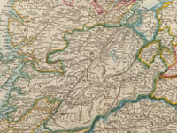
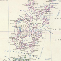
Argyll
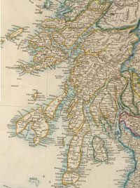
Parish
map
Report
Minutes
of Evidence
For Parliamentary & Military Roads, see Evidence
p.658
or summary.
Statute
Labour Roads (Abstract C - Statute Labour Roads
by County)
| Name
of Parish or District |
Length
of Roads |
| 1st
or North Argyll District |
46.0.0 |
| 2nd
or South Argyll District |
140.0.0 |
| 3rd
or Central District |
142.6.0 |
| 4th
or Kintyre District |
103.0.0 |
| 5th
or Tarbert District |
60.0.0 |
| 6th
or Lorn District |
270.0.0 |
| 7th
or Mull District |
124.4.0 |
| 8th
or Ardnamurchan District |
80.0.0 |
| 9th
or Morven District |
36.0.0 |
10th
or Islay District
(Islay 92, Colonsay 15 miles) |
107.0.0 |
| Total
|
1109.2.0 |
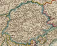
County of Aberdeen
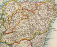
Parish
map
Report
Minutes
of Evidence
Turnpike
Roads (Abstract A - Turnpike Roads by County)
| Names
of Trusts |
Length
of Roads |
No.
of Tolls |
Bridge
of Dee Turnpike
|
1.4.0
|
0 |
| Inverury
|
15.4.0
|
3 |
| Old
Meldrum |
14.1.14
|
2 |
| Fyvie
|
7.6.73
|
1
1/2 |
| Ellon,
Peterhead & Fraserburgh |
52.4.0
|
9 |
| Skene
|
17.4.0
|
3 |
| Deeside
|
13.4.0
|
3 |
| Charleston
|
16.6.120
|
3 |
| Longside
|
12.0.0
|
3 |
| Udny
|
11.5.211
|
2 |
Newburgh
|
11.1.209 |
2 |
| Sheelagreen
|
11.4.83
2 |
2 |
| Raemoir
& Lumphanan |
17.1.22
3 |
3 |
| Alford
|
8.4.0
2 |
2 |
| Donside
|
19.7.117
|
4 |
| Corgarff
|
6.1.84
|
1 |
| Echt
& Midmar |
13.2.97
|
2
1/2
|
| Tarland
|
11.0.202
|
1
1/2 |
| Buchan
(part of) |
5.0.0
|
1 |
| Turriff
(part of) |
17.2.0
|
3 |
| Inverurie
& Forgue |
22.1.0
|
4 |
| Kintore
& Alford |
11.2.117
|
2 |
| Huntly
|
22.0.0
|
3
1/2 |
| Kinnethmont
|
9.1.0
|
2 |
| Gardensmill
|
13.2.0
|
2 |
| Insch
& West Foudland |
14.0.0
|
4 |
| Rhynie
|
10.4.1
|
2 |
| Strichen |
8.0.0 |
2 |
| Strichen
& Fraserburgh |
7.7.102
|
2 |
| Kemnay
|
3.3.168
|
1 |
| New
Pitsligo |
7.4.0
|
2 |
| Boyndlie
|
10.5.3
|
2 |
| Cortibrae
|
12.0.0
|
3 |
| Ballater
(20 miles, with 5 tolls. Only in course of construction) |
(20) |
(5) |
| Total
|
436.0.83
|
83 |
Statute
Labour Roads (Abstract C - Statute Labour roads
by County)
| Name
of Parish or District |
Length
of Roads |
| Deer
(13 parishes) |
346.1.11 |
| Ellon
(8 parishes) |
224.0.0 |
| Garioch
(15 parishes) |
184.4.68 |
| Kincardine
O’Neil (11 parishes) |
275.7.0 |
| Turiff
(6 parishes) |
273.0.0 |
| Aberdeen
(11 parishes) |
168.0.0 |
| Alford
(14 parishes) |
218.4.0 |
| Huntly
(9 parishes) |
120.0.0 |
| Town
of Aberdeen (3 parishes) |
46.4.137 |
| Total
|
1836.4.216 |
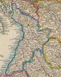
County of Ayr
Summary of entries relating
to Ayrshire
Parish
map
Report
Minutes
of Evidence
Turnpike
Roads (Abstract A - Turnpike Roads by County)
| Names
of Trusts |
Length
of Roads |
No.
of Tolls |
| Ayr
District |
145.0.0
|
31
½ |
| Kilmarnock
District |
120.0.0
|
81 |
| Mauchline
District |
105.4.0
|
25
½ |
| Maybole
District |
144.0.0
|
28
½ |
| Girvan
District |
69.5.0
|
15
½ |
| Stewarton
District |
21.4.0
|
4 |
| Irvine
District |
52.3.0
|
12
½ |
| Lochlibo
District |
15.0.0
|
5
½ |
| Beith
District |
23.4.0
|
12 |
| Largs
District |
18.0.0
|
6 |
| Total
|
714.4.0
|
172 |
Statute
Labour Roads (Abstract C - Statute Labour Roads
by County, page 35 of report)
| Name
of Parish or District |
Length
of Roads |
| Ten
districts and three separate parishes (districts
as above) |
640.0.0 |
County of Banff

Parish
map
Report
Minutes of Evidence
Turnpike
Roads (Abstract A - Turnpike Roads by County)
| Names
of Trusts |
Length
of Roads |
No.
of Tolls |
| Aberlour
& Inveravon |
10
2 156 |
2 |
| Boat
of Bridge (part of) |
5.3.115 |
2 |
| Boharm
Suspension Bridge |
1 |
0 |
| Botriphnie |
9.1.16 |
3 |
| Boyndie
|
12.7.57 |
3 |
| Cullen |
11.5.162 |
2
½ |
| Deskford |
10.2.207 |
2 |
| Eastside
bridge |
1 |
0 |
| Enzie
|
6.5.89
|
1
½ |
| Fochabers
(wholly in County of Elgin) |
- |
0 |
| Forglen
|
11.6.0 |
2 |
| Keith
(part of) |
6.0.0 |
2 |
| Marnock
|
20.0.218 |
3 ½ |
| Port
Gordon |
8.0.110 |
2 |
| Portsoy,
Keith & Huntly |
20.5.0 |
3 |
| Buchan
(part of) |
8.0.0
|
1
½ |
| Turriff
(part of) |
8.4.0 |
0
2/3 |
| Total
|
144.5.30
|
32
2/3 |
Statute
Labour Roads (Abstract C - Statute Labour Roads
by County)
| Name
of Parish or District |
Length
of Roads |
| Banff
(4 parishes) |
84.0.0 |
| Cullen
|
130.0.0 |
| Aberchirder
(4 parishes) |
90.0.0 |
| Keith
(5 parishes) |
108.0.0 |
| Aberlour
or Charleston (4 parishes) |
104.0.0 |
| Total
|
516.0.0 |
County of Berwick

Parish
map
Report
Minutes
of Evidence
Turnpike
Roads (Abstract A - Turnpike Roads by County)
| Names
of Trusts |
Length
of Roads |
No.
of Tolls |
| Eastern
District |
18.4.0 |
4 |
| Coldstream
Bridge |
- |
1 |
| Deanburn
District |
28.6.0 |
3 ½ |
| Cornhill
District (part of) |
27.7.90 |
5 ½ |
| Dunse
& Westruther |
10.0.0
|
1 |
| Middle
District |
58.0.0
|
9 |
| Upsettlington
Branch of Middle District |
12.0.0 |
1 |
| Ladykirk
& Norham Bridge |
- |
1 |
| Whiteburn
& Kelso |
11.3.0 |
2 |
| Mertoun
Bridge |
- |
1 |
| Total
|
161.4.90
|
29 |
Statute
Labour Roads (Abstract C - Statute Labour Roads
by County)
| Name
of Parish or District |
Length
of Roads |
| Foulden
(4 parishes) |
29.3.0 |
| Greenlaw
(Greenlaw parish) |
21.0.0 |
| Hume
(Hume parish) |
14.0.0 |
| Polwarth
(Polwarth parish) |
4.4.0 |
| Lauder
(4 parishes, Burgh of Lauder) |
56.0.0 |
| Dunse
(7 parishes) |
95.0.0 |
| Earlston
(4 parishes) |
47.0.0 |
| Ayton
(4 parishes) |
110.2.0 |
| Swinton
(6 parishes) |
79.7.0 |
| Total
|
457.0.0 |
County of Bute

Parish
map
Report
Minutes of Evidence
Statute
Labour Roads 122.0.0
For Parliamentary Roads, see Evidence p.658
or summary.
County of Caithness

Parish map
Report
Minutes
of Evidence
Parliamentary Roads 54.0.0
County Turnpikes etc 136.0.0
Parish Roads 41.0.0
For Parliamentary Roads see Evidence p.658
or summary.
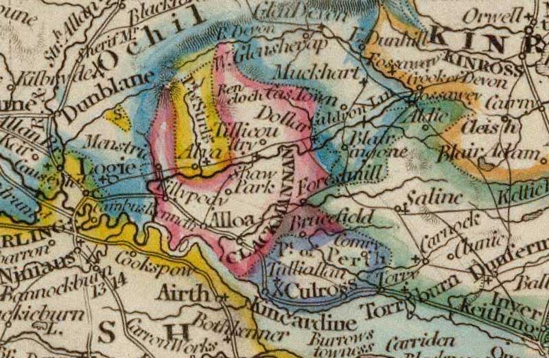
County of Clackmannan

Parish
map
Report
Minutes
of Evidence
Turnpike
Roads (Abstract A - Turnpike Roads by County)
| Names
of Trusts |
Length
of Roads |
No.
of Tolls |
| Clackmannanshire
(part of) |
11.4.0 |
4 |
| Kinross
& Alloa (part of) |
6.4.0
|
1
½ |
| Ochil
(part of) |
19.0.0 |
3 |
| Carnock
& Kennet (part of) |
0.4.0 |
0 |
| Total |
37.4.0 |
8
½ |
Statute
Labour Roads (Abstract C - Statute Labour Roads
by County)
| Name
of Parish or District |
Length
of Roads |
Parishes
of Alloa, Clackmannan, Dollar,
Logie and Tillicoultry |
38.0.0 |
County of Dumbarton

Parish
map
Report
Minutes
of Evidence
Turnpike
Roads (Abstract A - Turnpike Roads by County)
| Names
of Trusts |
Length
of Roads |
No.
of Tolls |
| Cumbernauld
(part of) |
9.0.0 |
3 |
| Kirkintilloch
& Cumbernauld |
12.0.0 |
5 |
| Gareloch |
20.0.0 |
5 |
| Yoker
or 1st District |
9.0.0 |
2 |
| Lawmuir
or 2nd District |
6.0.0 |
2 |
| Kilmaronock
or 3rd District |
15.0.0 |
3 |
| Helensburgh
or 4th District |
8.0.0 |
1
½ |
| Luss
or 5th District |
40.0.0 |
7
½ |
| Glasgow,Kirkintilloch
& Baldernoch (pt. of) |
2.4.60 |
1 |
| Third
District of West Stirlingshire (part of) |
6.7.159 |
1 |
| North
& South Lanarkshire (part of) |
5.0.0 |
1 |
| Total |
133.4.0 |
29 |
Statute
Labour Roads (Abstract C - Statute
Labour Roads by County)
| Name
of Parish or District |
Length
of Roads |
| Roseneath |
15.0.0 |
| Luss,
Row & Arrochar |
16.0.0 |
| Cardross
& Bonhill (east of Leven) |
9.0.0 |
| Kilmaronock
& Bonhill (east of Leven) |
24.0.0 |
| Dumbarton
(within Burgh) |
1.4.17 |
| Dumbarton
(extra Burghal) |
1.3.113 |
| West
Kilpatrick |
9.5.210 |
| East
Kilpatrick |
16.6.169 |
| Kirkintilloch
(Burghal) |
10.4.0 |
| Kirkintilloch
(Landward) |
13.6.0 |
| Cumbernauld
|
28.0.0 |
| Total
|
145.6.69 |
County of Dumfries

Parish
map
Report
Minutes
of Evidence
Turnpike
Roads (Abstract A - Turnpike Roads by County)
| Names
of Trusts |
Length
of Roads |
No.
of Tolls |
|
First, or Annandale |
79.0.0 |
11 |
| Second,
or Annan |
96.0.0 |
14 |
| Third,
or Eskdale |
39.6.0 |
4 |
Scotsdyke
& Haremoss (Western Division,
proportion of) |
19.0.0 |
4 |
| Fourth,
or Nithsdale |
96.0.0 |
12 |
| Glasgow
& Carlisle (part of) |
29.2.0 |
5 |
| Evan
Water (part of) |
6.2.0
|
1 |
| Liddesdale
(part of) |
5.2.0
|
1 |
| Total
|
370.4.0 |
52 |
Statute
Labour Roads (Abstract C - Statute Labour Roads
by County)
Name
of Parish or District
|
Length
of Roads |
| 8
Districts |
799.6.0 |
County of Edinburgh

Parish map
Report
Minutes
of Evidence
Turnpike
Roads (Abstract A - Turnpike Roads by County)
| Names
of Trusts |
Length
of Roads |
No.
of Tolls |
| Lasswade
& Wrightshouses District |
187.6.4 |
- |
| Dalkeith
& Post Road District |
84.7.218 |
- |
| Cramond
District |
25.2.33 |
- |
| Corstorphine
District |
21.4.190 |
- |
| Calder
& Slateford |
109.2.74 |
- |
| Total
|
428.7.79
|
80 |
Statute
Labour Roads (Abstract C - Statute Labour Roads
by County)
| Name
of Parish or District |
Length
of Roads |
| Thirty
Parishes |
171.4.0 |
County of Elgin
Parish map
Report
Minutes
of Evidence
Turnpike
Roads (Abstract A - Turnpike Roads by County)
| Names
of Trusts |
Length of Roads |
No.
of Tolls |
| Boat
of Bridge (Elginshire) |
8.0.0
|
1 |
| Consolidated
|
52.0.0
|
11 |
| Dava
|
8.0.0
|
2 |
| Rothes
|
12.0.0
|
2 |
| Findhorn
Suspension Bridge |
0.0.50 |
1 |
| Bridge
of Spey at Fochabers |
1 |
0 |
| Fochabers
Turnpike |
5.0.149
|
1 |
| Boat
of Bridge (Banffshire, part of) |
1.6.0 |
0 |
| Keith
(part of) |
1.0.0 |
0 |
| Total
|
87.6.199 |
19 |
Statute
Labour Roads (Abstract C - Statute Labour Roads
by County)
| Name
of Parish or District |
Length
of Roads |
| Elgin
(3 parishes) |
78.2.0 |
| Urquhart
& Duffus (6 parishes) |
96.0.0 |
| Forres
(6 parishes) |
130.2.0 |
| Rothes
(2 parishes) |
33.0.0 |
| Strathspey
(2 parishes) |
27.4.0 |
| Total |
360.0.0 |
County of Fife

Parish
map
Report
Minutes
of Evidence
Turnpike
Roads (Abstract A - Turnpike Roads by County)
| Names
of Trusts |
Length
of Roads |
No.
of Tolls |
| Cupar
District of Consolidated Turnpikes |
80.6.0
|
13 |
| St
Andrews |
137.0.0 |
20 |
| Kirkcaldy
|
78.4.0
|
13 |
| Dunfermline
|
45.0.0
|
9 |
| Cupar
& Kinross (part of) |
14.0.0 |
4 |
| Pitcairley |
4.0.0 |
1 |
| Outh
& Nivingstone (part of) |
19.0.0
|
4 |
| Leven
Bridge & Road |
7.4.0 |
5 |
| Great
North Road (part of) |
17.6.0
|
4 |
| Carnock
& Kennet (part of) |
2.0.0 |
1 |
| Ochil
(part of) |
1.0.0 |
0 |
| Total
|
106.4.0
|
74 |
Statute
Labour Roads (Abstract C - Statute Labour Roads
by County)
| Name
of Parish or District |
Length
of Roads |
| Cupar
(21 parishes) |
125.0.0 |
| St
Andrews (20 parishes) |
78.3.24 |
| Kirkcaldy
(14 parishes) |
69.5.15 |
| Dunfermline
(8 parishes) |
56.6.44 |
| Total
|
329.6.83 |
County of Forfar

Parish
map
Report
Minutes
of Evidence
Turnpike
Roads (Abstract A - Turnpike Roads by County)
| Names
of Trusts |
Length of Roads |
No. of Tolls |
| Montrose
& Brechin |
8.0.0
|
2 |
| Northern
|
7.4.0
|
1 |
| Montrose
& Forfar |
15.4.0
|
3 |
| Invergowrie |
3.0.0 |
1 |
| Strathmartine |
7.0.0 |
1 |
| Eastern
|
27.5.0
|
5 |
| Lumleyden
& Peterden |
11.5.0
|
2 |
| Strathmore
|
26.7.0
|
7 |
| Arbroath,
Brechin & Forfar |
21.6.131 |
4 |
| Cairnconan
|
3.0.0
|
1 |
| Central
|
7.4.0
|
2 |
| Forfar
& Kirriemuir |
6.0.0 |
2 |
| Dundee
& Cupar-Angus (part of) |
21.4.0 |
4 |
| Pitkerro
|
4.0.0
|
1 |
| Broughty-Ferry
and Baldovie |
7.0.0
|
1 |
| Dundee
& Forfar |
14.0.0
|
3 |
| Montrose
Bridge |
1 |
0 |
| Total
|
191.7.131
|
41 |
Statute
Labour Roads (Abstract C - Statute Labour Roads
by County)
| Name
of Parish or District |
Length of Roads |
| Dundee
(10 parishes) |
137.0.0 |
| Forfar
(16 parishes) |
271.0.0 |
| Brechin
(12 parishes) |
242.0.0 |
| Arbroath
(10 parishes) |
135.4.176 |
| Total
|
785.4.176 |
County of Haddington

Parish
map
Report
Minutes
of Evidence
Turnpike
Roads (Abstract A - Turnpike Roads by County)
| Names
of Trusts |
Length
of Roads |
No.
of Tolls |
| Great
Post Road |
34.0.0
|
11 |
| North
District |
52.4.0 |
11 |
| South
District |
27.2.0 |
5 |
| Kilpallet
District |
22.2.0 |
6 |
| Ormiston
District |
5.0.0 |
3 |
| Total
|
141.0.0 |
36 |
Statute
Labour Roads (Abstract C - Statute Labour Roads
by County)
| Name
of Parish or District |
Length of Roads |
| Twenty-five
Parishes |
295.0.0 |
County of Inverness (includes
Skye, Harris, N & S Uist and Barra)
Parish map (mainland);
parish map (islands)
Report
Minutes
of Evidence
Turnpike
Roads (Abstract A - Turnpike Roads by County)
| Names
of Trusts |
Length
of Roads |
No.
of Tolls |
| Castle-Stewart
& Nairn Turnpike (part of) |
11.4.0 |
2 |
Statute
Labour Roads (Abstract C - Statute Labour Roads
by County)
Name
of Parish or District
|
Length
of Roads |
| Inverness
(part of Inverness parish) |
7.0.140 |
| Petty
(Petty and Ardersier) |
14.4.0 |
| Aird
(4 parishes - incl. 2 part parishes) |
33.5.157 |
| Strathglass
(3 parishes - parts) |
56.4.0 |
| Urquhart
(3 parishes - incl 1 part parish) |
26.2.0 |
| Dores
(Dores, Boleskine, Abertarff) |
63.0.0 |
| Glengarry
(Kilmonivaig and Boleskine) |
12.0.0 |
| Strathnairn
(Daviot and Dunlichity) |
31.0.0 |
| Strathdearn
(Moy and Dunlichity) |
31.0.0 |
| Badenoch |
- |
| Strathspey
(Cromdale and Abernethy) |
16.0.0 |
| Fort
William (Kilmallie and Kilmonivaig) |
85.0.0 |
| Skye |
- |
| Dunveggan
(Duirnish and Bracadale) |
60.0.0 |
| Harris
(Harris) |
36.0.0 |
| South
Uist (South Uist) |
38.0.0 |
| Arisaig
(Ardnamurchan) |
30.0.0 |
| Glenelg
(Glenelg) |
15.0.0 |
| North
Uist |
- |
Dalcross
(Croy) 9.4.0
|
- |
| Barra
(Barra) |
15.0.0 |
| Culloden
(Inverness and Croy) |
15.0.166 |
| Moidart
|
- |
| Knoydart
(Kilmonivaig and Glenelg) |
- |
| Lochend |
- |
| Total
|
614.1.28 |
County of Kincardine

Parish
map
Report
Minutes
of Evidence
Turnpike
Roads (Abstract A - Turnpike Roads by County)
| Names
of Trusts |
Length
of Roads |
No.
of Tolls |
| Consolidated
Trust |
58.0.0 |
6 |
| Slug
Road |
15.6.0 |
3 |
| South
Deeside |
14.0.0 |
2 |
| Netherley
(or Fetteresso and Maryculter) |
11.0.0 |
1 |
| Marykirk
Bridge |
- |
1 |
| Wellington
Suspension Bridge 4.4.0 |
- |
1 |
| Total
|
103.2.0 |
14 |
Statute
Labour Roads (Abstract C - Statute Labour Roads
by County)
| Name
of Parish or District |
Length
of Roads |
| Five
Districts (19 parishes) |
397.0.0 |
County of Kinross
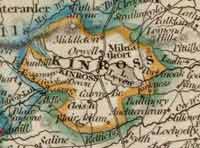
Parish map
Report
Minutes
of Evidence
Turnpike
Roads (Abstract A - Turnpike Roads by County)
| Names
of Trusts |
Length
of Roads |
No.
of Tolls |
| Cleish
|
15.0.0
|
1 |
| Milnathort
|
6.6.0
|
1
½ |
| Portmoak |
16.0.0 |
1 |
| Kinross
& Alloa (part of) |
6.0.0 |
1 ½ |
| Outh
& Nivingston (part of) |
4.0.0
|
1 |
| Great
North Road (part of) |
11.0.0 |
2 |
| Cupar
& Kinross (part of) |
3.4.0
|
0 |
| Total
|
62.2.0
|
7
½ |
Statute
Labour Roads (Abstract C - Statute Labour Roads
by County)
| Name
of Parish or District |
Length
of Roads |
| Kinross
& Orwell |
31.2.97 |
| Cleish
& Tullibole |
15.0.37 |
| Portmoak
|
3.0.0 |
| Total
|
49.2.136 |
Stewartry of Kirkcudbright
Parish
map
Report
Minutes
of Evidence
Turnpike
Roads (Abstract A - Turnpike Roads by County)
| Names
of Trusts |
Length
of Roads |
No.
of Tolls |
| County
Turnpikes |
249.4.0 |
29 |
Statute
Labour Roads (Abstract C - Statute Labour Roads
by County)
| Name
of Parish or District |
Length
of Roads |
| Twenty-Eight
Parishes |
511.0.0 |
County of Lanark
Parish
map
Report
Minutes
of Evidence
Turnpike
Roads (Abstract A - Turnpike Roads by County)
Names
of Trusts
|
Length of Roads |
No.
of Tolls |
| Bathgate
& Airdrie (part of) |
15.0.0
|
3 |
| Biggar
& Leadhills |
35.0.0
|
6 |
| Cambuslang
& Muirkirk |
55.0.0
|
12 |
| Carluke
|
23.4.0
|
5 |
| Corsethill
|
40.4.0
|
5 |
| Crossford
Bridge and approaches |
0.3.0
|
1 |
| Dalmarnock
Bridge |
- |
- |
| Garion
Bridge |
- |
1 |
| Garngad
Turnpike |
2.4.170
|
1 |
| Garscube
|
5.4.92
|
1 |
| Glasgow,Kirkintilloch
& Baldernock (pt.of) |
10.2.5
|
1 |
Glasgow
& Shotts (part of)
|
58.0.0 |
5 |
| Great
Western & St George’s |
3.4.7
|
2 |
| Lanark
and Hamilton, or Clydeside |
12.0.0 |
2 |
| E
& W Lanarkshire |
27.0.0
|
6 |
| N
& S Lanarkshire (part of) |
44.0.0
|
6 |
| Port-Dundas
& Craighall |
1.2.20
|
1 |
| Renfrew
|
5.0.194
|
1 |
| Three-Mile-House
(part of) |
1.7.2
|
0
½ |
| Wilsontown
& Lanark |
10.2.0
|
3 |
| Yoker
(part of) |
9.1.40 |
1 |
| Glasgow
& Carlisle (part of) |
32.0.0
|
6 |
| Evan
Water (part of) |
7.0.0
|
1 |
| Cumbernauld
(part of) |
10.0.0 |
3 |
| Parliamentary
Road |
1.0.0
|
1 |
Glasgow
Bridge
|
- |
3 |
| New
Suspension Bridge 1 |
- |
1 |
| South
Portland Street Suspension Bridge 1 |
- |
1 |
| Kelvin
Bridge 1 |
- |
1 |
| Renfrewshire
Turnpikes (part of) |
6.2.137
|
1 |
| Total
|
416.2.67
|
1 |
Statute
Labour Roads (Abstract C - Statute Labour Roads
by County)
| Name
of Parish or District |
Length
of Roads |
| Upper
Ward (20 parishes) |
376.7.0 |
| Middle
Ward (14 parishes) |
452.0.0 |
| Lower
Ward (6 parishes) |
87.1.0 |
| Total
|
916.0.0 |
County of Linlithgow

Parish
map
Report
Minutes
of Evidence
Turnpike
Roads (Abstract A - Turnpike Roads by County)
| Names
of Trusts |
Length of Roads |
No.
of Tolls |
| Bathgate
& Airdrie (part of) |
15.0.0 |
2 |
| Cramond
Bridge, Queensferry & Linlithgow |
15.1.0 |
4 |
| Cleuch
|
22.4.0 |
14 |
| Linlithgow
|
14.0.0 |
2 |
| Glasgow
& Shotts (part of) |
9.4.0 |
1 |
| Total
|
76.1.0 |
23 |
Statute
Labour Roads (Abstract C - Statute Labour Roads
by County)
| Name
of Parish or District |
Length
of Roads |
| 1A-1E
Ecclesmachan |
6.0.0 |
| Linlithgow |
28.5.0 |
| Abercorn
and part of Dalmeny |
7.7.0 |
| Torphichen |
23.0.0 |
| Carriden |
4.3.55 |
| 2A-2B
Uphall |
8.1.172 |
| Kirkliston
|
13.0.111 |
| 3
Dalmeny |
9.4.0 |
| 4
Bathgate |
30.0.0 |
| 5
Whitburn |
20.0.0 |
| 6
Livingstone |
8.0.0 |
| Total
|
158.5.118 |
County of Nairn
Parish
map
Report
Minutes
of Evidence
Turnpike
Roads (Abstract A - Turnpike Roads by County)
| Names
of Trusts |
Length of Roads |
No.
of Tolls |
| Nairnshire
Turnpikes |
19.6.0 |
4 |
| Castle
Stewart and Nairn (part of) |
2.0.0 |
0 |
| Total
|
21.6.0 |
4 |
Statute
Labour Roads (Abstract C - Statute Labour Roads
by County)
| Name
of Parish or District |
Length
of Roads |
| First,
or Nairn District |
5.0.0 |
| Second,
or Country District |
122.0.0 |
| Total
|
127.0.0 |
County of Orkney
Parish
map
Report
Minutes
of Evidence
No Turnpikes.
County
Assessment Roads (Abstract C - Statute Labour Roads
by County)
County of Peebles

Parish
map
Report
Minutes
of Evidence
Turnpike
Roads (Abstract A - Turnpike Roads by County)
| Names
of Trusts |
Length
of Roads |
No.
of Tolls |
| First
District |
16.4.0 |
4 |
Second
to Sixth Districts, inclusive;
including Tweed Bridge |
106.0.0 |
18 |
| Total
|
122.4.0 |
22 |
Statute
Labour Roads (Abstract C - Statute Labour Roads
by County)
| Name
of Parish or District |
Length
of Roads |
| Sixteen
Parishes |
106.6.0 |
County of Perth
Parish
map
Report
Minutes
of Evidence
Turnpike
Roads (Abstract A - Turnpike Roads by County)
Names
of Trusts
|
Length
of Roads |
No.
of Tolls |
| Athole |
37.4.0 |
6 |
| Auchterarder
|
11.0.0 |
2 |
| Blairgowrie
& Bridge of Cally |
6.0.0 |
2 |
| Blairgowrie
& Coupar-Angus |
4.6.0 |
2 |
| Carse
of Gowrie, or Dundee |
33.0.0 |
2 |
| Crieff
& Longcausewayhead (part of) |
17.0.0 |
3 |
| Dalpatrick |
6.4.0 |
2 |
| Dalreoch
|
12.0.0 |
2 |
| Drip,
Frew & Netherton |
10.0.0 |
2 |
| Dunblane,
Doune & Callendar |
29.0.0 |
5 |
| Dunkeld,
Aberfeldy & Kenmore |
23.4.0 |
3 |
| Dunning
|
9.0.0 |
2 |
| Gleneagles
|
24.0.0 |
5 |
| Glenfalloch |
7.0.0 |
1 |
| Glenlichorn
|
12.0.0 |
2 |
| Lochearn |
27.0.0 |
4 |
| Lochtayside
& Glendochart |
39.0.0 |
5 |
Menteith
& Burnbank
|
8.4.0
|
2 |
| Perth
& Coupar-Angus |
22.0.0 |
5 |
| Perth
& Crieff |
17.0.0 |
3 |
| Perth
& Dunkeld |
26.0.0 |
4 |
| Perth
& Kinclaven |
10.0.0 |
3 |
| Strathbraan |
7.4.0 |
2 |
| Strathtay
|
9.6.0
|
1
½ |
| Taybridge
|
26.0.0 |
5 |
| Tummelbridge |
22.0.0 |
3
½ |
| Great
North Road (part of) |
10.4.0
|
1 |
| Dundee
& Coupar-Angus (part of) |
1.4.0
|
1 |
| Outh
& Nivingston (part of) |
5.0.0 |
0 |
| Carnock
& Kennet (part of) |
6.4.0 |
1 |
| Stirling
to Drymen Bridge (part of) |
2.0.0
|
0 |
| Second
District of West Stirlingshire (pt. of) |
1.7.40
|
0 |
| Kinross
& Alloa (part of) |
4.4.0 |
1 |
| Ochil
(part of) |
4.4.0
|
1 |
| Clackmannanshire
(part of) |
8.4.0
|
3 |
| Dunkeld
Bridge |
- |
1 |
| Perth
Bridge |
- |
0 |
| New
Bridge of Earn |
- |
0 |
| Total |
501.7.40 |
88 |
Statute
Labour Roads (Abstract C - Statute Labour Roads
by County)
| Name
of Parish or District |
Length of Roads |
| Perth
District (16 parishes) |
139.6.116 |
| Weem
District (3 parishes) |
56.0.0 |
Breadalbane,
Glenlyon and Strathtay
(6 parishes) |
125.0.0 |
| Auchterarder
(6 parishes) |
57.4.0 |
| Blairgowrie
(7 parishes) |
100.6.0 |
| Carse
of Gowrie (9 parishes) |
90.0.0 |
| Coupar-Angus
(9 parishes) |
62.0.0 |
| Crieff
(8 parishes) |
120.0.0 |
| Culross
(2 parishes) |
18.0.0 |
| Dunblane
(9 parishes) |
272.0.0 |
| Dunkeld
(5 parishes) |
60.0.0 |
| Athole
(5 parishes) |
68.4.0 |
| Total
|
1164.4.116 |
County of Renfrew

Parish
map
Report
Minutes
of Evidence
Turnpike
Roads (Abstract A - Turnpike Roads by County)
| Names
of Trusts |
Length
of Roads |
No.
of Tolls |
Renfrewshire
Turnpikes, consisting of the
Gorbals, Kilmarnock, Paisley, Johnstone,
Renfrew and Barnsford Turnpikes (pt.of) |
151.4.158
|
32 |
| Renfrew
& Greenock |
13.0.0 |
4 |
| Kelly
Bridge Turnpike |
14.0.0 |
3 |
| Eastwood
|
15.0.0 |
1 |
| Eagleshame |
5.0.0 |
1 |
| Three-Mile-House
(part of) |
1.1.140 |
0 ½ |
| Yoker
(part of) |
0.3.180 |
1 |
| Total
|
200.2.38
|
41
½ |
Statute
Labour Roads (Abstract C - Statute Labour Roads
by County)
Name
of Parish or District
|
Length
of Roads |
| Abbey
Parish, including Johnstone |
28.1.0 |
| Cathcart
|
7.4.0 |
| Eagleshame |
19.0.0 |
| Eastwood
|
6.3.0 |
| Erskine
|
17.5.94 |
| Greenock
|
11.4.0 |
| Houston
& Killellan |
18.2.0 |
| Inchinnan
|
4.2.125 |
| Inverkip
|
12.3.93 |
| Kilbarchan
|
30.0.0 |
| Kilmacolm
|
40.0.0 |
| Lochwinnoch
|
35.0.0 |
| Mearns
|
33.4.0 |
| Neilston
|
25.2.20 |
| Pollockshaws,
Burgh of, |
3.0.0 |
| Port-Glasgow
|
4.1.32 |
| Renfrew
|
4.4.0 |
| Total
|
300.4.144 |
Counties of Ross & Cromarty
(includes Lewis)
 
Parish map (mainland);
parish map (islands)
Report
Minutes
of Evidence
Parliamentary Roads 210 1/4 - see Evidence p.658
or summary.
Statute
Labour Roads (Abstract C - Statute Labour Roads
by County)
| Name
of District |
Length of Roads |
| Tarbet,
Fearn, and Nigg |
39.0.0 |
| Tain
and Kincardine |
25.2.134 |
| Rosskean,
Kilmuir Easter, Logie Easter |
36.4.0 |
| Kiltearn
and Alness |
26.7.73 |
| Glensheal,
Lochalsh, and Kintail |
10.0.0 |
| Gairloch
|
65.0.0 |
| Killearnan,
Knockbain, Urquhart, and Urray |
64.3.151 |
| Cromarty,
Rosemarkie, Avoch, Resolis |
50.6.0 |
| Lewis
|
173.0.0 |
| Fodderty,
Contin, and part of Urray |
25.1.162 |
| Lochbroom |
15.4.0 |
| Dingwall
|
2.0.155 |
| Applecross
and Lochcarron |
13.6.0 |
| Contin
and Fodderty |
18.2.36 |
| Total
|
565.6.51
|
County of Roxburgh

Parish
map
Report
Minutes
of Evidence
Turnpike
Roads (Abstract A - Turnpike Roads by County)
| Names
of Trusts |
Length
of Roads |
No.
of Tolls |
| Kelso
Bridge |
- |
- |
| Great
Road |
12.6.0 |
2 |
| Kelso
Union, North Branch |
12.0.0 |
2 |
| Kelso
Union, South Branch |
10.0.0 |
3 |
| Kelso
Union, West Branch |
10.0.0 |
2 |
| Lauder
and Kelso |
21.0.0 |
3 |
| Haremoss
& Scotsdyke |
20.1.0 |
3 |
| Liddesdale
(part of) |
26.0.0 |
6 |
| Selkirk
& St Boswells |
6.2.0 |
2 |
| Roxburgh
Road, 1st and 2nd Assignations |
96.0.0
|
24 |
| Drygrange
Pontage |
- |
1 ½ |
| Scotsdyke
& Haremoss,Western Div.(pt.of) |
1.3.0 |
0 |
| Selkirkshire
Road & Bridge (part of) |
1.5.206 |
0 |
| Total |
217.1.206 |
48
½ |
Statute
Labour Roads (Abstract C - Statute Labour Roads
by County)
| Name
of Parish or District |
Length of Roads |
| Hawick
(6 parishes) |
120.4.0 |
| Liddesdale
(Castleton) |
26.0.0 |
| Jedburgh
(8 parishes) |
131.0.69 |
| Kelso
(12 parishes) |
168.0.195 |
| Melrose
(6 parishes) |
94.6.0 |
| Total
|
540.3.44 |
County of Selkirk
Parish
map
Report
Minutes
of Evidence
Turnpike
Roads (Abstract A - Turnpike Roads by County)
| Names
of Trusts |
Length
of Roads |
No.
of Tolls |
| Ettrick
Turnpike |
21.0.0 |
2 |
| Selkirkshire
Road and Bridge (part of) |
28.4.6 |
4 |
| Tweed
and Ettrick Bridges |
- |
1 |
| Total
|
49.4.6 |
7 |
Statute
Labour Roads (Abstract C - Statute Labour Roads
by County)
| Name
of Parish or District |
Length
of Roads |
| Six
parishes |
133.2.0 |
County of Stirling

Parish
map
Report
Minutes
of Evidence
Turnpike
Roads (Abstract A - Turnpike Roads by County)
| Names
of Trusts |
Length
of Roads |
No.
of Tolls |
| Crossmuirhead
and Higginsneuk |
5.0.0 |
1 |
| Denny
to Fintry |
4.6.0
|
1 |
| Kerse
Road & Bridge |
11.0.0 |
3 |
| Linlithgow
& Stirling |
44.0.0 |
8 |
| Redrow
to Peathill |
12.20 |
2 |
| Stirling
to Drymen Bridge (part of) |
21.0.0 |
4 |
| West
Stirlingshire 1st District |
21.1.14
|
4 |
| West
Stirlingshire 2nd District (part of) |
27.0.0 |
4 |
| West
Stirlingshire 3rd District (part of) |
6.3.158 |
1 |
| Crieff
& Longcausewayhead (part of) |
2.0.0
|
0 |
| Ochill
(part of) |
2.0.0
|
1 |
| Cumbernauld
(part of) |
1.0.0
|
0 |
| Glasgow,Kirkintilloch&Baldernock(part
of) |
6.0.195
|
1 |
| Total
|
163.5.142 |
30 |
Statute
Labour Roads (Abstract C - Statute Labour Roads
by County)
| Name
of Parish or District |
Length of Roads |
| Balfron
(5 parishes) |
57.4 |
| Campsie
(5 parishes) |
48.1 |
| Denny
(4 parishes) |
61.0 |
| Stirling
(4 parishes) |
50.0 |
| Alva
(Alva) |
3.0 |
| Logie
(Lecropt and Logie) |
16.0 |
| Polmont
(Muiravonside and Polmont) |
40.5 |
| Carron
(6 parishes) |
72.4 |
| Total
|
343.6 |
County of Sutherland

Parish
map
Report
Minutes
of Evidence
Parliamentary Roads 96 1/2 - see Evidence p.658
or summary.
Statute
Labour Roads (Abstract C - Statute Labour Roads
by County)
| Name
of Parish or District |
Length
of Roads |
County
Statute Labour Roads,
Bridges, and Ferries |
384.0.0 |
Road
from Lairg to Scourie (presently
maintained by the Duke of Sutherland) |
30.0.0 |
| Total
|
414.0.0 |
County of Wigtown

Parish
map
Report
Minutes
of Evidence
Turnpike
Roads (Abstract A - Turnpike Roads by County)
| Names
of Trusts |
Length
of Roads |
No.
of Tolls |
| Wigtownshire
Turnpikes |
51.0.0 |
6 |
Statute
Labour Roads (Abstract C - Statute Labour Roads
by County)
| Name
of Parish or District |
Length
of Roads |
| Seventeen
Parishes |
379.5.168 |
County of Zetland

Parish
map
Report
Minutes
of Evidence
No Turnpikes.
Statute
Labour Roads (Abstract C - Statute Labour Roads
by County)
| Name
of Parish or District |
Length
of Roads |
| Roads
already formed |
118.0.0 |
HIGHLAND
ROADS AND BRIDGES
See also Reports
of the Commission for Highland Roads and Bridges
for further information.
Toll Roads
County of Inverness
| Names
of Roads |
Length
of Roads |
No.
of Tolls |
| Moy
and Badenoch Roads |
64
½ miles |
8
|
| Beauly
Road |
15
¾ |
1 |
| Inverness
and Nairn Road |
12 |
2 |
| Fort
George Road |
13 |
1 |
| Total
|
105
¼ |
12
|
County of Ross
| Names
of Roads |
Length
of Roads |
No.
of Tolls |
| Contin
Road |
7
¾ |
1 |
| Invergordon
Road |
17 |
1 |
| Dingwall,
Fortrose and Fearn Roads |
44
½ |
3 |
| Kessock
Branch Roads |
8 |
1 |
| Total
|
77 |
6 |
County of Caithness
| Names
of Roads |
Length
of Roads |
No.
of Tolls |
| Thurso
Road |
21
|
2 |
| Dunbeath
Road |
33
|
1 |
| Total
|
54
|
3 |
Untolled Roads
County of Inverness
Names
of Roads
|
Length of Roads |
| Inverfarigaig
Road |
19 |
| Balichernoch
Road |
5 |
| Fort
Augustus and Glenmoriston Rd |
29 ½ |
| Invermorriston
Road |
26 ½ |
| Glengarry
Road |
31 2/3 |
| Lochnagaul
Road |
21 ½ |
| Lochyside
Road |
8 ½ |
| Laggan
Road |
36 |
| Ashiek
and Sconser Roads |
27 ½ |
| Broadford
Road |
15 ½ |
| Stein,
McLeod and Portree Roads |
41 ½ |
| Trotternish
14, and Snizort Roads 19 |
33 |
| Dunvegan
Harbour Roads |
5 |
| Strathglass
Road |
22 ¼ |
| Glenelg
and Rhaebuie Roads |
10 ¾ |
| Speyside
Road |
6 ½ |
| Moidart
Road |
6 ½ |
Military Roads
Inverness-shire
Names
of Roads
|
Length of Roads |
Fort
William 45, Boleskine 32½,
Corryarrock 8 |
85
½ |
| Skye
etc, Ferry Piers |
0 |
County of Ross
Names
of Roads
|
Length of Roads |
| Lochalsh
and Ardelve Roads |
16
½ |
| Tain
Road |
15 |
Glenshiel,
Kintail, Glenelg,
and Rhaebuie Roads |
37 ¾ |
| Lochcarron
Road |
49 |
| Kishorn
Road |
15 |
| Ferry
Piers in Lochalsh |
0 |
County of Sutherland
Names
of Roads
|
Length of Roads |
| Sutherland
Coast Road |
47 |
| Tongue
Road |
49 ½ |
| Fleet
Mound, Sluices, etc, about 1 mile |
0 |
| Bonar
Bridge |
0 |
County of Aberdeen
Alford Road 13 ½
Ballater Bridge
County of Nairn
Findhorn and Benauchlye Roads 20 2/3
County of Moray
Findhorn and Speyside, Grantown
and Duthill Roads 35 ½
County of Banff
Speyside Road 1 2/3
Counties of Moray and Banff
Craig Ellachie Bridge and Approaches 1
County of Bute
Arran Road 17
County of Argyll
Parliamentary Roads 130 ¾
County of Argyll
Military Roads
Glenco 31, Dalmally 27, Glencro 22 80
Total 960 ¾
| Counties |
Parliamentary
Roads |
Military
Roads |
| Inverness-shire*
|
383
|
148
½ |
| Ross-shire
|
210
½ |
0 |
| Sutherlandshire
|
96
½ |
0 |
| Caithness-shire
|
54 |
0 |
| Aberdeenshire
|
16 |
0 |
| Nairnshire
|
20
3/8 |
0 |
| Morayshire |
9 1/8 |
26
½ |
| Banffshire |
2 1/8 |
0 |
| Buteshire
|
17 |
0 |
| Argyll
|
130
¾ |
80 |
| Total
|
939
|
255 |
* There is also an Old Military Road from Fort Augustus
to Badenoch,
called the Corryarrock Road, used as a Drove Road, the
bridges of which
are kept in repair by the Commissioners.
There are 137 miles of County Roads in Caithness, formerly
kept up by
the Commisioners.
(top of page)
|