|

The
text below is mostly summaries with some extracts from
the original text. The links are mostly to Google Books,
usually to the first item of interest rather than the
first page of a parish. The NSA for Aberdeenshire is
volume 12. Some notes from MacFarlane's Geographical
Collections (mostly Volume I) have been added - these
are useful as they date from the 1720's. See here
for further information and links.
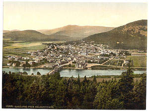
The
old photographs of Aberdeen and Ballater are from the
Detroit Publishing Company's Views of Landscape and
Architecture in Scotland - see thumbnails on Library
of Congress site here.
 |
| Road
types on the Black & Hall map |
Additional
information about parishes can be found on the Vision
of Britain site and on Scotland's
Places. The woodcut illustrations are by Thomas
Bewick and are linked to the original text on GoogleBooks
(General History of Quadrupeds and History of British
Birds).
The
maps are based on the quarter-inch OS map The Eastern
Highlands, 1923 and the half-inch map, sheets 14, 15
and 20, 1912 & 1914. With thanks to Ordnance Survey.
The parish maps are from Black
& Hall's map of Scotland, 1854, courtesy of
David
Rumsey Historical Map Collection. The images are
copyright Cartography Associates but have been made
available under a Creative
Commons license for non-commercial use. These extracts
are for general orientation only - detailed maps can
be accessed on the National
Library of Scotland site.
Overview
At
the time of the OSA, the 1790's, the roads were statute
labour which had been in operation for a few decades.
Except in a very few places the roads were very bad
as the work was done grudgingly, if at all, and without
any clear idea of how to make roads. Commutation, where
a person could pay a set rate instead of working himself,
allowed more competent workmen and overseers to be employed
and this gave better results.
There is however an interesting reference that the money
collected was never applied to the roads which of course
added to the general hostility to the system; in another
parish the labour was used to build private roads. Some
landowners, however, had roads and bridges built at
their own expense.
The
MacFarlane references, dating from the 1720's, are interesting
as they show that there were highways prior to statute
labour, and it is more than likely that some of these,
being main routes, existed at an earlier date.
With
the building of turnpikes, the roads improved greatly.
Several turnpikes are mentioned as are Parliamentary
roads.
Bridges
and fords were very important and there are frequent
references to how dangerous the rivers could be in flood,
sometimes even carrying bridges away. In Kildrummy,
stilts were used to get across the river.
The
military roads are mentioned, the Cairn o'Mounth road
that ran from Fettercairn to Huntly, the road from Blairgowrie
to Fort George that passed through Braemar, and the
road from Aberdeen to Corgarff. When the military ceased
to maintain the roads they deteriorated badly and nine
miles of the Corgarff road had to be replaced (Alford).
See Canmore
(RCAHMS) entries.
One common theme was the difficulty of obtaining peat;
mosses were running out or were being drained and much
time had to be spent to win the peats. The use of coal
was increasing though transport costs could be significant
for those parishes further away from the ports. Frequent
complaints are made about a tax levied on coals taken
beyond the Red Head near Arbroath.
A
canal had been built from Aberdeen to Inverury and had
originally been planned to carry on to Monymusk; other
canals were talked of in the north of the county but
were never made.
Apart
from many weekly markets, there were numerous fairs,
some long-established; and frequent mentions are made
of black cattle being bought up by drovers for the south
country and England. The development of steam sailing
vessels made it possible to take the cattle directly
to London by sea. As for other counties, travel was
limited at the time of the OSA but had greatly increased
by the 1830's with regular stage-coach services and
frequent carriers.
 |
|
A
speculative line (Romanum Iter Suppositum) for
a Roman road from Raedykes to Fochabers is shown
on the maps of Robertson
and Thomson. This is marked in red on the
above map. The yellow line is the course referred
to in the Canmore accounts - as said, no evidence
was found although the presence of camps on this
line is suggestive of a line of march, at least.
Details of the marching camps can be found on
Roman-Britain.org.
Most probably date from the Agricolan campaign
of AD 82-83, though a couple may be Severan (AD208-211).
The camp at Durno is off the line of the putative
road, whereas what was thought to have been a
camp at nearby Pitcaple is on the line but is
no longer considered to be Roman.
Recent work suggests other marching camps/outposts
on the coast of the Moray Firth - see The Last
Frontier, Antony Kamm, p.79.
Bennachie is one possibility for the site of Mons
Graupius.
|
There
are some interesting references to old roads: one was
to the "wine causeway" in Kintore west of
Aberdeen where customs had to be paid to the burgh of
Kintore and another to the "Lawrence Road"
leading through Culsamond parish to the fair at Old
Rayne.
Pioneering work by a Captain Shand had helped to establish
that the Romans had been in north-east Scotland which
was contrary to opinion at the time.
Several camps were identified as Roman with inevitable
speculation that they had been connected by a road.
A stretch of roadway, one mile long had been found at
Bennachie though difficulty was found in tracing it
further (not Roman - see Canmore record).
Early maps show a Roman road running NNW across Aberdeenshire
- see Canmore database for details of research into
Roman
roads in the area. No definite evidence for a road
is mentioned in these entries; they record the line
supposed to or likely to have been taken by this putative
road.
One difficulty is that it is linked to the 9th
Iter of Richard of Cirencester's De Situ Britanniae
(Six Old English Chronicles, edited J A Giles, London
1848) which is now thought to have been forged by a
Charles Bertram and so calls the existence of the road
into question (Chalmers in Caledonia, Vol.I, page
126ff) gives details of the route). However, even
if there is no road, it could show the line of march
taken by the Romans in their campaign.
Perhaps
the most interesting of these early roads are the "Pict's
Roads" mentioned in the Aboyne account. They do
appear to have been trackways, albeit short, though
the possibility that there was a continuous road of
this type from the Hill of Fare to Braemar does not
stand up to more detailed investigation.
Other
sources
The
construction of Aberdeenshire's first turnpike roads,
Thomas Day, Journal of Transport History, Sept. 2003
(article page numbers are at foot of web page)
The
Military Road from Braemar to the Spittal of Glen Shee,
Angus Graham, PSAS, Vol.97, (1963-64), pps 226-236
Roads in 1859
This
links to the 1859 Report of the Commissioners for Inquiring
into Matters relating to Public Roads in Scotland and
gives an overview of roads in Aberdeenshire at that
time.
Collections
for a history of the Shires of Aberdeen and Banff
, Spalding Club, 1843
This contains useful references to roads etc.
Notes
and sketches illustrative of northern rural life in
the eighteenth century, William Alexander, Edinburgh,
1877
Interesting details of roads, transport, fairs etc.
Heritage
Paths
Details
of some of the old tracks in Aberdeenshire, including
Mounth passes, the Maiden Causeway and the Corgarff
Military Road.
O
G S Crawford, Topography of Roman Scotland North of
the Antonine Wall, Cambridge University Press, 1949,
reprinted 2011
Comprehensive and authorative coverage of the Roman
roads.
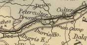
Aberdeen
OSA
(vol.19/140) |
 |
Page
152 Details of the bridges of Don and of Dee. The bridge
over the Don was built about 1320 by Bishop Cheyne -
it stands on the “great high road leading northward
from Aberdeen.”
The bridge over the Dee was built about 1530. It had
decayed badly by the 1720’s and was rebuilt at
that time by the town authorities.
Page 160 Mention of the high road called Cairn of Month
road from Brechin etc. to the Dee.
Page 183 Names of the older streets in the town, viz.
Castlegate, the Braidgate, the Overkirkgate, the Netherkirkgate,
the Gallowgate, the Gaistraw, the Shipraw, the Rottenraw,
the Dubbyraw, the Checkeraw, the Narrow-wynd, the Back-wynd,
the Correction-wynd, Putachie's-side, and the Green.
Page 200 ff. Details of trade with the continent. Also
the coastal trade.
Details of a proposed canal - it was to run up Donside
to Monymusk, with a branch up the Ury to Inch (the canal
was built and opened in 1807, but only to Inverurie).
NSA
p. 66 Steam vessels sail regularly to
many places, e.g. Leith, Lerwick, Kirkwall, Inverness,
Dundee, London, Peterhead. Details of sea-borne trade
are given.
p.68 Eighteen miles of canal to Inverurie opened in
1807. A fly-boat used to run on it but suffered much
from coaches on the adjacent turnpike-road. Recently
an iron boat capable of sailing at 9 mph has been introduced
but the competition from the coaches continues.
P.71 Export of building stone to London.
P.78 Gas lighting introduced from 1824.
P.96 Details of the postal service. The railways have
greatly speeded up the mails; Aberdeen serves as a central
point for the mail from the surrounding district.
There are about 20 coaches running from Aberdeen: 8
on the south road, 4 on the north road, 4 on the north
coast road, 2 on the Deeside road and 2 on the Skene
road. From time to time new services are tried but there
is some risk in this and they sometimes fail.
Page 101 Regular markets of various sorts
are held, e.g for meal, grain, butcher-meat, fish, linen,
timber and cattle.
P. 102 193 inns etc.
Streets.—In describing the streets of some
50 years before, it is noted they were very narrow and
made of round stones. Marischal Street between Castle
Street and the Quay was the first to be of dressed stone.
Around 1800 a turnpike to Inverurie was made with a new
approach into the town. New approaches were also made
from the south, one benefit of which was the removal of
many old houses. As there was a steep and dangerous descent
at the Windmill Brae and a steep ascent of the Shiprow
or Nether Kirkgate, several bridges were built across
the valley of the Denburn, one of which, on Union Street,
spans 132 feet and is 56 feet high.
1839
MacFarlane
The Garioch, Aberdeenshire 1724
Vol.1, Page 7 Fine bridge over Water of Don in Aberdeen.
Survey of the Town of Aberdeen 1685
Vol.3, Page 89 “It’s not to be omitted the
Town hath set up at every entry of the Town, seats of
hewn stone for the accommodation of old men and women
going to horse, which is very usefull, and a comely
thing.”
In the past a ferry boat had to be called from Torrie;
now there is one at the mouth of the Dee, near the Blockhouse.
Page 90 The causey of the Castle Gate has now been repaired
(it was so hollow the dubs and rains stood in pools)
some 50 years after the other streets were causeyed.
Aberdour
OSA
(v.12, p.575)
No particular mention of roads. |
 |
 NSA NSA
Page 267 Smuggling, once very common, has been completely
suppressed by the Preventive Coast Guard.
Page 268 Twenty or thirty years ago, a former owner
of the estate of Aberdour, which made up three fifths
of the parish carried out extensive improvements, including
badly needed roads and bridges, one road being seven
miles in length. There used to be a flourishing trade
in mill-stones quarried here - these were sent to the
south and west of Scotland.
Page 270 Parochial Economy.
Market-Town, Etc.—Fraserburgh, 8 miles away.
Means of Communication.—A
post-runner goes three times a week to Fraserburgh,
to which the Aberdeen mail coach runs each day.
The Fraserburgh to Banff turnpike touches the parish
at two distant points, and would be hard to access were
it not for the “great junction road”.
Page 273 Fairs.—Four fairs have been recently
established at New Aberdour, for cattle, merchandise
and hiring but are not well attended because of their
location. There is also a small fair called Byth market,
held twice a year in the south of the parish.
Inns and Alehouses.—Five.
Fuel.—Peat. Given the expense of obtaining
it, coal might be a cheaper option.
Miscellaneous Observations. In contrast to the
estate of Aberdour, the estate of Auchmedden has had
no roads made which makes life difficult for the tenants
(elsewhere he refers to the non-residence of the proprietor
which had led to “gross neglect and mismanagement
of the estate.”
1835 Revised 1840.
MacFarlane
Description of Countrey of Buchan Aberdeenshire 1721
Page 41 Bridge over water of Auchmedden between Aberdour
and Gemrie parishes. It was built by local gentry.
Description of the Parish of Aberdour 1724
Page 49 Bridge on the Burn of Glenquhitle in Aberdour
parish.
Page 50 King’s highway from Peterhead and Fraserburgh
to Banff passes through Aberdour.
Aboyne
and Glentanner
OSA
(v.19, p.296) |
 |
 Page
298 Timber is obtained from Glentanar. Page
298 Timber is obtained from Glentanar.
Page 299 Details of a proposed canal to the parish, with
a branch through Skene, Cluny and Monymusk, perhaps as
far as Alford.
NSA
Page 1049 Mention of Allach bridge near
Aboyne castle.
Page 1056 Antiquities - He gives a long description
of two parallel dikes that seem to form an avenue, generally
about 15 feet wide. On the east they head over Drumduan
moor towards the Hill of Fare and on the west towards
the hill of Knockice and Kinord. In view of their interest,
part of his text is given below. The occurence of "Pict's
roads" on the old 6" maps is shown below.
The Canmore database includes many sites in the area
- see for example NJ40SE
6, NJ40SE
7, NJ50SW
2 which give interpretations of the "roads".
It is very unlikely that the putative line of continuous
road from the Hill of Fare to Braemar could ever be
be established today.
|
On
Knockbeg, or little hill of Tillfoudie, are the
remains of a circular building (diameter 83 feet,)
composed of stones regularly laid, and the foundation
partly imbedded in rock, but without mortar or
cement; and at the base of the hill, in a corn-field,
about half a mile to the north-east, may be traced
the site of another erection, said to have been
similar; and connecting them are to be seen the
remains of two parallel dikes, forming a fenced
avenue or roadway. This avenue, thus secured on
each side and in no place under the breadth of
fifteen feet, though in many places more than
double that extent, leads to the east over the
adjoining moor of Drumduan, and can be traced
for miles, in the direction of the hill of Fare,
where, the writer has been told, it is connected
with similarly raised structures, known by the
name of Pict's houses or forts. The line extends
also westward to the hill of Knockice, and Kinord,
and is there too connected with a number of these
Picts' houses, though none of them, like the one
on Knockbeg, has been erected entirely of stone.
From Knockice, the enclosed line branches off
towards a ford in the Dee, and appears on the
opposite side in Glentanner, with more of these
ancient ruins planted, at intermediate spaces,
along it. The same is observable at Tillphoudie
hill (distant from Knockice five miles,) leading
also towards a ford in the Dee, and not far from
either bank are two of these raised forts, placed
like lunettes to protect the passage. Both the
diverging lines seem to point to a pass through
the Grampians, directly leading to Catterthun,
the great Caledonian fort, about twenty miles
distant, in the braes of Angus, and thought by
some to have been a stronghold of Galgacus. The
main line may be traced nearly parallel with the
north bank of the Dee, for about fifty miles from
hill of Fare by Knockice to Braemar, said to be
the Tamea of the Romans, and these parallel dikes
(a line of them branching also northward from
Knockice) have been represented by some antiquaries
as the remains of itinera of that people.

"Pict's roads" appearing on 1st edition
of 6" maps Aberdeenshire,
LXXXI,
LXXXII
(NLS). They do not appear on maps for the other
areas he mentions.
|
Page
1066 Parochial Economy. Market-Towns.—Aberdeen
is the main market town although it is 37 miles distant
from some parts of the parish. Stonehaven is a similar
distance but little business is conducted there. There
are turnpike roads to both places.
There is a fine inn at Charlestown, a post-office, a
shop, and various trades. The mail-coach from Aberdeen
comes through daily and there are several carriers in
a week.
Means of Communication.—The
Aberdeen turnpike (joined by one from Stonehaven at
Banchory Ternan) terminates at Aboyne but good commutation
roads lead onwards north and south of the Dee to Ballater
and Braemar.
The Parliamentary road to Alford starts in the parish
and from Aboyne there are good commutation roads towards
Tarland, the Cairnamonth and Inchmarnoch by either side
of Bellrory.
There are two stone bridges over the Tanner and various
others of stone and wood over other tributaries of the
Dee. Where the ferry boat crosses between Kincardinne
o’ Neil and Balnacraig in Aboyne parish, a wooden
bridge was built in the 14th century by Durward of Coull
but any traces have long disappeared.
Two miles to the east, we now have a fine stone bridge
of 3 arches at Potarch. There is a chain or suspension
bridge near the church, erected by the Earl of Aboyne
at his expense in 1831. One very similar had been built
there in 1828 (by the Earl) but was carried away by
the great flood of 1829. Both bridges cost him between
L6000/L7000; there is no pontage. Details of the suspension
bridge are given in a footnote: Length of suspension
portion, 230 feet; do. of two iron trussed arches, 60
and 50 do.; and length of two stone arches, 30 and 20
feet; depth of the foundation of the two principal piers
under the level of the river, 11 feet.
He
says: "The bridge having been tested and found
sound and there being a good road, part-turnpike, part
Parliamentary between Huntly and Aboyne, the advantages
of continuing this line south over the Grampians are
clear. A survey has been carried out for such a road
from Aboyne to the top of the forest of Birse, through
lower Glenesk, Clash of Wurren, and the parish of Menmuir,
where the Strathmore road would be joined near the bridge
of Finhaven, distant about twenty-five miles from Aboyne.
The cost would be less than the bridge at Aboyne and
would greatly benefit the country."
Page
1068 Fairs.—Five large markets are held
near Charlestown.
Inns.— Excellent inn at Aboyne and 4 others.
Fuel.—Peat, turf and wood. Many use coal
from Aberdeen.
Miscellaneous Observations. In the past currocks,
and creels, and litter trees were used instead of carts.
“The roads were wretched; and the nearest post-office
and bake-house at Aberdeen little more than sufficient
for the wants of the parish. From seed-time to harvest
many of the men were employed in the manufacture of
tubs, harrows, plough-beams, &c. which they carried
to Old Rayne fair, the Aberdeen timber and Auldton markets.”
1842
MacFarlane
Descriptions of Kincardine O’Neil, Aboyne and
Glentanar Parishes 1725
Page 101 Details of several roads are given, e.g. there
is a ferry boat over the Dee at Kincardine O’Neil
and there is a direct road between Aberdeen and Braemar.
The burn of Desk which divides Kincardine from Aboyne
is crossed by a “strong timber bridge with stone
land sleats.”
Road NE of Kincardine with a timber bridge over the
Burn of Canny. Road from Craigmyle towards Wester Billie
with “steps” over the Burn of Canny; road
northwards by the church at Tough etc.
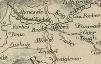
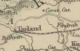
Alford
OSA
(v.15, p.447) |
 |
 Some
say the name may relate either to the Don being fordable
in the parish, or a particular ford on a now dry part
of the Lochel near the church. Some
say the name may relate either to the Don being fordable
in the parish, or a particular ford on a now dry part
of the Lochel near the church.
Page 464 There are quite a few cattle markets within 14
miles of here where drovers from the south buy the cattle.
Horses and sheep are also sold. Some sheep and cattle
are sold to the butchers in Aberdeen though for some reason
the price given for cattle is very low.
There were long-established weekly markets at Meiklendovie
and major fairs both there and at Kirkton of Alford. Only
the Kirkton fairs continue but they are quite small nowadays.
Page 465 Lime is brought from Aberdeen, 25 to 30 miles
distant. It comes from Sunderland or from Charlestown
on the Firth of Forth. It is sometimes brought (on bad
roads) by carters from Aberdeen, who are sometimes met
15 miles from the city by the farmers who take it the
rest of the way, and sometimes by the farmers who may
take grain to the city on their outward journey. As it
is so expensive, lime is little used for manuring, which
is a major obstacle to improving the land. Efforts need
to be made to discover limestone in this district and
if none is found, the alternative is to alter and mend
the roads, which have started to receive great attention.
Page 469 He gives some interesting observations on the
conduct of farm servants.
Page 470 Although peat is available, so
much effort has to be made to obtain it that many think
coal is preferable despite its cost and the long carriage
(from Aberdeen) required.
 |
| The
two military roads are shown here - as he says,
the east-west road had deteriorated badly.
Routes
based on Canmore
entries and Taylor and Skinner below. |
Page 471 Roads.—The roads in this county were
originally made by the statute labour or by the military.
Two of these military roads cross each other in this parish
- one the great Northern road leading from Fettercairn
to Huntly by the Cairn of Month, the other from Aberdeen
to Corgarff. They are both repaired by the statute labour
of the parishes they go through though as this is not
commuted, it is generally inadequate for this.
 |
| The
military road running north to Fochabers. From the
Taylor and Skinner Atlas of 1776 - original on Scribd
site. With thanks. |
The
Corgarff road, an important link between Aberdeen and
a large area of countryside, has deteriorated very badly
and is sometimes almost impassable despite liberal subscriptions
from local gentlemen.
It was decided in 1792 that a new road should be formed
for 9 miles along a better line and this work is now well
underway. When finished it should allow easy travel to
Aberdeen with attendant economic benefits.
NSA
He suggests the etymology is ford of
the river Ale - there is another ford about a mile away
over the larger river Don called Waterford.
Page 518 Parochial Economy. Market-Town.—
Aberdeen, 26 miles away.
Means of Communication.— Post comes from
Aberdeen daily; there is a post-office at Alford.
The turnpike road between Aberdeen and Strathdon runs
through, with a branch to Huntly and the great north
road. The Commissioners for Highland Roads and Bridges
have built a road that runs north and south through
the parish and crosses two turnpike roads to the south,
thereby making travel to various places much easier.
It is regrettable however, that the road has not been
extended over Cairn-a-mont as this would bring Brechin
and Dundee much closer to Alford and Huntly.
The commutation and private roads are generally in good
repair. All these roads have made agricultural progress
possible.
Stage-coach three times a week to Aberdeen.
Bridges.—We have all the bridges that are
required. The Parliamentary Commissioners built a fine
granite bridge over the Don in 1820, and recently another
over the Leochal. The cost of the bridges and the road
was L.5000, half of which was by subscription. This
road is of great benefit to the public as thousands
of cattle pass through on their way south.
Page 523 Fairs.—Two large cattle fairs,
and a monthly fair in winter for cattle, horses, and
grain.
Inn.—One inn.
Fuel.—As there is little fuel available,
coal has to be brought in at a high cost.
Miscellaneous Observations - Reference to cattle
now able to be transported by steam-ship to London.
1840
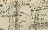
Auchindoir
and Kearn
OSA (v.12, p. 490)
not Kearn |
 |
 Page
493 Lime is brought 10 miles from Cabrach, along very
bad roads. Page
493 Lime is brought 10 miles from Cabrach, along very
bad roads.
NSA
Page
412 Parochial Economy. Market-Town.— Huntly,
about 12 miles away by a good turnpike. A stage-coach
to Aberdeen passes through the parish.
Fairs.—Four cattle markets.
Inns.—One inn, three alehouses.
Fuel.—Mostly peat. Coal is very expensive
due to the cost of carting it from the coast.
Miscellaneous Observations. - The parish had
suffered much by being too generous to travelling beggars.
The situation has improved since the decision to restrict
charity to those living here, and the setting up of
a rural police.
1840
Auchterless
OSA
(v.12, p.306)
|
 |
 New
bridge at Ellon. New
bridge at Ellon.
Page 311 Peat and moss are obtained only at the expense
of much effort and time from mosses 6 miles away. Coal
is available from Banff and Macduff. Although expensive
because of a heavy tax, some farmers are starting to use
it which allows them to use the time saved for obtaining
lime.
Page 312 One inn on the Aberdeen - Banff post-road. No
post-office.
Page 313 He gives an account of the camp at Genmailen
and various other remains in the area. He also gives a
long account of the work of Captain Shand, carried out
between 1758 and 1787, that had helped establish Glenmailen
and other sites as Roman and indeed that the Romans had
had a presence in NE Scotland which was contrary to opinion
at that time. Shand, having heard of the discovery by
a Mr Lawtie of ancient roads in Deskford parish, thought
that this made it more likely that the Romans advanced
by the Ythan and Doveron at Glenmailen and Auchnagoul
rather than down river from these. (See
George
Macdonald, The Roman Camps at Raedykes and Glenmailen,
PSAS, Vol.50, 1916, pps 317-359)
NSA
Page 286 It is thought that a camp on
the farms of Buss and Logie-Newton is of Roman origin.
Page 291 Turriff is the nearest market and post-town
- it is 6 miles from the church. Three miles of the
Aberdeen to Banff turnpike pass along the east side
of the parish; two stage coaches run on it each day.
Page 292 Peat and turf used for fuel; many bring coal
in from Banff and Macduff, 18 miles away.
Miscellaneous Observations. - The cross-roads
are much improved.
1840
Belhelvie
OSA
(v.7, p.218) |
 |
 Two
principal roads. Two
principal roads.
Page 220 The main drawback to improvement is the amount
of time spent in obtaining peat; the alternative fuel,
coal, is too expensive because of an unfair tax.
NSA
Page 246 There are two turnpike roads in the parish
on which the mail and other coaches run. No post office.
Page 248 Three cattle fairs, Seven inns on the turnpike
roads and used mostly by travellers. Peat used as fuel.
Coal is brought from Aberdeen or Newburgh.
1840
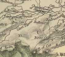
Birse
OSA (v.9, p.103) |
 |
 |
| The
Cairn a'Mounth road |
Page
122 Roads and Bridges.—The great road from
the Cairn o’Mount runs through here towards the Dee
at Inchbair, and is in good condition. Another road runs
through from the ferry at Aboyne, to Whitestone.
This, and the other roads were made and are maintained
by statute labour but in an inadequate manner. As a result
the roads are extremely bad in some places and in bad
weather. There is a need for it to be commuted. There
are no turnpikes and there is not enough traffic to justify
them.
There is a fine bridge at Whitestone on the road to the
north and one over the Birse near the church. Bridges
are needed over the Chattie, at Marywell, and at Inverchatt.
In particular, one is needed at Potarch where the great
north and south road crosses the Dee. The road is used
by the military and also by the public as it is much shorter
than going by the coast.
Recent use by the military could easily have been affected
if the river had been high, as it is often impassable.
The site lends itself to a bridge. Unsuccessful attempts
have been made to find the money and it is more than likely
that notwithstanding subscriptions, public aid would be
needed.
A road over the Grampians has been started - it will go
through Glen Chatt, the Forest, and Glenesk, and be 15
miles nearer to Angus etc than by the Cairn of Mount road.
It will be useful for travellers and traders, particularly
drovers and cattle dealers.
Advantages and Disadvantages - The
benefits of lime in improving the land has led to great
efforts to obtain fuel for burning the limestone such
as “cutting cart roads along the steep hills to
the mosses”, purchasing wood, and obtaining coals
from Aberdeen. The want of a bridge at Potarch makes itself
felt in these circumstances, Aberdeen being the object
of many journeys to market and for coal.
NSA
Page 790 He says that cattle raiders used a pass across
the Grampians still called the "Cattrin road."
The bridge of Potarch was built over the Dee in 1813
allowing access to the Deeside turnpike to Aberdeen.
A suspension bridge was built over the Dee in 1828 by
the Earl of Aboyne. It was destroyed by the 1829 flood
and rebuilt in 1830.
A bridge over the Feugh was built in 1835 - it lies
on the “great north and south road across the Grampians.”
Page 797 Parochial Economy.
Means of Communication.—“There is
no market-town, village, post-office, turnpike-road,
public carriage, or canal in the parish.”
The main roads here are the Great North Road from Brechin
by the Cairn o’Mount and the Grampians to Huntly
and Inverness, and the South Dee-side Road. In this
parish both start from Whitestone, the first reaching
the bridge of Potarch, the second, to the suspension
bridge of Aboyne.
Fairs.—Three fairs, held at Bridge of Potarch.
Inns.—Four alehouses, and a licensed shop.
Fuel.—Peat and turf, and some wood.
1842.
Bourtrie
OSA
(v.9, p.434) |
 |
 Page
436 Recently the farmers have started to bring lime in
from Aberdeen and Newburgh; also from Udny and the Buchan
country. Peat is used although much time is spent in gaining
it. Page
436 Recently the farmers have started to bring lime in
from Aberdeen and Newburgh; also from Udny and the Buchan
country. Peat is used although much time is spent in gaining
it.
NSA
Page 622 Mention of forts at Benachie, Keirhill in Skene,
and the Barmekyn in Echt being close to the Roman Iter
that runs from the camp at Normandykes to Glenmailen in
Forgue and the Castra Alata in the Moray Firth.
Page 628 Parochial Economy.
Market-Town.—The nearest is Old Meldrum but more
business is done at Inverury.
Miscellaneous Observations.
Although the roads have improved a little of late, they
are still very bad and compare unfavourably with nearby
parishes.
1842
Cairnie
OSA
(v.12, p.127) |
 |
 Page
129 Bad roads; no peat. Coal is brought from Portsoy “
by a road swarming with bogs and stones“. Page
129 Bad roads; no peat. Coal is brought from Portsoy “
by a road swarming with bogs and stones“.
NSA
Page 1017 Lime work at Ardonald. No mention
of roads.
MacFarlane
Description
of 9 Parishes 1724
Page 80 In Glass parish there is a stone bridge at Strathbogie;
also 1¼ miles SW of Glass church. The king’s
highway runs north-south and divides the parish from
Cairny; there is also a highway from Aberdeen to the
highlands.
Chapel
of Garioch
OSA
(v.11, p. 500) |
 |
 Page
503 Roads and Inns.—Our roads are made and
repaired by the statute labour which is poorly performed.
The Aberdeen to Inverness road passes through and in places
is near impassable. There are numerous cross-roads, and
these are very bad in winter. Page
503 Roads and Inns.—Our roads are made and
repaired by the statute labour which is poorly performed.
The Aberdeen to Inverness road passes through and in places
is near impassable. There are numerous cross-roads, and
these are very bad in winter.
Two inns on the Inverness road, and one on the road to
the upper part of the Garioch.
Peat is difficult to obtain, being from the hill of Bannochie
by a very steep road that becomes impassable in bad weather.
Lime too is only had at a distance.
NSA
Page 561 Mention of the old road from
Aberdeen to the upper part of the Garrioch and Cabrach
on a ridge of rising ground to the south of the river
Ury.
Page 570 There are traces of an ancient camp north of
the House of Pitcaple and foundations of an old bridge
over the Ury.
It is thought that the Romans crossed the Don at Inverury,
then passed Harlaw and Pitscurry in this parish. At
Pitscurry there was a station - this is between the
camps of Peterculter and Glen-mailen which are 26 miles
apart.
Chalmers in Caledonia thinks that there may have been
Roman roads further north that the one that passed near
Brechin and was heading for Keithock. In Aberdeenshire,
the Maiden Causeway (a name associated with some Roman
roads in the north of England) runs from Benochie where
there was a hill fort, for more than a mile into the
woods of Pittrodrie where the traces disappear. It is
14 feet wide and paved with stones (not Roman - see
Canmore record).
This
Maiden-way (says Colonel Shand) is on "the west
side of the ninth Iter on its course from the Don to
the springs of Ithan, (the Ituna of Richard, where the
camp of Glen-mailen was placed,) the station of Raedikes.
If this way were continued in its appropriate direction,
it would join the tract of the Iter near the river of
Ury, and contiguous to the supposed Roman post."
Page 576 Parochial Economy.
Market-Town.—Inverury, 5 miles away. Post-office
at Pitcaple.
Means of Communication.—There is a good
mileage of roads: four and a half of turnpike and 35
of statute labour roads. The roads and the bridges are
in good condition. The mail coaches from Aberdeen and
Inverness pass each other here each morning. Three stage-coaches
pass through most days, as well as carriers from Huntly,
Keith etc. going to Aberdeen.
Page 580 Inns, Alehouses, Etc.—One inn and
two ale-houses.
Fuel.—Many find it expensive and difficult
to obtain fuel. Tenants on the estates of Logie Elphinstone
and Fetternear are able to obtain peats locally but
other parishioners have to get their peat from near
the top of Bennachie by “a very steep and dangerous
road, which, in a rainy season, is almost impassable.”
Because of its distance only two cart-loads can be carried
home in a day. Coals can be obtained, either from Aberdeen
or the canal at Inverurie, and although costing much
the same by the time they reach here, are still very
expensive.
Miscellaneous Observations - There is a new turnpike
road on which the mail coach and three others run to
and from Aberdeen. In the past there were no coaches.
1835, revised 1840
MacFarlane
The Garioch, Aberdeenshire 1724
Page 6 - King’s highway from Aberdeen to Inverness
runs through Chappel of Garrioch parish (also P17 -
the king’s highway from Aberdeen to the high country
passes through here).
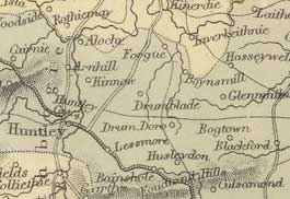
Clatt
OSA
(v.8, p.535) |
 |
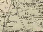 Page
536 Carts were first introduced in 1760 and are now in
common use though the horses being small cannot draw very
heavy loads. Cattle is sold to dealers from the south. Page
536 Carts were first introduced in 1760 and are now in
common use though the horses being small cannot draw very
heavy loads. Cattle is sold to dealers from the south.
Lime has to be brought a distance of 10 miles along a
very bad road, to which no attention is being given.
Page 540 It was made a burgh of barony in 1501 with the
power to hold fairs and markets.
Roads and Proposed Improvements.—Two main
highways pass through: the road from Edinburgh to Huntly,
Elgin etc. and the road from the high country to Aberdeen
passing through Glenlivet, Cabrach, Rhynie etc. The first
road was made about 25 years ago by the military and is
in reasonable condition. It is much shorter than going
through Aberdeen. If an inn were to be built at Clatt
it would serve as a convenient stage for travellers and
benefit the village.
He lists various arguments usually made against such attempts,
and gives counter-arguments, saying "The great
and popular objections, against attempts of this sort,
are, the distance from the county town, or any proper
sea port and harbour; scarcity of fuel; danger of engrossing
the working servants, and withdrawing the hands necessary
for agriculture, &c. But all these, in the present
case, might be obviated by a prudent economy; particularly,
by introducing a better breed and size of horses for the
carts; keeping the roads in due repair, by a proper application
of the statute work; and giving good encouragement to
dealers and merchants to settle in the village, and to
frequent the fairs and markets. As to want of fuel, that
complaint would soon cease, if the unreasonable coasting
duty on coals were taken off."
Page 544 Poor.—With so many
roads passing through, the parish sees many beggars and
vagrants both from the highlands and the south.
NSA
Page 849 In the time of James IV it was made a burgh
of barony with the right to hold weekly markets as well
as fairs.
Page 855 Obstacles.—
Farmers here are under the disadvantage of having to
travel for three days with their grain to reach Aberdeen,
which means a loss of one tenth or so of its value as
well as the loss of time. The roads too are inadequate
with no turnpike. "A turnpike road through the
parish, in continuation of the turnpike road, to Premnay
onwards to Rhynie, would be of incalculable advantage
to this parish and surrounding district, and, besides,
would furnish a very profitable investment to the money-lender;
and for the toll-duty, the farmer would receive a more
than adequate compensation in the comparative ease to
his horses, and the additional quantity of grain, lime,
&c. which they could convey."
Parochial Economy. Market-Town.— As a burgh
of barony, Clatt used to have weekly markets but these
have long fallen away. Now there are two fairs for cattle,
grain and hiring. The nearest market town is Huntly,
9 miles away, but the village is fairly self-sufficient
with tradesmen etc. There is a carrier in the village.
Means of Communication.—A post runner comes
each day from Rhynie.
Two main roads meet at the inn, Ford of Clatt. One is
“the North and South Road,” part of the military
road from Edinburgh to Huntly etc; the other is from
Aberdeen to Rhynie, Cabrach etc. The Aberdeen road is
30 miles longer but those coming from Edinburgh prefer
it to the military road by as it does not have to go
through the Grampians.
Page 859 Fuel.—Peats are very scarce due
to the mosses being drained, and the scarcely usable
turf from the hills is only reached by very bad roads
and takes much time and labour to obtain. Coal now has
to be used but the carriage from Aberdeen doubles its
cost.
1842.
MacFarlane
The Garioch, Aberdeenshire 1724
Page 14 King’s highway from Edinburgh to Inverness
runs through Clatt parish.
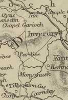
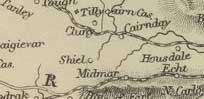
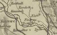
Cluny
OSA
(v.10, p.235) |
 |
 Page
237 “There are in the parish 801 black cattle,
1300 sheep, 132 horses, 2 waggons, 80 carts.” Page
237 “There are in the parish 801 black cattle,
1300 sheep, 132 horses, 2 waggons, 80 carts.”
About 30 years ago there were only two carts with everything
carried on horse back. Between 1750 and 1760 the gentlemen
of the county implemented the statute labour organised
by districts based on presbyteries in which the commissioners
of supply in each district were to hold regular meetings,
appoint supervisors, and call out all between 16 and 60
years of age for 6 days work before and after harvest.
There was a penalty of 1s.6d. for non-compliance.
The effects of this have now been felt over the county
with the roads repaired and the advantages recognised.
Turnpikes are soon to be erected on the major public roads
and it is hoped they will be used more widely as their
effects on trade are felt.
Lime shells are brought in from the Firth of Forth and
Sunderland.
Page 240 Fuel.—Peat and turf is very difficult
to find except moss on high ground and too far distant
to be easily obtained. As a result, coal is brought from
Aberdeen, and now that the coal tax is removed is more
affordable.
Two licensed houses.
NSA
Page 1018
No mention of roads.
MacFarlane
A Geographical Description of the Parishes of Monymusk
Kenmay and Cluny 1722
Page 95 There is a small bridge in Monymusk. Mention
of Boat of Kemnay on the river Don and a Boat in Monymusk.
There are also 2 or three fords.
The highway from Aberdeen passes the church of Kenmay
and leads over the Bridge of Ton over the Ton Burn.
The Rectified Highway called the Skene Road from Aberdeen
enters Clunie parish to the SE, runs past Drumlahoy
to Mill of Clunie where there is a bridge, then through
Monymusk parish to the parishes of Touch and Keig.
Coull
OSA
(v.3, p.198) |
 |
 199
One of the disadvantages of the parish is that it is far
from markets and the means of improvement - Aberdeen is
30 miles away. 199
One of the disadvantages of the parish is that it is far
from markets and the means of improvement - Aberdeen is
30 miles away.
202 Miscellaneous Observations.—The roads
in this parish are in tolerable repair, but many of them
very ill contrived. The statute labour is exacted in kind.
There are no turnpike roads here. There are in the parish
108 horses, 360 black cattle, and about 1500 sheep.
NSA
Page 960 Mention of road-making on the estate of Corse
as part of general improvements within the last twenty-five
years.
Crathie
and Braemar
OSA
(v.14, p.334) |
 |
 |
| The
Military Road running north from Coupar Angus to
Fort George, with the road from Abereen joining
it. The present day road between Cockbridge and
Tomintoul is often closed in winter due to snow.
|
“The
ancient name of Braemar was Ceann-an-drochait, which,
in Gaelic, signifies "bridgend."“
Page 345 Roads and Bridges.—The military
road from Blairgowrie to Fort George goes through these
parishes and was completed in the year 1749. The county
roads are statute labour which is commuted to 1s.6d.
for those between 16 and 60. A “proper road grieve”
and a squad of workmen are employed with better results
than when everyone did the work.
He speaks highly of the contribution made by the late
Mr Farquharson of Monally in the 5 parishes of Braemar,
Crathy, Glenmuick, Tullich, and Glengarden to the making
of roads and bridges. He was the first person in Aberdeenshire
to do so, starting a few years before 1745.
Advantages and Disadvantages - One disadvantage
is the lack of moss roads which means the fuel has to
be carried on horseback rather than by cart. The benefits
of such roads are shown in the estate of Manaltry where
a good road has been made to a moss and the tenants
have now provided themselves with carts.
Another disadvantage is that it is 50 miles to a port
town.
Antiquities.—King
Malcolm Kenmore is said to have had a hunting seat at
Castletown of Braemar, the remains of which can still
be seen. He is said to have thrown a drawbridge over
the water of Cluanadh, which gave the parish of Braemar
its original name of Ceann-an drochart or “head
of the bridge”.
While
the extension of the postal service to Kincardine O’Neil
is welcome, we will
still not benefit from it as it is still too far. At
present we send a man each week to Cupar Angus for letters
and newspapers- a post-office here would repay the Post
Office for the expense of setting up and running it.
 NSA NSA
Page 647 Malcolm Canmore had a hunting seat at Braemar,
and had a bridge built over the Cluny at Castleton,
hence the addition to the name, Bridge-end, from Ceann
Drockit.
Page 652 Parochial Economy.
Market-Town.—Aberdeen, 48 miles away.
Means of Communication.—Post-office at Castletown
of Braemar, with mail from Aberdeen each day - a receiving
office is planned for Crathie, which will very convenient.
A chain bridge, built in 1834 crosses the Dee, and replaces
two ferry boats.
Page 654 Fairs.—Three at Castletown of Braemar
for cattle and sheep, and one at Clachnaturn in Crathie.
Inns.— Three.
Fuel.—Mostly turf and peat, with some wood;
but coal is brought in from Aberdeen - its cost has
halved in the last 20 years.
1842.
Crimond
OSA
(v.11, p.409) |
 |
 Page
418 Roads.—The roads are maintained by statute
labour but usually too much was attempted in a year so
that the roads deteriorated. People were averse to doing
the work and supervision was poor. In addition, heritors
often had their own private roads repaired using the statute
labour. There is however more attention being paid to
public roads, and they are improving. Page
418 Roads.—The roads are maintained by statute
labour but usually too much was attempted in a year so
that the roads deteriorated. People were averse to doing
the work and supervision was poor. In addition, heritors
often had their own private roads repaired using the statute
labour. There is however more attention being paid to
public roads, and they are improving.
One licensed public house; several unlicensed ale-houses.
NSA
Page 713 Parochial Economy.
Market-Town.—Peterhead, 9 miles away, where
there is also a post-office - a footpost brings the
mail here. There is another post-office at Mintlaw.
Means of Communication.—There have been
several unsuccessful attempts to set up a coach service
between Peterhead and Fraserburgh, passing through here.
Two miles of turnpike in the parish and 7 or 8 bridges.
Although the side roads have improved more could be
done. In general the management of the roads is “grossly
defective”.
Page 715 Fairs and Alehouses.—Three fairs
for cattle etc and some grain and potatoes. Three whisky-shops.
Fuel.—Peat, from the south of the parish.
Miscellaneous Observations. - There are some
very useful new roads, in particular, the present turnpike
between Peterhead and Fraserburgh allows easy access
to the ports and thereby increases the value of agricultural
produce, and so rentals.
1840. Revised 1842
MacFarlane
Description
Parish of St Fergus, Banffshire and Crimond, Aberdeenshire
1722
Page 67 Wooden bridge and ford in Crimond parish.
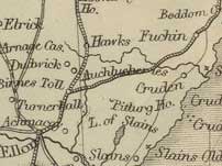
Cruden
OSA
(v.5, p.431)
No particular mention of roads. |
 |
 NSA NSA
Page 980 Quarries.—Quarries used to supply
granite for bridges in London etc. but are now closed
up.
Parochial Economy.
Two small markets are held. Post-office halfway between
Ellon and Peterhead, on the turnpike road.
Alehouses.—Ten.
Fuel.— The peat mosses are running out although
many still use peat. In the summer coal comes in at the
Ward; at other times it is brought from Peterhead or Newburgh.
1840.
MacFarlane
Description of Countrey of Buchan Aberdeenshire 1721
Page 38 Stone bridge on the River Cruden in Cruden parish.
The bridge was erected by a bishop of Brechin.
Culsamond
OSA
(v.3, p.240)
Peat and turf available for fuel. |
 |
 |
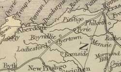
| Course
of the Lawrence Road |
NSA
Page 731 Antiquities.—An
ancient highway, called the Lawrence Road, crosses Culsamond
hill near its top and was the road taken by people travelling
to St Lawrence Fair at Old Rayne (dating from 1493 -
The
Incidence of Saints' Names in Relation to Scottish Fairs,
Sir James Balfour Paul, PSAS, Vol.52, page 167).
There are three sacred fountains in this parish; St
Mary's Well, on the farm of Colpie; St Michael's, at
Gateside; and another, at the foot of the Culsamond
Bank, a little west of the Lady's Causeway.
(Note: O.G.S.Crawford in Topography
of Roman Scotland, p.115 thinks that the Lawrence Road
and other stretches of road are the old highway from
Old Aberdeen to the north-west. He suggests the route
went by Parkhill, Fintray, Kinmuck, Harlaw, Old Rayne
and Tillymorgan to Rothiemay.)
Page 734 British Camp.—There are remains
of a British fort and various fortifications on and
near the Hill of Culsamond, near Cadden, a name which
implies entrenchments or look-out posts.
Two and a half miles north of this is the Roman camp
at Glenmailen. They had a camp at Devana, north of the
Dee, in Peterculter parish, and the remains on the top
of Bennachie along with a section of paved Roman road,
14 ft wide and “long covered with heath” suggests
they had a camp here also (not Roman - see Canmore record).
Bennochie is about 12 miles from Devana.
The road is aligned on a small post opposite Pitcaple,
presumably set up to protect the Bennochie camp. Another
camp on Barra Hill, near Old Meldrum would also serve
this purpose, protecting it from the east, and probably
Glenmullin as well.
Opinion is divided as to the route taken by the Romans
between Devana and Bennochie. Some think they came by
the right of Achlae, Fiddy and Kinmundy then NNW to
the Don at Kintore and then by the Starth to the ford
at Inverurie, very near to Bennochie. Whatever the case,
it is certain they had a fort on the east of Bennochie.
Macfarlane
The Garioch, Aberdeenshire 1724
Page 4 King’s highway from Aberdeen to Inverness
runs through Culsalmon parish (also P16 - another highway
passes through here from the high country to Buchan).
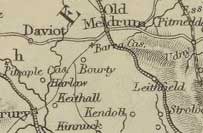
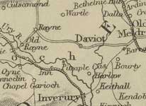
Daviot
OSA
(v.6, p.85) |
 |
 English
lime is brought from Aberdeen and Newburgh, local lime
from Udny and Pitmedden. English
lime is brought from Aberdeen and Newburgh, local lime
from Udny and Pitmedden.
NSA
Page 825 Cattle taken to London by steamer.
Page 827 Parochial Economy.
Means of Communication.—The nearest market
and post towns are Old Meldrum and Inverury. One of
the commutation roads has branches to each of these
places.
In 1835 a turnpike road from Old Meldrum to Sheelagreen
in Culsamond parish was made that passes through this
parish - it connects the east and west branches of the
Great North Road leading between Aberdeen and Inverness.
No coach runs on this road, as yet.
Page 829 Fairs, Inns, Etc. and Fuel.—No
fairs. Two Inns. Turf and peat, and coal from Inverurie.
Miscellaneous Observations - Existing roads have
been improved and two new turnpikes made, on one of
which a stage-coach runs between Aberdeen and Huntly.
1837. Revised 1842.
MacFarlane
A Geographical Description of the Parish of Daviot
Page 84 Daviot parish has one highway which runs from
Inverury to Turreff.
New
Deer
OSA
(v.9, p.184) |
 |
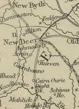 The
public road from Aberdeen by Udny and Tarves passes through. The
public road from Aberdeen by Udny and Tarves passes through.
Page 186 Details of trade in farm produce.
In discussing the parish in 1737 he says that “there
was not a cart, but his own, in the parish: nor were there
roads which could be travelled in many places. Then, and
for many years after, there was but one carrier, who went
weekly to Aberdeen with a horse and packets. Sometimes
he even went with nothing but a back creel and brought
what merchandise and provisions were at the time necessary.
Now, there is sufficient employment for 3 or 4 carriers,
who go each with a cart and two horses.”
Inn used by travellers.
The disadvantage of distance to a port or market could
be overcome by having a canal from Peterhead to neighbouring
Deer (Old Deer).
NSA
Page 176 The Castle of Fedderate stood
in the middle of a morass across which there was a causeway
and a drawbridge.
Page 182 Means of Communication.—The post
comes each day from Aberdeen through Methlic and continues
to Strichen, Peterhead, New Pitsligo and Banff.
The parish has nearly 100 miles of road with a good road
most of the way to Ellon, 13 miles away. The Peterhead
- Banff turnpike passes through the parish on which a
coach runs each day. A stage-coach comes via Ellon from
Aberdeen to New and Old Deer and Strichen.
Fairs.— Five are held through the year.
Inns.— Three. Spirits sold by retailers of
tea and tobacco.
Fuel.—Mostly peat. 1840.
MacFarlane
Description
of the Parish of New Deer 1723
Page 62 The king’s highway from Tarves to Fraserburgh
and that from Peterhead to Turreff pass through the
parish of New Deer. There are two stone bridges in the
parish.
Deer,
Old
OSA
(v.16,
p.469) |
 |
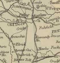 The
high road from Aberdeen to Fraserburgh cuts it longitudinally,
and is intersected by the roads from Banff and Old Meldrum
to Peterhead. The
high road from Aberdeen to Fraserburgh cuts it longitudinally,
and is intersected by the roads from Banff and Old Meldrum
to Peterhead.
Page 473 Many black cattle are bought by drovers for the
English market.
Page 475 Lime available locally.
Page 479 Many shops and the usual trades. Good accommodation
for travellers in inns.
Page 481 A canal to Peterhead is feasible. Since the removal
of the coal tax, coal is beginning to replace peat, at
a great saving of time and effort.
Page 482 Reference to the Abbey of Deer.
NSA
Page 152 Five carriers in parish
Page 160 Parochial Economy.
Roads and Public Conveyances.—Two turnpike
roads cross at Mintlaw in Longside; one leading north
from Aberdeen to Fraserburgh, the other east-west between
Banff and Peterhead. Mail-coaches run on both roads.
For the last two years a stage-coach has run from here
to Aberdeen each day in summer, less in winter.
Five miles of the road on which this coach runs is badly
made with a poor line. A new road, which has been long
planned, is needed from the Banff turnpike through Old
Deer towards Ellon through a stretch of inaccessible
and waste countryside. This would shorten the distance
to Aberdeen by several miles and be a great convenience.
If those whose land it would pass through would meet
most of the expense, it is likely that they would benefit
from it.
Other districts lack good roads and as the statute labour
money is inadequate for the making of needed roads,
those owning the lands would need to follow the example
set by some of the proprietors and meet the expense
of making the roads if progress is to be made.
Mail is taken by runner to Mintlaw in Longside, and
Stewartfield, 2 or 3 miles from Old Deer.
Page 164 Fairs, Etc.—There are two main
fairs (Aikey and St Dustan’s) for cattle and horses,
and three lesser ones. In the past many items made at
home were sold at the main fairs.
Fuel.—Although peat can still be obtained
in several places (which he names), sea-borne coal is
easily obtained at much the same price. In addition,
the draining of the damp mosses will improve the local
climate and allow the land to be reclaimed.
Miscellaneous Observations. Since the last account,
two turnpike roads have been made and several others
made or properly repaired.
MacFarlane
Description of the Parish of Old Deer 1723
Page 62 The king’s highways from Aberdeen to Fraserburgh
and from Strathbogie, Turreff etc to Peterhead intersect
in the parish of Old Deer. There are two great fairs
and a weekly market.
At the east side of the village there is a wooden bridge
and another wooden bridge over the Ugie nearby. A fine
stone bridge has been erected at the expense of a local
landowner, who had also built a small bridge near his
house at Bruxie.
Drumblade
OSA
(v.4, p.52) |
 |
 Page
54 Peat, turf etc used as fuel, also coal landed at Portsoy
and Banff. Page
54 Peat, turf etc used as fuel, also coal landed at Portsoy
and Banff.
Page 55 “The roads in this parish are not in good
repair, on account of the clay soil, the want of gravel,
the great length of highway, and the small number of people
to look after it. The statute labour is, however, exacted,
and but in very few instances commuted. There are no turnpikes;
the general opinion seeming to be against them.”
NSA
Page 301 On Robin’s Height (a hill on Sliach) there
are remains which some think to be Roman although it
is more likely they are connected with a campaign involving
Robert the Bruce and the Earl of Buchan.
Page 302 The farm of Causeway End, Kinore is said to
be so named because a Roman road ended here, This road
ran through Knightland moss over to Sliach.
Page 310 Parochial Economy.
Market-Town.—Huntly is the nearest market and
post-town. The post and newspapers are brought by an
individual once a week for a small charge.
Means of Communication.—The district is
badly served by mail and it would be advantageous if
a runner could be set up between Huntley and Turriff,
with intermediate receiving-houses. At present letters
to Turriff, 12 miles away, have to go by Huntly and
Aberdeen, more than 70 miles. Besides Huntly and Turriff,
the other places this parish has much communication
with, are Banff, Macduff, Portsoy, and Inverurie, all
nearly 20 miles away. Grain is mostly sent to Banff
and Macduff for export.
Six miles of the post-road (a turnpike) from Aberdeen
to Inverness by Huntly, and 4 miles of the Huntly and
Banff turnpike pass through the parish.
Three coaches, the Mail, the North Defiance, and Duchess
of Gordon, pass through the parish each day.
Page 314 Fair.—There used to be a large
and busy fair called the Sliach Market. Apart from a
small fair on the Saddlehill, the bulk of the trade
at the Sliach market is now carried out at a market
in Huntly, without any inconvenience felt by the people
here.
Inns.—Five.
Fuel.—Some poor peat, and turfs are used
though somewhat scarce. Tenants in Lessendrum are allowed
to bring peats from the moss of Foudlin, in Forgue parish.
English coal is brought in from Banff and Macduff.
MacFarlane
Description Parish of Drumblade
Page 86 In the parish of Drumblade the public road goes
from Strathbogy to Aberdeen. There is also a highway
from Huntley to Turreff that passes through.
Drumoak
OSA
(v.3, p.315) |
 |
 The
usual fuel is peat. The roads are in good order and are
statute labour which is partly in kind, partly commuted. The
usual fuel is peat. The roads are in good order and are
statute labour which is partly in kind, partly commuted.
NSA
Page 894 Parochial Economy.
Market-Town, etc.—Aberdeen is the nearest market
and post-town.
The turnpike road between Aberdeen and Braemar runs through
the parish for about 6 miles. On it the mail coach to
Ballater runs each day, and in summer, a stage-coach to
Banchory.
Page 898 Fairs.—Five recently-established
cattle fairs which are poorly attended.
Inns.— Two. One is a stage on the Aberdeen
to Banchory road, the other on the Aberdeen to Kincardine
O’Neil road.
Fuel.—Mostly peat and wood, but coal from
Aberdeen is being used more and more as the peat becomes
exhausted.
1840. Revised 1842.
MacFarlane
Drumack
(Drumoak)
Page 429 Passage boat on the Dee.
Dyce
OSA
(v.3, p.130) |
 |
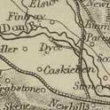 “There
is a hill, which runs quite cross the parish, from south
to north, called Tyre-baggar, or perhaps, rather Tyre-beggar,
as formerly the road from Garioch to Aberdeen, went over
the middle of it, which must have been very tiresome to
travellers. Now the post-road goes along the south end,
which is more easy.” (Note: user “Chili”
on the Megalithic Portal site suggests it may mean “land
of the acorns”). “There
is a hill, which runs quite cross the parish, from south
to north, called Tyre-baggar, or perhaps, rather Tyre-beggar,
as formerly the road from Garioch to Aberdeen, went over
the middle of it, which must have been very tiresome to
travellers. Now the post-road goes along the south end,
which is more easy.” (Note: user “Chili”
on the Megalithic Portal site suggests it may mean “land
of the acorns”).
Paving stones for London streets are quarried here.
Bridges and Roads.—The roads are statute labour
and are poor. No bridges of any note, and no turnpikes.
Fuel.—Mostly
turf, though some bring peat from Fintray and Newmacher
and some bring coal from Aberdeen.
NSA
Page 121 Granite quarried here used to be sent to London.
Page 128 Parochial Economy.
Market-Town.—Aberdeen.
Means of Communication.—Turnpikes from Aberdeen
to Inverness and Banff pass through, as does a canal
between Aberdeen and Inverurie that carries passengers
and coal and lime. While very convenient, it is not
thought to be very profitable.
Inns.—One inn on the high road, mostly used
by travellers.
Fuel.—Most can afford coal though some use
broom and whin. The coal is brought by road and canal.
Echt
OSA
(v.13, p.615) |
 |
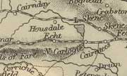 Produce
sent to Aberdeen. Produce
sent to Aberdeen.
Page 621. Peat and turf used as fuel. The roads are statute
labour and in good condition.
NSA
Page 740 Parochial Economy.
Market-Town.—Aberdeen.
Means of Communication.—Penny post office.
Three different turnpikes pass through on which there
are three toll-bars. The Lord Forbes coach from Aberdeen
to Alford etc travels through the parish. It would be
advantageous if there were also coaches on the Aberdeen
to Tarland road and on the Raemoir and Cullerly road
from Aberdeen to Kincardine O'Neil, Aboyne etc. There
are 9 small bridges in the parish.
Page 742 Fairs.—Several markets and trysts
for cattle, grain, hiring etc.
Inns, Alehouses, Etc.—Five, all on the turnpike
roads.
Fuel.—As peat begins to be used up, it is
being replaced by coal, brought from Aberdeen. Wood
is scarce but as plantations mature, it should become
easily available.
1842.
Ellon
OSA
(v.3,98) |
 |
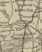 The
Ythan can be navigated from its mouth at Newburgh nearly
as far as Ellon. The
Ythan can be navigated from its mouth at Newburgh nearly
as far as Ellon.
Page 101 Peat is commonly used as fuel but the mosses
are remote, especially for those in the south of the parish.
Coal would be cheaper were it not for the tax.
The roads are quite poor though with some good bridges
on the busiest roads. The statute labour is partly commuted
and it would be preferred if this became general. A bridge
over the Ythan at Ellon is planned.
There is an inn in the town and 5 alehouses in the parish.
 |
| Watertown
and ferries on the Ythan |
NSA
Page
901 Lighters bring coal and lime up the River Ythan to
Watertown, very close to the village of Ellon.
Page 921 Parochial Economy.
Markets, Means of Communication, Etc.—There is
no regular provision market here but butcher meat is available
and fish is brought from Collieston and Newburgh both
to here and surrounding places by the fisher-women from
these places. The parish is generally self-sufficient
for butter, eggs, hens etc.
A market is held each month for cattle and grain, much
of which goes to Aberdeen and Newburgh. There
are also 6 fairs. The Ellon fair at Marymas used to be
important and was attended by dealers from the south of
Scotland and England. This has changed since steamers
have made it easy to transport the cattle directly to
London. The business now is mostly transactions between
home dealers.
Two
of the fairs are mostly for hiring. Much has been made
of the evils of this system but both parties become well-known
to each other which allows them, on either side, to avoid
any with a bad reputation.
There is a post-office here, to which deliveries are made
by the mail coaches that run on the Aberdeen to Peterhead
and Fraserburgh road. Runners take mail to Newburgh, Slains,
New Deer etc.
There is also a coach that passes through
every two days from Strichen and Old Deer on its way to
Aberdeen, and two carriers to Aberdeen. Other carriers,
who cross the Ythan at Ellon, afford access to all parts
of Buchan. Another turnpike goes to Newburgh.
The
commutation roads used to be neglected but are now much
improved, and some new lines made, all of which benefits
progress in the parish. The road funds are managed well
and where insufficient, the proprietors will often advance
loans without interest. Everyone is aware of the importance
of good roads so it is likely that the roads will continue
to improve.
Although
some licensed premises are unnecessary, those on the public
roads are generally needed for travellers.
1841
MacFarlane
Page 97 There is a ferry boat in Ellon.
Description of the paroches of Ellon & Logie Buchan
Page 427 There are passing boats at Ellon and at Kinharache.
There is no public road through Logie Buchan.
Fintray
OSA
(v.3, p.236) |
 |
 238
Advantages and Disadvantages - Among the disadvantages
are the distance from lime or marl and the scarcity of
peat - poorer people cannot afford coal because of the
tax. 238
Advantages and Disadvantages - Among the disadvantages
are the distance from lime or marl and the scarcity of
peat - poorer people cannot afford coal because of the
tax.
One advantage is that the journey to the Aberdeen markets
and back can be made in one day.
Miscellaneous Observations - The roads are reasonably
good and bridges have been built over all the rivulets.
NSA
Page 171 Parochial Economy.
Market-Town, Etc.—The nearest market town is
Aberdeen, reached on 6 or 7 miles of turnpike and the
rest of the way on good commutation roads. The road
from Keith-hall to Aberdeen runs through centre of the
parish.
Page 174 Inns.—Two.
Fuel.— As the moss where peat and turf was
obtained is mostly used up, coal is now brought in from
Aberdeen.
Forbes
and Kearn
OSA
(v.11, p.189) |
 |
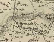 Page
192 Peat and turf are available at the hill of Correen
but much time that could be spent on other tasks is
wasted in obtaining them. Page
192 Peat and turf are available at the hill of Correen
but much time that could be spent on other tasks is
wasted in obtaining them.
Page 197 The roads under the statute labour system are
wretched and scarcely passable in winter.
NSA
See Tullynessle and Forbes
Forgue
OSA
(v.12, p.279) |
 |
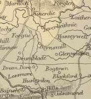 Page
280 Grain taken to Portsoy and Banff. Page
280 Grain taken to Portsoy and Banff.
Page 287 Antiquities.—Until recently, it was
thought that the Romans did not progress beyond the Grampians.
However, Captain Shand of this parish carried out considerable
research which convinced him that they had, and that the
remains on Barra-hill and Glenmailen were Roman.
The writer notes how larger camps are often associated
with smaller works, both round and rectangular, and lists
various of these. He remarks on the possibility of a Roman
road passing this way and notes that an ancient road had
been found leading through Forgue, Deskford and towards
the Spey.
Roads.
— The roads are poor because of the soil and the
statute labour being commuted. It would be better to raise
the money and employ competent workmen.
A bridge over the Doveron at Marnoch and another at Auchintender
on the Aberdeen road that passes through the Garioch,
would be a great benefit.
Fuel.
— Peat and turf is brought from Foudland but
at such expense and difficulty that coal from Banff and
Portsoy, 17 miles away, is starting to be used. It would
help if the duty on coal was removed.
NSA
Page 601 Antiquities.—Possible Roman remains
on the Seedhill of Auchaber, about a mile distant from
the camp at Glenmellan (now Glenythan) and on a road that
continued to the Spey through Forgue, Rothiemay and other
parishes on its line.
Page 604 Market-Town.— Huntly, 7 miles away.
The turnpikes from Huntly to Banff and Huntly to Aberdeen
pass through the parish; the latter has a coach service.
Other roads are poor but the turnpikes enable produce
to be taken to the main market towns quite easily.
Page 610 Inns.—One inn, at Bagniebrae, where
the Banff and Aberdeen turnpikes meet.
Fairs.— Three held at Hawkhill for cattle, sheep
and general goods. 1842.
Foveran
OSA
(v.6, p.62) |
 |
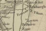 Page
64 The Ythan is navigable for three miles. Page
64 The Ythan is navigable for three miles.
Page 68 Peat is scarce and coal expensive because of the
tax. The roads which are statute labour are reasonably
good. Many would like to have turnpikes and are aware
of their benefits.
 |
| Ferries
on the Ythan |
NSA
Page 700 Details of the port of Newburgh. Ferry-boat on
the Ythan about three-quarters of a mile above the village.
Parochial Economy.
Means of Communication.—The Aberdeen to Peterhead
turnpike road on which the mail runs, passes through the
parish. There is also a daily coach between Aberdeen and
Ellon. Three public houses lie on this road.
The Aberdeen to Methlick turnpike touches the parish and
there is a new turnpike between Old Meldrum and Newburgh.
Good cross roads branch off the Peterhead turnpike, and
one of them, the Fiddes road, usefully connects with the
Udny turnpike road.
Fraserburgh
OSA
(v.6, p.1) |
 |
 Page
8 Peat is scarce and coal, because of the tax is expensive. Page
8 Peat is scarce and coal, because of the tax is expensive.
There is no post directly to Peterhead and Banff - it
goes through Aberdeen.
NSA
Mention of the old and new roads to Banff.
Page 250 Much work has been done on roads and there
are now excellent turnpikes to Aberdeen, Peterhead,
Banff and Strichen.
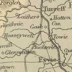
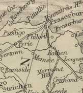
Fyvie
OSA
(v.9,
p.459) |
 |
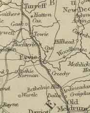 Page
464 The Aberdeen to Banff road passes through. It is maintained
by the statute labour and is in good condition. There
is a post office on it, near the church. Page
464 The Aberdeen to Banff road passes through. It is maintained
by the statute labour and is in good condition. There
is a post office on it, near the church.
NSA
Details are given of the religious establishments in
the parish, and of the old burgh of Fyvie.
Page 336 Roads.—Being an inland parish,
goods and manure have to be brought long distances.
The nearest harbours at Macduff, Aberdeen and Newburgh
are about 20 miles away. However, the roads are good
and the canal at Inverurie that runs to Aberdeen is
very useful for the carriage of lime, bone-dust, coal
etc. Inverurie itself is useful as a market for farm
produce.
The commutation road-money is about L.123 and administered
by the heritors and their factors under the oversight
of the district trustees and the general county trustees.
As well as the assessment, tenants help by allowing
their horses and carts to be used in the making of roads,
and heritors have made many roads at their own expense.
Page 337 Parochial Economy.
Market-Town, Etc.—Old Meldrum and Turriff are
the nearest market-towns.
Means of Communication.—Post-office with
a daily post. A stagecoach also runs daily on the Aberdeen
to Banff turnpike. New turnpikes are to be built that
will pass through this parish: one from Forgue to Inverury
and another from Aberdeen to Banff by Metlich, Cuminestown
etc.
Page 343 Fairs.— Two ancient fairs continue
to be held. He notes that about forty fairs are held
each year, within 10 miles of the church, and questions
whether this is too many.
Inns, Alehouses, Etc.—Small inn at Lewes
of Fyvie. Nine retailers of spirits.
Fuel.—Mostly peat. Coal is very expensive
because of the distance from the coast.
1838 Revised 1840
MacFarlane
Description
Parishes of Ochterless, Tureff and Fyvie in Aberdeen
1723
Page 94 In Fyvie parish there is a bridge over the Ythan
at Lewes of Fyvie, half a mile from the village.
Glenbucket
OSA
(v.19, p.607) |
 |
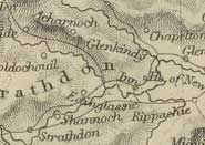 The
parish is very isolated being 30 miles to Aberdeen which
is the nearest market and post-town. Sometimes we are
cut off for 6 or 8 weeks. The
parish is very isolated being 30 miles to Aberdeen which
is the nearest market and post-town. Sometimes we are
cut off for 6 or 8 weeks.
NSA
Page 436 Reference to a narrow and romantic pass east
of the parish. No particular mention of roads except
that they are much wanted.
Glenmuick,
Tullich and Glengairn
OSA
(v.12, p.215) |
 |
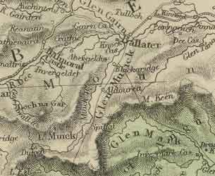 Page
220 There is a good bridge over the Muick, near the church,
built about 50 years ago by subscription and another fine
bridge, half a mile below the church, called the Bridge
of Ballater. Page
220 There is a good bridge over the Muick, near the church,
built about 50 years ago by subscription and another fine
bridge, half a mile below the church, called the Bridge
of Ballater.
The well known Wells of Pananich are in this parish. Mr
Farquharson made good roads to the wells and generally
was very attentive to roads making some new ones and repairing
others. He also made arches over some small streams that
were sometimes unfordable.
NSA
Page 781 Parochial Economy.
Villages.—Ballater and Tullich. Ballater is
popular with tourists come to take the air and admire
the scenery. It has a post-office, served daily from
Aberdeen.
Means of Communication.—An excellent commutation
road runs north of the Dee to Charleston of Aboyne where
a turnpike road, 30 miles in length, leads to Aberdeen.
A mail-coach runs each day, and there are three carriers
but no public coach.
Another commutation road runs south of the Dee and there
are several cross roads all in good condition.
Two fine stone bridges have been swept away by floods:
the first was in 1799, and the second, a replacement built
in 1808-9, was destroyed in 1829. It had cost about L.5000,
half paid by subscription, and half by the Parliamentary
Commission for Highland Roads and Bridges. This itself
was replaced by a wooden bridge in 1834 and cost L.2000,
again under the same funding arrangements.
There is a bridge over the Water of Muick on the road
to the south of the Dee and another over the Water of
Gairn on the road north of the Dee, both very useful
bridges.
Page 786 Fairs.—Two fairs at Ballater for
cattle etc, and one for grain, hiring servants, and
settling accounts.
Inns.—Eleven.
Fuel.—Peat, wood and coal.
1842
Glengairn
parish
Mention of “the well known crags or Pass of
Ballatar, where the tremendous impending rocks threaten
the astonished traveller with immediate destruction.”
Page 227 Miscellaneous Observations.—There
is a very old stone bridge over the Gairn and another,
6 miles upriver, built by the government on one of the
Highland roads. There is another bridge over the Girnie.
MacFarlane
A Description of the two Shires of Aberdeen and Banff
Vol.2, Page300 Timber from the wood of Pananich near
Glen Muick is conveyed to Aberdeen but not by the rough
and stony road.
Huntly
OSA
(v.11,
p.467) |
 |
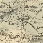 Extent
and Roads.—The roads, made by statute labour,
are often impassable. Extent
and Roads.—The roads, made by statute labour,
are often impassable.
Two principal streets in the town. Where they cross they
form a square where markets are held.
Page 469 There is a modern bridge of three arches over
the Bogie that can be used by heavy carriages going to
and from Aberdeen, 34 miles away. It is also used for
peat and turf, from 5 miles away.
There is a very old bridge over the Doveron, strengthened
by iron bands to the height where flood waters might reach.
Without this bridge, journeys on the associated road between
Portsoy and Keith, Fochabers, Gordon Castle, and the river
Spey would often be impossible when the river is in flood.
NSA
Page 1037 In the floods of 1829, bridges on the Bogie
and Deveron were swept away. The ruins of some can still
be seen.
Page 1041 Parochial Economy.
Roads, Bridges, Etc.—Roads are as follows:-
- Aberdeen by Keith, Fochabers and Elgin to Inverness.
Excellent bridges are at both ends of the town. The
Mail, Defiance, and Duchess of Gordon coaches run on
this road;
- on the south, a turnpike towards Rhynie;
- on the north, a road to Portsoy, 17 miles away;
- on the north-east, a road to Banff, 21 miles away.
Fairs, Etc.—About a dozen annual fairs or
markets, including two feeing markets for the hire of
farm-servants. He has some trenchant remarks about the
drawbacks of the system, both the effects on morality
and the mercenary nature of the hiring where each party
cares little about the other.
Inns, Etc.—Excellent inn in Huntly, and
4 others. There are also 12 public-houses and a couple
of spirit-dealers.
Fuel.— Peat and turf. English coal is landed
at Portsoy and then brought the 17 miles to Huntly.
Some wood is also used.
November 1842.
Insch
OSA
(v.17, p.482) |
 |
 Page
484 A canal has been proposed, at least to Inverurie. Page
484 A canal has been proposed, at least to Inverurie.
There is a weekly market here and 2 or 3 small fairs.
If the canal reached here it would become the market place
for upper Garioch.
NSA
Page 751 Mention of the Gallow Road beside the Gallow
Hill.
Page 754 He surmises that the fort at Dunnideer and nearby
place names incorporating the word “ward” could
have been so placed as to defend a major pass from the
Garioch to the north and west.
Page 757 Major slate quarry at Foudland though its output
is less than formerly because of the high cost of transport.
Parochial Economy.-- Two markets: one is for cattle
etc, the other for hiring. There are several shopkeepers
and several tradesmen.
The nearest post-office is at Old Rain, from where the
mail is brought by private runner.
He refers to three roads that link to Huntly: the mail
road from Aberdeen; one to the west of Foudland; and one
through Kennethmont and Gartly.
Page 761 Inns, Etc.—Five.
Fuel.—The mosses in Foudland which supplied
many, are near exhausted and it is likely that people
will come to depend on coal more and more. Some here are
allowed peat from the Hill of Melschach in Kennethmont
but have to bring it four miles.
1842.
Inverury
OSA
(v.7, p.331) |
 |
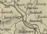 Page
332 Bridges.—A fine bridge was built over
the Don last year for a cost of L.2000, raised by subscription.
A bridge is still needed for the Ury and it is hoped some
help will be given by the government as the King’s
highway from Aberdeen to Inverness passes through here
and is 14 miles shorter than the road by Old Meldrum and
Turriff. Page
332 Bridges.—A fine bridge was built over
the Don last year for a cost of L.2000, raised by subscription.
A bridge is still needed for the Ury and it is hoped some
help will be given by the government as the King’s
highway from Aberdeen to Inverness passes through here
and is 14 miles shorter than the road by Old Meldrum and
Turriff.
Peat has to be brought a long way from other parishes
with much loss of time. Some coal is brought in from Aberdeen.
NSA
Page 683 He gives details of the Aberdeen Canal that ran
to Port Elphinstone near Inverury, which at that time
was thriving. He notes the “hundreds of carts,
sometimes, in a day, delivering grain, and carrying away
coals, lime, bones, dung, bricks, iron, timber, or other
materials for house-building“.
Page 684 Parochial Economy. Twenty fairs for cattle,
horses, sheep, and grain. The town is lit by gas. Post
office.
A new turnpike road has been made from Inverury towards
the bridge of Marnock, running through Chapel Daviot,
Fyvie, Auchterless, and Forgue.
At least three coaches run to Aberdeen each day.
1842
Macfarlane
The Garioch, Aberdeenshire 1724
 Page
8 The king’s highway from Aberdeen to Inverness
runs through the town of Inverurie. The highway uses
fords and passage boats to cross the Don and Water of
Urie. Page
8 The king’s highway from Aberdeen to Inverness
runs through the town of Inverurie. The highway uses
fords and passage boats to cross the Don and Water of
Urie.
Keig
OSA
(v.11, p.455) |
 |
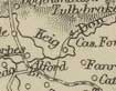 One
boatman. One
boatman.
Page 459 Dung and fuel carried on creels on the sides
of horses.
Roads — Aberdeen is the nearest sea-port,
25 miles away. The roads are statute labour but recently
landlords both here and in neighbouring parishes have
started subscribing towards a new road on a different
line to Aberdeen.
NSA
Page 952 Cattle now sent directly to London by steamers.
Page 954 Parochial Economy. Market-Towns, Etc.—The
nearest towns are Inverury and Kintore, 12 and 14 miles
distant. However, Aberdeen, 25 miles away is used as
the market town.
The turnpike road between Aberdeen and Alford passes
through the south part of the parish. There is a mail-gig
and a coach to Aberdeen. The post-office is at Whitehouse,
just outside the parish.
There are ten and a half miles of commutation roads
and 5 miles of roads made by proprietors through their
lands. The commutation fund is L.31.10s.2d a year.
There are also 5 miles of hill roads and one and a half
miles of old commutation road that are in bad condition
and little used.
Keig bridge over the Don was built in 1817 at a cost
of L.2300, half by subscription and half by the government.
1842
Keithhall
and Kinkell
OSA
(v.2, p.527) |
 |
Page
532 Mention of cattle being sold for the south country.
Agricultural produce sent to Aberdeen.
Page 534 Details of fuel. Lime brought in from Aberdeen
and from kilns in some neighbouring parishes.
 Page
540 Carriages, Carts. - One carriage and about
100 single and double carts. Forty years ago there was
only one cart in Keithhall, and dung was carried in
creels on horse back. Page
540 Carriages, Carts. - One carriage and about
100 single and double carts. Forty years ago there was
only one cart in Keithhall, and dung was carried in
creels on horse back.
Advantages and Disadvantages.—
Among the disadvantages are “the distance from
lime and marl, and from any considerable market-town;
and the number of carriages, or feudal services, every
farmer being obliged to bring 6 cart-loads from Aberdeen
yearly, to the principal heritor, besides, peats from
the moss..”
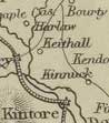 NSA NSA
Page 746 Parochial Economy.
Inverury is the market and post town.
Two bridges on the Ury; one of stone, built about 30
years ago; the other of stone piers and a wooden arch,
built recently.
Fairs. - Michael Fair, at Kinkell, for cattle
and horses.
Alehouses.—None.
Fuel.—Peat and turf.
1842.
Kemnay
OSA
(v.12, p.199) |
 |
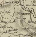 Page
207 Two public houses, mostly used by travellers. Page
207 Two public houses, mostly used by travellers.
Page 208 No bridges.
Page 211 Two public roads, made and maintained by statute
labour: the Aberdeen road and the road to Inverury and
Old Meldrum.
NSA
page 817 No mention of roads other than a reference
to the public highway.
1842
MacFarlane
A Geographical Description of the Parishes of Monymusk
Kenmay and Cluny 1722
Page 95 There is a small bridge in Monymusk. Mention
of Boat of Kemnay on the river Don and a Boat in Monymusk.
There are also 2 or three fords.
The highway from Aberdeen passes the church of Kenmay
and leads over the Bridge of Ton over the Ton Burn.
The Rectified Highway called the Skene Road from Aberdeen
enters Clunie parish to the SE, runs past Drumlahoy
to Mill of Clunie where there is a bridge, then through
Monymusk parish to the parishes of Touch and Keig.
Kennethmont
OSA
(v.13, p.66) |
 |
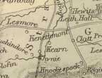 Page
72 Roads.—The roads are statute labour. There
is little gravel available hence they are often deep though
still passable. The military road to Huntly and Fort George
through the Cairn-o'-Mount has been neglected by the government
but is kept up here by the statute labour. Page
72 Roads.—The roads are statute labour. There
is little gravel available hence they are often deep though
still passable. The military road to Huntly and Fort George
through the Cairn-o'-Mount has been neglected by the government
but is kept up here by the statute labour.
Peat is the usual fuel. Coal is brought from Aberdeen
by some.
Page 77 Fairs.—Of two old fairs here, one
used to be held during the night and was called Sleepy-market.
When the proprietor changed it to the day time, the people
chose to neglect it.
Page 79 Advantages and Disadvantages. There are
plenty of nearby fairs where cattle and sheep can be sold.
There is also a weekly market at Huntly, or if need be,
Aberdeen can be used. The road there, since the new bridge
at Inverurie over the Don, is now safe.
NSA
Page 586 Parochial Economy. Market-Town.—The
nearest is Huntly, 8 miles away. Most of the grain however
is taken to Inverurie, 18 miles away, from where it is
taken to Aberdeen by canal. On the return journey, lime
and coal are carried. As this can be done in a day, the
farmers no longer take their produce to the east, or north
coast, as they used to do.
Means of Communication.—Until the turnpike
road from Aberdeen to Huntly, Inverness etc. opened 6
years ago, the parish had bad roads. Two coaches used
to take a turnpike road through the hills of Foudland
but have now changed to the other road as it is more level
and faster (though 3 miles longer) and passes through
more interesting countryside.
Page 588 Fairs.—Three cattle fairs. A long
time ago, there used to be a fair held at Christ’s
Church, to the east of the parish.
Fuel.—Mostly peat but much time is spent in
obtaining it and the mosses are becoming exhausted. As
a result coal is starting to be used.
1840. Revised 1841.
MacFarlane
The Garioch, Aberdeenshire 1724
Page 16 No highway in parish of Kinnemonth.
Kildrummy
OSA
(v.18, p.411) |
 |
 “The
parish is unequally divided by the river, which the
people commonly pass upon stilts; which are poles or
stakes, about 6 feet in length, with a step on one side,
on which the passenger raised about 2 feet from the
ground, resting them against his sides and armpits,
and moving them forward by each hand, totters through.” “The
parish is unequally divided by the river, which the
people commonly pass upon stilts; which are poles or
stakes, about 6 feet in length, with a step on one side,
on which the passenger raised about 2 feet from the
ground, resting them against his sides and armpits,
and moving them forward by each hand, totters through.”
Page 413 Before carts were introduced, creels were used
to carry the dung, and grain was carried in panniers
on horse-back.
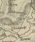 NSA
NSA
page 976 The castle was besieged by Edward I.
No mention of roads.
Kincardine
O'Neil
OSA
(v.6, p.55)
No mention of roads. |
 |
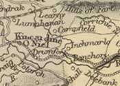 NSA NSA
Page 832 A fine granite bridge was built in 1812 at
a cost of L.3500, half by subscription and half by Government.
When close to completion, it was badly damaged by timber
floating down when the river was high - the contractor
was able to secure damages from the owners of the timber.
The bridge was also damaged in the floods of 1829 but
repaired thereafter.
The bridge lies on the old military road from Perth
by Brechin and Cairn o’Mount through here to Huntly
and Inverness, however, although a good road has been
made to Huntly the road southwards is not suited to
carriages so much of the usefulness of the bridge is
lost. It is hoped “a road to Cuttishillock, on
this side of the Mount, part of which was made last
year, will soon be completed.”
In
1829, the burn of Belty destroyed two stone bridges,
and badly damaged three more.
Page
836 Parochial Economy.
Markets.—Two long-standing markets are held
in the village for cattle etc and two others and two
feeing-markets have recently been set up. There is also
a monthly market at Tomaveen, in the north of the parish.
Post-office. - the mail-coach passes through
on its way between Aberdeen and Ballater.
Page 839 Fuel.—Peat, mostly from the hill
of Fare.
Inns, Etc.—Besides the inn (where the district
courts are held) there are about a dozen places that
sell spirits.
1842.
MacFarlane
Descriptions of Kincardine O’Neil, Aboyne and
Glentanar Parishes 1725
Page 101 Details of several roads are given, e.g. there
is a ferry boat over the Dee at Kincardine O’Neil
and there is a direct road between Aberdeen and Braemar.
The burn of Desk which divides Kincardine from Aboyne
is crossed by a “strong timber bridge with stone
land sleats.”
Road NE of Kincardine with a timber bridge over the
Burn of Canny. Road from Craigmyle towards Wester Billie
with “steps” over the Burn of Canny; road
northwards by the church at Tough etc
Kinellar
OSA
(v.3, p.496) |
 |
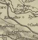 497
In summer, fields are rented by strangers for grazing
cattle and later taken to the market at Aberdeen. 497
In summer, fields are rented by strangers for grazing
cattle and later taken to the market at Aberdeen.
Inclosures and Roads.— The roads are maintained
by the statute labour which is commuted at a rate of 1s.6d.
for 6 days although those who wish can do the 6 days work.
Trade and Fuel.—“Besides cattle, considerable
quantities of meal and barley are sold at Aberdeen. Peats
are the common and principal article of fuel. Coals are
also brought from Aberdeen, which is 9 miles distant.”
NSA
Page 118 Parochial Economy. Kintore, 2 miles
away, was replaced in 1837 as the post-town by Blackburn.
Inverurie, 7 miles away, is the nearest market-town
and has 20 fairs each year.
A fine turnpike between Aberdeen and the north-west
passes through. The mail and three other coaches run
on this each day - their fares are moderate. Only one
cross-road serving one farm is in good condition; the
others are very bad and nothing at all has been spent
on the one near the church for 20 years.
A canal between Aberdeen and Inverurie, opened in 1797,
has a passage boat and other boats carrying coal, lime
and manure from Aberdeen and grain, slates, wood etc
into Aberdeen.
1840
King
Edward
OSA
(v.11, p.398) |
 |
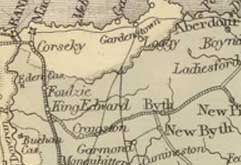 Page
406 Roads and Fuel.—The statute labour is
performed badly. The Banff to Turiff post-road has good
bridges and its condition improved of late though more
remains
to be done on this, and other
roads. It is believed that commutation or turnpikes are
the only means of improving the roads; long experience
having shown statute labour to be ineffective. Page
406 Roads and Fuel.—The statute labour is
performed badly. The Banff to Turiff post-road has good
bridges and its condition improved of late though more
remains
to be done on this, and other
roads. It is believed that commutation or turnpikes are
the only means of improving the roads; long experience
having shown statute labour to be ineffective.
Peat etc. used for fuel. Bad weather and the time spent
in obtaining peat has led many to use coal even when it
was taxed.
NSA
Page 282 Market-Towns.—Banff and Macduff.
Means of Communication.—The mail-gig and the
Earl of Fife coach travel daily on the turnpike road between
Aberdeen and Banff and several carriers go weekly to Aberdeen.
The main post-office is in Banff with a penny-post in
Newbyth served from Turriff.
As well as the Aberdeen to Banff turnpike, the Banff and
Buchan turnpike runs through the parish. The bridges on
these roads are good.
The bridge of Alvah, near Duff House, is a fine span over
the Doveran.
Page 284 Fairs.—Three fairs held at Newbyth.
Inns.—Five.
Fuel.—Mostly peat though many who live at
a distance from the mosses find coal from Macduff or Banff
is more convenient and less time-consuming.
Miscellaneous Observations.
The turnpike roads between Turriff and Banff, and Banff
and Buchan have been a great benefit to the parish. The
country roads have also improved in recent years.
1840
Kintore
OSA
(v.13, p.81) |
 |
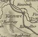 As
a very early burgh, it had several privileges, now transferred
to Aberdeen. One seems to have been a requirement to pay
customs on shipments of wine, there being “a causeway
at the east end of the freedom of Kintore, near Kinellar,
on the way to Aberdeen, still called the Wine Causeway.” As
a very early burgh, it had several privileges, now transferred
to Aberdeen. One seems to have been a requirement to pay
customs on shipments of wine, there being “a causeway
at the east end of the freedom of Kintore, near Kinellar,
on the way to Aberdeen, still called the Wine Causeway.”
Page 86 Forty years ago carts were unknown and everything
was carried on horse-back in creels etc.
Black cattle driven south.
Page 89 Highways and Bridges — A road from
Aberdeen enters this parish where it splits, one branch
passing west into Kenmay and up Donside, the other trending
NW through Kintore, Inverurie etc to Inverness. A fine
bridge over the Don was built on this road about three
years ago. Generally all the streams are bridged.
The roads are better here than in many of the nearby parishes
as there is plenty of sand and gravel, and between Kintore
and Inverury “needs no making at all.” They
are statute labour, commuted at 1s. 6d.
There are two taverns, necessary for travellers on the
great north road.
NSA
Page 659 In the past, Kintore was an important thoroughfare
as it was where the great northern road by Aberdeen
and some of the roads over the Grampian passses, met.
Page 663 Parochial Economy.
Shops in the burgh, and Aberdeen is only 12 miles away
and easily reached. The post-office was the first in
the district.
The great northern road passes through the parish, with
a branch to Kenmay from where the Alford turnpike can
be reached. The mail-coach and three others pass through
twice a day.
A canal, 18 miles in length, runs from Aberdeen to Port
Elphinstone nearby. Details of the canal and the goods
transported on it are given.
Revised 1842
MacFarlane
(Vol.2)
Kintore
p.286 Kintore is on the king’s highway.
Leochel
and Cushnie
OSA
(v.6, p.212) |
 |
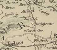 Page
217 About 200 cattle are sold to graziers or dealers from
the south; horses also have been sold and taken south,
in the past 8 years. Page
217 About 200 cattle are sold to graziers or dealers from
the south; horses also have been sold and taken south,
in the past 8 years.
As the mosses are mostly exhausted, fuel is scarce. The
removal of the coal-duty would be a great help in overcoming
this problem.
The roads are statute labour, all aged between 15 and
60 having to work 6 days or pay 1s.6d. The roads themselves
are not well made.
NSA (on Edina site - browse scanned pages)
Page 1127 Parochial Economy.
Market-Town.—Although Aberdeen at 28 miles
distance is farther than Kintore and Inverurie, it is
used as the market town. Lime and coal is brought on
return.
A 6 mile length of good commutation road joins the Alford
turnpike at Whiteley, in Tough parish. The Government
road from Donside to Deeside and the Tarland turnpike
pass through the parish.
The bridges are generally in good condition except one
over the Leochel at Scuttrie, on the Whiteley road,
carried away in the floods of 1839.
The nearest post-offices are Alford and Tarland, both
about 6 miles distant.
Page
1131 Fairs.—Five busy fairs for cattle,
sheep etc are held on a moor near Scuttrie, on the Craigievar
estate.
Inns.—One
Fuel.—Much time and effort is spent in obtaining
peat and turf; the latter coming from the Red-hill of
Lumphanan and the Glen of Cushnie, which are distant
and difficult of access. Coal from Aberdeen is starting
to be used.
1843
Leslie
OSA
(v.8, p.511) |
 |
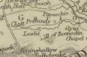 At
the time of James II Leslie was made a burgh of barony
and allowed to hold fairs and markets, though these are
long discontinued. At
the time of James II Leslie was made a burgh of barony
and allowed to hold fairs and markets, though these are
long discontinued.
Page 517 Fuel. - Some poor peat and turf is used
and is so difficult to win that it is a great impediment
to improving the country. Although coal will always be
expensive because of freight and transport, it would help
greatly if the coal tax was removed.
Page
518 Mention of road to Alford.
Advantages and Disadvantages. - Produce is taken
to Aberdeen, 30 miles away, on very bad roads. Lime also
can only be obtained from a distance.
The statute labour system operates here in a haphazard
manner, hence the roads are poor. It is noticeable however
that there is now a spirit for improving the roads. In
neighbouring Alford, the proprietors are making a road
by subscription to Aberdeen. It is hoped that those in
the Garioch will follow this example.
NSA
Page 1024 Parochial Economy.
Means of Communication.—A commutation road runs
alongside the Gady to Premnay to reach the Inverury -
Aberdeen turnpike. Another reaches the Huntly turnpike.
Most produce is taken to Inverury, and some to Huntly.
1842
Logie-Buchan
OSA
(v.4, p.421) |
 |
Ythan
navigable for 3 miles.
Page 426 Roads and Bridges.—The roads have
been made and are repaired by the statute labour, although
it is applied in a haphazard manner and more would be
achieved if it was commuted at the rate of 1s.6d. for
the season. The gentlemen of the district have paid much
attention to building bridges.
The Ythan affords easy access to lime and coal.
NSA
|
| Ferries
on the Ythan |
Page
802 Coal, lime and bones are carried by lighters up
the Ythan for some four miles.
Mention of the Boat of Logie, near Watertown.
Page 804 On the Ythan there are two ferry-boats near
the church, where a chain-bridge would be very useful
although this would be unnecessary if the planned work
for a bridge on the Fraserburgh/Peterhead to Aberdeen
turnpike just below the ferry goes ahead. It would cost
about L.5000 and save two miles.
Page 807 Details are given of Robert Gordon of Straloch
and his mapping endeavours.
Page 811 Mention of the Ferry of Logie being on the
main route from north-east Buchan to Aberdeen, the main
road passing along the sea-shore of Belhelvie. At the
time there was a kirk-town with markets and ale-houses.
Page 814 Parochial Economy.
Market-Town, Etc.—Aberdeen is the nearest market-town,
15 miles away, and Ellon, 2 miles away, the nearest
post-town.
The great north road to Aberdeen passes through and
the mail and other coaches run on it. Another turnpike
leads to Newburgh and is much used for the carriage
of lime, grain etc.
Page 816 Alehouses.—One.
Fuel —The main fuel is coal, obtained at
Newburgh. Peat and turf have to be brought in from other
parishes as the mosses here are near exhausted.
Miscellaneous Observations. A major impetus to
change has been given by turnpike roads and better commutation
roads. One of their benefits is that they form “most
convenient and gently sloping base lines in the process
of fielding.“
Revised 1842
MacFarlane
Parish of Logie Buchan 1723
page 97 A ferry boat on the south side of the river
Ythan mentioned in account of Logie Buchan, also in
connection with Methlik parish (page 98).
Description of the paroches of Ellon & Logie Buchan
Page 427 There are passing boats at Ellon and at Kinharache.
There is no public road through Logie Buchan.
Logie-Coldstone
OSA
(v.9, p.510)
No particular mention of roads. |
 |
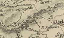 NSA
(on Edina site - browse scanned pages) NSA
(on Edina site - browse scanned pages)
Page 1073 Antiquities - A paved road was found
on Cairnmore of Blelack, possibly connected with the
nearby Pict’s Howe.
MacFarlane
Description of eighteen parishes in the shire and
diocese of Aberdeen C.1720
Page 24 In Coldstane and Logie parish there is a highway
between Aberdeen and the heights of Strathdone etc.
Longside
OSA
(v.15,
p.282) |
 |
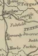 Page
283 The idea of a canal from Peterhead to Old Deer is
talked about. Page
283 The idea of a canal from Peterhead to Old Deer is
talked about.
Page 292 Although peat is available, much time and effort
is expended in obtaining it; coal, now the tax is removed,
could be an alternative.
No particular mention of roads.
NSA
Page 866 Parochial Economy. The nearest market-town
is Peterhead, 6 miles away; there is a post office at
Mintlaw.
The Aberdeen to Fraserburgh and Peterhead to Banff turnpikes
pass through Mintlaw; the mail coach runs on the first
and a stage-coach on the second. There are many other
well-planned roads but not in the best condition. The
bridges at Auchlee and Rora are old and in bad condition
and need to be replaced.
About 40 years ago, a canal was started here for transporting
shell-sand but it was abandoned long ago.
Page 871 Fairs.—Two are held at Longside,
three at Lenabo and six at Mintlaw, all are for cattle,
sheep and horses. There is a weekly grain-market in
Peterhead.
Inns.—Three.
Fuel.—Mostly peat though much time and effort
is spent in obtaining it. Coal is had at Peterhead and
will no doubt become the only fuel available.
1841. Revised 1842.
MacFarlane
Description
of the Parish of Longside, Aberdeenshire 1723
Page 70 Two timber bridges over Water of Ugie in the
parish of Longside.
Lonmay
OSA
(v.16, p.631)
Page 633 Mention of the feasibility of a canal.
|
 |
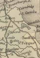 NSA NSA
Page 230 Fraserburgh is the nearest market-town, 4 miles
away.
Means of Communication.— Mail and newspapers
are delivered to Cortebrae. The turnpike from Peterhead
to Banff by Fraserburgh passes through, as does the
Fraserburgh to Aberdeen turnpike by Mintlaw. Coaches
run on these roads.
Page 235 Fairs.—Two cattle and sheep fairs.
Inns, Alehouses, Etc - 5 or 6.
Fuel.—Peat.
1835. Revised 1840.
Macfarlane
Description of the Parish of Lonmay, Aberdeenshire
1722
Page 68 In the parish of Lonmay, the king’s highway
goes from Inveralochie south past the church to the
Calsay of Kininmunth and then by a timber bridge over
the Water of Eugie to Old Deer.
Lumphanan
OSA
(v.6, p.382) |
 |
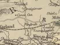 Page
385 With the north and south roads passing through here,
it is easy for farmers to sell their cattle to dealers
from the south country, though not always at a time when
they would get a good price. Page
385 With the north and south roads passing through here,
it is easy for farmers to sell their cattle to dealers
from the south country, though not always at a time when
they would get a good price.
The distance of Aberdeen (24 miles) is a disadvantage
and there is no lime or marl. Much time is spent on peat
which are carted on “bye roads where carts are
drawn with danger and difficulty.” Some think
coal from Aberdeen would be an alternative.
Due to the north and south roads, we have some trouble
with beggars and pilferers.
Page 389 The roads are reasonably maintained by the statute
labour, though not always enthusiastically especially
if the individual is older. Six days have to be worked
or a payment made in its place.
There is much need for bridges with burns becoming impassable
at times. Two great roads intersect near the church.
NSA
(on Edina site - browse scanned pages)
Page 1094 Parochial Economy.
Means of Communication.— The Aberdeen to
Tarland turnpike passes through from east to west. Two
roads cross the parish from north to south; the “rude
military road, made about 1746, and the finely kept
one, executed under the authority of the Parliamentary
Commissioners for Highland Roads and Bridges.”
1843
Machar,
New
OSA
(v.6,
p.465) |
 |
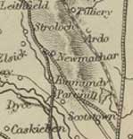 Page
470 Advantages and Disadvantages - It is only 10
miles from Aberdeen which affords a ready market for produce
and where coal can be obtained. There is a good public
road. Page
470 Advantages and Disadvantages - It is only 10
miles from Aberdeen which affords a ready market for produce
and where coal can be obtained. There is a good public
road.
Page 472 Fuel - Although peat is available, much
time is spent on obtaining it. Coal is expensive due to
the coasting tax.
Page 474 Roads.—In summer the roads are good
but in winter the amount of traffic and the clayey soil
makes them deteriorate quickly.
The post road that runs south-north was originally made
by the military and is now maintained by the statute labour.
This requires 6 days work each year, or if preferred,
a payment of 3d. per day which is used to employ day labourers.
Justices of the Peace appoint an overseer and an announcement
is made the preceding Sunday of the requirement to attend
for work. The day labourers do a much better job than
those called up who are generally uninterested in the
value of good roads and perform the labour reluctantly
and in a slovenly manner.
There are no turnpikes - their utility is recognised but
they may be too costly for this district.
Miscellaneous - There are 6 alehouses near the
road between Aberdeen and Old Meldrum, mostly used by
carriers and travellers.
The nearest post-offices are at Aberdeen and Old Meldrum.
NSA
Page 1032 Parochial Economy.
Market Towns.—Aberdeen and Old Meldrum.
Means of Communication.—There is now a post-office,
near the turnpike road.
There is a new turnpike road that has replaced the old
turnpike that meets with the Peterhead turnpike, near
the old bridge of Don. The old road is still in good condition.
A stage-coach to Banff runs on the new road as well as
a mail-gig and the mail coach. Regular carriers.
There are good statute labour roads.
There is a wooden bridge over the Don on the public road
that is thought too weak for heavy carriages and is to
be replaced by a stone bridge nearby.
Page 1035 Fairs.— Attempts have been made
to start a cattle fair here, but with limited success.
Inns, Ale-houses, Etc.—Three inns, on the
turnpike road.
Fuel — Peat and turf, although coal, brought
from Aberdeen, is starting to be used. August 1842.
MacFarlane
A Short Account of the Parish of New Macar
Page 84 In New Macar parish the “Marcket Road”
from Aberdeen to Banff runs by Parkhill Kinmundy, the
church, Udny and Turriff.
Old
Machar
Page
1074 - NSA
only (on Edina site - browse scanned pages)
No mention of roads. |
 |
Meldrum
OSA
(v.13, p.153) |
 |
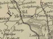 Page
160 Miscellaneous Observations. It would be beneficial
if the roads from Old Meldrum to the sea-ports of Aberdeen
and Newburgh were in better repair, especially to Newburgh
which is nearer than Aberdeen and where lime and coal
costs less. Page
160 Miscellaneous Observations. It would be beneficial
if the roads from Old Meldrum to the sea-ports of Aberdeen
and Newburgh were in better repair, especially to Newburgh
which is nearer than Aberdeen and where lime and coal
costs less.
NSA
Page 480 Parochial Economy. Market-Town.—Old
Meldrum has a market for cattle and grain every two
weeks, and two annual hiring fairs. There is a post
office.
Means of Communication.—There is a turnpike
road between Aberdeen and Banff that passes through
here, and was opened in in 1804. Apart from two carriers
who travel to Aberdeen each week, the post comes through
twice a day, and a stage-coach which is economical and
convenient.
Page 483 Fuel - As peat has mostly been used
up, coal is commonly used, carted in from Newburgh and
Aberdeen.
Miscellaneous Observations - He refers again
to the 1804 turnpike road, noting how it allowed farm
produce to reach Aberdeen throughout the year and how
it had generally simulated improvements, impossible
when the roads were poor.
A new turnpike now runs between the upper part of the
Garioch and the coast which will benefit the district
and Old Meldrum by giving easier access to markets and
allowing coal to be had at Newburgh which is nearer
than Aberdeen.
November 1840.
MacFarlane
The Garioch, Aberdeenshire 1724
Page 11 The king’s highway from Aberdeen to Banff
runs through the parish and village of Old Meldrum.
Methlick
OSA
(v.4, p.320) |
 |
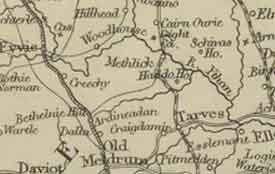 “The
roads and bridges over burns are pretty tolerable, and
have been made by statute labour.” “The
roads and bridges over burns are pretty tolerable, and
have been made by statute labour.”
Much produce is sent to Aberdeen.
Two ferry-boats.
Peat and turf used as fuel. Two ale-houses.
NSA
Page 971 Parochial Economy.
Market-Town.—No market-town in the parish.
Grain is taken to Inverury, Newburgh, and Aberdeen -
bones and lime are brought from the first two places.
Lime is also available locally from kilns at Udny, Aquhorthies,
and Barrack.
Means of Communication.—Mail is brought
by a gig that runs daily from Aberdeen; the nearest
post-town used to be Old Meldrum, 7 miles distant.
Although there is no turnpike road, there are good commutation
roads to New Deer, Fyvie, Ellon, Old Meldrum, and Tarves.
A turnpike to Aberdeen can be reached at the last four
places. A carrier from here goes to Aberdeen every two
weeks but the nearest stage-coach is at Tarves.
Page 973. Ecclesiastical State. There are references
to two fords in Methlick in a charter of 1373 relating
to a gift of land to the church.
Page 975 Fairs.—Two fairs are held for hiring
and cattle but not many cattle are sold. One of the
fairs, Dennick’s fair (St Devenick) is of great
antiquity.
Alehouses.—Four alehouse and 3 spirit shops.
Fuel — Peat.
August 1842.
MacFarlane
Parish of Logie Buchan 1723
page 97 A ferry boat on the south side of the river
Ythan mentioned in account of Logie Buchan, also in
connection with Methlik parish (page98).
Midmar
OSA
(v.2,
p.516) |
 |
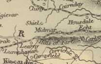 Page
521 In one part of the parish the public road and the
cross roads are well kept; in another, where the principal
heritor is not resident, they are not. Page
521 In one part of the parish the public road and the
cross roads are well kept; in another, where the principal
heritor is not resident, they are not.
The public road is kept by the statute labour, requiring
6 days service for those aged 15 to 60 years; a few
people choose to pay the commutation rate of 1s.6d.
The statute labour was first introduced here about 1752.
NSA
Page 633 Parochial Economy.
Market Town - Aberdeen, 15 miles away.
Miscellaneous Observations - Good roads, both
turnpike and parish. Stage-coaches run through the parish.
Monquhitter
OSA
(v.6, p.121) |
 |
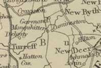 Page
135 Drovers buy 300 black cattle each year. Page
135 Drovers buy 300 black cattle each year.
Miscellaneous Remarks. Peat is used as fuel though
much time is taken to obtain it. Some use coal but the
tax makes it too expensive for many.
The roads are statute labour which can be converted at
a rate of 1s. 6d per annum. The roads can be used throughout
the year as the rivulets have been bridged. “As
there is no post road, the expense of turnpikes would
be useless and intolerable.”
NSA
Page 768 He refers to a proposed turnpike road through
Cuminestown that would allow for easy communication
to Aberdeen and Banff. In a footnote however he says
that there had been a delay, and that generally the
roads were in an extremely poor condition.
Parochial Economy. Market-Towns, Etc—Cattle-markets
are held at Turriff, 6 miles away. Grain is exported
from Macduff and Banff, 15 miles distant, and coal and
lime brought on return. The parish is very badly provided
with roads compared to others.
 Page
771 Fairs, Etc.— Horse and cattle fair held
in Cuminestown. Other markets have been set up at the
estate of Auchry. Page
771 Fairs, Etc.— Horse and cattle fair held
in Cuminestown. Other markets have been set up at the
estate of Auchry.
Inns and Alehouses.—Five.
Fuel.—The peat and turf (from Auchry) is
now almost exhausted.
1842.
Monymusk
OSA
(v.3, p.66) |
 |
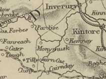 Two
good roads to Aberdeen, 18 miles away. Two
good roads to Aberdeen, 18 miles away.
Page 68 Minerals — About a mile NW of the
church there is an iron mine which has not been developed
because fuel is so scarce. The road to it is passable.
Aberdeen is the market town for grain and cattle.
NSA
Page 467 Parochial Economy. Market-Town.—Aberdeen,
19 miles away, is the nearest market. The village existed
in the time of Malcolm Canmore. There is a daily post
and three carriers each week to Aberdeen, which place
can be reached by two turnpike roads. One joins the
great north road near Kintore and the other goes through
Midmar, Echt and Skene parishes - this can be joined
3 miles from the village by a commutation road that
passes through the parish of Cluny. The distances is
much the same by either route.
Page 473 Fairs.—Three annual fairs. There
are also monthly markets for the sale of cattle and
grain in the winter months.
Inns.—There is an inn in the village and
an ale-house at the ferry boat on the opposite side
of the Don.
Fuel.—Peat, turf and wood and some coal
from Aberdeen which is brought by canal to Kintore.
Miscellaneous Observations.
Since the last Statistical Account, roads are greatly
improved.
1840
MacFarlane
A Geographical Description of the Parishes of Monymusk
Kenmay and Cluny 1722
Page 95 There is a small bridge in Monymusk. Mention
of Boat of Kemnay on the river Don and a Boat in Monymusk.
There are also 2 or three fords.
The highway from Aberdeen passes the church of Kenmay
and leads over the Bridge of Ton over the Ton Burn.
The Rectified Highway called the Skene Road from Aberdeen
enters Clunie parish to the SE, runs past Drumlahoy
to Mill of Clunie where there is a bridge, then through
Monymusk parish to the parishes of Touch and Keig.
Newhills
OSA
(v.6, p.34) |
 |
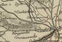 In
the late 1600s, a burgess of Aberdeen had a bridge built
here at his own expense after seeing 4 people drown in
the Buxburn where crossed by the great north road. In
the late 1600s, a burgess of Aberdeen had a bridge built
here at his own expense after seeing 4 people drown in
the Buxburn where crossed by the great north road.
Page 38 Granite from the quarries here is taken to Aberdeen
by the farmers here on their carts for export to London.
Three annual fairs. Peat is plentiful. Three ale-houses
used by travellers on the two public roads that pass through
the parish.
NSA
Page 237 A benefactor built a large stone bridge over
the Buxburn on the old road to Aberdeen (sometime before
the mid-1660’s).
Page 239 Three turnpike roads leading to Aberdeen.
Granite quarried locally is sent to Aberdeen, London
and elsewhere.
MacFarlane
Description Parish of Newhills, Aberdenshire 1725
Page 99 The North Road passes through Newhills parish
and crosses the bridge of Buxburn. A public road runs
through Alford to the highlands.
|
Oyne
OSA
(v.15, p.105)
|
 |
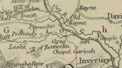 Page
106 The roads are very bad.
Page
106 The roads are very bad.
Proposed Canals.—Canals have been proposed
from Aberdeen to Inverury south of the Don, and from Inverury
to Old Rayne.
Page 109 Fuel.—Like four or five other parishes,
peat comes from Bennochie, and takes at least 2 months
to obtain. The canal would remove this inconvenience.
NSA
Page 642 In 1793 there were 50 carts which were of little
use on the then “rugged, steep and narrow roads”
and fuel, manure etc were taken on horseback.
Page 644 Parochial Economy.
Market-Town.—The nearest is Inverury, 7
miles away, by a turnpike road. There are two branches
of this road: to Huntly and to Insch by Pitmachie. The
mail-coach and the Defiance run between Aberdeen and
Inverness, and there is a coach to Huntly. Post office
at Oldrain.
A large number of beggars, mostly from the towns, pass
through.
Page 646 Fairs.—Hiring markets at Pitmachie
at Whitsunday and Martinmas.
Inns and Alehouses.—Eight.
1839. Revised 1842.
Peterculter
OSA
(v.16, p.358) |
 |
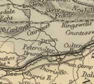 Other
than the bridge of Dee, 6 miles to the east, this (near
the church) is the chief crossing place of the Dee for
several roads leading from different places. There are
ferry boats here. Other
than the bridge of Dee, 6 miles to the east, this (near
the church) is the chief crossing place of the Dee for
several roads leading from different places. There are
ferry boats here.
Page 360 In a footnote he refers to the possible course
for a canal between the Dee and Loch Skene and how it
could be continued towards the Don, near to another possible
canal between Aberdeen and Monymusk.
Lime is carried in from Aberdeen.
Page 365 The road to the moss of Leuchar is very bad.
Page 371 Three ale-houses, useful for travellers and for
conducting business.
Page 375 Roads and Bridges.—Although good
materials are to hand, the roads are not very good. Some
cross-roads cannot be travelled on by carriages, others
are difficult for foot-passengers, and parts of the Aberdeen
road are in need of repair. Two residents had helped improve
this and other roads, in some places building them.
The course taken by the Aberdeen road had been badly planned
so that with its ascents and descents in such a short
distance it presents an emblem of the elevations and depressions
which frequently occur in the journey of life. There is
thought of laying out another road in a better line but
the expense may be too much - a turnpike act may be the
best way forward.
It is worth mentioning that many, although they complain
about the roads, do not do their statute labour service
and some are so unwilling to pay the commutation money
that pledges sometimes have to be taken. He says: “There
may indeed be some cause of complaint, if what I have
heard be true, that some years the commutation-money has
been collected through whole districts, and none of it
applied to the making or repairing of roads."
"As one travels along, he cannot help being offended
at seeing several cart-loads of small stones, which had
been gathered off the fields, thrown into a pit or ditch
at the road-side, when they might have been better disposed
of to fill up pits and ruts, and broken places in the
middle of the road.”
A stone bridge, built in 1608 and repaired in 1710, crosses
the Leuchar-burn on the road from Aberdeen to part of
Cromar etc. Part of the parapet has fallen down and a
beast and cart fell off about 15 years ago. A rampart
called the Guard-dike is nearby and is said to have been
where a guard of men was placed to prevent the spread
of plague from Aberdeen in the mid-1600s.
Another bridge is on the Deeside road, over the burn of
Culter, and is in good repair. It was widened about 40
years ago and can now take carriages. Nearby there is
a much more suitable place for a bridge which would have
avoided a steep climb.
There
are two other arched stone bridges: over Garvock-burn,
on the road to the house of Drum; and a small one near
the church. He notes that there are several bridges “composed
of long stones laid horizontally, and supported at each
end by a stone wall.”
Page 384 He describes the aggressive behaviour of some
of the vagrants who often infest the country, and notes
that a correction and work-house for the shire of Aberdeen
and Banff has been proposed.
When conditions are right, rafts of timber are floated
down from 7 or 8 miles upriver.
NSA
Page 107 There used to be a large quarry from which
stones were transported into Aberdeen.
Page 108 Mention of the camp at Normandykes. Formerly
thought to have been erected by the Danes or by William
the Norman, it is now considered to be Roman. It is
sited on the north of the Dee and may have guarded several
fords here.
P112. Parochial Economy.
Market and Post Town. - Aberdeen.
Means of Communication.—The Deeside turnpike
runs through the south of the parish for 4 miles. The
mail coach between Aberdeen and Castletown of Braemar
runs on this each day, and another coach runs in the
summer between Aberdeen and Banchory. Ballater is a
favourite destination with the wells of Pannanich nearby.
The turnpike to Skene also passes through. Local roads
(“cross accommodation roads”) are adequate.
1840
Peterhead
OSA
(v.16, p.541) |
 |
 Page
579 Roads.—The roads are statute labour and
in poor repair. There will be no improvement until turnpikes
are introduced.
Page
579 Roads.—The roads are statute labour and
in poor repair. There will be no improvement until turnpikes
are introduced.
Page 591 Fuel.—In the country peat is used
and in town supplemented with coal. As the peat is running
out, coal will have to be used, probably an advantage
to the farmers as it will allow them to spend their time
on other tasks.
Language - “There is a place called Stay
the Voyage, where the family of Marischal used to halt
in their way from Inverugie to Peterhead.”
Page 593 Town of Peterhead - Many details of the
town and its extensive import/export trade to London etc,
Norway and the Baltic etc. are given.
Page 614 Kerb and carriageway stones sent to London and
other places.
Page 619 Fairs.—Weekly market; two annual
fairs.
Taverns.—There are 30 taverns, all in the
town, except for 2 in Boddom
Shops.—Thirty five shops, many trades.
Post-office.—There is a post-office here,
with 6 posts.
Page 626 "In 1763, there was no post-chaise; now
there are two in the town, which suffice in winter, but
are not enough to cater for summer visitors."
Hints of Improvement - “…the streets
better paved, and illuminated with lamps in winter..”
NSA
Page 347 There is a bridge over the Ugie, 2 miles from
the town, built in 1686 by the counties of Aberdeen
and Banff.
Page 363 Quarries which supplied granite for public
buildings in London and elsewhere. Gas works in the
town. Details of shipping, fishing, manufactures etc.
Page 371 A Police Act was obtained in 1820 but prior
to this the streets in the town had been improved by
providing sidewalks, removing irregularities and replacing
the former rough stones with metalling.
Page 372 The town has a post-office. There are turnpike
roads to Aberdeen, Banff and Peterhead. The mail coach
runs to and from the first two places daily and the
Defiance stage-coach runs daily to Aberdeen and the
Lord Saltoun to Fraserburgh every two days.
Page 392 Two hiring fairs and a weekly market. Forty
six public houses, 28 spirit-dealers. The main inn where
the coaches call in is very fine. As peat is almost
worked out, coal is mostly used.
Page 386 Miscellaneous Observations - In contrast
with the time of the first account, the streets are
now well-made and are lit with gas. There were no turnpikes
then and the roads very poor (p.394). Turnpikes were
made in 1812, and many other roads have been made.
1837 Revised 1840
MacFarlane
Description Parish of Peterhead 1733
Page 70 Good stone bridge in Peterhead.
Pitsligo
OSA
(v.5, p.96) |
 |
 A
public road from Fraserburgh to Banff passes through.
A
public road from Fraserburgh to Banff passes through.
Peat comes from 5 miles away and the time taken in obtaining
it could be more usefully spent on other tasks. Coal is
more expensive than it should be because of the unjust
tax.
NSA
Page 403 In the centre of the parish the old road between
Banff and Fraserburgh and the Rosehearty to Strichen
road cross each other. The turnpike between Fraserburgh
and Banff touches the south-east corner of the parish
and is convenient for those living there.
MacFarlane
Description of the Parish of Pitsligo 1723
Page 50 King’s highway between Fraserburgh and
Banff passes through Pitsligo.
Premnay
OSA
(v.16, p.637) |
 |
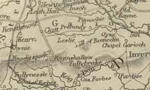 Page
639 Lime is brought from Aberdeen, 24 miles away, although
it would be within easy reach if the projected canal reached
to Insch.
Page
639 Lime is brought from Aberdeen, 24 miles away, although
it would be within easy reach if the projected canal reached
to Insch.
NSA
Page 696 Parochial Economy.
Means of Communication.—The road from Insch
to Keig and the road from the upper district of the
country to Inverury and Aberdeen cross each other near
the centre of the parish.
On the first road, a bridge was built over the Gady
at Auchleven in 1836 and cost L.70. The second road
was turnpiked between the church and the Mill of Craden,
where it joins the Inverness to Aberdeen road which
gives easy access to the canal at Inverury. Lime, bone
and coal can be had there, and grain is taken to Aberdeen.
Recently another turnpike has been made from Kennethmont
to Inverury - it joins the Insch road about a mile from
the church.
MacFarlane
The Garioch, Aberdeenshire 1724
Page 16 King’s highway from Aberdeen to the high
country passes through Premnay parish by Miln of Barns
and Overhall.
Rathen
OSA
(v.6, p.15) |
 |
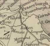 Page
20 Several bridges were destroyed in floods in 1789.
Page
20 Several bridges were destroyed in floods in 1789.
NSA
Page 296 Means of Communication - The turnpikes
from Aberdeen and Peterhead to Fraserburgh meet at Cortes
in the parish. The cross-roads are lately improved.
1840
MacFarlane
Description of the Parish of Rathen 1723
Page 55 Two wooden bridges over Water of Pilhorth in
parish of Rathen. One is ¼ mile west of the church
on the road to Old Dear and the other is between Carnbuilg
and the sea on the Frazerburgh to Peterhead road.
Rayne
OSA
(v.15, p.110) |
 |
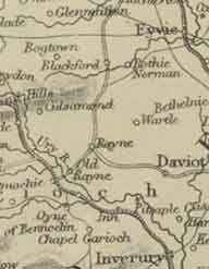 Page
112 Peat is available but takes much time to gather
in, time that could be better spent on other activities. Page
112 Peat is available but takes much time to gather
in, time that could be better spent on other activities.
The roads are in “tolerable repair“.
Page 115 Meal taken to Aberdeen. One hundred and eighty
cattle bought by dealers for the south country.
Up to half a dozen poor people from the Highlands pass
through daily in the summer.
Lime is 23 miles distant.
NSA
Page 426 A Roman road is thought to have passed Cairnhill
in nearby Culsamond parish, leading from the large camp
south of the Dee to the camp at Glenmellan near the
Ythan. There may be a signal post connected with the
road at Freefield, one mile from Cairnhill.
Page 432 Parochial Economy.
Market-Town.—The nearest is Inverury, 8
miles away on the turnpike road to Aberdeen.
Means of Communication.—The Royal Mail from
Aberdeen to Inverness calls at the post-office in Old
Rain each day, as does another coach.
A new turnpike passes through the parish - it runs from
the Huntly road at Garden’s Mill over to Old Meldrum
from where Newburgh can be reached. As yet it is not
busy but being near the slate quarries may prove very
useful.
Page 435 Fairs.—Tryst of Warthill, Lawrence
Fair at Old Rain, a new market at Old Rain, and Andersons
fair at Kirktown. There are also two feeing markets
at Old Rain.
Alehouses.—Four alehouses.
Fuel.—Peat.
Miscellaneous Observations.
Better parish roads leading to the turnpikes would be
a benefit.
October 1840.
Rhynie
(OSA Rhynie & Essie)
OSA
(v.19 p.289) |
 |
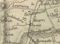 Page
295. The parish suffers from its distance to markets.
A canal from Aberdeen to the head of the Garioch or from
Huntly to Rhynie would help greatly.
Page
295. The parish suffers from its distance to markets.
A canal from Aberdeen to the head of the Garioch or from
Huntly to Rhynie would help greatly.
NSA
Page 1015
No particular mention of roads.
St
Fergus
OSA
(v.15, p.134) |
 |
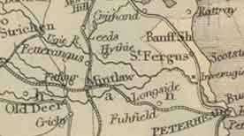 Page
138 A canal could be made at moderate cost from the mouth
of the Ugie along the south of the parish and to the west.
Page
138 A canal could be made at moderate cost from the mouth
of the Ugie along the south of the parish and to the west.
Page 145 Roads and Bridge.—The Peterhead to
Fraserburgh and Banff, and the Peterhead to Old Deer roads
(both statute labour) pass through the parish. They are
adequate but will only improve if they are turnpiked.
People will not work on the roads when they can redeem
their labour for 3d a day.
If a mail coach is established north of Aberdeen, the
route should be by the coast as the road by Fyvie often
has deep snow, and there would be more passengers on the
coast, particularly visitors to the mineral well at Peterhead.
The only bridge is over the Ugie on the Peterhead to Fraserburgh
and Banff road, built in the reign of James VII of Scotland
and II of England.
NSA
Page 187 A canal was built about 1800 on the south side
of the parish to link the proprietors lands with Peterhead
but ran into legal difficulties and has now been abandoned.
Page 193 The session-chest contains a paper in the hand
of the last Earl Marischal concerning the causewaying
of part of the public road. The chest also contains
documents showing that the kirk-session built and repaired
small bridges to give easier access to the church, sometimes
at its own expense. (George
Keith, 10th and last Earl Marischal inherited his title
in 1712 but had to leave the country after his involvement
in the Jacobite uprising of 1715. He returned for two
brief visits in the 1760’s and died in 1778)
Page 197 In commenting on population totals, the writers
refers to workers from other parishes employed in the
first decade of the 1800’s in making the turnpike
road.
Page 206 Parochial Economy.
Means of Communication, Etc.—Peterhead, 5 miles
away, is the market and post town. The turnpike from
Peterhead to Fraserburgh passes through the parish -
a coach runs on it three times a week. The bridge over
the Ugie, on the turnpike, was built in the time of
James II of England.
Page 213 The parish is much troubled by vagrant poor.
No fairs. Four inns. Peat and turf are used as fuel,
and some coal from Peterhead - a peat caster is employed
rather than the tenants own servants to obtain the peat.
MacFarlane
Description of Countrey of Buchan Aberdeenshire 1721
Page 39 Bridge over Eugie in parish of St Fergus, near
to Peterhead.
Description Parish of St Fergus, Banffshire and Crimond,
Aberdeenshire 1722
Page 66 Bridge over Eugie at Inverugie in St Fergus
parish, also 2 fords close by. Bridge over water of
Anchie.
Skene
OSA
(v.4, p.57) |
 |
 Page
60 Aberdeen is easily reached with the produce of the
parish, and where lime etc. can be brought in return. Page
60 Aberdeen is easily reached with the produce of the
parish, and where lime etc. can be brought in return.
Peat used as fuel.
140 carts, one chaisse.
The roads are just adequate. There are no turnpikes and
they are not wished for. Some necessary bridges have now
been built.
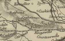 NSA
(on Edina site - browse scanned pages)
NSA
(on Edina site - browse scanned pages)
Page 1098 Mention of the Roman road passing through the
parish between the rivers Dee and Don.
Page 1100 Parochial Economy.
Means of Communication.—In the east of the
parish the road from Aberdeen splits into two branches
of turnpike road: one through the middle of the parish
towards Alford and Strathdon; the other to the south,
towards Tarland and Kincardine. On the first road there
is a stage-coach to Alford and a mail-gig. The market
town is Aberdeen from where coal, lime and bone-manure
are brought. The commutation roads are now in much better
condition.
Page
1101 Inns, Etc.—Two inns on the middle turnpike,
used by travellers and carriers. There are various shops
and tradesmen in the parish.
Fuel.—Peat is easily available in the parish.
Some wood, and coal from Aberdeen is also used.
1843.
Slains
OSA
(v.5, p.275) |
 |
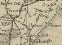 Details
of the fishing trade.
Details
of the fishing trade.
Page 281 Local limestone used about 20 years ago in repairing
the Aberdeen to Peterhead highway. The growth of clover
on patches where this had been used, when the rest of
the road was bare, suggested its use as a manure.
Page 285 Miscellaneous Facts.—
“Peats are the only fuel used here. The roads
are kept in pretty good repair by the statute labour,
though this is not fully sufficient. There are no turnpikes.”
Seven ale-houses
Ellon is the nearest post-office.
NSA
Smuggling was very prevalent here and the caves on the
coast afforded good hiding places for the contraband.
Page 596 Parochial Economy.
Market-Town.—Ellon is the nearest market
and post town, 6 miles away.
Ale-houses.—Three ale-houses; one spirit
dealer.
Fuel.—Peat.
1840
Strathdon
OSA
(v.13, p.171) |
 |
 Page
175 Butter and cheese are taken to the market at Tarland,
9 miles away. Cattle are sold to Aberdeen burchers, or
to drovers.
Page
175 Butter and cheese are taken to the market at Tarland,
9 miles away. Cattle are sold to Aberdeen burchers, or
to drovers.
Forty years ago there were only one or two carts - creels
being used for carrying dung and peats, a practice that
continues in the upper part of the parish. In the lower
part there are 50 or more carts. One gentleman has a carriage.
Page 185 The roads are not good; the statute labour is
mostly done in kind, with some choosing to pay the commutation
rate of 1s.6d.
There are 2 stone bridges on the Don, one just west of
the church, the other at the castle of Corgarff, on the
King's road from Edinburgh to Fort George.
Two ale-houses but no inn for travellers.
 |
| Military
roads in Strathdon |
NSA
Page 526 Mention of the old military road by Corgarff
over to Fort George.
Page 531 In the floods of 1829 the water reached within
a few feet of the keystone of the arch on the bridge of
Pooldhulie Bridge, normally 24 feet above the river.
Page 544 There is a fortification just above the confluence
of the Nochty and the Don. It is in line with traces of
a Roman road mentioned by Chalmers and so could have been
Roman, although there is also the possibility that it
may have been later.
Page 549 Poaching in the hills still continues carried
out by “bands of desperate characters”, though
from outwith the parish.
Page 553 Parochial Economy. Market-Town.—The
nearest is Aberdeen, 45 miles away, where grain and other
produce is taken, and where coal, merchandize and groceries
are obtained. There is a weekly market for butcher-meat
at Rhynie, 18 miles away.
Means of Communication.— Eighteen miles of
a turnpike road runs through to Corgarff and there are
good cross roads made by the heritors on their estates.
Three stone bridges over the Don and 7 over other rivers.
There is an old bridge at Pooldhulie (it, and one other
survived the floods of 1829), Luib bridge built in 1832,
and an iron bridge over the Nochty on the turnpike road.
A coach runs to Aberdeen every second day; in winter it
stops at Mossat, 12 miles away.
Page 557 Fairs.—Five, for sheep, cattle, meal
etc.
Inns and Alehouses.—One inn and 5 licensed
houses. Seven have been closed through the exertions of
the writer with the support of the heritors.
Fuel.—Peat and wood, although coal from Aberdeen
is bought by the better-off.
Miscellaneous Observations.
Among the great improvements since the last accounts are
the access to the strath given by the turnpike, the good
cross-roads, and bridges. Unlike the last account when
manure was still carried out in creels and there were
only 50 carts, there are now 309 carts, and nearly all
proprietors have a carriage.
1838
MacFarlane
Description of eighteen parishes in the shire and diocese
of Aberdeen C.1720
Page 21 Boat of Alford over the river Don in Strathdone
parish. The highway between Perth and Inverness passes
through here. There is a new bridge over the Don at
Pot of Pool d’oylie.
Page 37 Bridge of Peiduly near Strathdon kirk.
Strichen
OSA
(v.7,
p.416) |
 |
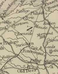 Page
417 Roads in good order. Yarn market.
Page
417 Roads in good order. Yarn market.
Page 419 Post office. Five markets in the parish. Lime
and peat available locally.
NSA
Page 689 Parochial Economy.
Means of Communication - The Aberdeen to Fraserburgh
turnpike road passes through; a mail-coach runs on this.
There is also a turnpike between Peterhead and Banff,
passing through Mormond, and a turnpike to Fraserburgh
much used for transporting lime, bone, and manure as
well as grain.
The mail comes from Aberdeen daily to the post office,
and a carrier goes weekly to that town.
Page 692 Inns.—Three.
Fairs.—Five horse and cattle fairs.
1840. Revised 1842.
MacFarlane
Description of the Parish of Strichen 1723
Page 60 There are three highways in the parish of Strichen.
One comes in from Pitsligo and goes to Old Deer, Ellon
and Aberdeen; another comes from Frazerburgh and goes
to New Deer and Turriff; and a third that passes between
Old Deer and Frazerburgh going by Rindrought. There
is a ford at Rindrought and a timber bridge for horse
and foot.
There are three bridges in the parish: Rindrought, as
said; Howfoord for those on foot only though there is
also a ford; and one just above the church with a nearby
ford. There is another ford near the church at the old
mill of Streechen on the way to Pitsligo and Aberdour.
Tarland
and Migvie
OSA
(v.6, p.222) |
 |
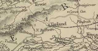 The
village of Tarland has a weekly market and 6 fairs. There
are several shops and trades in the village.
The
village of Tarland has a weekly market and 6 fairs. There
are several shops and trades in the village.
Page 227 There is a stone bridge over the Deskry at Rippachy
on the highway from Strathdon to Aberdeen. It allows access
by another road to Tarland, and through Cromar.
Page 232 The roads, which are statute labour, are in good
condition.
NSA
Page 843 Lime and coals brought from Aberdeen and elsewhere.
Tarland is the market-town for this area. There are
7 markets for cattle, horses, farm produce etc.
Parochial Economy.
Village.—The village of Tarland has a post
and stamp office, an inn and alehouses, and several
shops for groceries etc.
Bridge over the burn of Tarland - it allows communication
between Dee and Don-side. Recently a turnpike road was
made to Aberdeen which passes through the parishes of
Coull, Lumphanan, Kincardine O'Neil, and Midmar. Since
the statute labour was commuted the cross-roads have
improved. 1842
Tarves
OSA
(v.5, p.309) |
 |
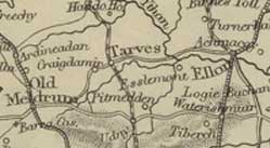 Page
311 Markets attended are in Aberdeen and Old Meldrum. Page
311 Markets attended are in Aberdeen and Old Meldrum.
Peat used as fuel.
Miscellaneous Observations - The statute labour
roads are adequate. There used to be fairs held nearly
every month in the village near the church for black cattle
etc. “Now there are only 5 or 6 fairs or markets
in the parish.”
NSA
Page 670 In describing farming 70 years before, he says
that manure and peat were carried on creels on horseback,
and meal was carried to market in sacks, also on horseback.
It was only the landed proprietors who had carts or
wheeled carriages.
Page 673 Cattle sent to Aberdeen for use there, or are
taken by steamer to London.
Page 675 Parochial Economy.
Roads and Markets.— There are good markets
for farm produce and easy access by turnpike road to
Aberdeen and Newburgh. English lime is brought up the
Ythan to Waterton.
Roads have been made in the parish and are in excellent
condition.
There are 6 long-standing markets here for cattle, horses,
and grain. As said, many of the cattle are sent to London.
1842
Tough
OSA
(v.8, p.261) |
 |
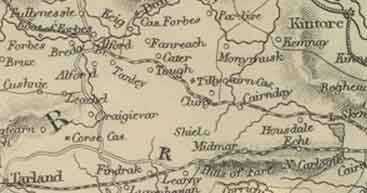 Page
267 Roads.—The roads are better than they
ever were, though there is still room for improvement.
Some lie too low on a clay bottom and so become “deep
and heavy in the winter”; they need to be raised
and gravel spread on them.
Page
267 Roads.—The roads are better than they
ever were, though there is still room for improvement.
Some lie too low on a clay bottom and so become “deep
and heavy in the winter”; they need to be raised
and gravel spread on them.
It is recognised by men of property in the district that
good roads are needed for their estates to improve. At
a recent meeting the plans and estimates for a new road
to Aberdeen were approved and subscriptions given. Statute
labour is commuted.
Fuel, etc.—Peat and turf obtainable close
by.
Page 270 An inn is needed for travellers on the road from
Aberdeen to Strathdon that passes through here.
NSA
Page 617 Parochial Economy.
Market-Towns.— Inverury and Kintore, each
about 13 miles away.
Means of Communication.— Turnpike to Kintore
- farmers sometimes take produce to the canal there
and bring back lime. Mostly however they go to Aberdeen
as terms are better. It is 22 miles by a relatively
flat turnpike road.
Two turnpikes touch the parish: Aberdeen to Strathdon
on which there is a stage and mail coach, and Aberdeen
to Tarland. There is a post-office at Whitehouse. Bridges
in good condition.
Page 619 Although there is no market in the parish,
several are held in nearby places, e.g. Alford, Scuttry
and Monymusk.
Inn.—There is a respectable inn at Whitely,
on the high road.
Fuel.— Peat.
Miscellaneous Observations. - He discusses the
problems caused by the wandering poor.
1835. Revised 1842.
Towie
OSA
(v.4, p.547) |
 |
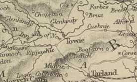 Page
550 Some meal and bear is sold up country near the head
of the rivers Dee and Don, and some to Aberdeen where
sheep are also taken. Black cattle are bought up, here
and in neighbouring parishes and taken south. Page
550 Some meal and bear is sold up country near the head
of the rivers Dee and Don, and some to Aberdeen where
sheep are also taken. Black cattle are bought up, here
and in neighbouring parishes and taken south.
Page 552 Miscellaneous Observations. -“The
scarcity of fuel, which is turf, peat, and heath, brought
from hills far off, and the distance from a sea-port,
are great disadvantages to this parish.”
“The roads here are indifferent. They were originally
made, and are kept in repair by the statute labour, which
is partly exacted in kind, and partly commuted. When paid
in kind, it turns generally to little account. A general
commutation seems to be the preferable mode.”
NSA
Page 419 Means of Communication.— There
are two roads to Aberdeen: the old road and the turnpike
road. In addition to the 2 miles of turnpike there are
about 10 miles of commutation road.
Ale-houses.— Two licensed ale and spirit-dealers.
Fairs.—Two cattle trysts and 2 feeing markets.
Miscellaneous Observations.
Although the roads are much improved, there is still
much to be done, especially bye-roads to the farms.
There are 3 wooden foot-bridges on the Don but they
are often impassable when the river is flooded; this
is inconvenient and dangerous for school children.
1840
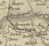 Page
28 Cattle bought by drovers. Page
28 Cattle bought by drovers.
Page 32 “The roads are in better repair in this
than in most other parishes; the statute labour has hitherto
been exacted in kind; and although a commutation has been
proposed, it has not, in general, been agreed on as the
most proper mode for this country.”
“The fuel generally made use of, is turf and heath
from the hills, there being very little peat to be got
in the parish.”
NSA
Page 455 Parochial Economy.
Market-Towns.—Aberdeen, more than 26 miles
away, is the main market town. Lime is brought from
quarries at Ardonald and Grange, both nearly 20 miles
away, by a road that passes through Huntly. The bulk
of the grain is carried to Aberdeen.
There are several monthly markets and two fairs in neighbouring
Alford for cattle and grain.
Means of Communication.—Post-office served
by the Aberdeen mail-gig that takes 3 hours for the
journey. The Lord Forbes stage-coach runs every two
days to Aberdeen. The Bridge-Inn is very fine, conveniently
sited where the road from Huntly to Kincardine and the
Grampians crosses the Aberdeen to Strathdon road, and
promises to be a fine resort for fishing etc.
The bridge is very fine. It was damaged in 1829 but
quickly repaired. There is also a wooden bridge, 3 miles
upriver, built by the Master of Forbes near his mansion-house.
1838. Revised 1840.
MacFarlane
Description of eighteen parishes in the shire and diocese
of Aberdeen C.1720
Page 35 A highway between Edinburgh and Inverness runs
through Tullinessel parish.
Turriff
OSA
(v.17/394) |
 |
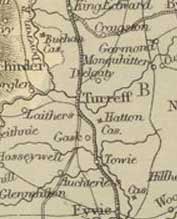 Page
397 In 1511 it was made a burgh of barony with the right
to hold a market and fairs. Page
397 In 1511 it was made a burgh of barony with the right
to hold a market and fairs.
Five carriers in the parish.
Page 409 Cattle sold to drovers.
Page 410 Details of peat and turf used for fuel.
NSA
Page 993 Mention of the Boat of Magie.
Page 999 Cattle sent to London by steamer.
Page 1004 Eggs.—Several old women travel
around the parish buying eggs and sending them by carrier
to Aberdeen.
Fairs.—Eight fairs for cattle, sheep etc.
Feeing-markets are also held though they do have a bad
effect on morals.
Page 1005 Parochial Economy. Market-Town, Etc. and
the nearest Sea Ports.—Although there is no
weekly market, butcher meat is available and there are
several shops where all commodities can be obtained.
There are also many trademen and artisans.
The nearest posts are Banff and Macduff, both about
10 miles away. Grain is exported from both, and coal,
lime, bone-dust and other merchandise brought in.
Means of Communication.—Post-office
with deliveries twice a day. A stage-coach between Aberdeen
and Banff passes through each lawful day, and a number
of carriers both from these towns and others pass through
regularly.
Roads.—The turnpike road that passes through
here does not have the best line and was not constructed
in the way roads are now which makes it difficult to
repair. As a result it does not give a good return on
the money laid out to construct it.
The statute labour is commuted - he gives details of
how the money is raised both for the parish and the
town.
Bridges.—A stone bridge was built in 1826
over the Doveron at a cost of L.2500, raised by subscription
and a loan. There is a pontage, used to pay off the
interest on the loan. There is a bridge over the burn
of Turriff, and some smaller ones, all in good condition.
Page 1011 Coal Fund.—This was set up about
18 years ago, whereby coal brought from Banff and Macduff
is supplied to those in need of it.
Page 1013 Inns, Etc.— Respectable inns and
taverns in the town, and numerous ale-houses and spirit-shops.
Police, Etc.—The parish was formerly much
troubled by vagrants and travelling mendicants, but
they are much less since the rural police was established.
Fuel.—Mostly English coal.
November 1842.
MacFarlane
Description of Countrey of Buchan Aberdeenshire 1721
Page 42 Bridge in Turriff.
Description Parishes of Ochterless, Tureff and Fyvie
in Aberdeen 1723
Page 92 In Turriff parish there is a bridge over the
Turriff near the town.. The king’s highway from
Aberdeen to Banff passes through the town.
Tyrie
OSA
(v.6, p.138) |
 |
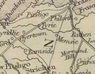 Page
144 Improvements - In talking about conditions
40 years before, he remarks that: Page
144 Improvements - In talking about conditions
40 years before, he remarks that:
“the communication from place to place was along
paths which were to be known by the footsteps of beasts
that passed through them,” and that “their
peats were brought home in creels; the few things the
farmer had to sell were carried to market, upon the backs
of horses; and their dunghills were hard by their doors.”
NSA
Page 724 Parochial Economy.
Market Town.— Fraserburgh, 5 miles away.
Means of Communication.—Post office in New
Pitsligo. Eight miles of turnpike.
Page 727 Fairs, Inns, Alehouses, Etc.—Four
cattle-markets and, recently, a corn-market every fortnight.
Two inns and 6 alehouses in New Pitsligo.
Udny
OSA
(v.4, p.156) |
 |
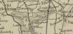 Produce
sent to Aberdeen.
Produce
sent to Aberdeen.
The public roads are very bad and under poor management.
NSA
Page 135 Parochial Economy.
Means of Communication.—There is a post-office
here served daily from Aberdeen. Turnpikes from Aberdeen
lead to the north and to Meldrum with another over to
Newburgh. Coaches run on the two Aberdeen roads. Bridges
on the main roads are excellent.
Page 137 Fairs.—Three well-attended fairs
mostly for black cattle.
Inns.—Seven
Fuel.—About half is peat, still gathered
with much effort; the other half is coal which is much
cheaper.
1840
Top
|