|
Introduction
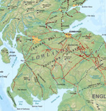
There was for a time, a "golden
age" in Scotland that lasted from the mid-1100�s up
to the Wars of Independence in the late 1200�s. It saw
relatively settled conditions of peace and prosperity
in which feudalism, effective administration, new towns
and the Church played an important part.
David I was a prime mover in this,
founding new towns, giving lands to his followers, appointing
sheriffs to administer law and order in newly formed
shires and promoting the foundation of abbeys with generous
grants of land and money, an example followed by his
major vassals.
Side by side with the building
of the abbeys, and smaller religious houses, went the
development of the land gifted to them for their upkeep.
Typically this was farming and the raising of livestock
but mining and salt panning was also carried out. The
monks had considerable skills in these areas and within
a short time were running profitable ventures.
To keep a record of the lands
and other privileges granted to them, the abbeys maintained
chartularies. These listed in detail the boundaries
of their lands, their rights in respect to fishing,
gathering wood, grazing their animals, mining, grinding
corn and so on. A number of these chartularies have
survived and provide a valuable insight into a long-forgotten
age. Without them we would have only the most general
picture of how the landscape of the 12th and 13th centuries
was organised. As it is we know the names of places
and landmarks, where the boundaries of their land ran,
what they used the lands for, where they took their
produce, and where the roads were.
Many of the chartularies were
published in the 19th century by historical societies
like the Bannatyne Club. Although in their original
Latin, in an abbreviated script called Record Script
that makes them difficult to read, many of the charters
have been translated or summarised over the years which
makes them much more accessible. Two books in particular
are very useful. One is the Monastic Annals of Teviotdale
by Rev. James Morton which was published in 1832 which
includes a listing of their lands and properties by
parish, the other is Origines Parochiales Scotiae (OPS)
published 1851-55 which gives a history of Scottish
parishes with many references to the monastic charters.
From our point of view, the charters
contain many valuable references to roads. Some of these
are well known, such as the road from Newbattle Abbey
to the Monklands, and the wagon road between Kelso and
Lesmahagow. Others are referred to in various studies
such as the "via regia" running up past Dunscore to
Glencairn and R P Hardie made extensive use of the charters
in The Roads of Mediaeval Lauderdale. Others are hardly
known at all.
 |
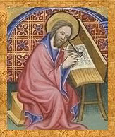
| Monks and pilgrims would have
been a common sight on mediaeval roads |
Several terms are used in the
charters to refer to roads such as via, via regia, semita,
calceia as well as vadum and pons for ford and bridge
respectively. There were also rights of way that the
monasteries negotiated with landowners. The different
terms undoubtedly served to differentiate between these.
Calceia or causeway was a definite construction while
semita or way was probably a beaten track though still
a definte route taken between two places. Via was probably
a definite track that in some parts was in a natural
state, i.e. a beaten track but constructed in other
places perhaps by a cutting to allow an easier gradient
for waggons or a causeway to cross water-logged ground.
Via Regia or King's Highway implies a right of passage
without having to seek permission from landowners and
although some were along the Roman roads others must
have been more of the nature of a via, partly beaten
track, partly constructed.
The fairly primitive nature of
the roads is understandable in view of the resources
required to build a road. As a rough guide to this,
when the Military Road was being constructed through
Galloway in the 1700's, the rate of work was one and
a half yards per man per day or 150 yards in 100 days.
It is unlikely the monasteries could have released their
men for any longer than three months in one year with
all the other duties to be completed. It would require
12 men to complete one mile of road in any one year.
By the same reasoning 120 men would be needed for 10
miles in a year and 50 years for the same number to
complete 500 miles of road.
Even allowing for the higher standard
of the Military Road and thus a higher yardage being
possible on a monastic road, it would still have been
a major commitment of resources over a long period of
time. It would also have been unnecessary. They did
not have a need for well-constructed roads - so long
as they permitted the movement of animals and the carrying
of produce on pack-horses, sledges and waggons and carts
they would be perfectly suitable. They would also have
had roads remaining from earlier periods. The Roman
roads were still there and the indigenous populations
of each area would have had their own network of routes
available for use.
While it is unlikely then that
they developed a large network of major roads it is
quite likely that they "improved" the routes
they were using. As said above, this could have been
making cuttings to ease gradients, or causeways, or
even making short lengths of "made" roads.
Bridges also would have been quite possible with their
resources and skills. The evidence seems to support
this view.
With these qualifications in mind,
this section will note the roads mentioned in the charters
and try to identify where they ran. For convenience
it will be organised by county and parish. Where possible,
the links are to translations but as some of the original
chartularies are available online, links have also been
given to these. A list of contractions used in Record
Script can be found here.
A standard work listing most Latin words encountered
in charters in their contracted form is The Record Interpreter
by Charles Trice Martin and can be found on the Internet
Archives.
Top
|